Huddersfield
Jump to navigation
Jump to search
-
Aspley Basin Marina, where the Huddersfield Broad Canal and the Huddersfield Narrow Canal meet
-
View of the Narrowboat Marina on the Huddersfield Broad Canal at Aspley
-
Berry Brow rail station, Huddersfield
-
Photo of Bilberry & Digley Reservoirs, looking towards Holmfirth
-
View of Bolster Moor, Golcar, Huddersfield
-
View of Train exiting Thurstonland Tunnel at Brockholes in 1978
-
Brockholes Railway Station
-
View of Butternab & Beaumont Park, Huddersfield - From Taylor Hill
-
View of the Caldercliffe area of Berry Brow, Huddersfield
-
View of Castle Hill, Huddersfield - From Farnley Tyas - Taken whilst old Public house was being demolished to build a new one, which was subsequently also demolished for failing to comply to planning permission
-
Series of photos showing original Castle Hill Pub and replacement which was demolished as it had no planning permission
-
David Brown Tractor Factory, Meltham, West Yorkshire
-
View of Farnley Tyas, from Castle Hill, Huddersfield
-
View of Golcar, Huddersfield
-
View of Hall Bower, from Castle Hill Huddersfield
-
View inside one of the bars in the 'Head of Steam' Public Bar at Huddersfield Railway Station, plus a pint of Dark Mild taken by me at the same time!
-
View of Hepworth, West Yorkshire, from Mount
-
View of Holme Moss radio transmission Tower, from Kiln Bent Road
-
View of Holme Village from Kiln Bent Road
-
Black & White Image of Snow covered A6024 Woodhead Road, into Holme Village, from Holme Moss in the Dark Peak area of The Peak District National Park, During the Winter of 1978
-
View of Holmfirth from Cliffs above Cliff Road, view is taken facing southwest - The A6024 (Woodhead Road) goes from the centre of the village to the top left of the photo
-
A view over Holmfirth from Victoria park to the rear of the library in the 1980's - Date=c1980's
-
Honley Rail Station, on the Penistone Line
-
Honley Rail Tunnel heading towards Berry Brow
-
view of Honley, Huddersfield
-
Section of Huddersfield Broad Canal between Turnbridge Lift Bridge and Aspley
-
View along Huddersfield Narrow Canal From the Wakefield oad Tunnel, at Aspley Basin, towards the Huddersfield University Buildings
-
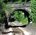
View Through Wakefield Road Tunnel At Aspley Basin (A629) which connects the Huddersfield Broad and narrow Canals
-
View of Platforms inside Huddersfield Railway Station
-
Huddersfield Railway Station in St Georges Square
-
Description=1000px Image of Huddersfield from Castle Hill
-
View from Mount of Jackson Bridge - Dobroyd Mill is shown to the left and below that the A616 Huddersfield to Penistone Road
-
View of Kirkroyds & Lydgate, New Mill from Mount - The chimmney of Moorhouse and Brookes Mill Rises from the bottom of Greenhill Bank
-
View of Lepton from Castle Hill, Huddersfield
-
View of Lockwood, Huddersfield, from Primrose Hill - The Penistone Line Lockwood Rail Viaduct is to top left of Photo
-
View of Longley, from Castle Hill, Huddersfield
-
View of Longroyd Bridge, Huddersfield - Taken passing over valley by train
-
Central area of the image shows Lowerhouses Housing Estate, approx 1 mile south of Huddersfield - To the top of the image are the Bradley and Moldgreen area housing estates - viewed from Castle Hill
-
View from Castle Hill showing, from the bottom upwards, Longroyd Bridge & Paddock, Marsh, Lindley, and the Huddersfield Royal Infirmary
-
Meltham and lower Holme Valley, West Yorkshire. Netherton and Newsome are seen centre left
-
Meltham Cub Scout pack on 'Blackpool Bridge' near Digley Reservoir in the Peak District during the late 1970s
-
Photo of Meltham Village area taken from road going over Wessenden
-
View of Netherfields estate and Netherthong, Holmfirth, West Yorkshire - Photo shows 'New Road' going uphill from the A6024
-
View of Netherton & South Crosland, from Castle Hill, Huddersfield - Meltham Village is in the valley to top left of photo
-
Set of stitched photos showing a view of Newsome from Castle Hill, Huddersfield - Towards the top of the photo can be seen:- Beaumont Park, Walpole, Lockwood, Rashcliffe and Folly Hall
-
View of Paddock, Huddersfield - Taken from train whilst passing over viaduct
-
Rashcliffe Hill Flats during Demolition, by local housing authority
-
View of Scholes, Holmfirth, Kirklees from Tenter Hill
-
View of Thornton Lodge, Taken whilst passing South along the viaduct by train, over Longroyd Bridge - The Victoria Tower at Castle Hill can be seen in the distance above the clock at Newsome Mill
-
View of Totties, near Holmfirth, from Mount
-
Photo of the Windlass Lifting Bridge at Turnbridge, Huddersfield - This bridge allows Vehicular Traffic to cross the Canal from St Andrews road to the rear of the sports centre
-
View of The upper Holme Valley, West Yorkshire, England
-
Image of The Victoria Tower overlooking Huddersfield
-
View of Aspley along Wakefield Road leading South from The Huddersfield Ringroad - The Marina is left of centre


