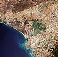
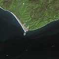
Category:Satellite pictures of Andalusia
Jump to navigation
Jump to search
Autonomous communities of Spain: Andalusia · Balearic Islands · Basque Autonomous Community · Canary Islands · Castile and León · Catalonia · Galicia · Community of Madrid · Region of Murcia · Navarre · Valencian Community · Autonomous cities: Ceuta · Melilla
Subcategories
This category has only the following subcategory.
S
Media in category "Satellite pictures of Andalusia"
The following 40 files are in this category, out of 40 total.
-
(Almería) Greenhouses of Almería, Spain (cropped).jpg 1,125 × 1,123; 1.3 MB
-
(Barbate) Strait of Gibraltar, Mediterranean Sea (cropped).jpg 1,306 × 1,304; 370 KB
-
(Estepona) Strait of Gibraltar, Mediterranean Sea (cropped).jpg 322 × 319; 71 KB
-
(Granada) Greenhouses of Almería, Spain (cropped).jpg 1,402 × 1,403; 2.73 MB
-
(Jaén) Greenhouses of Almería, Spain (cropped).jpg 1,322 × 1,323; 2.35 MB
-
(Jerez) Seville, Spain (49104522676) (cropped).jpg 656 × 651; 276 KB
-
(Puerto de Motril) Greenhouses of Almería, Spain (cropped).jpg 548 × 423; 58 KB
-
Agricultural monitoring in Spain ESA371156.gif 1,087 × 784; 5.86 MB
-
Aljarafe.jpg 1,012 × 664; 105 KB
-
Almeria, Spain (ASTER).jpg 2,037 × 1,270; 528 KB
-
Almeria-Invernaderos.jpg 540 × 334; 70 KB
-
Andalucia satelite.jpg 1,198 × 668; 120 KB
-
Bahía de Algeciras - ic Landsat.jpg 1,060 × 989; 440 KB
-
Bay of Gibraltar, Mediterranean Sea by Planet Labs.jpg 4,840 × 3,630; 6.4 MB
-
Cadiz, Spain.png 17,792 × 10,611; 40.91 MB
-
Drought in Andalusia in April 2023.jpg 4,001 × 4,069; 7.61 MB
-
Flooding in Southern Spain 2010-03-09.jpg 720 × 480; 101 KB
-
Gades.jpg 984 × 642; 32 KB
-
Gibraltar (satellite view).jpg 2,048 × 1,280; 611 KB
-
Gibraltar World Wind view annotated.jpg 1,280 × 958; 366 KB
-
Gibraltar-NLT Landsat7.jpg 1,018 × 694; 489 KB
-
Golfo de Cádiz - ic Landsat.jpg 1,060 × 989; 263 KB
-
Greenhouses of Almería, Spain.jpg 12,658 × 13,068; 28.56 MB
-
ISS-44 Strait of Gibraltar.jpg 4,928 × 3,280; 5.57 MB
-
ISS014-E-17504 - View of Spain.jpg 3,032 × 2,064; 780 KB
-
NASA photo of plasticulture, Campo de Dalías, Spain.jpg 3,032 × 2,000; 3.07 MB
-
Plastic sea, Almería Spain.jpg 3,032 × 2,008; 1.3 MB
-
Severe drought in Andalucía, Spain.jpg 4,013 × 2,543; 3.61 MB
-
Seville, Andalucia.jpg 3,696 × 2,460; 4.61 MB
-
Seville, Spain ESA21469794.jpg 14,198 × 13,837; 362.52 MB
-
Seville, Spain ESA21469794.tiff 14,198 × 13,837; 562.1 MB
-
Seville, Spain ESA370862.jpg 1,920 × 1,447; 3.98 MB
-
Seville, Spain ESA370862.tiff 4,275 × 3,222; 78.84 MB
-
SevilleSpain-NASA.jpg 3,200 × 2,400; 4.39 MB
-
Southern Spain NASA MODIS 2009-03-08.jpg 720 × 480; 107 KB
-
Strait of Gibraltar, Mediterranean Sea.jpg 12,675 × 13,077; 29.07 MB
-
STS059-238-074 Strait of Gibraltar.jpg 5,275 × 5,222; 13.27 MB
-
Tarifa SPOT 1165 r.jpg 250 × 200; 30 KB
-
Tarifa SPOT 1165.jpg 500 × 500; 52 KB
-
The sea of greenhouses, Almería.jpg 3,507 × 2,540; 5.07 MB


