Category:Peloponnese Region
Jump to navigation
Jump to search
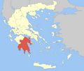
English: The Peloponnese region (Greek: Περιφέρεια Πελοποννήσου) is an administrative region in southern Greece. It borders the West Greece region to the north and Attica to the north-east. The region has an area of about 15,490 square kilometres (5,980 square miles). It covers most of the Peloponnese peninsula, except for the northwestern subregions of Achaea and Elis which belong to West Greece and a small portion of the Argolid peninsula that is part of Attica.
Français : Le Péloponnèse constitue l'une des 13 périphéries (régions administratives) de la Grèce. Avec 15,490 km2, elle couvre une part importante de la péninsule du Péloponnèse. La périphérie regroupe cinq des sept districts régionaux de la péninsule. Seul deux districts régionaux situés au nord-ouest de celle-ci sont rattachés à la périphérie de Grèce-Occidentale.
one of the 13 administrative regions of Greece | |||||
| Upload media | |||||
| Instance of | |||||
|---|---|---|---|---|---|
| Part of | |||||
| Location | Decentralized Administration of Peloponnese, Western Greece and the Ionian Islands, Greece | ||||
| Capital | |||||
| Head of government |
| ||||
| Population |
| ||||
| Area |
| ||||
| official website | |||||
 | |||||
Subcategories
This category has the following 16 subcategories, out of 16 total.
C
M
N
P
Pages in category "Peloponnese Region"
This category contains only the following page.
Media in category "Peloponnese Region"
The following 61 files are in this category, out of 61 total.
-
2019-01-21 Photo 1 - Panayia Yiatrissa - Southern View.png 902 × 677; 1.12 MB
-
2019-01-21 Photo 10 - by Cindy Rury - Panayia Yiatrissa Templon.png 902 × 1,202; 1.96 MB
-
2019-01-21 Photo 11 - by Cindy Rury - Panayia Yiatrissa Pantocrator.png 902 × 1,202; 1.98 MB
-
2019-01-21 Photo 12 - Panayia Yiatrissa - Wall Iconography.png 902 × 677; 1.32 MB
-
2019-01-21 Photo 13 - Panayia Yiatrissa - Door arch adornment.png 902 × 677; 1.09 MB
-
2019-01-21 Photo 14 - by Cindy Rury - Panayia Yiatrissa Main Chapel Doorway.png 902 × 1,202; 1.72 MB
-
2019-01-21 Photo 15 - Panayia Yiatrissa - Courtyard fountain.png 902 × 1,202; 2.02 MB
-
2019-01-21 Photo 16 - Panayia Yiatrissa - Arched Rampart Sunset.png 902 × 677; 877 KB
-
2019-01-21 Photo 17 - Panayia Yiatrissa - Eastern Moonrise Panorama.png 902 × 195; 293 KB
-
2019-01-21 Photo 18 - Panayia Yiatrissa circa 1905.jpg 2,847 × 1,734; 1.91 MB
-
2019-01-21 Photo 19 - Panayia Yiatrissa circa 1950.jpg 2,259 × 1,369; 1.82 MB
-
2019-01-21 Photo 2 - Panayia Yiatrissa - Entrance View.png 902 × 1,202; 1.73 MB
-
2019-01-21 Photo 20 - Panayia Yiatrissa above Kastania Village.png 902 × 1,223; 2.24 MB
-
2019-01-21 Photo 3 - Panayia Yiatrissa - Internal Entrance View.png 901 × 1,201; 1.85 MB
-
2019-01-21 Photo 4 - Panayia Yiatrissa - Lower Courtyard Chapel.png 902 × 677; 1.08 MB
-
2019-01-21 Photo 5 - Panayia Yiatrissa - Lower Courtyard.png 901 × 601; 1.15 MB
-
2019-01-21 Photo 6 - Panayia Yiatrissa - Lower Courtyard Dedication.png 899 × 675; 902 KB
-
2019-01-21 Photo 9 - Panayia Yiatrissa - Iconostasis.png 902 × 1,086; 1.88 MB
-
AcroCorinthe (2516396219).jpg 1,375 × 460; 178 KB
-
Acrocorinthe (2516485941).jpg 1,369 × 709; 241 KB
-
Aghios Andreas Harbor (194404029).jpeg 2,048 × 1,536; 950 KB
-
Flag map of Peloponnese.png 1,080 × 1,115; 151 KB
-
Flag-map of Peloponnese peninsula (Morea).png 493 × 506; 79 KB
-
GreecePeloponnesus.png 200 × 204; 21 KB
-
Laxi easter 042.jpg 2,560 × 1,920; 2.44 MB
-
Loutraki view.jpg 3,024 × 3,024; 3.78 MB
-
Nafplio (29644815).jpeg 1,365 × 2,048; 1.54 MB
-
Out rider (5065893682).jpg 1,024 × 683; 396 KB
-
Paralia Tyrou (34580458865).jpg 5,422 × 3,389; 12.9 MB
-
Peloponnese location map.png 1,000 × 1,032; 189 KB
-
Peloponnisos in Greece.svg 1,003 × 825; 1.15 MB
-
Periferia Peloponnisou.png 800 × 679; 92 KB
-
Periphery peloponnese municipalities1.svg 832 × 875; 253 KB
-
Sousaki volcano 10.jpg 2,976 × 3,968; 7.78 MB
-
Sousaki volcano 12.jpg 2,976 × 3,968; 6.43 MB
-
Sousaki volcano 13.jpg 2,976 × 3,968; 6.37 MB
-
Sousaki volcano 14.jpg 2,976 × 3,968; 7.61 MB
-
Sousaki volcano 15.jpg 2,976 × 3,968; 6.84 MB
-
Sousaki volcano 16.jpg 2,976 × 3,968; 6.01 MB
-
Sousaki volcano 2.jpg 2,976 × 3,968; 5.65 MB
-
Sousaki volcano 3.jpg 3,968 × 2,976; 5.02 MB
-
Sousaki volcano 4.jpg 2,976 × 3,968; 6.64 MB
-
Sousaki volcano 5.jpg 2,976 × 3,968; 5.86 MB
-
Sousaki volcano 6.jpg 2,976 × 3,968; 7.1 MB
-
Sousaki volcano 7.jpg 2,976 × 3,968; 5.95 MB
-
Sousaki volcano 8.jpg 3,968 × 2,976; 6.83 MB
-
Sousaki volcano 9.jpg 2,976 × 3,968; 6.05 MB
-
Sousaki volcano.jpg 2,976 × 3,968; 6.47 MB
-
View from Gerania Ori.jpg 3,024 × 4,032; 1.66 MB
-
Vista panorámica del actual sitio arqueológico de Tirinto..jpg 3,634 × 2,577; 4.4 MB
-
Ατενίζοντας τα γερσνισ.jpg 2,616 × 3,392; 2.23 MB
-
Γερανια ευλογημενα.jpg 1,600 × 1,200; 249 KB
-
Η ομορφιά στο γερσνια.jpg 4,032 × 3,024; 3.77 MB
-
Η ωρα του θεου.jpg 4,032 × 3,024; 1.88 MB
-
Καταστροφη.jpg 720 × 960; 59 KB
-
Λιμνοθάλασσα Γιάλοβας.jpg 4,000 × 3,000; 3.06 MB
-
Μικρός επισκέπτης.jpg 3,052 × 2,866; 2.55 MB
-
Πύρινη λαίλαπα.jpg 960 × 646; 36 KB


