Category:Maps of the history of Lebanon
Jump to navigation
Jump to search
- Maps of the history of Lebanon — its history within the Ancient Near East, Levant, Middle East, and Western Asia.
Subcategories
This category has the following 12 subcategories, out of 12 total.
Media in category "Maps of the history of Lebanon"
The following 38 files are in this category, out of 38 total.
-
 Seljuk Empire locator map.svg 800 × 488; 161 KB
-
 1680 Sidon detail map Turcicum imperium by Frederik de Wit BPL 15917.png 1,064 × 748; 1.55 MB
-
 Civil war Lebanon map 1976a.gif 243 × 261; 2 KB
-
 Lebanon civil war map 1976.gif 528 × 288; 7 KB
-
 2014 Lebanon Battle 3D (30249978553).jpg 3,939 × 2,827; 4.54 MB
-
 Armenia Throughout History.gif 700 × 525; 38 KB
-
 Buhturid Mount Lebanon.png 1,059 × 1,207; 2.54 MB
-
 Civil war Lebanon map 1983a.gif 243 × 261; 3 KB
-
 East Beirut canton.png 2,231 × 2,258; 35 KB
-
 Damascus Eyalet, Ottoman Empire (1795).png 2,434 × 2,037; 591 KB
-
 Sidon Eyalet, Ottoman Empire (1795).png 2,434 × 2,037; 590 KB
-
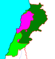
 Free Lebanon State.png 2,231 × 2,258; 51 KB
-
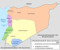
 French Mandate for Syria and the Lebanon map ar.svg 922 × 762; 190 KB
-
 French Mandate for Syria and the Lebanon map ca.svg 983 × 813; 577 KB
-
 French Mandate for Syria and the Lebanon map de.svg 922 × 762; 268 KB
-
 French Mandate for Syria and the Lebanon map en.svg 922 × 762; 245 KB
-
 French Mandate for Syria and the Lebanon map es.svg 983 × 813; 529 KB
-
 French Mandate for Syria and the Lebanon map fr.svg 922 × 762; 251 KB
-
 French Mandate for Syria and the Lebanon map he.svg 922 × 762; 253 KB
-
 French Mandate for Syria and the Lebanon map tr.svg 922 × 762; 245 KB
-
 Historiska gränser Armenien.gif 698 × 507; 38 KB
-
 Lebanon religious groups distribution with Mount Lebanon 1862-1917 borders shown.svg 2,700 × 3,484; 677 KB
-
 Liban des Croisades vers 1180 EC.jpg 1,196 × 1,280; 340 KB
-
 LittleArmeniaPrincipality of AntiochTripoli-Arabic.jpg 530 × 600; 89 KB
-
 Long knives.png 494 × 442; 499 KB
-
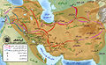 Map of Ardashir & shapur's campaign.jpg 1,172 × 723; 347 KB
-
 Mohammad adil-Muslim invasion of Syria-3-es.svg 1,367 × 1,520; 509 KB
-
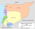
 Mutasarrifato del Monte Libano.jpg 1,682 × 2,484; 1.05 MB
-
 Orient Mejan - Fin de la Premiera Crosada.png 703 × 929; 127 KB
-
 Ottoman Syria 1900-ca.svg 463 × 533; 248 KB
-
 Ottoman Syria 1900-es.svg 463 × 533; 217 KB
-
 Ottoman Syria 1900.svg 356 × 500; 55 KB
-
 Seljuq Empire1100-es.svg 2,758 × 1,689; 410 KB
-
 Seljuq Empire1100. he.svg 642 × 396; 254 KB
-
 Seljuq Empire1100.svg 642 × 396; 253 KB
-
 Yusuf Sayfa Territorial Zenith.png 856 × 1,204; 252 KB
-
 السلطنة الأيوبية.jpg 589 × 427; 87 KB
-
 فتوح مصر والنوبة.jpg 1,345 × 1,929; 695 KB


.jpg)


.png)
.png)


