Category:Maps of the Irish Sea
Jump to navigation
Jump to search
Subcategories
This category has the following 4 subcategories, out of 4 total.
Media in category "Maps of the Irish Sea"
The following 34 files are in this category, out of 34 total.
-

-
 202 of '(Black's Guide to the Isle of Man.)' (11234284593).jpg 1,781 × 1,941; 531 KB
-
 Nord Ostsee Hafen.jpg 4,563 × 3,956; 6.89 MB
-
 Admiralty Chart No 1826 Burrow Head to Liverpool, Published 1953.jpg 11,149 × 16,186; 58.6 MB
-
 Admiralty Chart No 1411 Braich-y-Pwll to Clogher Head, Published 1954.jpg 16,435 × 11,327; 48.57 MB
-

-
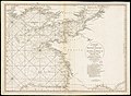
 A chart of the Irish sea... - btv1b53010627r.jpg 9,531 × 16,081; 21.16 MB
-

-

-
 A general chart of Saint George's Channel... - btv1b530105978 (1 of 7).jpg 23,391 × 15,057; 45.59 MB
-
 A new and correct mapp of St Georges Channell... - btv1b53010410f (1 of 2).jpg 11,108 × 8,595; 12.97 MB
-
 A new and original survey of the North and St George's channels... - btv1b53010440p (1 of 2).jpg 8,231 × 12,041; 15.48 MB
-
 A new hydrographical survey of the North and Saint George's Channels... - btv1b53010686s (1 of 2).jpg 12,669 × 19,666; 33.41 MB
-
 Admiralty Chart Catalogue 1967 Page 019 Index B2.jpg 8,568 × 6,809; 9.47 MB
-
 Admiralty Chart No 1824a East Coast of Ireland, Published 1886.jpg 8,391 × 15,548; 15.73 MB
-
 Admiralty Chart No 1825a The Irish Sea, Published 1925.jpg 16,412 × 15,521; 22.26 MB
-
 Admiralty Chart No 1825b Irish Sea Sheet II, Published 1868.jpg 16,397 × 14,764; 73.56 MB
-
 British Channel Bay of Biscay Chart 1780.jpg 9,041 × 6,638; 15.7 MB
-

-
 FMIB 36895 Marees de la Mer d'Irlande Indication des Libnes Cotidales.jpeg 495 × 1,037; 154 KB
-
 FMIB 43875 Height of the Tides in St George's Channel.jpeg 857 × 1,283; 292 KB
-
 Irish Sea location map.svg 305 × 397; 824 KB
-
 Irish Sea – relief, ports, limits.tif 1,043 × 1,507; 4.5 MB
-
 IrishSeaReliefMap hr.jpg 461 × 561; 71 KB
-
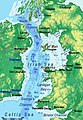 IrishSeaReliefMap.jpg 1,043 × 1,507; 2.15 MB
-
 IrishSeaReliefmap.png 1,043 × 1,507; 535 KB
-
 Isle of Man Brit Isles Sect 3.svg 939 × 677; 967 KB
-
 Locatie Ierse Zee.PNG 649 × 475; 20 KB
-
 Location Irish Sea.png 649 × 475; 22 KB
-
 North Channel.png 972 × 821; 1.14 MB
-
 PSM V83 D344 Map of the irish sea.png 1,741 × 2,207; 200 KB
-
 Solway Firth map.png 1,000 × 622; 320 KB
-
 Steam packet route map.png 304 × 195; 24 KB
-
 Steam packet route map.svg 628 × 503; 46 KB

%27_(11234284593).jpg)


.jpg)
.jpg)
.jpg)
.jpg)
.jpg)
.jpg)


.jpeg)


.jpg)