Category:Maps of the Cold War
Jump to navigation
Jump to search
Subcategories
This category has the following 13 subcategories, out of 13 total.
A
C
I
- Maps of the Iran-Iraq War (35 F)
L
M
- Maps of Warsaw Pact (26 F)
S
U
V
W
- World maps of the Cold War (49 F)
Pages in category "Maps of the Cold War"
This category contains only the following page.
Media in category "Maps of the Cold War"
The following 71 files are in this category, out of 71 total.
-
1945 Alemaniaren lehen banaketa II. Mundu Gerra amaitu ondoren.jpg 2,008 × 2,835; 842 KB
-
1945 Russian and Manchurian Strategic Urban Areas.jpg 3,972 × 2,941; 1.27 MB
-
1950-1953 Koreako Gerra.jpg 2,008 × 2,835; 706 KB
-
1961 anti-Soviet Union propaganda map - Concept of Deterrence.jpg 18,421 × 14,336; 40.4 MB
-
The Third World – Cockpit of Conflict, Soviet Global Power Projection.png 1,203 × 881; 184 KB
-
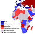
AfricaColdWar.png 585 × 600; 55 KB
-
Asian rimland, 1950.jpg 1,029 × 1,349; 250 KB
-
AtomWeaponVW.jpg 1,132 × 982; 163 KB
-
August 1945 Coverage of USSR by B-29s and B-36s.jpg 1,297 × 1,518; 556 KB
-
Bamboo Curtain.PNG 300 × 213; 6 KB
-
Chain reaction, 1950.jpg 636 × 1,282; 315 KB
-
Changes in borders post cold war.PNG 588 × 464; 17 KB
-
CheGuevaraCountries.jpg 1,357 × 690; 147 KB
-
Chevaline patrol limits-corrected.png 447 × 424; 10 KB
-
Chrome Dome 1961.jpg 2,882 × 1,949; 3.92 MB
-
Cold War Africa 1980.PNG 458 × 437; 18 KB
-
Cold War WorldMap 1962.png 1,405 × 703; 64 KB
-
Cold-war-47-55-s.svg 1,000 × 450; 858 KB
-
Coldwar.svg 384 × 387; 1,003 KB
-
Cold–War Africa 1980.PNG 458 × 437; 18 KB
-
Communist Block.svg 940 × 477; 1.86 MB
-
Communist Contagion (cropped).jpg 2,879 × 1,179; 1.33 MB
-
Continental Defense Warning Systems.png 1,260 × 789; 727 KB
-
Course followed by USS Triton in 1960.png 834 × 918; 862 KB
-
Deployment of USAF combat forces CONUS as of July 1, 1960.png 830 × 595; 259 KB
-
Deployment of USAF combat forces worldwide as of July 1, 1960.png 849 × 584; 547 KB
-
Dew line 1960.jpg 962 × 996; 196 KB
-
Division de Asia por bandos en la Guerra Fría.svg 8,268 × 11,692; 616 KB
-
English Electric Canberra and Martin B-57 Canberra operators.png 1,425 × 625; 30 KB
-
Europe Comunism NATO.png 2,056 × 1,754; 492 KB
-
First second third worlds map.svg 860 × 440; 1.36 MB
-
GIUK gap.png 1,024 × 1,239; 769 KB
-
Guerra Fria alianças em 1947-1953.png 1,405 × 703; 58 KB
-
Guik gap.gif 1,024 × 1,239; 465 KB
-
Guèrra de Vietnam (1965).png 737 × 640; 117 KB
-
Hoang Sa3.PNG 642 × 442; 72 KB
-
Hub of Asia, 1955.jpg 1,060 × 1,470; 316 KB
-
INF-FacilitiesUSSR.jpg 3,162 × 2,488; 856 KB
-
Influence russia in europe.PNG 604 × 202; 7 KB
-
Map of Marxist–Leninist states.png 1,425 × 625; 36 KB
-
Mapa Pakistanu Zachodniego PL.gif 700 × 600; 13 KB
-
Mediterranean 1956.jpg 1,095 × 1,550; 274 KB
-
Modified Phase II Safeguard defense (FY 71 recomendation).png 972 × 742; 588 KB
-
Molotov plan 1947.png 596 × 219; 9 KB
-
Next objectives for the Soviets, 1950.jpg 973 × 549; 219 KB
-
North Radar System.png 2,168 × 1,699; 1.59 MB
-
Operation Chrome Dome.png 1,174 × 611; 106 KB
-
Politically independent Central European states during Cold war.png 1,811 × 1,687; 687 KB
-
Premiera Guèrra d'Afganistan.png 692 × 448; 85 KB
-
Soviet naval threat to the Trident-armed submarine fleet.png 1,200 × 752; 747 KB
-
The growth of Russian Imperialism, 1961.jpg 1,900 × 1,139; 937 KB
-
The Soviet Union and all of its states.png 6,460 × 3,403; 1,005 KB
-
Trident Pacific area of operations from Bangor naval base.png 1,250 × 971; 790 KB
-
Trident patrol area 1975 and beyond.png 1,372 × 895; 732 KB
-
U2 GrandSlam-ru.png 941 × 630; 353 KB
-
US fallout exposure.png 615 × 432; 119 KB
-
United States collective security arrangements by 1960.png 1,424 × 808; 1.24 MB
-
US Civil Defense Regional Boundaries and Field Installations.png 1,024 × 808; 515 KB
-
West Pakistan Map.gif 700 × 600; 13 KB


