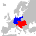
Category:Maps of the Central Powers
Jump to navigation
Jump to search
Media in category "Maps of the Central Powers"
The following 26 files are in this category, out of 26 total.
-
Central Powers gains in WWI.jpg 1,198 × 863; 120 KB
-
Central Powers military in Ukraine 1918 01.jpg 2,464 × 1,434; 1.76 MB
-
Dual Alliance in 1914.png 1,298 × 1,314; 198 KB
-
Dual Alliance in 1914.svg 450 × 456; 468 KB
-
Europe 1914 bg.png 1,198 × 863; 610 KB
-
Europe 1914.jpg 1,198 × 863; 110 KB
-
FR-WW1-1914.png 3,223 × 2,324; 184 KB
-
FR-WW1-1915-French-plans.png 3,223 × 2,324; 203 KB
-
FR-WW1-1916-French-plans.png 3,223 × 2,324; 203 KB
-
FR-WW1-1920-ar.png 2,578 × 1,859; 1.16 MB
-
FR-WW1-1920.png 3,223 × 2,324; 211 KB
-
Imperios centrales diacronico.png 2,965 × 1,845; 389 KB
-
Map 1914 WWI Alliances.jpg 1,682 × 1,328; 615 KB
-
PotenciasEnLiza1914-pt.svg 998 × 593; 442 KB
-
PotenciasEnLiza1914.svg 998 × 593; 444 KB
-
Schieramenti WWI.png 1,357 × 628; 36 KB
-
Subject Nationalities of the German Alliance.jpg 23,928 × 18,121; 86.26 MB
-
The battle fronts of Europe LOC 2016432164.jpg 4,468 × 2,961; 1.77 MB
-
The battle fronts of Europe LOC 2016432164.tif 4,468 × 2,961; 37.85 MB
-
TripleAlianzaEn1914.svg 450 × 456; 468 KB
-
World War I battle fronts of Europe overlaid over a map of the United States.jpg 2,234 × 1,481; 571 KB
-
WW1 Central Powers 6 Sept 1915.svg 450 × 456; 468 KB
-
WW1-French-plans.png 1,600 × 4,860; 1.37 MB
-
WWI-re.png 1,480 × 625; 42 KB
-
أوروبل-1914.png 3,753 × 2,658; 1.11 MB


