Category:Maps of Southern Rhodesia
Jump to navigation
Jump to search
Media in category "Maps of Southern Rhodesia"
The following 27 files are in this category, out of 27 total.
-
Flag map of Rhodesia (1964–1968).svg 766 × 699; 104 KB
-
Flag map of Rhodesia (1968–1979).svg 800 × 732; 438 KB
-
Flag map of Southern Rhodesia (1924–1964).svg 766 × 699; 94 KB
-
Flag map of Zimbabwe Rhodesia (1979).svg 769 × 699; 29 KB
-
LocationRhodesia (cuadrado - square).jpg 100 × 100; 8 KB
-
LocationRhodesia.png 250 × 115; 5 KB
-
Map of Southern Rhodesia c1927.jpg 1,400 × 828; 252 KB
-
RhodAfrican1970.png 858 × 785; 168 KB
-
Rhodesia adm location map with names.svg 832 × 754; 183 KB
-
Rhodesia Outline.png 400 × 399; 48 KB
-
Rhodesia.png 554 × 550; 107 KB
-
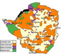
Rhodesia1970a.png 795 × 723; 157 KB
-
RhodesiaAllies1965-es.svg 1,015 × 967; 915 KB
-
RhodesiaAllies1965.png 624 × 475; 69 KB
-
RhodesiaAllies1975-en.svg 1,015 × 967; 825 KB
-
RhodesiaAllies1975-es.svg 1,015 × 967; 900 KB
-
RhodesiaAllies1975.png 624 × 475; 63 KB
-
Rhodesialand Arabic.png 699 × 747; 200 KB
-
Rhodesialand.png 700 × 645; 135 KB
-
Rhodesian general election 1970.png 1,512 × 732; 69 KB
-
South Africa and its future (1903) (14759321596).jpg 3,200 × 1,738; 311 KB
-
Southern Rhodesia (1909) (14784484432).jpg 2,956 × 2,940; 1.87 MB
-
Southern Rhodesia 1914.png 2,000 × 1,863; 427 KB
-
Third Salisbury administration, 1895-1900 (1900) (14593217290).jpg 5,412 × 5,408; 2.56 MB
-
Union of South Africa provinces and Rhodesia.png 406 × 533; 49 KB
-
מפה של רודזיה.jpg 510 × 388; 56 KB
-
罗德西亚形势图1975.jpg 624 × 475; 45 KB


