Category:Maps of Mindanao
Jump to navigation
Jump to search
Wikimedia category | |||||
| Upload media | |||||
| Instance of | |||||
|---|---|---|---|---|---|
| Category combines topics | |||||
| Mindanao | |||||
second largest island of the Philippines | |||||
| Instance of | |||||
| Part of | |||||
| Location | PH | ||||
| Located in or next to body of water | |||||
| Highest point | |||||
| Population |
| ||||
| Area |
| ||||
| Different from | |||||
 | |||||
Subcategories
This category has the following 9 subcategories, out of 9 total.
Media in category "Maps of Mindanao"
The following 38 files are in this category, out of 38 total.
-
1890 Mindanao.jpg 1,536 × 1,067; 129 KB
-
1989 Autonomous Region in Muslim Mindanao creation plebiscite.svg 3,930 × 3,107; 1.11 MB
-
2019 Cotabato EQs+faults.png 2,452 × 2,615; 4.41 MB
-
3ZCHI-subanen-tribe-territory-in-mindanao-islands-philippines.png 1,546 × 1,274; 165 KB
-
Agusan river watershed.png 1,536 × 1,152; 382 KB
-
Carte administrative de Mindanao.png 1,053 × 1,000; 171 KB
-
Carte topographique de Mindanao.svg 2,339 × 1,789; 1.42 MB
-
Map chavacano.gif 450 × 267; 5 KB
-
Cordillera and Bangsamoro.svg 1,871 × 2,468; 1.41 MB
-
Department of Mindanao and Sulu in the Philippines.svg 512 × 792; 1.27 MB
-
Guerrilla armies on Mindanao.jpg 2,008 × 1,413; 1.38 MB
-
L'extremité méridionale de Midanao (19546575116).jpg 5,656 × 3,728; 2.95 MB
-
Lake Lanao-Agus watershed.png 1,181 × 1,520; 207 KB
-
Lebak location map.png 974 × 655; 80 KB
-
MaguindanaoMapMaximumExtent.png 1,820 × 1,115; 364 KB
-
Map of Lumad in Mindanao Islands.png 1,594 × 1,646; 442 KB
-
Map of Maguindanao 1521.png 3,830 × 3,669; 396 KB
-
Mindanao - DPLA - 96a777667adf9c5d56b7597f82c447ad.jpg 14,978 × 11,340; 14.29 MB
-
Mindanao administrative map.svg 512 × 358; 1.65 MB
-
Mindanao and its associated islands.png 1,347 × 1,109; 31 KB
-
Mindanao blank map.png 1,177 × 655; 66 KB
-
Mindanao in Philippines.svg 1,871 × 2,468; 1.38 MB
-
Mindanao Red.png 2,000 × 3,120; 215 KB
-
Mindanao regions.PNG 1,551 × 1,094; 56 KB
-
MOA-AD 2008 Map (cropped).jpg 639 × 551; 87 KB
-
MOA-AD 2008 Map.jpg 842 × 595; 85 KB
-
Moro Sultanates (Philippines) (cropped).png 778 × 654; 572 KB
-
Moro Sultanates (Philippines).png 1,539 × 966; 1.43 MB
-
Ph fil department of mindanao and sulu.png 2,000 × 3,120; 133 KB
-
Ph locator map mindanao and sulu.PNG 2,000 × 3,120; 84 KB
-
Philippines relief location map (Mindanao).svg 656 × 486; 2.21 MB
-
Provincia de Maranao.JPG 470 × 395; 38 KB
-
Rafflesia verrucosa map.png 903 × 671; 392 KB
-
Sharia District Courts of the Philippines.svg 1,374 × 778; 129 KB
-
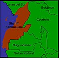
ShariffKab.jpg 492 × 485; 26 KB
-
Subanon Territories.png 666 × 700; 126 KB
-
SYiYY-subanen-ancestral-land-in-mindanao-islands-philippines(1).png 1,240 × 1,164; 145 KB


