Category:Maps of Allied occupation zones of Germany
Jump to navigation
Jump to search
Subcategories
This category has only the following subcategory.
Media in category "Maps of Allied occupation zones of Germany"
The following 77 files are in this category, out of 77 total.
-
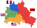
 1945 Berlin Zones (30249103203).jpg 1,762 × 1,330; 1.46 MB
-
 1946 Greater Berlin City Council election.svg 836 × 562; 408 KB
-
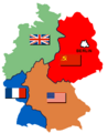
 Allied occupation in Germany (1945-1949).png 1,012 × 1,198; 242 KB
-
 Allied Occupation Zones.jpg 1,256 × 956; 1.68 MB
-
 American Sector Germany.png 464 × 599; 81 KB
-
 Belgische Strijdkrachten Duitsland.png 330 × 153; 5 KB
-
 Berlin Blockade-map.svg 774 × 593; 64 KB
-
 Besatzungszonen in Deutschland und Österreich.png 640 × 544; 82 KB
-
 Besatzungszonen ohne ar.png 331 × 405; 4 KB
-
 Besatzungszonen ohne text.png 331 × 405; 6 KB
-
 Besatzungszonen.jpg 320 × 450; 74 KB
-
 Bizonia Occupation Map.jpg 823 × 1,134; 1.09 MB
-
 British Sector Germany.png 464 × 599; 84 KB
-
 Deutsches Reich DDR Karte.png 593 × 681; 861 KB
-
 Deutschland Besatzungszonen - 1945 1946.svg 650 × 830; 225 KB
-
 Deutschland Besatzungszonen 1945 1946 amerikanisch.png 500 × 646; 21 KB
-
 Deutschland Besatzungszonen 1945 1946 britisch.png 500 × 646; 22 KB
-
 Deutschland Besatzungszonen 1945 1946 franzoesisch.png 500 × 646; 18 KB
-
 Deutschland Besatzungszonen 1945 1946.png 500 × 646; 20 KB
-
 Deutschland Besatzungszonen 1945 amerikanisch.png 500 × 646; 21 KB
-
 Deutschland Besatzungszonen 1945 britisch.png 500 × 646; 22 KB
-
 Deutschland Besatzungszonen 1945 franzoesisch.png 500 × 646; 18 KB
-
 Deutschland Besatzungszonen 1945 sowjetisch.png 500 × 646; 19 KB
-
 Deutschland Besatzungszonen 1945.png 464 × 599; 52 KB
-
 Deutschland Besatzungszonen 1945.svg 2,183 × 2,766; 246 KB
-
 Deutschland Besatzungszonen 8 Jun 1947 - 22 Apr 1949 amerikanisch.svg 1,075 × 1,273; 744 KB
-
 Deutschland Besatzungszonen 8 Jun 1947 - 22 Apr 1949 britisch.svg 1,075 × 1,273; 738 KB
-
 Deutschland Besatzungszonen 8 Jun 1947 - 22 Apr 1949 franzoesisch.svg 1,075 × 1,273; 734 KB
-
 Deutschland Besatzungszonen 8 Jun 1947 - 22 Apr 1949 sowjetisch.svg 1,075 × 1,273; 740 KB
-
 Deutschland Besatzungszonen 8 Jun 1947 - 22 Apr 1949.svg 1,075 × 1,273; 766 KB
-
 Deutschland mit Postleitgebieten und Besatzungszonen - btv1b531896061.jpg 10,442 × 8,470; 17.47 MB
-
 Deutschland nach dem Krieg.jpg 365 × 525; 187 KB
-
 Duitslandchurchill.png 998 × 896; 171 KB
-
 Duitslanddefinitief.png 998 × 896; 195 KB
-
 Duitslandroosevelt.png 998 × 896; 200 KB
-
 EAC Zonenprotokoll 1.png 2,362 × 2,006; 379 KB
-
 EAC Zonenprotokoll 2.png 2,362 × 2,006; 373 KB
-
 EAC Zonenprotokoll 3.png 2,362 × 2,006; 392 KB
-
 Flag Map of Allied-Occupied Germany.png 3,492 × 2,966; 899 KB
-
 Franz Besatzungszone.jpg 1,196 × 1,643; 250 KB
-
 FRG 1949 - 1990.png 350 × 477; 14 KB
-
 Germany after WWII zones F.png 350 × 477; 10 KB
-
 Germany after WWII zones UK.png 350 × 477; 11 KB
-
 Germany after WWII zones USA.png 350 × 477; 10 KB
-
 Germany after WWII zones USSR.png 350 × 477; 11 KB
-
 Germany divided BRD.png 350 × 477; 10 KB
-
 Germany location map labeled 8 Jun 1947 - 22 Apr 1949-colored.svg 1,075 × 1,273; 822 KB
-
 Germany Morgenthau Plan-en.svg 1,000 × 900; 129 KB
-
 Germany Morgenthau Plan.png 998 × 896; 146 KB
-
 Germany Occupation Zones 1947 blank.jpg 470 × 626; 61 KB
-
 Germany occupation zones with border He.jpg 842 × 1,148; 805 KB
-
 Germany occupation zones with border.jpg 1,460 × 1,212; 861 KB
-
 Man bij een landkaart, Bestanddeelnr 254-2229.jpg 2,628 × 2,554; 1.07 MB
-
 Map FRG GDRsvg.svg 592 × 801; 156 KB
-
 Map-Germany-1945.svg 3,492 × 2,966; 726 KB
-
 Map-Germany-1947-2.png 3,492 × 2,966; 414 KB
-
 Map-Germany-1947.svg 3,482 × 2,956; 559 KB
-
 Morgenthau Plan map.svg 671 × 442; 132 KB
-
 Morgenthau-plan.png 400 × 375; 17 KB
-
 Occupation Zone.png 1,280 × 1,087; 308 KB
-
 Occupation zones map of Germany and Austria, March 1946 (159080993).png 4,518 × 3,751; 29.58 MB
-
 Occupied Germany and Berlin.png 452 × 409; 10 KB
-
 Regierungsbezirk Minden in NRW 1946.svg 584 × 582; 142 KB
-
 Regierungsbezirk-Minden-194.png 593 × 802; 89 KB
-
 Soviet Occupied Germany.png 514 × 416; 12 KB
-
 Soviet Sector Germany.png 514 × 416; 9 KB
-
 Trizone Occupation Map.jpg 823 × 1,134; 1.04 MB
-
 US Army Germany occupation zones 1945.jpg 1,436 × 1,188; 1.61 MB
-
 독일-미국령.png 1,422 × 722; 87 KB
-
 독일-소련령.png 1,422 × 722; 60 KB
-
 독일-영국령.png 1,431 × 722; 87 KB
-
 독일-프랑스 점령지역.png 1,434 × 673; 83 KB
-
 독일-프랑스령.png 1,434 × 673; 58 KB
-
 동베를린.png 1,434 × 697; 55 KB
-
 서베를린.png 1,434 × 711; 167 KB
-
 자르 보호령.png 800 × 947; 120 KB
-
 프랑스령 독일 지역.png 1,434 × 627; 33 KB
.jpg)

.png)


.png)


