Category:Maps of Aa en Hunze
Jump to navigation
Jump to search
Wikimedia category | |||||
| Upload media | |||||
| Instance of | |||||
|---|---|---|---|---|---|
| Category combines topics | |||||
| Aa en Hunze | |||||
municipality in the Netherlands | |||||
| Pronunciation audio | |||||
| Instance of |
| ||||
| Named after | |||||
| Location | Drenthe, Netherlands | ||||
| Located in or next to body of water | |||||
| Capital | |||||
| Head of government |
| ||||
| Inception |
| ||||
| Population |
| ||||
| Area |
| ||||
| Elevation above sea level |
| ||||
| Replaces |
| ||||
| official website | |||||
 | |||||
Subcategories
This category has only the following subcategory.
Media in category "Maps of Aa en Hunze"
The following 19 files are in this category, out of 19 total.
-
Map - NL - Municipality code 1680 (2009).svg 300 × 160; 530 KB
-
2013-AaenHunze.jpg 4,435 × 4,363; 9.63 MB
-
BAG woonplaatsen - Gemeente Aa en Hunze.png 2,419 × 2,419; 1.29 MB
-
Drouwenerzand 1899.jpg 423 × 451; 67 KB
-
Gem-AaenHunze-2014Q1.jpg 8,430 × 8,517; 25.38 MB
-
Gem-AaenHunze-OpenTopo.jpg 8,584 × 8,666; 7.74 MB
-
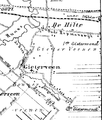
Gieterveen.png 259 × 304; 24 KB
-
Kostvlies.jpg 1,237 × 664; 160 KB
-
LocatieAaEnHunze.png 280 × 130; 8 KB
-
Map - NL - Aa en Hunze (2009).svg 625 × 575; 2.23 MB
-
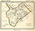
Netherlands, Anloo, map of 1866.jpg 1,200 × 1,070; 579 KB
-
Netherlands, Gieten, map of 1867.jpg 1,200 × 1,075; 517 KB
-
Nieuwediep.jpg 834 × 1,190; 172 KB
-
NL - locator map municipality code GM1680 (2016).png 2,125 × 1,417; 428 KB
-
Schipborg on the map of the Netherlands - improved version.jpg 427 × 500; 99 KB
-
Schipborg on the map of the Netherlands-2.jpg 409 × 491; 82 KB
-
Schipborg on the map of the Netherlands.jpg 417 × 500; 81 KB
-
Westerveld van Rolde.jpg 372 × 447; 35 KB
-
Zandbergen Drouwenerzand.jpg 1,167 × 1,352; 79 KB


