Category:Imuta-ike
Jump to navigation
Jump to search
| Object location | | View all coordinates using: OpenStreetMap |
|---|
body of water   | |||||
| Upload media | |||||
| Instance of | |||||
|---|---|---|---|---|---|
| Located in protected area |
| ||||
| Location | Kedōin-chō Imuta, Satsumasendai, Kagoshima Prefecture, Japan | ||||
| Heritage designation |
| ||||
 | |||||
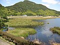
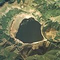
Media in category "Imuta-ike"
The following 7 files are in this category, out of 7 total.
-
 20090830 imutaike kagoshima-ken japan.jpg 2,400 × 1,594; 588 KB
-
 Imuta-ike Panorama 2011.jpg 5,229 × 1,660; 3.41 MB
-
 Imutaike 2.jpg 3,648 × 2,736; 2.27 MB
-
 Imutaike Kagoshima Japan.jpg 1,500 × 1,500; 351 KB
-
 Imutaike.jpg 3,648 × 2,736; 1.65 MB
-
 Shops at the lake - panoramio.jpg 1,024 × 768; 342 KB
-
 The peat forming vegetation of Imuta-ike monument.jpg 2,524 × 1,492; 532 KB


