Please tell us which country and city you'd like to see the weather in.

Tysvær
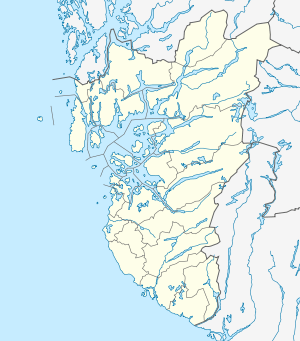
Tysvær is a municipality in Rogaland county, Norway. It is part of the Haugalandet region. The municipality is located on the Haugalandet peninsula on the northern side of the Boknafjorden, just east of the towns of Kopervik and Haugesund. The administrative centre of the municipality is the village of Aksdal. Other villages in the municipality include Dueland, Førre, Grinde, Hervik, Hindaråvåg, Nedstrand, Skjoldastraumen, Susort, Tysvær, and Yrke.
The European route E39 highway and European route E134 highways traverse the municipality with their junction located at Aksdal in Tysvær. The Frekasund Bridge on the E39 highway connects the mainland of Tysvær to the island municipality of Bokn to the south. The Karmøy Tunnel connects Tysvær to the town of Kopervik in neighboring Karmøy municipality.
General information
The municipality of Tysvær was established in 1849 when it was separated from the large municipality of Skjold. Initially, the municipality had a population of 2,058. On 1 January 1965, there was a major municipal merger which took place as the result of recommendations by the Schei Committee. The municipality of Tysvær was merged with the municipality of Nedstrand and parts of the municipalities of Avaldsnes, Skjold, Vats, and Vikedal. On 1 January 1969, the small Sponevik farm area (population: 6), just north of the village of Skjoldastraumen, was transferred from the neighboring Vindafjord municipality to Tysvær.
Tysværvåg
Tysvær or Tysværvåg is a village in Tysvær municipality in Rogaland county, Norway. The village is located at the end of the small Tysværvågen bay, about 2 kilometres (1.2 mi) off of the European route E39 highway. The nearby village of Susort lies about 8 kilometres (5.0 mi) south of the village of Tysvær, the municipal centre of Aksdal lies about 12 kilometres (7.5 mi) to the north, and the village of Hervik lies about 7 kilometres (4.3 mi) to the east. Tysvær Church is located in the village, serving the southwest portion of the municipality.