Please tell us which country and city you'd like to see the weather in.
Thornliebank
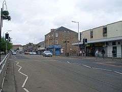
Coordinates: 55°48′22″N 4°19′01″W / 55.806°N 4.317°WThornliebank (Scots: Thonliebank, Scottish Gaelic: Bruach nan Dealgan) is a suburb of Glasgow in East Renfrewshire, Scotland, 6 miles (10 km) south of Glasgow's city centre. It is served by Thornliebank railway station and lies to the east of the M77 motorway.
History
It is not known when Thornliebank was first settled although it has been ascertained that it did not exist prior to the 18th century. The village first makes its appearance on Thomas Richardson's map of 1795 and was, at the time, referred to as 'Thorny Bank', a title believed to have been inspired by the substantial number of thorn trees that were prevalent in the area. In 1789 it was a little street of cottages but it had grown by 1845, to have a population of 1366. This was largely due to the Crum family, who established and ran the Thornliebank printworks. John Crum founded the works in Main Street in 1778 to print locally woven linen.
Walter Crum who was in charge by 1819 was a chemist and Fellow of the Royal Society. He replaced spinning and weaving by calico printing with bleaching, turkey red dyeing and "beetling". This brought immigrants from Northern Ireland and the New Statistical Account of Scotland described Thornliebank as "a very flourishing village where, thirty years ago, three families did not exist".