
Landsat program
The Landsat program is the longest-running enterprise for acquisition of satellite imagery of Earth. On July 23, 1972 the Earth Resources Technology Satellite was launched. This was eventually renamed to Landsat. The most recent, Landsat 8, was launched on February 11, 2013. The instruments on the Landsat satellites have acquired millions of images. The images, archived in the United States and at Landsat receiving stations around the world, are a unique resource for global change research and applications in agriculture, cartography, geology, forestry, regional planning, surveillance and education, and can be viewed through the USGS 'EarthExplorer' website. Landsat 7 data has eight spectral bands with spatial resolutions ranging from 15 to 60 meters; the temporal resolution is 16 days.
History
Hughes Santa Barbara Research Center initiated designed and fabricated the first three Multispectral Scanners (MSS) in the same year man landed on the moon, 1969. The first prototype MSS was completed within nine months by fall of 1970 when it was tested by scanning Half Dome at Yosemite National Park.

Landsat 7
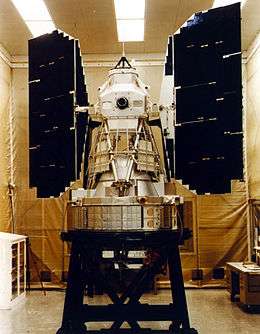
Landsat 7, launched on April 15, 1999, is the seventh satellite of the Landsat program. Landsat 7's primary goal is to refresh the global archive of satellite photos, providing up-to-date and cloud-free images. The Landsat Program is managed and operated by the USGS, and data from Landsat 7 is collected and distributed by the USGS. The NASA World Wind project allows 3D images from Landsat 7 and other sources to be freely navigated and viewed from any angle. The satellite's companion, Earth Observing-1, trails by one minute and follows the same orbital characteristics. Landsat 7 was built by Lockheed Martin Space Systems Company.
Satellite specifications
Landsat 7 was designed to last for five years, and has the capacity to collect and transmit up to 532 images per day. It is in a polar, sun-synchronous orbit, meaning it scans across the entire earth's surface. With an altitude of 705 kilometers +/- 5 kilometers, it takes 232 orbits, or 16 days, to do so. The satellite weighs 1973 kg, is 4.04 m long, and 2.74 m in diameter. Unlike its predecessors, Landsat 7 has a solid state memory of 378 gigabits (roughly 100 images). The main instrument on board Landsat 7 is the Enhanced Thematic Mapper Plus (ETM+).
Landsat 3
Landsat 3 is the third satellite of the Landsat program. It was launched on March 5, 1978, with the primary goal of providing a global archive of satellite imagery (satellite data are called images and not photos because they are not just reflected light exposure, but recordings of radiative electromagnetic energy fluxes of surface materials). Unlike later Landsats, Landsat 3 was managed solely by NASA. Landsat 3 is no longer in operation, having been decommissioned on September 7, 1983, far beyond its designed life expectancy of one year.
Specifications
Landsat 3 had essentially the same design as Landsat 2. It carried a Multi-Spectral Scanner, which had a maximum 75 meters (246 ft) resolution. Unlike the previous two Landsat missions, a thermal band was built into Landsat 3's Multi-Spectral Scanner, but this instrument failed shortly after the satellite was deployed. Landsat 3 was placed into a polar orbit at about 920 kilometers (570 mi), and took 18 days to cover the entire Earth's surface.