Please tell us which country and city you'd like to see the weather in.

Huancavelica
Huancavelica (Spanish pronunciation: [waŋkaβeˈlika]) or Wankawilka in Quechua is a city in Peru. It is the capital of the Huancavelica region and according to the 2007 census had a population of 40,004 people (41,334 in the metropolitan area). The city was established on August 5, 1572 by the Viceroy of Peru Francisco de Toledo. Indigenous peoples represent a major percentage of the population. It has an approximate altitude of 3,660 meters; the climate is cold and dry between the months of February and August with a rainy season between September and January. It is considered one of the poorest cities in Peru.
Geography
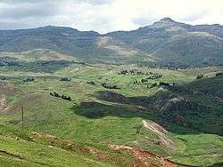
The Huancavelica area features a rough geography with highly varied elevation, from 1,950 metres in the valleys to more than 5,000 metres on its snow-covered summits. These mountains contain metallic deposits. They consist of the western chain of the Andes, which includes the Chunta mountain range, formed by a series of hills, the most prominent of which are: Sitaq (5,328m), Wamanrasu (5,298m) and Altar (5,268m).

Huancavelica Region
Huancavelica is a region in Peru with an area of 22,131.47 km² and a population of 454,797 (2007 census). The capital is the city Huancavelica. The region is bordered by Lima Region and Ica in the west, Junín in the north, and Ayacucho in the east.
Political division
The region is divided into seven provinces.
Province (Capital)
The main cities are Huancavelica, Pampas and Lircay. There are many little districts like Querco in Huancavelica. Querco is a nice little town. Most of the residents are agricultors. They own cattle, sheep, pigs, horses, mules, llamas, goats, chickens, and donkeys.
The People
The region is mostly inhabited by indigenous people of Quechua descent.
Languages
According to the 2007 Peru Census, the language learnt first by most of the residents was Quechua (64.03%) followed by Spanish (35.67%). The following table shows the results concerning the language learnt first in the Huancavelica Region by province:
Radio Stations - Huancavelica
SEARCH FOR RADIOS
Podcasts:

Latest News for: huancavelica
Lightning Strikes Soccer Team in Peru, Killing Player
Peruvian nursery nursery donates 35,000 citrus plants to Commune of Huancavelica
- 1
