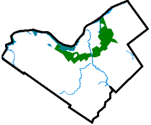
Green belt (United Kingdom)
In United Kingdom town planning, the green belt is a policy for controlling urban growth. The idea is for a ring of countryside where urbanisation will be resisted for the foreseeable future, maintaining an area where agriculture, forestry and outdoor leisure can be expected to prevail. The fundamental aim of green belt policy is to prevent urban sprawl by keeping land permanently open, and consequently the most important attribute of green belts is their openness.
The Metropolitan Green Belt around London was first proposed by the Greater London Regional Planning Committee in 1935. The Town and Country Planning Act 1947 then allowed local authorities to include green belt proposals in their development plans. In 1955, Minister of Housing Duncan Sandys encouraged local authorities around the country to consider protecting land around their towns and cities by the formal designation of clearly defined green belts.
Green belt policy has been criticised for reducing the amount of land available for building and therefore pushing up house prices, as 70% of the cost of building new houses is the purchase of the land (up from 25% in the late 1950s).

Green belt
A green belt or greenbelt is a policy and land use designation used in land use planning to retain areas of largely undeveloped, wild, or agricultural land surrounding or neighbouring urban areas. Similar concepts are greenways or green wedges which have a linear character and may run through an urban area instead of around it. In essence, a green belt is an invisible line designating a border around a certain area, preventing development of the area and allowing wildlife to return and be established.
Purposes
In those countries which have them, the stated objectives of green belt policy are to:
The green belt has many benefits for people:
Green belt (disambiguation)
Green belt or greenbelt is an area of protected open space around an urban area.
Green belt may also refer to:
- Metropolitan Green Belt, protected area around London, England, United Kingdom
- Greenbelt Station, a Washington Metro and MARC train station
- Greenbelt Historic District
- Greenbelt Homes, Inc., an historic housing cooperative
- Greenbelt Park, a national park in Greenbelt

Allegheny County belt system
The Allegheny County Belt System color codes miscellaneous county roads to form a unique system of routes in Allegheny County, Pennsylvania, and around the city of Pittsburgh.
Unlike many major American cities that utilize number-coded limited-access roads to form belt systems, the belts in the Allegheny County Belt System are not intended to be used as high-speed routes. Rather, the belt system is to be used as a navigational aid for motorists in unfamiliar portions of the county. Roads that make up the Belt System retain their previous names. The five original routes are, from outermost to innermost, the Red, Orange, Yellow, Green, and Blue Belts. The Purple Belt was not part of the original system and was added later.
History
The Allegheny County Belt System was developed in the late 1940s by Joseph White, an engineer with the Allegheny County Department of Public Works, as a wayfarer system using a network of federal, state, and municipal roads to offer residents alternative traffic patterns which did not lead to downtown Pittsburgh's congested Golden Triangle. As such, it actually predates the Interstate Highway System developed during the Eisenhower administration.
Podcasts:

