Please tell us which country and city you'd like to see the weather in.

Acton, Wrexham
Coordinates: 53°03′39″N 2°58′50″W / 53.0607°N 2.9805°W / 53.0607; -2.9805
Acton is a local government community, the lowest tier of local government, part of the Wrexham County Borough in Wales. It lies in the north-eastern part of the market town of Wrexham. The area is largely residential and at its centre, lies Acton Park, the location of the former Acton Hall.
History, Geography
Acton was originally one of the townships of the parish of Wrexham (in 1886, the township was transferred to the new ecclesiastical parish of Rhosddu). Under the civil administration, the civil parish of Acton, based on the old township's boundaries, was part of the Wrexham Rural District, but was abolished in 1935 and parts were transferred to the civil parishes of Bieston and Wrexham Regis. All the latter structures were abolished under the terms of the Local Government Act 1972.
In 1985, a Boundary Commission review led to the creation of four new community areas within Wrexham itself, Acton, Rhosddu, Offa, and Caia Park, each of which would have their own community council.

Wrexham
Coordinates: 53°02′46″N 2°59′35″W / 53.046°N 2.993°W / 53.046; -2.993
Wrexham (/ˈrɛksəm/ REKS-əm; Welsh: Wrecsam; Welsh pronunciation: [ˈwrɛksam]) is a town in north Wales. It is the administrative centre of the wider Wrexham County Borough, located in the east of the region. It is situated between the Welsh mountains and the lower Dee Valley alongside the border with Cheshire, England. As the largest town in the north of Wales, it is a major centre of the region's administrative, commercial, retail and educational infrastructure.
At the time of the United Kingdom Census 2011, the Wrexham locality had a population of 61,603 as defined by the Office for National Statistics; the larger urban area had a population of 65,692, the fourth-largest in Wales.
History
Prehistoric to Roman times
Human activity in the Wrexham area dates back to the Mesolithic period (8000 to 4300 BC). By the early Middle Bronze Age the area had developed into a centre for an innovative metalworking industry.
A Roman civilian settlement was located in the Plas Coch area of Wrexham and excavations have revealed evidence of agriculture and trade with the wider Roman world.

Wrexham County Borough
Wrexham County Borough (Welsh: Bwrdeistref Sirol Wrecsam [ˈwrɛksam]) is a local government principal area centred on the town of Wrexham in north-east Wales. The county borough has a population of nearly 135,000 inhabitants. Just under half of the population live either within the town of Wrexham or its surrounding conurbation of urban villages which has a population of around 63,000 people. The remainder live to the south and east of the town in more rural areas. The area has strong links with coal-mining.
The county borough was formed on 1 April 1996. Borough status was inherited from the town of Wrexham, granted over 150 years ago. Most of the area was previously part of the district of Wrexham Maelor - with several communities coming from Glyndŵr - in the county of Clwyd.
The area includes a portion of the eastern half of the historic county of Denbighshire (although not forming part of the principal area of Denbighshire), and two exclaves of historic Flintshire - English Maelor and the parish of Marford and Hoseley.
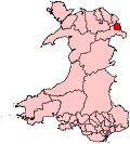
Wrexham (UK Parliament constituency)
Wrexham (Welsh: Wrecsam) is a parliamentary constituency in Wales which is represented in the House of Commons of the Parliament of the United Kingdom. It elects one Member of Parliament (MP) by the first-past-the-post system of election.
The Wrexham Welsh Assembly constituency was created with the same boundaries in 1999.
History
Until 1885, Wrexham was part of the Denbighshire parliamentary constituency, which elected one Member of Parliament until the Reform Act 1832 increased this to two members. In 1885 the Denbighshire constituency was split and Wrexham became part of the new East Denbighshire constituency.
In 1918 the Wrexham constituency was created, electing one Member of Parliament. For the 1983 general election, major boundary reorganisation saw large areas removed from the Wrexham constituency to form the new constituency of Clwyd South West (later to become Clwyd South).
Boundaries
Wrexham constituency consists of the following electoral wards: Acton, Borras Park, Brynyffynnon, Cartrefle, Erddig, Garden Village, Gresford East and West, Grosvenor, Gwersyllt East and South, Gwersyllt North, Gwersyllt West, Hermitage, Holt, Little Acton, Llay, Maesydre, Marford and Hoseley, Offa, Queensway, Rhosnesni, Rossett, Smithfield, Stansty, Whitegate, Wynnstay.