
ཨའིསི་ལེནཌ
| Please translate this article into Dzongkha or check its translation. Please translate this template into Dzongkha (e) |

-
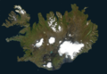 Combined satellite image of Iceland
 -
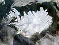 NASA satellite image of Iceland
 -
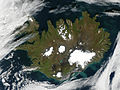 Iceland on September 9 2002
 -
-
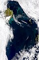
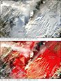 Grímsvötn eruption Nov. 2004
 -
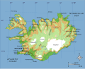 A map of Iceland with major geographical features marked
 -
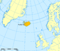 Iceland between Scandinavia, British Islands, and Greenland
 -
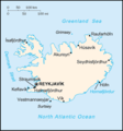 CIA Factbook map of Iceland
 -
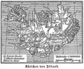 Historical map of Iceland (1888)
 -
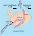 Mid-Atlantic Rigde
 -
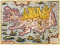 Iceland in 1590, Ortelius


- Commons:[༡]
| Please translate this article into Dzongkha or check its translation. Please translate this template into Dzongkha (e) |
| སྤྱི་མཐོང་གཏོར་མ་འབྲེལ་ལམ་འཚོལ་ཡོད། འདི་ནི་ཤོག་ངོས་བསྐྱར་བྱས་པ་ཚུ་དབྱེ་བ། |