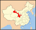
Datei:China-Gansu.png
China-Gansu.png (268 × 218 Pixel, Dateigröße: 16 KB, MIME-Typ: image/png)
Dateiversionen
Klicke auf einen Zeitpunkt, um diese Version zu laden.
| Version vom | Vorschaubild | Maße | Benutzer | Kommentar | |
|---|---|---|---|---|---|
| aktuell | 15:56, 15. Jul. 2005 |  | 268 × 218 (16 KB) | Schaengel89~commonswiki | transparent background |
| 23:39, 4. Jun. 2005 |  | 268 × 218 (9 KB) | Ran | '''en''': Location of Gansu Province in the People's Republic of China. See Category:Locator maps of province-level divisions of the People's Republic of China for more information. '''zh''': 甘肅省在中華人民共和國的位置。另見[[:Cat |
Dateiverwendung
Die folgenden 13 Seiten verwenden diese Datei:
Globale Dateiverwendung
Die nachfolgenden anderen Wikis verwenden diese Datei:
- Verwendung auf bn.wikipedia.org
- Verwendung auf da.wikipedia.org
- Verwendung auf en.wikipedia.org
- Wikipedia:WikiProject Chinese provinces/Locator maps
- Xiahe County
- Yongjing County
- Daxia River
- Kongtong Mountains
- Subei Mongol Autonomous County
- Bairi Tibetan Autonomous County
- Zhuanglang County
- Huangyangchuan
- User:OldakQuill/temp
- Dunhuang Mogao International Airport
- Yongchang County
- Qingyang Airport
- Template:Gansu-geo-stub
- Xifeng, Qingyang
- Mazong Mountain
- Liancheng National Nature Reserve
- Longxi County
- Lintao County
- Min County
- Wushao Mountain
- 2008 Tibetan unrest
- Chongxin County
- Guanghe County
- Hezheng County
- Dongxiang Autonomous County
- Xihe County
- Wushan County, Gansu
- Qingshui County
- Qin'an County
- Gangu County
- Zhangjiachuan Hui Autonomous County
- Qinzhou, Tianshui
- Maiji, Tianshui
- Huining County
- Jingyuan County, Gansu
- Yongdeng County
- Gaolan County
- Yuzhong County
- Zhenyuan County, Gansu
- Ning County
- Zhengning County
- Huan County
- Huachi County
- Heshui County
- Gulang County
- Tongwei County
Weitere globale Verwendungen dieser Datei anschauen.


