Search results
Jump to navigation
Jump to search
Did you mean: program landesamt
Search categories • Skip PDFs and DjVus • View other tools
|
Help
|
|
Browse
|
Search
|
Create the page "Program Landsat" on this wiki!
 English Landsat program timeline in 2021 applies to jurisdiction: United States of America determination method: work of the federal government of the...(1,334 × 628 (180 KB)) - 16:59, 17 August 2024
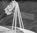 English A sketch of Landsat-6 in orbit...(656 × 582 (296 KB)) - 00:52, 8 May 2022
 English The NASA/USGS Landsat Program provides the longest continuous space-based record of Earth’s land in existence. Landsat data give us information...(1,200 × 1,200 (2.86 MB)) - 08:33, 30 August 2024
- English Let’s take a look at the Landsat program 2023, as we delve into studies revealing the environmental impact of river mining, the decline in global...(WebM VP8/Opus video file, 6 min 18 s) - 03:16, 18 August 2024
- English Landsat Next looks to push the program’s spectral capabilities even further, boasting an additional 15 spectral bands, bringing the total to 26...(WebM VP8 video file, 28 s) - 03:22, 18 August 2024
 Lake Disappointment, Western Australia; Landsat image screen capture from NASA's World Wind program English...(1,278 × 728 (206 KB)) - 06:48, 11 February 2023
 English Landsat Next looks to push the program’s spectral capabilities even further, boasting an additional 15 spectral bands, bringing the total to 26...(3,434 × 1,918 (7.36 MB)) - 03:13, 18 August 2024
 Landsat image of Goat Paddock crater, Western Australia; screen capture from NASA's World Wind program...(924 × 685 (197 KB)) - 14:33, 18 March 2018
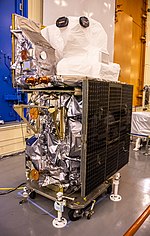 English Landsat 9 in processing applies to jurisdiction: United States of America determination method: work of the federal government of the United States...(4,618 × 7,276 (32.28 MB)) - 13:49, 18 August 2024
 English Landsat 9 satellite applies to jurisdiction: United States of America determination method: work of the federal government of the United States...(3,840 × 2,160 (648 KB)) - 11:41, 17 August 2024
 Landsat image of the Connolly Basin crater (circular feature in centre); screen capture from the NASA World Wind program English determination method:...(985 × 728 (162 KB)) - 19:43, 11 April 2024
 Paddock crater, Western Australia; oblique Landsat image (x3 vert. exad.) draped over digital elevation data; screen capture from NASA's World Wind program....(1,024 × 689 (217 KB)) - 14:46, 18 March 2018
 centre), Western Australia; oblique Landsat image (x3 vert. exad.) draped over digital elevation data; screen capture from NASA's World Wind program....(1,018 × 728 (257 KB)) - 14:39, 18 March 2018
 Oblique Landsat image draped over digital elevation data (x10 vertical exaduration), Connolly crater (circular depression in centre); screen capture from...(928 × 580 (121 KB)) - 19:43, 11 April 2024
 display on a computer screen. For the high-definition version, see File:Corsica (Landsat 7) - high definition.png. English determination method: SHA-1...(2,689 × 4,359 (15.96 MB)) - 08:45, 16 April 2024
 -116.4098595 p040r035_7x20000611.ETM-EarthSat-Orthorectified NASA Landsat Program (processed outside USGS) processed Global Land Cover Facility Institute...(4,362 × 3,876 (755 KB)) - 15:05, 17 August 2024
 English Landsat 9 spacecraft is moved into position for encapsulation on Aug. 16, 2021 applies to jurisdiction: United States of America determination...(1,220 × 1,920 (366 KB)) - 21:32, 15 August 2024
 File:San Francisco Landsat7 Lg.jpg (category Landsat images of the United States)Public domain, from the USGS and NASA Landsat 7 program. Image shows San Francisco, California. Originally uploaded by Gentgeen, of the en.wikipedia....(475 × 784 (394 KB)) - 12:58, 17 August 2024
 English Landsat 8 passing over Colorado on 8.10.20...(1,300 × 1,056 (121 KB)) - 21:39, 21 October 2022
 numbers for rangeland from Landsat data ( ) Author Zevenbergen, Adrian W Title Runoff curve numbers for rangeland from Landsat data Series title Hydrology...(1,245 × 1,620 (3.48 MB)) - 15:49, 25 August 2024


.png)

.png)


.png)


