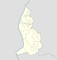
File:Liechtenstein location map.svg

Original file (SVG file, nominally 568 × 603 pixels, file size: 165 KB)
Captions
Captions
Summary
[edit]| DescriptionLiechtenstein location map.svg |
Deutsch: Positionskarte von Liechtenstein
Quadratische Plattkarte. Geographische Begrenzung der Karte:
English: Location map of Liechtenstein
Equirectangular projection. Geographic limits of the map:
|
||
| Date | 07-09-2008 | ||
| Source | own work, using Liechtenstein-Planken.svg by William Shewring | ||
| Author | Maximilian Dörrbecker (Chumwa) | ||
| Permission (Reusing this file) |
I, the copyright holder of this work, hereby publish it under the following licenses:
This file is licensed under the Creative Commons Attribution-Share Alike 3.0 Unported license.
You may select the license of your choice. |

|
This map has been made or improved in the German Kartenwerkstatt (Map Lab). You can propose maps to improve as well.
azərbaycanca ∙ čeština ∙ Deutsch ∙ Deutsch (Sie-Form) ∙ English ∙ español ∙ français ∙ italiano ∙ latviešu ∙ magyar ∙ Nederlands ∙ Plattdüütsch ∙ polski ∙ português ∙ română ∙ sicilianu ∙ slovenščina ∙ suomi ∙ македонски ∙ русский ∙ ქართული ∙ հայերեն ∙ বাংলা ∙ ไทย ∙ +/−
|
File history
Click on a date/time to view the file as it appeared at that time.
| Date/Time | Thumbnail | Dimensions | User | Comment | |
|---|---|---|---|---|---|
| current | 06:15, 29 September 2013 |  | 568 × 603 (165 KB) | Chumwa (talk | contribs) | corr |
| 20:35, 27 September 2013 |  | 568 × 603 (80 KB) | Chumwa (talk | contribs) | corr | |
| 16:52, 22 September 2008 |  | 568 × 604 (202 KB) | Chumwa (talk | contribs) | Flächenfarbe der "anderen Staaten" korrigiert | |
| 10:19, 7 September 2008 |  | 568 × 604 (202 KB) | Chumwa (talk | contribs) | um bereits existierendes Breite-Höhe-Verhältnis wiederherzustellen... | |
| 09:34, 7 September 2008 |  | 435 × 807 (202 KB) | Chumwa (talk | contribs) | == Beschreibung == {{Information |Description= {{de|Positionskarte von Liechtenstein}} Quadratische Plattkarte. Geographische Begrenzung der Karte: * N: 47.30° N * S: 47.03° N * W: 9.45° O * O: 9.67° O {{en|Location map of [[:de: |
You cannot overwrite this file.
File usage on Commons
The following 29 pages use this file:
- User:Chumwa/Gallery
- User:Iketsi/Sandbox/maps
- User talk:NordNordWest/Archive12
- File:2009 Liechtenstein general election - Results by constituency.svg
- File:2013 Liechtenstein general election - Results by constituency.svg
- File:2017 Liechtenstein general election - Results by constituency.svg
- File:Balzers in Liechtenstein.svg
- File:Balzers map.png
- File:Eschen in Liechtenstein.svg
- File:Eschen map.png
- File:Gamprin in Liechtenstein.svg
- File:Gamprin map.png
- File:Liechtenstein - Gemeinden mit Exklaven.png
- File:Mauren in Liechtenstein.svg
- File:Oberland in Liechtenstein.svg
- File:Planken in Liechtenstein.svg
- File:Planken map.png
- File:Ruggell in Liechtenstein.svg
- File:Schaan in Liechtenstein.svg
- File:Schaan map.png
- File:Schellenberg in Liechtenstein.svg
- File:Triesen in Liechtenstein.svg
- File:Triesen map.png
- File:Triesenberg in Liechtenstein.svg
- File:Triesenberg map.png
- File:Unterland in Liechtenstein.svg
- File:Vaduz in Liechtenstein.svg
- File:Vaduz map.png
- File:列支敦士登行政区划地图.png
File usage on other wikis
The following other wikis use this file:
- Usage on af.wikipedia.org
- Usage on als.wikipedia.org
- Usage on an.wikipedia.org
- Vaduz
- Schaan
- Triesenberg
- Planken
- Balzers
- Triesen
- Schellenberg
- Ruggell
- Mauren
- Eschen
- Gamprin
- Bendern
- Plantilla:Mapa de localización Liechtenstein
- Nendeln
- Schaanwald
- Mäls
- Mühleholz
- Hinterschellenberg
- Ebenholz
- Gaflei
- Malbun
- Steg (Liechtenstein)
- Silum
- Masescha
- Rotenboden
- Samina (Liechtenstein)
- Wangerberg
- Sücka
- Usage on ar.wikipedia.org
- Usage on ast.wikipedia.org
View more global usage of this file.
Metadata
This file contains additional information such as Exif metadata which may have been added by the digital camera, scanner, or software program used to create or digitize it. If the file has been modified from its original state, some details such as the timestamp may not fully reflect those of the original file. The timestamp is only as accurate as the clock in the camera, and it may be completely wrong.
| Width | 568.382px |
|---|---|
| Height | 603.144px |
