Category:Rivers of New South Wales
Zur Navigation springen
Zur Suche springen
Bundesstaaten von Australien: Neusüdwales · Queensland · Südaustralien · Tasmanien · Victoria · Westaustralien
Innere Gebiete Australiens: Australian Capital Territory · Northern Territory
Außengebiete Australiens:
Innere Gebiete Australiens: Australian Capital Territory · Northern Territory
Außengebiete Australiens:
Wikimedia-Kategorie | |||||
| Medium hochladen | |||||
| Ist ein(e) | |||||
|---|---|---|---|---|---|
| Kategorie kombiniert die Themen | |||||
| |||||
Unterkategorien
Es werden 121 von insgesamt 121 Unterkategorien in dieser Kategorie angezeigt:
In Klammern die Anzahl der enthaltenen Kategorien (K), Seiten (S), Dateien (D)
A
- Abercrombie River (6 D)
- Allyn River (2 D)
- Avon River (Gloucester) (2 D)
B
- Barnard River (1 D)
- Beardy River (3 D)
- Beardy Waters (1 D)
- Bega River (6 D)
- Bellinger River (13 D)
- Bombala River (5 D)
- Boonoo Boonoo River (5 D)
C
- Cataract River (Wollondilly) (1 D)
- Chandler River (4 D)
- Clyde River (12 D)
- Cobrabald River (1 D)
- Cockburn River (1 D)
- Colo River (7 D)
- Coolaburragundy River (4 D)
- Cooplacurripa River (1 D)
- Corang River (2 D)
- Cuttaburra Creek (1 D)
D
- Deua River (4 D)
- Dilgry River (1 D)
E
- Endrick River (2 D)
F
- Fish River (Gunning) (4 D)
- Forbes River (1 D)
G
- Gara River (1 D)
- Gloucester River (3 D)
- Goobarragandra River (5 D)
- Grose River (8 D)
- Gwydir River (11 D)
H
- Hacking River (10 D)
I
- Ingeegoodbee River (1 D)
J
K
L
- Little Manning River (1 D)
M
- Mann River (New South Wales) (2 D)
- Mongarlowe River (10 D)
- Moruya River (3 D)
- Munmurra River (2 D)
- Myall River (5 D)
N
- Nambucca River (5 D)
- Narran River (3 D)
- Nattai River (1 D)
- Nowendoc River (1 D)
- Nymboida River (3 D)
P
- Paroo River (10 D)
- Peel River (5 D)
Q
R
S
T
- Telegherry River (1 D)
- Thredbo River (14 D)
- Tia River (5 D)
- Turon River (7 D)
W
- Wadbilliga River (1 D)
- Wallamba River (4 D)
- Wilson River (6 D)
- Wolgan River (3 D)
- Wollomombi River (2 D)
Y
- Yarrangobilly River (3 D)
- Yarrowitch River (1 D)
Medien in der Kategorie „Rivers of New South Wales“
Folgende 53 Dateien sind in dieser Kategorie, von 53 insgesamt.
-
 174 Fish R. nr O'Connell, Apr 79 (52125807401).jpg 2.560 × 1.920; 1,21 MB
-
 A river scene possibly near Scone (3169113072).jpg 1.024 × 790; 487 KB
-
 Abercrombie River & Copperhannia Creek (New South Wales, Australia) (40310429520).jpg 3.008 × 2.000; 4,73 MB
-
 AU-NSW-Goodooga-Birrie River new bridge-2021.jpg 3.264 × 2.448; 1,65 MB
-
 AU-NSW-Goodooga-Birrie River old bridge-2021.jpg 3.264 × 2.448; 1,77 MB
-
 AU-NSW-Goodooga-Bohkara River-2021.jpg 3.264 × 2.448; 1,86 MB
-
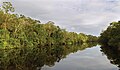
 Australian bush river reflection.jpg 2.032 × 1.524; 1,13 MB
-
 Batemans Bay.jpg 4.081 × 2.720; 2,86 MB
-
 BBlanche-3866.jpg 1.200 × 800; 1,13 MB
-
 Collarenebri NSW - Big Leather Watercourse sign near Collymongle.jpg 3.648 × 2.736; 1,58 MB
-
 Coonong Creek Bushland Reserve Gymea Bay.jpg 6.000 × 4.000; 6,88 MB
-
 CSIRO ScienceImage 3191 Aerial view of river.jpg 1.960 × 3.008; 3,86 MB
-
 CSIRO ScienceImage 3370 Aerial view of river.jpg 1.960 × 3.008; 6,8 MB
-
 CSIRO ScienceImage 3645 Aerial view of river.jpg 3.008 × 1.960; 4,05 MB
-
 Drowning tractor (139814072).jpg 800 × 565; 48 KB
-
 DuckmaloiRiver near OberonNSW 2013 02 24.jpg 4.229 × 2.969; 7,89 MB
-
 Eastern Creek Doonside.jpg 1.600 × 1.067; 623 KB
-
 Esk-river-01.jpg 767 × 450; 125 KB
-
 Evans River. NSW (3795273242).jpg 3.888 × 2.592; 4,29 MB
-
 FishRiver OberonNSW at OConnell 2013 02 24.jpg 5.184 × 3.456; 7,77 MB
-
 Glencoe Creek Marowin Brook.jpg 1.600 × 1.067; 1,5 MB
-
 Gloucester Valley 2013 June.jpg 1.577 × 1.051; 187 KB
-
 Gundablouie Bridge over Moonie River in Collarenebri NSW.jpg 3.648 × 2.736; 2,59 MB
-
 Jenolan Caves Imperial Cave river.jpg 3.888 × 2.592; 4,66 MB
-
 Lansdowne River 2023.jpg 4.032 × 2.268; 5,1 MB
-
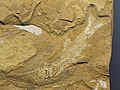 Leptolepis talbragarensis.JPG 1.600 × 1.200; 635 KB
-
 Local waterhole, Royal National Park.jpg 4.000 × 3.000; 9,58 MB
-
 Macquarie Pass Cascades.jpg 1.620 × 1.080; 556 KB
-
 Macquarie Pass National Park River.jpg 3.264 × 4.928; 3,18 MB
-
 Meroo River at Yarrabin (Merrendee).jpg 4.032 × 3.024; 3,98 MB
-
 Middle harbour creek 2.jpg 640 × 480; 52 KB
-
 Middle harbour creek.jpg 640 × 480; 58 KB
-

-
 Mount Cogo Wilson River Port Macquarie News South Wales (1).png 768 × 432; 623 KB
-
 Nattai River aerial.jpg 5.616 × 3.744; 5,64 MB
-
 Pelican River.jpg 3.395 × 1.866; 1,23 MB
-
 River of Big Hole, New South Wales.jpg 1.112 × 577; 896 KB
-
 River scene with boat, sail forming an awning (3230394794).jpg 1.024 × 776; 626 KB
-
 River scene with man in rowing boat and camp (3575334386).jpg 1.024 × 783; 562 KB
-
 River scene with possibly snow on rocks (3194989457).jpg 1.024 × 780; 469 KB
-
 River scene with rowing boat and boat shed (3230393892).jpg 1.024 × 778; 534 KB
-
 Simon sees - 51246338645.jpg 4.032 × 3.024; 4,72 MB
-
 Snowy River Crossing, Kosciuszko National Park.jpg 3.000 × 1.000; 1,83 MB
-
 Stewarts River 2023.jpg 4.032 × 2.268; 4,89 MB
-
 The oyster leases at Tuncurry, Lakes Way, NSW. - panoramio.jpg 1.189 × 1.786; 1,03 MB
-
 Trout fishing on Big Badja's River, Cooma (NSW) (23143075422).jpg 4.992 × 3.202; 1,75 MB
-
 Uralla to Bundarra roadside views 4.jpg 1.780 × 1.055; 520 KB
-
 Wallamba River - panoramio.jpg 1.706 × 2.560; 457 KB
-
 Wang Wauk River 2023.jpg 4.032 × 2.268; 5,73 MB
-
 Wilsons River and Riverside Park, Lismore.jpg 2.704 × 1.724; 934 KB
-
 Wilsons-river-lismore.jpg 12.150 × 3.090; 6,35 MB
-
 Wyong River 2023.jpg 4.032 × 2.268; 6,02 MB
-
 Wyong River Paddling - panoramio.jpg 1.936 × 1.296; 1.009 KB
.jpg)
.jpg)
_(40310429520).jpg)


.jpg)


.jpg)


.jpg)


.png)


.jpg)
.jpg)
.jpg)
.jpg)


_(23143075422).jpg)


