Category:Pressath
Vai alla navigazione
Vai alla ricerca
comune tedesco     | |||||
| Carica un file multimediale | |||||
| Audio della pronuncia | |||||
|---|---|---|---|---|---|
| Istanza di |
| ||||
| Parte di |
| ||||
| Luogo | circondario di Neustadt an der Waldnaab, distretto dell'Alto Palatinato, Baviera, Germania | ||||
| Popolazione |
| ||||
| Superficie |
| ||||
| Altezza sul mare |
| ||||
| sito web ufficiale | |||||
 | |||||
Sottocategorie
Questa categoria contiene le 3 sottocategorie indicate di seguito, su un totale di 3.
S
Pagine nella categoria "Pressath"
Questa categoria contiene un'unica pagina, indicata di seguito.
File nella categoria "Pressath"
Questa categoria contiene 23 file, indicati di seguito, su un totale di 23.
-
De-Pressath.ogg 1,8 s; 17 KB
-
 DEU Pressath COA.svg 1 006 × 1 076; 17 KB
-
 Digitales Orthofoto von Pressath (Bayerische Vermessungsverwaltung).tif 27 500 × 35 000; 1,72 GB
-
 Eschenbach 0145.png 1 034 × 1 477; 1,28 MB
-
 Eschenbach 0146.png 1 034 × 1 477; 1,33 MB
-
 Eschenbach 0148.png 1 034 × 1 477; 1,25 MB
-
 Eschenbach 0149.png 1 034 × 1 477; 1,58 MB
-
 Eschenbach 0150.png 1 034 × 1 477; 1,48 MB
-
 Eschenbach 0151.png 1 034 × 1 477; 1,1 MB
-
 Eschenbach 0152.png 1 034 × 1 477; 1,28 MB
-
 Feuchtbiotop Grünbachweiher 2 - panoramio.jpg 4 608 × 3 456; 7,45 MB
-
 Feuchtbiotop Grünbachweiher 3 - panoramio.jpg 4 608 × 3 456; 8,45 MB
-
 Feuchtbiotop Grünbachweiher 4 - panoramio.jpg 4 608 × 3 456; 8,14 MB
-
 Feuchtbiotop Grünbachweiher 5 - panoramio.jpg 4 608 × 3 456; 9,76 MB
-
 Hessenreuth - panoramio.jpg 1 600 × 1 200; 320 KB
-
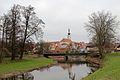 Pressath Haidenaab 29 12 2015.JPG 5 184 × 3 456; 6,99 MB
-
 Pressath in NEW.svg 1 000 × 532; 740 KB
-
 PRESSATH nieder.png 480 × 360; 5 KB
-
 PRESSATH nieder.svg 512 × 427; 21 KB
-
 Pressath P1130637.jpg 2 048 × 1 536; 1,38 MB
-
 Pressath P1130642.jpg 2 048 × 1 536; 1,34 MB
-
 Schloss Döllnitz.PNG 609 × 367; 547 KB
-
 Wappen Pressath.png 150 × 160; 4 KB


