Category:Landkreis Ravensburg
Jump to navigation
Jump to search
Urban districts (cities): Baden-Baden · Freiburg · Heidelberg · Heilbronn · Karlsruhe · Mannheim · Pforzheim · Stuttgart · Ulm
district of Baden-Württemberg, Germany | |||||
| Upload media | |||||
| Instance of |
| ||||
|---|---|---|---|---|---|
| Location | Tübingen Government Region, Baden-Württemberg, Germany | ||||
| Capital | |||||
| Head of government |
| ||||
| Population |
| ||||
| Area |
| ||||
| Elevation above sea level |
| ||||
| official website | |||||
 | |||||
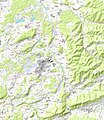
The district de:Landkreis Ravensburg in Baden-Württemberg, Germany
Subcategories
This category has the following 32 subcategories, out of 32 total.
*
- Landratsamt Ravensburg (9 F)
- Beschreibung des Oberamts Leutkirch (1 P, 290 F)
- Beschreibung des Oberamts Waldsee (1 P, 242 F)
- Beschreibung des Oberamts Wangen (1 P, 296 F)
N
Pages in category "Landkreis Ravensburg"
This category contains only the following page.
Media in category "Landkreis Ravensburg"
The following 23 files are in this category, out of 23 total.
-
2022-11-16-2 Galläpfel.jpg 2,672 × 4,000; 4.34 MB
-
2022-11-16-3 Galläüfel.jpg 4,000 × 2,672; 4.34 MB
-
BudS - Argenbühl Topo.jpg 8,960 × 9,770; 36.87 MB
-
BudS - Bodnegg Topo.jpg 5,755 × 6,070; 13.24 MB
-
BudS - Grünkraut Topo.jpg 5,130 × 6,140; 11.21 MB
-
BudS - Gullen Topo.jpg 8,320 × 10,600; 42.82 MB
-
BudS - Isny Topo.jpg 8,770 × 10,150; 34.05 MB
-
BudS - Kißlegg Topo.jpg 8,500 × 9,100; 29.11 MB
-
BudS - Leutkirch Topo.jpg 7,970 × 7,600; 28.82 MB
-
BudS - LK Ravensburg Topo.jpg 10,300 × 8,400; 50.9 MB
-
BudS - Schlier Topo.jpg 7,550 × 8,600; 21.83 MB
-
BudS - Vogt Topo.jpg 6,590 × 7,530; 17.12 MB
-
BudS - Waldburg Topo.jpg 6,370 × 7,660; 16.21 MB
-
BudS - Wolfegg Topo.jpg 7,900 × 9,890; 24.33 MB
-
Dodge Sportsman Winnebago (1981) (36265628315).jpg 4,896 × 3,672; 6.09 MB
-
Dodge Sportsman Winnebago (1981) (36265776235).jpg 3,846 × 3,144; 1.65 MB
-
Grünenbach - Iberg - Waldburg, RV v SO 01.jpg 4,592 × 2,244; 479 KB
-
KFZ-Zulassungsplakette des Landratsamtes Ravensburg-neu.JPG 1,120 × 1,120; 246 KB
-
Landappbw 179531 1824 Karbach.jpg 720 × 1,280; 137 KB
-
Landappbw 179532 1822 Mühle Karbach.jpg 720 × 1,280; 189 KB
-
Landappbw 179534 1824 Apfelbaum Ettensweiler.jpg 1,280 × 720; 177 KB
-
Sonnenaufgang über dem Fohrenweiher.jpg 4,000 × 2,672; 3.32 MB
-
Topografische Karte Fuchsenloch.jpg 518 × 370; 71 KB


