Category:Barrage de la Girotte
Jump to navigation
Jump to search
| Object location | | View all coordinates using: OpenStreetMap |
|---|
  | |||||
| Upload media | |||||
| Instance of | |||||
|---|---|---|---|---|---|
| Made from material | |||||
| Location | Hauteluce, canton of Beaufort | ||||
| Owned by | |||||
| Operator | |||||
| Inception |
| ||||
| Width |
| ||||
| Length |
| ||||
| Height |
| ||||
| Mountain range | |||||
| Drainage basin |
| ||||
| Reservoir created | |||||
 | |||||
Media in category "Barrage de la Girotte"
The following 43 files are in this category, out of 43 total.
-
 Alpage @ Sentier du Col du Joly au Col de Véry (51036230197).jpg 6,240 × 4,160; 8.31 MB
-
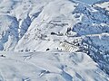 Barrage de la Girotte (hiver 2015).JPG 2,048 × 1,536; 1.31 MB
-
 Barrage de la Girotte Col de la Fenêtre.jpg 4,608 × 3,456; 5.03 MB
-
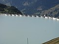
 Barrage de la Girotte à voûtes multiples.jpg 1,947 × 2,371; 1.17 MB
-
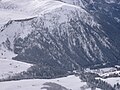
 Barrage de la Girotte, Montagne d'Outray, Vallée du Dorinet (vue du Col du Joly).jpg 2,048 × 1,536; 562 KB
-
 Barrage de la Girotte.jpg 2,048 × 1,536; 2.92 MB
-
 Centrale de Belleville.jpg 4,260 × 2,396; 1.84 MB
-
 Chèvrerie du lac de la Girotte.jpg 4,416 × 3,312; 2.17 MB
-
 Croix du lac de la Girotte (plaque).jpg 3,312 × 4,416; 10.35 MB
-
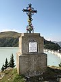 Croix du lac de la Girotte.jpg 3,312 × 4,416; 6.36 MB
-
 ETH-BIB-Lac de la Girotte Savoie-LBS H1-020689.tif 5,724 × 4,535; 74.32 MB
-
 Girotte 01.JPG 3,168 × 2,376; 2.81 MB
-
 Girotte Belleville 15.JPG 3,168 × 2,376; 2.89 MB
-
 Girotte winter 06.JPG 2,376 × 3,168; 2.8 MB
-
 Haute-Savoie Les Contamines Montjoie - panoramio (4).jpg 1,716 × 1,109; 718 KB
-
 Hike around Tête de la Cicle (48935087567).jpg 5,472 × 3,648; 4.43 MB
-
 Lac de la Girotte @ Col du Joly @ Les Contamines-Montjoie (51032364088).jpg 6,240 × 4,160; 8.45 MB
-
 Lac de la Girotte @ Hike around Tête de la Cicle (48934331113).jpg 5,472 × 3,648; 5.67 MB
-
 Lac de la Girotte @ Sentier du Col du Joly au Col de Véry (51035406383).jpg 6,240 × 4,160; 7.12 MB
-
 Lac de la Girotte @ Sentier du Col du Joly au Col de Véry (51035407178).jpg 6,240 × 4,160; 8.13 MB
-
 Lac de la Girotte @ Sentier du Col du Joly au Col de Véry (51036128951).jpg 6,240 × 4,160; 6.14 MB
-
 Lac de la Girotte D20120907 a.jpg 4,416 × 3,312; 1.93 MB
-
 Lac de la Girotte D20120907 b.jpg 4,416 × 3,312; 1.77 MB
-
 Lac de la Girotte D20120907 c.jpg 4,416 × 3,312; 5.37 MB
-
 Lac de la Girotte D20120907 d.jpg 4,416 × 3,312; 6.29 MB
-
 Lac de la Girotte D20120907 e.jpg 4,416 × 3,312; 6.33 MB
-
 Lac de la Girotte D20120907 f.jpg 4,416 × 3,312; 930 KB
-
 Lac de la Girotte D20120907 g.jpg 3,312 × 4,416; 1.97 MB
-
 Lac de la Girotte D20120907 h.jpg 4,416 × 3,312; 2.13 MB
-
 Lac de la Girotte D20120907 i.jpg 3,312 × 4,416; 1.26 MB
-
 Lac de la Girotte D20120907 j.jpg 3,312 × 4,416; 1.67 MB
-
 Lac de la Girotte D20120907 k.jpg 4,416 × 3,312; 3.1 MB
-
 Lac de la Girotte D20120907 l.jpg 4,416 × 3,312; 1.62 MB
-
 Mont de Vorès (51036190608).jpg 6,240 × 4,160; 7.76 MB
-
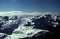
 Mont-Blanc from la Girotte.jpg 4,416 × 3,312; 1,018 KB
-
 Rochers des Enclaves @ Sentier du Col du Joly au Col de Véry (51036134666).jpg 6,240 × 4,160; 7.62 MB
-
 Sentier du Col du Joly au Col de Véry (51035396008).jpg 6,240 × 4,160; 9.81 MB
-
 Sentier du Col du Joly au Col de Véry (51035403058).jpg 6,240 × 4,160; 10.34 MB
-
 Sentier du Col du Joly au Col de Véry (51035405803).jpg 4,160 × 6,240; 11.85 MB
-
 Sentier du Col du Joly au Col de Véry (51036132491).jpg 6,240 × 4,160; 9.54 MB
-
 Sentier du Col du Joly au Col de Véry (51036135311).jpg 6,240 × 4,160; 7.59 MB
-
 Sommet @ Mont de Vorès (51037019992).jpg 6,240 × 4,160; 6.93 MB
-
 Vers Beaufort @ Sentier du Col du Joly au Col de Véry (51036244502).jpg 6,240 × 4,160; 7.97 MB
.jpg)
.JPG)


.jpg)


.jpg)


.jpg)
.jpg)
.jpg)
.jpg)
.jpg)
.jpg)
.jpg)


.jpg)

.jpg)
.jpg)
.jpg)
.jpg)
.jpg)
.jpg)
.jpg)
.jpg)