Atlas of Indonesia

|
Wikimedia Commons Atlas of the World The Wikimedia Atlas of the World is an organized and commented collection of geographical, political and historical maps available at Wikimedia Commons. Discussion • Update the atlas • Index of the Atlas • Atlas in categories • Other atlases on line |
|
| ||||||||||||||||||||||||||||||||||||||||||


General maps
-
 Indonesia (svg map)
 -
 Provinces of Indonesia since 1945-2012
 -
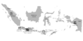
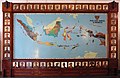 Ethnic Map in the National Museum of Indonesia
 -
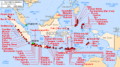
 Indonesia Ethnic Groups Map English
 -
 Time Zones of Indonesia
 -
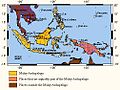
 Major volcanoes
 -
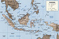
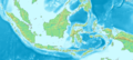
 Map of Indonesia
 -
 Map of Indonesia in Indonesian
 -
 Map of Indonesia
 -
 Map of Indonesia
 -
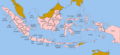 Provinces of Indonesia
 -
 Provinces of Indonesia in Indonesian
 -
-
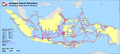 Pelni Ship Route Network
 -
 World Heritage
 -
 Indonesia in Indonesian Flag
 -
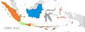
 Indonesia's Exclusive Economic Zone
 -
 GLAM
GLAM -
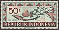
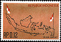 1963 stamp
 -
 1949 stamp
 -
 1948 stamp
 -
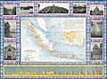
 An upside down map of Indonesia
 -
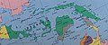 An upside down map of Indonesia (detail)


.jpg)

Location maps
-
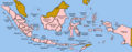
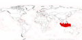
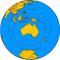
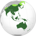 Indonesia is located in Asia Pacific
 -
 Specifically in the Maritime South East Asia (SEA), also called East Indian Islands, or Malay Archipelago
 -
 Sometimes the area is called Indo-Pacific, originally referring to the marine realms and biogeography, but lately used in political and military sense as well.
 -
 Sometimes Maritime South East Asia and Oceania are combined together
 -
 And sometimes SE Asia is grouped together with East Asia and the Pacific (Australia, NZ, etc.) into ESEAP region
 -
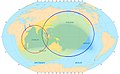
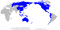 Asia Pacific, Indo Pacific, Maritime SEA, and Oceania, together create super region called Pacific Rim (all countries that borders Pacific Ocean). Indonesia is the 3rd largest country in Pacific Rim.
 -
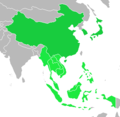 Indonesia is the largest country in Southeast Asia (ASEAN), and second largest after China, in ASEAN+3
 -
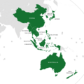 Indonesia is central in the Regional Comprehensive Economic Partnership (RCEP)

.jpg)


History maps
This section holds a short summary of the history of the area of present-day Indonesia, illustrated with maps, including historical maps of former countries and empires that included present-day Indonesia.

|
Tarumanagara kingdom, 4th-7th century |

|
Sunda Kingdom, 7th-16th century |

|
Srivijaya Empire, 8th century |

|
Majapahit Empire, 14th century |

|
Trowulan, Majapahit capital, 14th century |

|
Java Great Post Road, 19th century |

|
Map of the Japanese Empire (1870-1942) |
Old maps
This section holds copies of original general maps more than 70 years old. Category:Old maps of Indonesia sorted by map date (prior to independence of Indonesia in 1945):
-
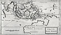 A map of the East Indies, from William Dampier's New Voyage Round the World, published 1697
 -
-
 Dutch map 1920
 -
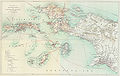
 Map of Batavia, 1681


See also:
- https://www.raremaps.com/category/Maps/Asia/Southeast_Asia/Indonesia
- https://www.raremaps.com/category/Maps/Asia/Southeast_Asia/Southeast_Asia
- https://antique-maps.lt/product-category/maps/asia/southeast-asia/
Galleries
- Subnational atlas
- User galleries
- User:Bennylin/Maps
External links
- Digital Atlas of Indonesian History by Robert Cribb archive copy at the Wayback Machine from 17th century and earlier
Notes and references
|
General remarks:
|