Вторая Камчатская экспедиция
Zur Navigation springen
Zur Suche springen
English: The Second Kamchatka expedition was an expedition between 1733 and 1743. The goal was to find and map the eastern reaches of Siberia and new sea routes from North America to Japan.
Deutsch: Die Zweite Kamtschatkaexpedition (auch: Große Nordische Expedition) war eine zwischen 1733 und 1743 durchgeführte Expedition zur Erkundung Sibiriens und zur Suche von Seewegen nach Nordamerika und Japan.
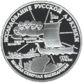
Русский: Вторая Камчатская экспедиция (известная также как Великая Северная экспедиция) — экспедиция 1733—1743 годов, целью которой было найти и нанести на карту восточные пределы Сибири и новый морской путь от Северной Америки до Японии.
The Academy of Sciences at Saint Petersburg
[Bearbeiten]-
Engraving Aufriss der Akademie (1741)
-
Engraving Durchschnitt von der Kayserlichen Bibliothec, und Kunstkammer gegen Morgen (1741)
Portraits of the protagonists
[Bearbeiten]-
Vitus Bering (1680–1741), cf. description for more details about this picture
-
Johann Georg Gmelin (1709–1755)
-
Louis De l'Isle de la Croyère (before 1688–1741)
-
Stepan Petrowitsch Krascheninnikow (1711–1755)
Original Documents
[Bearbeiten]Letters
[Bearbeiten]-
Letter of Vitus Jonassen Bering to his son Jonas, written at Ochotsk in 1740
-
Letter of Bering's wife Anna Christina to her father Matthias Pülse, written at Ochotsk in 1740
Drawings
[Bearbeiten]-
First encounter with Aleuts at Schumagin-Island. Drawing by Sven Waxell, the mate of Berings ship St. Peter.
-
Waxell: First encounter with Aleuts (Detail).
-
Drawing of the Stellersche Sehkuh by Sven Waxell.
-
Siberean peony (Paeonia anomala L.) from Johann Georg Gmelins Flora Sibirica drawn by Johann Wilhelm Lürsenius.
Contemporary views of siberian towns
[Bearbeiten]-
Irkutsk, ink drawing, 1735
-
Map of Okhotskoi Ostrog, ink drawing, 1737
Printed Works
[Bearbeiten]Title pages
[Bearbeiten]-
Title page of Gmelins Leben Herrn Georg Wilhelm Stellers (1748)
-
Title page of volume 9 of Müllers Sammlung rußischer Geschichte (1764)
Illustrations
[Bearbeiten]-
Drawing of the Stellersche Sehkuh as part of a map by Sofron Chitrow, 1744
-
Illustration from Georg Wilhelm Stellers ausführliche Beschreibung von sonderbaren Meerthieren (1753).
-
Illustration from Stepan Krasheninnikovs Account of the Land of Kamchatka (1755)
-
Illustration from Georg Wilhelm Stellers Beschreibung von dem Lande Kamtschatka (1774)
Cartographic images of eastern Russia before and after the expedition
[Bearbeiten]-
Guillaume Delisle: L'Asie (1700). After Delisle the legendary land "Jesso" lies in the north of Japan.
-
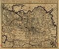
Nicolaas Witsen: Tartaria (1705)
-
Detail from Guillaume Delisle's Carte de Tartarie (1706). On the northeastern edge of Asia de Lisle has written: "On ne sait pas ou se termine cette chaine de montagnes, et si elle ne va pas joindre quelque autre continent".
-
Detail from Guillaume Delisle's Carte d'Asie (1723). Delisle supposes the legendary "Terre de la Companie" to be located in the southeast of the mouth of the Amur River.
-
Ivan Kirilov: General map of Russian Empire. Official map, published by the Academy of Sciences at Saint Petersburg in 1745.
-
Detail from Jean Baptiste Bourguignon d'Anville's Troisième partie de la carte d'Asie (1753)
-
A map of Kamtschatka engraved from the russian map by Tho. Jefferys from the 1764 London edition of Krascheninnikows History of Kamtschatka
-
The Russian Discoveries. Map by Thomas Jefferys, published after his death by Robert Sayer.
-
Карта 1745 года на основе результатов Великой северной экспедиции.
-
Карта представляющая изобретения российскими мореплавателями на северной части Америки. 1773
The myth
[Bearbeiten]-
Nikitin: Bering's death at the Bering Island in 1741


