U.S. flag An official website of the United States government.

dot gov icon Official websites use .gov

A .gov website belongs to an official government organization in the United States.

https icon Secure websites use HTTPS

A small lock or https:// means you’ve safely connected to a .gov website. Share sensitive information only on official, secure websites.

News Highlights

There's a lot going on at NOAA's National Ocean Service.

Aranzazu Lascurain (second from right), Southeast and Caribbean regional lead for NOAA’s Office for Coastal Management, or OCM, and partners plant young mangroves in the U.S. territory of Puerto Rico in January 2024. OCM provided funding to partners to rebuild the mangroves in Jobos Bay National Estuarine Research Reserve after they were decimated by Hurricanes Irma and Maria in 2017. (Image credit: BoriCorps).
Helping protect Caribbean region’s coastal zones an exciting adventure

Aranzazu Lascurain, the Southeast and Caribbean regional lead for the Office for Coastal Management (OCM), is helping to implement the Coastal Zone Management Act within the region. Her position frequently takes her to the Caribbean, where she networks and shares information about funding opportunities and technical assistance — all to support the office’s mission of enhancing U.S. coastal resilience.

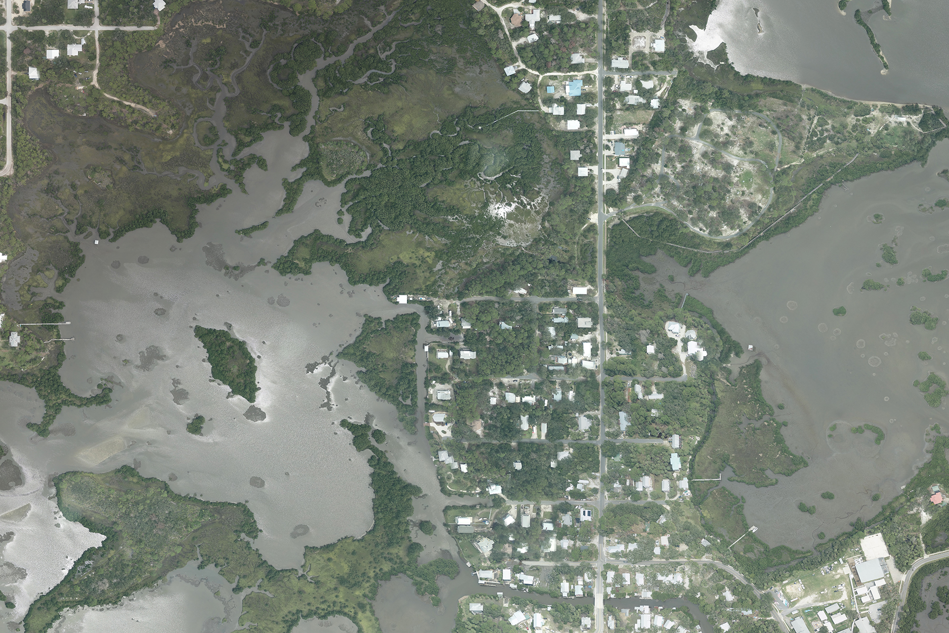
Aerial view of Cedar Key, Florida collected by NOAA aircraft on August 7, 2024.
Hurricane Debby: aerial imagery

The National Geodetic Survey (NGS) is collecting aerial damage assessment images in the aftermath of Hurricane Debby. Aerial imagery is a crucial tool to determine the extent of the damage inflicted by flooding, and to compare baseline coastal areas to assess the damage to major ports and waterways, coastlines, critical infrastructure, and coastal communities.

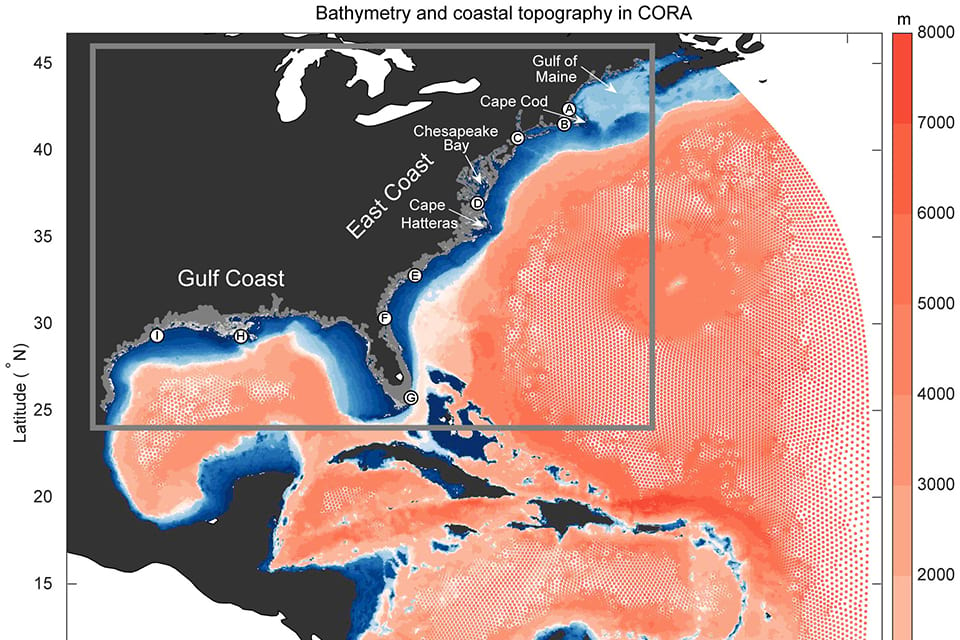
A depiction of the Advanced Circulation Model used for NOAA's Coastal Ocean Reanalysis. The gray box shows the focus region of the assessment — the U.S. East Coast, Gulf of Mexico, and Carribean Sea. Credit: Cooperative Institute for Marine and Atmospheric Research, School of Ocean and Earth Science and Technology, University of Hawai’i at Mānoa
NOAA study validates sea level data for future flood risk outlooks

A team of NOAA and university sea level rise experts have verified 40 years of data to accurately assess flood-risk changes on the Atlantic, Caribbean and Gulf of Mexico coasts. Their findings have been published in the latest edition of Frontiers In Marine Science.

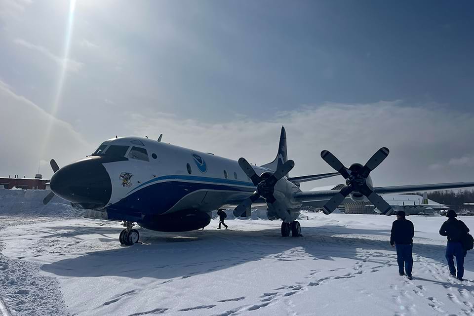
The Gravity for the Redefinition of the American Vertical Datum, or GRAV-D, crew with the plane affectionately named Miss Piggy.
Accurate positioning data for Alaska and the Arctic

Alaska has the longest coastline of any state in the nation. The state is also tectonically active and known for its challenging weather and ocean conditions. Many federal agencies are involved with the modernization of critical geospatial data and mapping products for Alaska, with NOAA’s National Geodetic Survey (NGS) playing a leading role.

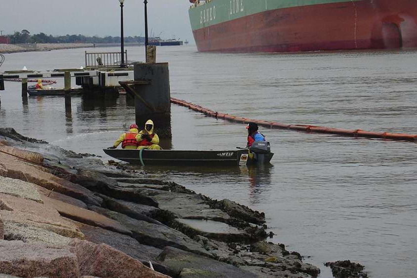
Workers clean oil from the rocks following a spill in Port Arthur, Texas in January 2010.
Protecting the nation's coastal ocean

NOAA's Office of Response and Restoration, or OR&R for short protects and restores ocean and coastal resources from the impacts of threats such as oil, chemicals, marine debris, and disasters to benefit the environment, public, and economy. For 25 years, OR&R experts have played a key role ensuring that our coastal communities are resilient and protected for future generations.

The Top 40

Looking for a recent story? Here are our latest 40 posts.

  1. Helping protect Caribbean region’s coastal zones an exciting adventure
    26 Aug 2024
  2. Hurricane Debby: aerial imagery
    8 Aug 2024
  3. NOAA study validates sea level data for future flood risk outlooks
    26 June 2024
  4. Exploring the Pacific on NOAA Ship Rainier
    4 Apr 2024
  5. Accurate positioning data for Alaska and the Arctic
    18 Mar 2024
  6. Protecting the nation's coastal ocean
    28 Feb 2024
  7. Reaching New Heights
    5 Feb 2024
  8. Maritime commerce in a changing climate
    1 Nov 2023
  9. Pollution settlement will benefit salmon, wildlife and people in Portland Harbor, Oregon
    1 Nov 2023
  10. NOS Strategic Plan 2024-2028
    19 Sep 2023
  11. Hurricane Lee Emergency Response Imagery
    17 Sep 2023
  12. NOS releases modeling strategy
    1 Sep 2023
  13. Hurricane Idalia: Aerial Imagery
    31 Aug 2023
  14. Coastal Resilience: How the National Ocean Service supports this national priority
    18 Aug 2023
  15. Studying the health of dolphins after pollution
    10 Mar 2023
  16. December 2022 water levels break eight historical records
    19 Jan 2023
  17. NOS Fiscal Year 2022: Year in Review
    18 Jan 2023
  18. NOAA to Launch Major Advancement in Seasonal High Tide Flooding Predictions
    14 Dec 2022
  19. Corals Week 2022
    2 Dec 2022
  20. Meet the International Coral Reef Initiative
    2 Dec 2022
  21. NOAA Winter High Tide Bulletin
    15 Nov 2022
  22. Save Spectacular: Celebrating 50 Years of National Marine Sanctuaries
    21 Oct 2022
  23. Looking Back and Looking Forward
    11 Oct 2022
  24. Hurricane Ian: Damage Assessment Imagery Available
    30 Sep 2022
  25. Ramping Up Renewable Energy: How NOS is helping boost offshore wind energy in the US
    21 Sep 2022
  26. NOAA Fall High Tide Bulletin
    16 Aug 2022
  27. 2021 National Ocean Service Science Report
    20 Jul 2022
  28. Mapping the Gaps in Our Ocean Knowledge with Seabed 2030
    29 Jun 2022
  29. Application Guide for the 2022 Sea Level Rise Technical Report Now Available
    22 Jun 2022
  30. NOAA Summer High Tide Bulletin
    16 May 2022
  31. Container Ship MV Ever Forward is Moving Again
    18 Apr 2022
  32. The NOAA Science Behind Marking the U.S. Census Center of Population
    21 Mar 2022
  33. NOAA Spring High Tide Bulletin
    16 Feb 2022
  34. 2022 Sea Level Rise Technical Report
    15 Feb 2022
  35. Major Update to NOAA's Coastal County Snapshots
    18 Jan 2022
  36. National Ocean Service Annual Report
    10 Jan 2022
  37. Winter High Tide Bulletin
    22 Nov 2021
  38. Over $130 Million to Restore 10 Polluted Waterways Across the Country
    9 Nov 2021
  39. NOAA Awards $15.2M for Harmful Algal Bloom Research
    27 Oct 2021
  40. NOAA Proposes Connecticut National Estuarine Research Reserve
    17 Sep 2021