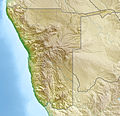
Fichier:Namibia location map.svg

Taille de cet aperçu PNG pour ce fichier SVG : 623 × 600 pixels. Autres résolutions : 249 × 240 pixels | 498 × 480 pixels | 797 × 768 pixels | 1 063 × 1 024 pixels | 2 127 × 2 048 pixels | 1 300 × 1 252 pixels.
Fichier d’origine (Fichier SVG, nominalement de 1 300 × 1 252 pixels, taille : 196 kio)
Historique du fichier
Cliquer sur une date et heure pour voir le fichier tel qu'il était à ce moment-là.
| Date et heure | Vignette | Dimensions | Utilisateur | Commentaire | |
|---|---|---|---|---|---|
| actuel | 12 octobre 2013 à 19:57 |  | 1 300 × 1 252 (196 kio) | NordNordWest | upd |
| 16 février 2010 à 22:50 |  | 1 300 × 1 252 (296 kio) | Uwe Dedering | {{Information |Description={{de|Location map of Namibia Equirectangular projection. Strechted by 108.0%. Geographic limits of the map: * N: -16.4° N * S: -29.6° N * W: 11.0° E * E: 25.8° E Made with Natural Earth. Free vector and raster map data @ nat |
Utilisation du fichier
Les 71 pages suivantes utilisent ce fichier :
- Ambassade de France en Namibie
- Arandis
- Aroab
- Aus
- Aérodrome d'Ondangwa
- Aérodrome d'Oranjemund
- Aérodrome de Katima Mulilo-Mpacha
- Aérodrome de Lüderitz
- Aérodrome de Rundu
- Aérodrome de Windhoek-Eros
- Aéroport de Walvis Bay
- Aéroport international Hosea Kutako de Windhoek
- Bethanie (Namibie)
- Camp de concentration de Shark Island
- Cathédrale Sainte-Marie de Windhoek
- Collision aérienne de 1997 en Namibie
- Eenhana
- FIDES Bank Namibia
- Frontière entre le Botswana et la Zambie
- Gare de Swakopmund
- Gare de Windhoek
- Garub
- Gobabis
- Grootfontein
- Henties Bay
- Hoachanas
- Independence Stadium (Windhoek)
- Kamanjab
- Karasburg
- Karibib
- Katima Mulilo
- Keetmanshoop
- Khorixas
- Kolmanskop
- Lüderitz
- Mariental
- Nkurenkuru
- Okahandja
- Okahao
- Omaruru
- Omitara
- Ompundja (ville)
- Omuthiyagwiipundi
- Ondangua
- Ongandjera
- Ongwediva
- Opuwo
- Oranjemund
- Oshakati
- Otavi
- Otjiwarongo
- Outapi
- Outjo
- Pont Katima Mulilo
- Rehoboth (Namibie)
- Reiterdenkmal
- Rundu
- Sesfontein
- Swakopmund
- Tsumeb
- Vol LAM Mozambique Airlines 470
- Vol South African Airways 228
- Walvis Bay
- Windhoek
- Modèle:Carte/Aéroports en Afrique/Namibie
- Modèle:Carte/Namibie
- Modèle:Géolocalisation/Namibie
- Modèle:Géolocalisation/Namibie/Documentation
- Catégorie:Aéroport en Namibie
- Projet:Cartographie/Géolocalisation/Maintenance/Images des pays
- Module:Carte/données/namibie
Usage global du fichier
Les autres wikis suivants utilisent ce fichier :
- Utilisation sur af.wikipedia.org
- Walvisbaai
- Oranjemund
- Karasburg
- Omaruru
- Karibib
- Usakos
- Otjiwarongo
- Keetmanshoop
- Olifantsrivier
- Mariental
- Maltahöhe
- Hentiesbaai
- Langstrand
- Grootfontein
- Vaalgras
- Rehoboth
- Rundu
- Gobabis
- Warmbad, Namibië
- Tsumeb
- Bethanie
- Otjimbingwe
- Seeheim
- Sjabloon:Liggingkaart Namibië
- Fransfontein
- Omuthiya
- Luhonono
- Namibwoestyn
- Noordoewer
- Arandis
- Aranos
- Kalkfeld
- Outjo
- Otavi
- Witvlei
- Oshakati
- Brukkaros
- Aus
- Asab
- Okahandja
- Suid-Afrikaanse Lugdiens-vlug 228
- Ramansdrift
- Hosea Kutako Internasionale Lughawe
- Windhoek Eros-lughawe
- Walvisbaai-lughawe
- Grootfonteinlughawe
- Katima Mulilo-lughawe
- Ondangwa
- Katima Mulilo
- Gochas
Voir davantage sur l’utilisation globale de ce fichier.


