Mine sisu juurde

Fail:India Maharashtra locator map.svg

Lehekülje sisu ei toetata teistes keeltes.
Klõps ikoonil viib faili leheküljele Wikimedia Commonsis.
Allikas: Vikipeedia

Algfail (SVG-fail, algsuurus 1574 × 1738 pikslit, faili suurus: 836 KB)

Pealkiri
Maharashtra locator map
Kirjeldus
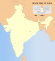
Locator map of the state of Maharashtra, India with district boundaries.
Map legend
Kuupäev
Allikas

Üleslaadija oma töö
International Borders: University of Texas map library - India Political map 2001
Disputed Borders: University of Texas map library - China-India Borders - Eastern Sector 1988 & Western Sector 1988 - Kashmir Region 2004 - Kashmir Maps.
State and District boundaries: Census of India - 2001 Census State Maps - Survey of India Maps.
Other sources: US Army Map Service, Survey of India Map Explorer, Columbia University

Map specific sources: .
Looja
This Image was created by User:PlaneMad.
  • If you are using the image under the creative commons share alike license please credit the photo CC-by-sa PlaneMad/Wikimedia and include a link to this page. No explicit permission is needed from me, but id appreciate an email if my work has been of help to you.
  • If you dont want to release your work under a creative commons license, please mail me at arun.planemad@gmail.com or catch me at my Website to negotiate a custom license as per your needs.
Luba
(Faili edasikasutus)
Autoriõiguse omanikuna avaldan selle teose järgmise litsentsi all:
w:et:Creative Commons
omistamine sarnaselt jagamine
See fail kuulub jurisdiktsiooniga sidumata Creative Commonsi litsentsi "Autorile viitamine + jagamine samadel tingimustel 3.0" alla.
Tohid:
  • jagada – teost kopeerida, levitada ja edastada
  • kohandada – valmistada muudetud teoseid
Järgmistel tingimustel:
  • omistamine – Pead materjali sobival viisil autorile omistama, tooma ära litsentsi lingi ja märkima ära, kas on tehtud muudatusi. Sobib, kui teed seda mõistlikul viisil, kuid seejuures ei tohi jääda muljet, et litsentsiandja tõstab esile sind või seda, et sina materjali kasutad.
  • sarnaselt jagamine – Kui töötled, kujundad ümber või arendad materjali edasi, siis pead oma töö levitamiseks kasutama sama litsentsi, mille all on algupärand, või ühilduvat litsentsi.

The frontiers depicted on the Indian maps in Wikipedia are from a neutral point of view and may differ from official government maps of India, Pakistan and China. Please consult local laws governing publication of maps before usage.
 Geotemporal data
Date depicted 20. sajand teine pool ja 21. sajand
Spatial reference system conic
Bounding box
36°42′N 64°48′E / 36.70°N 64.8°E / 36.70; 64.8 37°14′N 99°00′E / 37.23°N 99.0°E / 37.23; 99.0
5°54′N 68°46′E / 5.9°N 68.76°E / 5.9; 68.76 6°15′N 96°05′E / 6.25°N 96.09°E / 6.25; 96.09
Georeferencing Georeference the map in Wikimaps Warper If inappropriate please set warp_status = skip to hide.
 Archival data
Märkused Part of WikiProject India Maps
Teised versioonid


Notes

Depiction of India's borders

  • The territorial boundaries of India are shown as per the actual ground situation in accordance with international practices followed by the United Nations ([1], [2]) and the National Geographic Society ([3], [4])
  • This map is meant to be for illustrative purpose only and is not authenticated by official government sources. Please check the list of sources and references used to create the map for a measure of accuracy and verifiability.
  • The usage of these maps in India, Pakistan and China are governed by different laws that restrict depictions of boundaries other than what is officially recognized by the state. Please check local laws and modify the map accordingly before use.

Explanation of disputed boundaries

  • Boundary of Indian claim : The territory India claims is legally theirs, but the claim is disputed by China and Pakistan.
  • Line of Control/Line of Conflict : The de facto administrative boundary recognised by the international community. This UN ceasefire line is considered as a temporary solution to an ongoing conflict since the departure of the British Raj.

Borders of disputed regions

The depicted extent of the former territory of the British Indian Empire, succeeded by Republic of India, may not be accepted by few countries as legal due to ongoing border disputes:

  • The northern Himalayan region of the disputed territory Indian-administered Kashmir is claimed by India including (Pakistan-administered Kashmir) and the Chinese-occupied territory of (Ladakh plateau). Since 1972, it is divided between all three countries. See also Line of Control and Line of Actual Control.
  • Siachen glacier (shown white) is an actively contested region between India and Pakistan. Since 1984, the region is under Indian control.
  • The northeastern territory of Arunachal Pradesh is almost entirely claimed by China as part of its Tibetan territory.
  • Minor areas of eastern Kashmir's Ladakh division, Himachal Pradesh and Uttarakhand on the Chinese frontier are claimed by China. These areas are under Indian control.
  • A small area of Uttarakhand adjoining the Nepal border along the Sarda river is disputed between the two countries.

For a detailed map of all disputed regions in South Asia, see Image:India disputed areas map.svg

Internal borders

The borders of the state of Meghalaya, Assam and Arunachal Pradesh are shown as interpreted from the North-Eastern Areas (Reorganisation) Act, 1971, but has yet to be verified.

Territorial waters

The limit of the territorial waters of India extends to twelve nautical miles measured from the appropriate baseline. See this for more information.

Pealdised

Lisa üherealine seletus sellest, mida fail esitab

Selles failis kujutatud üksused

kujutab

media type inglise

image/svg+xml

Faili ajalugu

Klõpsa kuupäeva ja kellaaega, et näha sel ajahetkel kasutusel olnud failiversiooni.

Kuupäev/kellaaegPisipiltMõõtmedKasutajaKommentaar
viimane29. detsember 2008, kell 08:53Pisipilt versioonist seisuga 29. detsember 2008, kell 08:531574 × 1738 (836 KB)Planemad{{Information |Description= |Source= |Date= |Author= |Permission= |other_versions= }}
6. august 2006, kell 19:28Pisipilt versioonist seisuga 6. august 2006, kell 19:281639 × 1852 (750 KB)Planemad{{WikiProject_India_Maps |Title=Maharashtra locator map |Description=Locator map of the state of Maharashtra, India with district boundaries. |Source=. |Date=August 6 2006 |Author=w:user:Nichalpw:user:Planemad |Thumbdir=CHANGE }}

Seda faili kasutab järgmine lehekülg:

Globaalne failikasutus

Järgmised muud vikid kasutavad seda faili:

Vaata selle faili globaalset kasutust.

Metaandmed