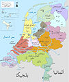
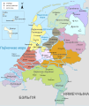
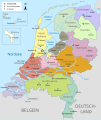
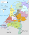
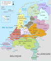
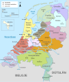
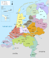
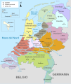
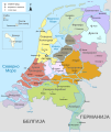
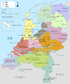
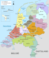
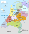
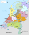
File:Map provinces Netherlands-en.svg
Appearance

Size of this PNG preview of this SVG file: 506 × 600 pixels. Other resolutions: 202 × 240 pixels | 405 × 480 pixels | 648 × 768 pixels | 864 × 1,024 pixels | 1,727 × 2,048 pixels | 743 × 881 pixels.
Original file (SVG file, nominally 743 × 881 pixels, file size: 1,003 KB)
File history
Click on a date/time to view the file as it appeared at that time.
| Date/Time | Thumbnail | Dimensions | User | Comment | |
|---|---|---|---|---|---|
| current | 19:28, 19 January 2024 |  | 743 × 881 (1,003 KB) | Illchy | File uploaded using svgtranslate tool (https://svgtranslate.toolforge.org/). Added translation for id. |
| 17:43, 29 April 2023 |  | 743 × 881 (987 KB) | Dymitr | File uploaded using svgtranslate tool (https://svgtranslate.toolforge.org/). Added translation for be-tarask. | |
| 09:27, 25 November 2021 |  | 743 × 881 (909 KB) | Andrei Stroe | File uploaded using svgtranslate tool (https://svgtranslate.toolforge.org/). Added translation for ro. | |
| 08:39, 12 April 2019 |  | 743 × 881 (811 KB) | Thayts | Tweaked text position | |
| 11:32, 17 February 2019 |  | 743 × 881 (811 KB) | Thayts | Fixed svg | |
| 11:18, 17 February 2019 |  | 743 × 881 (811 KB) | Thayts | Added a bit more spacing between Eastern/Western and Scheldt | |
| 11:06, 17 February 2019 |  | 743 × 881 (811 KB) | Thayts | Fixed Eastern Scheldt which wasn't rendered by the MediaWiki engine; removed Belgian city of Antwerp | |
| 05:21, 14 February 2019 |  | 743 × 881 (809 KB) | Alphathon | Updated borders | |
| 20:34, 23 August 2015 |  | 743 × 881 (847 KB) | Alphathon | Fixed stroke weight on a Friesland lake | |
| 20:27, 23 August 2015 |  | 743 × 881 (847 KB) | Alphathon | Covered over the strokes at the mouths of rivers |
File usage
The following 16 pages use this file:
- 2008–09 KNVB Cup
- French war planning 1920–1940
- Geology of the Netherlands
- King's commissioner
- List of islands of the Netherlands
- List of windmills in the Netherlands
- Netherlands
- Provinces of the Netherlands
- Provincial politics in the Netherlands
- User:Alphathon/Gallery
- User talk:Gidonb/Archive 2008
- Wikipedia:Reference desk/Archives/Humanities/2014 September 25
- File talk:Netherlands Map.svg
- File talk:Netherlands map large.png
- Template:Provinces of the Netherlands imagemap
- Portal:Islands
Global file usage
The following other wikis use this file:
- Usage on ace.wikipedia.org
- Usage on af.wikipedia.org
- Usage on ang.wikipedia.org
- Usage on an.wikipedia.org
- Usage on ar.wikipedia.org
- Usage on ay.wikipedia.org
- Usage on azb.wikipedia.org
- Usage on be-tarask.wikipedia.org
- Usage on bg.wikipedia.org
- Usage on blk.wikipedia.org
- Usage on bn.wikipedia.org
- Usage on ceb.wikipedia.org
- Usage on diq.wikipedia.org
- Usage on en.wikiversity.org
- Usage on eu.wikipedia.org
- Usage on fa.wikipedia.org
- Usage on ff.wikipedia.org
- Usage on fi.wikipedia.org
- Usage on fr.wikipedia.org
- Usage on gl.wikipedia.org
- Usage on haw.wikipedia.org
- Usage on he.wikipedia.org
- Usage on ia.wikipedia.org
- Usage on id.wikipedia.org
- Usage on io.wikipedia.org
- Usage on jv.wikipedia.org
- Usage on ka.wikipedia.org
- Usage on ko.wikipedia.org
- Usage on la.wikipedia.org
View more global usage of this file.

