
User:Roke/maps
Note: If you can improve or update any maps I have posted you are free to do so. If you disagree with any, you are free to replace, remove or delete them. This is a free encyclopedia after all. If you need assistance for editing images, try the folks at the Wikipedia:Graphic Lab/Map workshop or WikiProject Maps as I have been inactive here.

Maps
-
-

-

-
-

-

-
-
-
-

-
-
-
-

-
-
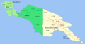
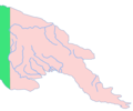 New Guinea rivers and similar locator maps
 -

-


Atlases
recommended atlases
- Black, Jeremy. 2001, DK Atlas of World History Dorling Kindersley, New York ISBN 0-7894-4609-X
- Haywood, John 2001, Cassell's Atlas of World History Andromeda Oxford Ltd, Oxfordshire ISBN 0-304-35757-X
- Overy, Richard, 2006, The Times Complete history of the world Times Books ISBN 0-00-774629-6
- Overy, Richard, 2003, The Times. Mapping History. History of the 20th century. ISBN 0-0071-6637-0
- The Times History of Europe 3,000 years of History in Maps, 2003 Times Books ISBN 0-0071-3161-5
- Kinder, Hermann and Hilgemann, Werner, 2003, Penguin Atlas of World History, Penguin Group, London ISBN 0-141-01263-3
- McEvedy, Colin. 1982, Penguin Atlas of Ancient, Medieval, Modern and Recent History, Penguin Books, Middlesex, England ISBN 0-14-0708-34-0
- Swift, Michael 2006, Mapping the World, Chartwell Books Inc. ISBN 0-7858-2074-4
- Philip's Atlas of World History, 1992, Philip's ISBN 0-540-05677-4
- Yenne, Bill 2005 Atlas of North American Railroads, MBI Publishing Company, St. Paul, Minnesota, ISBN 0-7603-2299-6
- 1923 Historical Atlas by William R. Shepherd general history atlas
- 1912 Cambridge Modern History Atlas
map colours
I try to use the standard WikiProject Maps colours where possible:
| Color | Hex | RGB | Sample | Used for |
|---|---|---|---|---|
| Black | #000000 | 0, 0, 0 | Primary label color | |
| Brown | #A08070 | 160, 128, 112 | Political borders. Country, state, and province borders should be brown. | |
| Light brown | #D0C0A0 | 208, 192, 160 | Secondary political borders. | |
| Light yellow | #FFFFD0 | 255, 255, 208 | Primary territory of interest, or one of four choices for four-color maps. | |
| Pink | #FFD0D0 | 255, 208, 208 | Another color to be used for four-color maps. | |
| Orange | #F8A20C | 248, 162, 12 | A third color to be used for four-color maps. | |
| Green | #3CE67B | 60, 230, 123 | A fourth color to be used for four-color maps. | |
| Light blue | #CEFEF2 | 206, 254, 242 | An alternate color to be used for four-color maps. | |
| Orange | #F7D3AA | 247, 211, 170 | Alternative color for the above Tan (surrounding territories). | |
| Medium blue | #9EC7F3 | 158, 199, 243 | Bodies of water. Oceans or lakes. | |
| Blue | #1821DE | 24, 33, 222 | Water borders, if necessary. For lake or ocean borders that need a color contrasting with surrounding land, or for rivers. | |
| Red | #B00000 | 176, 0, 0 | Points of interest. Cities, especially. | |
| Red-orange | #F07568 | 240, 117, 104 | Alternative color for the above Red (points of interest). | |
| Medium red | #E0584E | 224, 88, 78 | Border color for areas highlighted in Red-orange | |
| Green | #A0F090 | 160, 240, 144 | Parks or natural preservation areas |
Names
- Chinese (simplified) - 地图
- Dutch - kaart
- French - carte
- German - Diagramm
- Italian - carta
- Japanese - 地図
- Korean - 지도
- Polish - mapa
- Portuguese - mapa
- Russian - карта
- Spanish - mapa
- Swedish - karta