
Prangli
 | |
| Geography | |
|---|---|
| Location | Baltic Sea |
| Coordinates | 59°37′28″N 25°01′15″E / 59.62444°N 25.02083°E |
| Area | 6.44 km2 (2.49 sq mi) |
| Highest elevation | 9 m (30 ft) |
| Administration | |
Estonia | |
| Demographics | |
| Population | 151 |
| Pop. density | 23/km2 (60/sq mi) |
Prangli (Swedish: Vrangö) is an Estonian island in the Gulf of Finland.
The first records are from 1387 as when it was called Rango. The first Settlers came from Sweden. The Estonian culture spread to the island in the 17th century.
Prangli is part of Viimsi Parish. In Kelnase is a harbour which is connected by ferry to Leppneeme on the mainland.
The vegetation, especially in the east of the island is mainly fir trees.
The lighthouse on Prangli was built in 1923.
Gallery
-
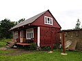
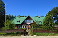 House of culture
 -
 Local store
 -
 Mälgi harbour
 -
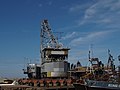 Kelnase harbour
 -
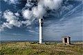 Prangli NW light beacon
 -
 Museum
 -
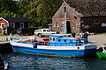 Boat Helge
 -
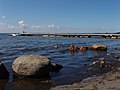
 Glacial erratic
 -
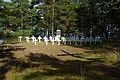 Memorial site


.JPG)


External links
This Harju County location article is a stub. You can help Wikipedia by expanding it. |