Akoko North-East: Difference between revisions
Masterswap4 (talk | contribs) Added wiki link Tags: Reverted Visual edit Mobile edit Mobile web edit |
Masterswap4 (talk | contribs) Source Tags: Reverted Visual edit Mobile edit Mobile web edit |
||
| Line 67: | Line 67: | ||
The [[postal code]] of the area is 342.<ref>{{cite web|title=Post Offices- with map of LGA |publisher=NIPOST |url=http://www.nipost.gov.ng/PostCode.aspx |accessdate=2009-10-20 |archiveurl=https://web.archive.org/web/20091007011423/http://www.nipost.gov.ng/PostCode.aspx |archivedate=7 October 2009 |url-status=dead }}</ref> |
The [[postal code]] of the area is 342.<ref>{{cite web|title=Post Offices- with map of LGA |publisher=NIPOST |url=http://www.nipost.gov.ng/PostCode.aspx |accessdate=2009-10-20 |archiveurl=https://web.archive.org/web/20091007011423/http://www.nipost.gov.ng/PostCode.aspx |archivedate=7 October 2009 |url-status=dead }}</ref> |
||
== Economy == |
|||
The people that live in Akoko Northeast are mostly employed in agriculture, growing significant amounts of products like yam and cocoa. Trade and ceramics are two more important industries in the region. A limitless array of goods is available for purchase at marketplaces like Oja Oba, Okore, and Osele.<ref>{{Cite web |title=Akoko North East Local Government Area |url=https://www.manpower.com.ng/places/lga/621/akoko-north-east |access-date=2023-10-26 |website=www.manpower.com.ng}}</ref> |
|||
== Geography == |
== Geography == |
||
Revision as of 09:38, 26 October 2023
Akoko North-East | |
|---|---|
 | |
| Coordinates: 7°31′00″N 5°45′00″E / 7.5166°N 5.75°E | |
| Country | |
| State | Ondo State |
| Time zone | UTC+1 (WAT) |
 | |
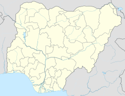
Akoko North-East is a Local Government Area in Ondo State, Nigeria.[1] Its headquarters is in the town of Ikare. Ikare consist of 16 districts or towns, namely:[2] Okela, Okegbe Okorun, Eshe, Odo, Ilepa, Okoja, Iku, Odeyare, Odoruwa, Okeruwa, Iyame, Igbede, Oyinmo, Ishakunmi, and Ekan.
It has an area of 372 km2 and a population of 175,409 at the 2006 census.
The postal code of the area is 342.[3]
Economy
The people that live in Akoko Northeast are mostly employed in agriculture, growing significant amounts of products like yam and cocoa. Trade and ceramics are two more important industries in the region. A limitless array of goods is available for purchase at marketplaces like Oja Oba, Okore, and Osele.[4]
Geography
Akoko northeast Local Government Area covers a total area of 372 km squared and has a humidity of 60 percent with average temperature estimated at 28 degrees centigrade.[5]
Business information
References
- ^ "Residents defy Ondo governor's 24-hour curfew | Premium Times Nigeria". 2021-11-25. Retrieved 2022-04-08.
- ^ "Akoko North East LGA". www.finelib.com. Retrieved 2022-03-16.
- ^ "Post Offices- with map of LGA". NIPOST. Archived from the original on 7 October 2009. Retrieved 2009-10-20.
- ^ "Akoko North East Local Government Area". www.manpower.com.ng. Retrieved 2023-10-26.
- ^ "Akoko North East Local Government Area". www.manpower.com.ng. Retrieved 2023-10-26.
- ^ "Akoko North East LGA". www.finelib.com. Retrieved 2023-10-26.


