
Crna Trava: Difference between revisions
→History: Typo fixing, replaced: fro → for using AWB |
Rescuing 1 sources and tagging 0 as dead. #IABot (v1.6.1) (Balon Greyjoy) |
||
| Line 47: | Line 47: | ||
}} |
}} |
||
'''Crna Trava''' ([[Serbian Cyrillic]]: Црна Трава, {{IPA-sh|t͡sr̩̂ːnaː trǎːʋa|sr}}) is a village and municipality located in the [[Jablanica District]] of the [[Southern and Eastern Serbia|southern Serbia]]. According to 2011 census, the population of the village is 434 inhabitants, while population of the municipality is 1,661. This is the smallest by population and poorest municipality in Serbia.<ref>http://www.b92.net/eng/news/society-article.php?yyyy=2010&mm=10&dd=18&nav_id=70355</ref> |
'''Crna Trava''' ([[Serbian Cyrillic]]: Црна Трава, {{IPA-sh|t͡sr̩̂ːnaː trǎːʋa|sr}}) is a village and municipality located in the [[Jablanica District]] of the [[Southern and Eastern Serbia|southern Serbia]]. According to 2011 census, the population of the village is 434 inhabitants, while population of the municipality is 1,661. This is the smallest by population and poorest municipality in Serbia.<ref>{{cite web |url=http://www.b92.net/eng/news/society-article.php?yyyy=2010&mm=10&dd=18&nav_id=70355 |title=Archived copy |accessdate=2010-10-18 |deadurl=yes |archiveurl=https://web.archive.org/web/20101022024941/http://www.b92.net/eng/news/society-article.php?yyyy=2010&mm=10&dd=18&nav_id=70355 |archivedate=2010-10-22 |df= }}</ref> |
||
== Name == |
== Name == |
||
Revision as of 14:27, 8 December 2017
Crna Trava
Црна Трава | |
|---|---|
Village and municipality | |
 View on Crna Trava | |
 Location of the municipality of Crna Trava within Serbia | |
| Coordinates: 42°48′36.53″N 22°17′56.43″E / 42.8101472°N 22.2990083°E | |
| Country | |
| Region | Southern and Eastern Serbia |
| District | Jablanica |
| Settlements | 25 |
| Government | |
| • Mayor | Slavoljub Blagojević (PSS) |
| Area | |
| • Municipality | 312 km2 (120 sq mi) |
| Elevation | 964 m (3,163 ft) |
| Population (2011 census)[2] | |
| • Town | 452 |
| • Municipality | 1,661 |
| Time zone | UTC+1 (CET) |
| • Summer (DST) | UTC+2 (CEST) |
| Postal code | 16215 |
| Area code | +381(0)16 |
| Car plates | LE |
Crna Trava (Serbian Cyrillic: Црна Трава, Serbo-Croatian pronunciation: [t͡sr̩̂ːnaː trǎːʋa]) is a village and municipality located in the Jablanica District of the southern Serbia. According to 2011 census, the population of the village is 434 inhabitants, while population of the municipality is 1,661. This is the smallest by population and poorest municipality in Serbia.[3]
Name
The name of the village in Serbian translates to Black Grass. The origin of the name dates back to 1389, when Battle of Kosovo took place. A Serbian reserve army unit, composed of Serbian archers and cavaliers, decided to take a rest on a grass field Vilin Lug ("Fairy Grove") while travelling to the battlefield. [4] Since the flowers and other herbs covering the field were highly poisonous, the soldiers became intoxicated, thereby they did not wake up on time for the battle. Realizing that fact, they cursed the grass that poisoned them, branding it "black" grass.
History
Illyrian tribes inhabited the area in the 5th century BC. Romans occupied the region in the 2nd century BC and exploited the ores in the vicinity, mining for gold, iron and clay. The region of Crna Trava especially developed during the reign of King Milutin in the 13th and 14th century. The original Church of Saint Nicholas was built in that period, so as the important Crna Trava Monastery. During the reign of Ottoman sultan Suleiman the Magnificent, the monastery was a metochion of Hagia Sophia and Crna Trava had certain benefits from that, as the region was considered a waqf so it wasn't directly ruled by the Turks as the others regions were. The monastery doesn't exist for a loing time and it is not known to whom it was dedicated. It is speculated that it was located near the Čuka hill, below the Crni Vrh peak.[4]
Demographics
| Year | Pop. | ±% p.a. |
|---|---|---|
| 1948 | 13,614 | — |
| 1953 | 12,902 | −1.07% |
| 1961 | 12,319 | −0.58% |
| 1971 | 9,672 | −2.39% |
| 1981 | 6,366 | −4.10% |
| 1991 | 3,789 | −5.06% |
| 2002 | 2,563 | −3.49% |
| 2011 | 1,663 | −4.69% |
| Source: [5] | ||
Crna Trava, along with the rest of Vlasina region, suffers from heavy depopulation, chiefly for economic reasons. The municipality had a population of 13,614 in 1948 and 1,339 in 2016.[6] The settlement had a population of 2,798 in 1921 and 434 in 2011.
Though achieving a municipal status already in 1876 and being famous for its construction workers, Crna Trava gained a notoriety of being the most depopulated part of Serbia for decades. It is estimated that in 2017 there are 30,000 people originating from Crna Trava who today live in the capital of Serbia, Belgrade.[4]
Ethnic groups
Ethnic composition of the municipality:
| Ethnic group | Population |
|---|---|
| Serbs | 1,641 |
| Bulgarians | 5 |
| Gorani | 3 |
| Russians | 2 |
| Others | 12 |
| Total | 1,663 |
Tourism
Tourism is not developed, even though Crna Trava is only 10 km (6.2 mi) away from the Lake Vlasina. The average altitude of the surrounding area is 1,300 m (4,300 ft) and combined with the climate, produces a clean, fresh air and the growth of the still wild grown strawberries, raspberries and blueberries so as mushrooms and herbal plants.[4]
Church of Saint Nicholas
The Church of Saint Nicholas was originally built during the reign of King Milutin, c. 1300, but was destroyed later. The new church was built on its foundations in 1635. It had no service held from 1942 to 2012. On the day of Saint Procopius of Scythopolis, on 21 July, an annual regional festivity is held at the church.[4]
Gallery
-
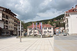 Village center
 -
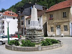 Monument in village center
 -
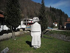 Monument in village center
 -
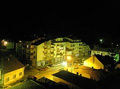 Village center at night
 -
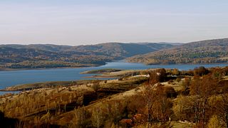 Vlasina Lake near Crna Trava


See also
References
- ^ "Municipalities of Serbia, 2006". Statistical Office of Serbia. Retrieved 2010-11-28.
- ^ "2011 Census of Population, Households and Dwellings in the Republic of Serbia: Comparative Overview of the Number of Population in 1948, 1953, 1961, 1971, 1981, 1991, 2002 and 2011, Data by settlements" (PDF). Statistical Office of Republic Of Serbia, Belgrade. 2014. ISBN 978-86-6161-109-4. Retrieved 2014-06-27.
- ^ "Archived copy". Archived from the original on 2010-10-22. Retrieved 2010-10-18.
{{cite web}}: Unknown parameter|deadurl=ignored (|url-status=suggested) (help)CS1 maint: archived copy as title (link) - ^ a b c d e Slavica Stuparušić (13 August 2017), "Duga kao vesnik obnove Manastirišta", Politika-Magazin No. 1037 (in Serbian), pp. 22–24
- ^ "2011 Census of Population, Households and Dwellings in the Republic of Serbia" (PDF). stat.gov.rs. Statistical Office of the Republic of Serbia. Retrieved 12 January 2017.
- ^ Serbia - Administrative division: districts and municipalities
External links


| International | |
|---|---|
| National | |
This Jablanica District, Serbia location article is a stub. You can help Wikipedia by expanding it. |