
Lake Ladoga: Difference between revisions
Kwamikagami (talk | contribs) |
RodRabelo7 (talk | contribs) m deprecated |
||
| (29 intermediate revisions by 21 users not shown) | |||
| Line 1: | Line 1: | ||
{{short description|Freshwater lake in Russia}} |
{{short description|Freshwater lake in Russia}} |
||
| ⚫ | |||
{{More citations needed|date=May 2019}} |
|||
| ⚫ | |||
|name = Lake Ladoga |
|name = Lake Ladoga |
||
|image = Sortavalan saaristoa.jpg |
|image = Sortavalan saaristoa.jpg |
||
| Line 16: | Line 15: | ||
|outflow = [[Neva River|Neva]] |
|outflow = [[Neva River|Neva]] |
||
|catchment = {{convert|276000|km2|sqmi|abbr=on}} |
|catchment = {{convert|276000|km2|sqmi|abbr=on}} |
||
|basin_countries = |
|basin_countries = Russia<br>Finland (minor) |
||
|length = {{convert|219|km|mi|abbr=on}} |
|length = {{convert|219|km|mi|abbr=on}} |
||
|width = {{convert|138|km|mi|abbr=on}} |
|width = {{convert|138|km|mi|abbr=on}} |
||
|area = {{convert| |
|area = {{convert|17891|km2|sqmi|abbr=on}} |
||
|depth = {{convert| |
|depth = {{convert|47.3|m|ft|abbr=on}} |
||
|max-depth = {{convert|230|m|ft|abbr=on}} |
|max-depth = {{convert|230-260|m|ft|abbr=on}} |
||
|volume = {{convert|837|km3|cumi|abbr=on}} |
|volume = {{convert|837|km3|cumi|abbr=on}} |
||
|residence_time = |
|residence_time = |
||
| Line 30: | Line 29: | ||
}} |
}} |
||
'''Lake Ladoga''' ({{IPAc-en|'|l|ae|d|@|g|@}}; {{lang- |
'''Lake Ladoga''' ({{IPAc-en|'|l|ae|d|@|g|@}}; {{lang-ru|Ла́дожское о́зеро|Ladozhskoye ozero}}, {{IPA|ru|ˈladəʂskəjə ˈozʲɪrə|IPA}} or {{lang|ru|Ла́дога|Ladoga|label=none}}, {{IPA|ru|ˈladəɡə|IPA}}; {{lang-fi|Laatokka}} [earlier in Finnish ''Nevajärvi'']; {{Lang-olo|Luadogu}}; {{lang-vep|Ladog, Ladoganjärv}}) is a [[Fresh water|freshwater]] lake located in the [[Republic of Karelia]] and [[Leningrad Oblast]] in northwestern Russia, in the vicinity of [[Saint Petersburg]]. |
||
It is the largest lake located entirely in |
It is the largest lake located entirely in Europe, the second largest lake in Russia after [[Lake Baikal|Baikal]], and the [[list of lakes by area|14th largest freshwater lake by area]] in the world. It is comparable in size to [[Lake Ontario]]. ''[[Ladoga Lacus]]'', a [[methane]] lake on [[Saturn]]'s moon [[Titan (moon)|Titan]], is named after the lake. |
||
==Etymology== |
==Etymology== |
||
In one of [[Nestor the Chronicler|Nestor's]] chronicles from the 12th century a lake called "the Great Nevo" is mentioned, a clear link to the [[Neva River]] and possibly further to [[Finnish language|Finnish]] ''nevo'' 'sea' or ''neva'' 'bog, quagmire'.<ref name="Geographical names of the world">[[:ru:Поспелов, Евгений Михайлович|Evgeny Pospelov]]: ''Geographical names of the world. Toponymic dictionary.'' Second edition. Astrel, Moscow 2001, pp. 106f.</ref> |
In one of [[Nestor the Chronicler|Nestor's]] chronicles from the 12th century a lake called "the Great Nevo" is mentioned, a clear link to the [[Neva River]] and possibly further to [[Finnish language|Finnish]] ''nevo'' 'sea' or ''neva'' 'bog, quagmire'.<ref name="Geographical names of the world">[[:ru:Поспелов, Евгений Михайлович|Evgeny Pospelov]]: ''Geographical names of the world. Toponymic dictionary.'' Second edition. Astrel, Moscow 2001, pp. 106f.</ref> |
||
Ancient [[Norse sagas]] and Hanseatic treaties both mention a city made of lakes named [[Old Norse]] ''Aldeigja'' or ''Aldoga''.<ref name="Kirilovsky">S. V. Kirilovsky: ''Did you know?'' In: ''Gazetteer Leningrad region.'' Lenizdat, Leningrad 1974, pp. 79f.</ref> Since the beginning of the 14th century this hydronym was commonly known as ''Ladoga''. According to T. N. Jackson, it can be taken "almost for granted that the name of Ladoga first referred to the river, then the city, and only then the lake". Therefore, he considers the primary hydronym Ladoga to originate in the eponymous inflow to the lower reaches of the [[Volkhov River]] whose early [[Finnic languages|Finnic]] name was ''Alodejoki'' (corresponding to modern {{lang-fi|Alojen joki}}) 'river of the lowlands'.<ref name="Geographical names of the world" /> |
Ancient [[Norse sagas]] and Hanseatic treaties both mention a city made of lakes named [[Old Norse]] ''Aldeigja'' or ''Aldoga''.<ref name="Kirilovsky">S. V. Kirilovsky: ''Did you know?'' In: ''Gazetteer Leningrad region.'' Lenizdat, Leningrad 1974, pp. 79f.</ref> Since the beginning of the 14th century this hydronym was commonly known as ''Ladoga''. According to T. N. Jackson, it can be taken "almost for granted that the name of Ladoga first referred to the river, then the city, and only then the lake". Therefore, he considers the primary hydronym Ladoga to originate in the eponymous inflow to the lower reaches of the [[Volkhov River]] whose early [[Finnic languages|Finnic]] name was ''Alodejoki'' (corresponding to modern {{lang-fi|Alojen joki}}) 'river of the lowlands'.<ref name="Geographical names of the world" /> |
||
The Germanic toponym (''Aldeigja'' ~ ''Aldoga'') was soon borrowed by the Slavic population and transformed by means of the Old East Slavic metathesis ''ald- → lad-'' to {{lang-orv|Ладога}}. The Old Norse intermediary word between Finnish and Old East Slavic word is fully supported by archeology, since the Scandinavians first appeared in Ladoga in the early 750s, that is, a couple of decades before the [[Ilmen Slavs|Slavs]].<ref>T. N. Jackson: [http://altladoga.narod.ru/newsarh/2006/ald.htm ''Альдейгья. Археология и топонимика.''] Памятники средневековой культуры: Открытия и версии. Saint |
The Germanic toponym (''Aldeigja'' ~ ''Aldoga'') was soon borrowed by the Slavic population and transformed by means of the Old East Slavic metathesis ''ald- → lad-'' to {{lang-orv|Ладога}}. The Old Norse intermediary word between Finnish and Old East Slavic word is fully supported by archeology, since the Scandinavians first appeared in Ladoga in the early 750s, that is, a couple of decades before the [[Ilmen Slavs|Slavs]].<ref>T. N. Jackson: [http://altladoga.narod.ru/newsarh/2006/ald.htm ''Альдейгья. Археология и топонимика.''] {{Webarchive|url=https://web.archive.org/web/20071111042343/http://altladoga.narod.ru/newsarh/2006/ald.htm |date=2007-11-11 }} Памятники средневековой культуры: Открытия и версии. Saint Petersburg, 1994. pp. 77—79.</ref> |
||
Other hypotheses about the origin of the name derive it from {{lang-krl|aalto}} 'wave' and {{lang-krl|aaltokas}} 'wavy', or from the Russian dialectal word алодь, meaning 'open lake, extensive water field'.<ref name="Toponymy of Ladoga Karelia">N. Mammoth: [https://web.archive.org/web/20070322002516/http://www.laatokka.info/articles/laatokka_mamontova_01.htm ''Топонимика Приладожья''].</ref> [[Eugene Helimski]] by contrast, offers an etymology rooted in |
Other hypotheses about the origin of the name derive it from {{lang-krl|aalto}} 'wave' and {{lang-krl|aaltokas}} 'wavy', or from the Russian dialectal word алодь, meaning 'open lake, extensive water field'.<ref name="Toponymy of Ladoga Karelia">N. Mammoth: [https://web.archive.org/web/20070322002516/http://www.laatokka.info/articles/laatokka_mamontova_01.htm ''Топонимика Приладожья''].</ref> [[Eugene Helimski]] by contrast, offers an etymology rooted in German. In his opinion, the primary name of the lake was {{lang-non|*Aldauga}} 'old source', associated to the open sea, in contrast to the name of the [[Neva River]] (flowing from Lake Ladoga) which would derive from the German expression for 'the new'. Through the intermediate form ''*Aldaugja'', {{lang-non|Aldeigja}} came about, referring to the city of Ladoga.<ref>{{cite journal |
||
| |
|last = Helimski |
||
| |
|first = Eugene |
||
| |
|author-link = Eugene Helimski |
||
| |
|date = 2008 |
||
| |
|title = LADOGA AND PERM REVISITED |
||
| |
|url = http://www.ejournals.eu/sj/index.php/SEC/article/viewFile/1072/1068 |
||
| |
|journal = [[Studia Etymologica Cracoviensia]] |
||
| |
|publisher = [[Cracow University]] |
||
| |
|volume = 13 |
||
| |
|issue = 1 |
||
| |
|pages = 75–88 |
||
| |
|access-date = 5 May 2020 |
||
|archive-date = 3 August 2020 |
|||
}} |
|||
|archive-url = https://web.archive.org/web/20200803005912/http://www.ejournals.eu/sj/index.php/SEC/article/viewFile/1072/1068 |
|||
| ⚫ | |||
|url-status = dead |
|||
| ⚫ | |||
==Geography== |
==Geography== |
||
[[Image:Brockhaus and Efron Encyclopedic Dictionary b33 242-0.jpg|thumb|left|Lake Ladoga, as illustrated in the [[Brockhaus and Efron Encyclopedic Dictionary]] (1890—1907)]] |
[[Image:Brockhaus and Efron Encyclopedic Dictionary b33 242-0.jpg|thumb|left|Lake Ladoga, as illustrated in the [[Brockhaus and Efron Encyclopedic Dictionary]] (1890—1907)]] |
||
The lake has an average surface area of 17,891 km<sup>2</sup> (excluding the islands), slightly larger than [[Kuwait]]. Its north-to-south length is 219 km and its average width is 83 km; the average depth is |
The lake has an average surface area of 17,891 km<sup>2</sup> (excluding the islands), slightly larger than [[Kuwait]]. Its north-to-south length is 219 km and its average width is 83 km; the average depth is 47 m, although it reaches a maximum of 230 m in the north-western part. Basin area: 276,000 km<sup>2</sup>, volume: 837 km<sup>3</sup><ref>{{cite journal | last1 = Sorokin | first1 = Aleksander I. | display-authors = etal | year = 1996 | title = New morphometrical data of Lake Ladoga | journal = [[Hydrobiologia]] | volume = 322 | issue = 1–3| pages = 65–67 | doi = 10.1007/BF00031806 | s2cid = 28835088 }}</ref> (earlier estimated as 908 km<sup>3</sup>). There are around 660 islands, with a total area of about 435 km<sup>2</sup>. Ladoga is, on average, 5 m above sea level.<ref>Калесник С.В. Ладожское озеро. Л.: Гидрометеоиздат, 1968.</ref> Most of the islands, including the famous [[Valaam]] archipelago, [[Kilpola]] and [[Konevets]], are situated in the northwest of the lake. |
||
Separated from the [[Baltic Sea]] by the [[Karelian Isthmus]], it drains into the [[Gulf of Finland]] via the [[Neva River]]. |
Separated from the [[Baltic Sea]] by the [[Karelian Isthmus]], it drains into the [[Gulf of Finland]] via the [[Neva River]]. |
||
Lake Ladoga is navigable, being a part of the [[ |
Lake Ladoga is navigable, being a part of the [[Volga–Baltic Waterway]] connecting the [[Baltic Sea]] with the [[Volga River]]. The [[Ladoga Canal]] bypasses the lake in the south, connecting the Neva to the [[Svir]]. |
||
The basin of Lake Ladoga includes about 50,000 lakes and 3,500 rivers longer than 10 km. About 85% of the water inflow is due to tributaries, 13% is due to [[Precipitation (meteorology)|precipitation]], and 2% is due to underground waters. |
The basin of Lake Ladoga includes about 50,000 lakes and 3,500 rivers longer than 10 km. About 85% of the water inflow is due to tributaries, 13% is due to [[Precipitation (meteorology)|precipitation]], and 2% is due to underground waters. |
||
| Line 70: | Line 71: | ||
{{see also|Geology of the Baltic Sea|Svecofennian orogeny}} |
{{see also|Geology of the Baltic Sea|Svecofennian orogeny}} |
||
[[Image:Baltic History 7500-BC.svg|thumb|upright=0.8|[[Ancylus Lake]] around 7,000 BC.]] |
[[Image:Baltic History 7500-BC.svg|thumb|upright=0.8|[[Ancylus Lake]] around 7,000 BC.]] |
||
Geologically, the Lake Ladoga depression is a [[graben]] and [[syncline]] [[structural geology|structure]] of [[Proterozoic]] age ([[Precambrian]]). This "Ladoga–Pasha structure", as it is known, hosts [[Jotnian|Jotnian sediments]]. During the [[Quaternary glaciation|Pleistocene glaciation]]s the depression was partially stripped of its [[sedimentary rock]] fill by glacial [[overdeepening]].<ref name=amantovetal>{{cite journal |last1=Amantov |first1=A. |last2=Laitakari |first2=I. |last3=Poroshin |first3=Ye |date=1996 |title=Jotnian and Postjotnian: Sandstones and diabases in the surroundings of the Gulf of Finland |url= https://www.researchgate.net/publication/259459569|journal=[[Geological Survey of Finland|Geological Survey of Finland, Special Paper]] |volume=21 |pages=99–113 |access-date=27 July 2015}}</ref> During the [[Last Glacial Maximum]], about 17,000 years [[before present|BP]], the lake served likely as a channel that concentrated ice of the [[Weichselian glaciation|Fennoscandian Ice Sheet]] into an [[ice stream]] that fed glacier lobes further east.<ref name=Stroevenetal2016>{{cite journal|author-last=Stroeven|author-first=Arjen P. |author-last2=Hättestrand|author-first2=Clas |author-last3=Kleman|author-first3=Johan|author-last4=Heyman|author-first4=Jakob |author-last5=Fabel|author-first5=Derek |author-last6=Fredin|author-first6=Ola |author-last7=Goodfellow|author-first7=Bradley W. |author-last8=Harbor|author-first8=Jonathan M. |author-last9=Jansen|author-first9=John D. |author-last10=Olsen|author-first10=Lars |author-last11=Caffee|author-first11=Marc W. |author-last12=Fink|author-first12=David |author-last13=Lundqvist|author-first13=Jan |author-last14=Rosqvist|author-first14=Gunhild C. |author-last15=Strömberg|author-first15=Bo |author-last16=Jansson|author-first16=Krister N. |author-link13=Jan Lundqvist |date=2016|title=Deglaciation of Fennoscandia|journal=[[Quaternary Science Reviews]] |volume=147|pages=91–121|doi=10.1016/j.quascirev.2015.09.016 |bibcode=2016QSRv..147...91S |doi-access=free}}</ref> |
Geologically, the Lake Ladoga depression is a [[graben]] and [[syncline]] [[structural geology|structure]] of [[Proterozoic]] age ([[Precambrian]]). This "Ladoga–Pasha structure", as it is known, hosts [[Jotnian|Jotnian sediments]]. During the [[Quaternary glaciation|Pleistocene glaciation]]s the depression was partially stripped of its [[sedimentary rock]] fill by glacial [[overdeepening]].<ref name=amantovetal>{{cite journal |last1=Amantov |first1=A. |last2=Laitakari |first2=I. |last3=Poroshin |first3=Ye |date=1996 |title=Jotnian and Postjotnian: Sandstones and diabases in the surroundings of the Gulf of Finland |url= https://www.researchgate.net/publication/259459569|journal=[[Geological Survey of Finland|Geological Survey of Finland, Special Paper]] |volume=21 |pages=99–113 |access-date=27 July 2015}}</ref> During the [[Last Glacial Maximum]], about 17,000 years [[before present|BP]], the lake served likely as a channel that concentrated ice of the [[Weichselian glaciation|Fennoscandian Ice Sheet]] into an [[ice stream]] that fed glacier lobes further east.<ref name=Stroevenetal2016>{{cite journal|author-last=Stroeven|author-first=Arjen P. |author-last2=Hättestrand|author-first2=Clas |author-last3=Kleman|author-first3=Johan|author-last4=Heyman|author-first4=Jakob |author-last5=Fabel|author-first5=Derek |author-last6=Fredin|author-first6=Ola |author-last7=Goodfellow|author-first7=Bradley W. |author-last8=Harbor|author-first8=Jonathan M. |author-last9=Jansen|author-first9=John D. |author-last10=Olsen|author-first10=Lars |author-last11=Caffee|author-first11=Marc W. |author-last12=Fink|author-first12=David |author-last13=Lundqvist|author-first13=Jan |author-last14=Rosqvist|author-first14=Gunhild C. |author-last15=Strömberg|author-first15=Bo |author-last16=Jansson|author-first16=Krister N. |author-link13=Jan Lundqvist |date=2016|title=Deglaciation of Fennoscandia|journal=[[Quaternary Science Reviews]] |volume=147|pages=91–121|doi=10.1016/j.quascirev.2015.09.016 |bibcode=2016QSRv..147...91S |doi-access=free|hdl=1956/11701|hdl-access=free}}</ref> |
||
Deglaciation following the [[Weichselian glaciation]] took place in the Lake Ladoga basin between 12,500 and 11,500 [[Before Present|radiocarbon years BP]]. Lake Ladoga was initially part of the [[Baltic Ice Lake]] (70–80 m. above present [[sea level]]), a historical [[freshwater]] stage of [[Baltic Sea]]. It is possible, though not certain, that Ladoga was isolated from it during [[regression (geology)|regression]] of the subsequent [[Yoldia Sea]] [[brackish]] stage (10,200–9,500 BP). The isolation threshold should be at [[Heinjoki]] to the east of [[Vyborg]], where the [[Baltic Sea]] and Ladoga were connected by a strait or a river outlet at least until the formation of the River Neva, and possibly even much later, until the 12th century AD or so.<ref>{{Cite journal | author = Ailio, Julius | year = 1915 | title = Die geographische Entwicklung des Ladogasees in postglazialer Zeit | journal = Bull. Comm. Géol. Finlande | volume = 45 | pages = 1–159 }}</ref><ref name="davydova">{{cite journal | last1 = Davydova | first1 = Natalia N. | display-authors = etal | year = 1996 | title = Late- and postglacial history of lakes of the Karelian Isthmus | journal = [[Hydrobiologia]] | volume = 322 | issue = 1–3| pages = 199–204 | doi = 10.1007/BF00031828 | s2cid = 9631019 }}</ref> |
Deglaciation following the [[Weichselian glaciation]] took place in the Lake Ladoga basin between 12,500 and 11,500 [[Before Present|radiocarbon years BP]]. Lake Ladoga was initially part of the [[Baltic Ice Lake]] (70–80 m. above present [[sea level]]), a historical [[freshwater]] stage of [[Baltic Sea]]. It is possible, though not certain, that Ladoga was isolated from it during [[regression (geology)|regression]] of the subsequent [[Yoldia Sea]] [[brackish]] stage (10,200–9,500 BP). The isolation threshold should be at [[Heinjoki]] to the east of [[Vyborg]], where the [[Baltic Sea]] and Ladoga were connected by a strait or a river outlet at least until the formation of the River Neva, and possibly even much later, until the 12th century AD or so.<ref>{{Cite journal | author = Ailio, Julius | year = 1915 | title = Die geographische Entwicklung des Ladogasees in postglazialer Zeit | journal = Bull. Comm. Géol. Finlande | volume = 45 | pages = 1–159 }}</ref><ref name="davydova">{{cite journal | last1 = Davydova | first1 = Natalia N. | display-authors = etal | year = 1996 | title = Late- and postglacial history of lakes of the Karelian Isthmus | journal = [[Hydrobiologia]] | volume = 322 | issue = 1–3| pages = 199–204 | doi = 10.1007/BF00031828 | s2cid = 9631019 }}</ref> |
||
| Line 85: | Line 86: | ||
==Wildlife== |
==Wildlife== |
||
The Ladoga is rich with fish. 48 forms (species and infra specific taxa) of fish have been encountered in the lake, including [[Rutilus|roach]], [[carp bream]], [[zander]], [[European perch]], [[ruffe]], endemic variety of [[smelt (fish)|smelt]], two varieties of ''[[Coregonus albula]]'' (vendace), eight varieties of ''[[Coregonus]] lavaretus'', a number of other [[Salmonidae]] as well as, albeit rarely, endangered [[Atlantic sturgeon]] (formerly confused with [[European sea sturgeon]]). Commercial fishing was once a major industry but has been hurt by overfishing. After the war, between |
The Ladoga is rich with fish. 48 forms (species and infra specific taxa) of fish have been encountered in the lake, including [[Rutilus|roach]], [[carp bream]], [[zander]], [[European perch]], [[ruffe]], endemic variety of [[smelt (fish)|smelt]], two varieties of ''[[Coregonus albula]]'' (vendace), eight varieties of ''[[Coregonus]] lavaretus'', a number of other [[Salmonidae]] as well as, albeit rarely, endangered [[Atlantic sturgeon]] (formerly confused with [[European sea sturgeon]]). Commercial fishing was once a major industry but has been hurt by overfishing. After the war, between 1945 and 1954, the total annual catch increased and reached a maximum of 4,900 tonnes. However, unbalanced fishery led to the drastic decrease of catch in 1955–1963, sometimes to 1,600 tonnes per year. [[Trawling]] has been forbidden in Lake Ladoga since 1956 and some other restrictions were imposed. The situation gradually recovered, and in 1971–1990 the catch ranged between 4,900 and 6,900 tonnes per year, about the same level as the total catch in 1938.<ref>{{cite journal | last1 = Kudersky | first1 = Leonid K. | display-authors = etal | year = 1996 | title = Fishery of Lake Ladoga — past, present and future | journal = [[Hydrobiologia]] | volume = 322 | issue = 1–3| pages = 57–64 | doi = 10.1007/BF00031805 | s2cid = 43547080 }}</ref> Fish farms and recreational fishing are developing.<ref>{{cite web| url = http://ladoga.krc.karelia.ru/resources/fish/index.shtml| title = Ladoga| access-date = 2007-01-29| archive-date = 2020-01-17| archive-url = https://web.archive.org/web/20200117083942/http://ladoga.krc.karelia.ru/resources/fish/index.shtml| url-status = live}}</ref> |
||
It has its own [[endemic (ecology)|endemic]] [[ringed seal]] subspecies known as the [[Ladoga seal]]. |
It has its own [[endemic (ecology)|endemic]] [[ringed seal]] subspecies known as the [[Ladoga seal]]. |
||
| Line 93: | Line 94: | ||
[[Nizhnesvirsky Natural Reserve]] is situated along the shore of Lake Ladoga immediately to the north of the mouth of the [[River Svir]]. |
[[Nizhnesvirsky Natural Reserve]] is situated along the shore of Lake Ladoga immediately to the north of the mouth of the [[River Svir]]. |
||
The Ladoga has a population of [[Arctic char]] that is genetically close to the [[Sommen charr|chars of Lake Sommen]] and [[Vättern|Lake Vättern]] in southern Sweden.<ref name=Hammar2014>{{cite journal |last1=Hammar |first1=J. |date=2014 |title=Natural resilience in Arctic charr ''Salvelinus alpinus'': life history, spatial and dietary alterations along gradients of interspecific interactions |journal=[[Fish Biology]] |volume=85 |issue=1 |pages=81–118 |doi= 10.1111/jfb.12321 |pmid=24754706}}</ref> |
The Ladoga has a population of [[Arctic char]] that is genetically close to the [[Sommen charr|chars of Lake Sommen]] and [[Vättern|Lake Vättern]] in southern Sweden.<ref name=Hammar2014>{{cite journal |last1=Hammar |first1=J. |date=2014 |title=Natural resilience in Arctic charr ''Salvelinus alpinus'': life history, spatial and dietary alterations along gradients of interspecific interactions |journal=[[Fish Biology]] |volume=85 |issue=1 |pages=81–118 |doi= 10.1111/jfb.12321 |pmid=24754706|bibcode=2014JFBio..85...81H }}</ref> |
||
== History == |
== History == |
||
[[File:Konevets Cathedral from east.JPG|thumb|Konevsky monastery]] |
[[File:Konevets Cathedral from east.JPG|thumb|Konevsky monastery]] |
||
In the [[Middle Ages]], the lake formed a vital part of the [[trade route from the Varangians to the Greeks |
In the [[Middle Ages]], the lake formed a vital part of the [[trade route from the Varangians to the Greeks|trade route from the Varangians to the Eastern Roman Empire]], with the Norse emporium at [[Staraya Ladoga]] defending the mouth of the Volkhov since the 8th century. In the course of the [[Swedish–Novgorodian Wars]], the area was disputed between the [[Novgorod Republic]] and Sweden. In the early 14th century, the fortresses of [[Korela Fortress|Korela]] (Kexholm) and [[Oreshek]] (Nöteborg) were established along the banks of the lake. |
||
During the [[Russo-Swedish War (1656–1658)|Russo-Swedish War]] of 1656–1658, the Swedes deployed several armed vessels (called Lodja) on lake Ladoga to combat the Russians though no large sea battles were fought. <ref>{{Cite book |last=Englund |first=Peter |title=Den oövervinnerlige: om den svenska stormaktstiden och en man i dess mitt |date=2000 |publisher=Atlantis |isbn=978-91-7486-999-6 |location=Stockholm |pages=649 |language=Swedish}}</ref> |
|||
| ⚫ | The ancient [[Valaam Monastery]] was founded on the island of [[Valaam]], the largest in Lake Ladoga, abandoned between |
||
| ⚫ | The ancient [[Valaam Monastery]] was founded on the island of [[Valaam]], the largest in Lake Ladoga, abandoned between 1611 and 1715, restored in the 18th century, and evacuated to Finland during the [[Winter War]] in 1940. In 1989 the monastic activities in the Valaam were resumed. Other historic cloisters in the vicinity are the [[Konevets Monastery]], which sits on the [[Konevets]] island, and the [[Alexander-Svirsky Monastery]], which preserves samples of [[Culture of ancient Rus#Muscovite period|medieval Muscovite architecture]]. |
||
| ⚫ | During the [[Ingrian War]], a fraction of the Ladoga coast was occupied by |
||
| ⚫ | During the [[Ingrian War]], a fraction of the Ladoga coast was occupied by Sweden. In 1617, by the [[Treaty of Stolbovo]], the northern and western coast was ceded by Russia to Sweden. In 1721, after the [[Great Northern War]], it was restitutioned to Russia by the [[Treaty of Nystad]]. In the 18th century, the [[Ladoga Canal]] was built to bypass the lake which was prone to winds and storms that destroyed hundreds of cargo ships.<ref name="nezhikhovsky">Нежиховский Р.А. Река Нева. 3-е изд. Leningrad: Гидрометеоиздат, 1973. P. 158.</ref> |
||
Later, from around 1812–1940 the lake was shared between Finland and Russia. According to the conditions of the 1920 [[Treaty of Tartu (Russian–Finnish)|Tartu Peace Treaty]] militarization of the lake was severely restricted. However, both Soviet Russia and Finland had flotillas in Ladoga (see also [[Finnish Ladoga Naval Detachment]]). After the [[Winter War]] (1939–40) according to the [[Moscow Peace Treaty]], Ladoga, previously shared with Finland, became an internal basin of the Soviet Union. |
Later, from around 1812–1940 the lake was shared between Finland and Russia. According to the conditions of the 1920 [[Treaty of Tartu (Russian–Finnish)|Tartu Peace Treaty]] militarization of the lake was severely restricted. However, both Soviet Russia and Finland had flotillas in Ladoga (see also [[Finnish Ladoga Naval Detachment]]). After the [[Winter War]] (1939–40) according to the [[Moscow Peace Treaty]], Ladoga, previously shared with Finland, became an internal basin of the Soviet Union. |
||
During |
During World War II not only Finnish and Soviet, but also German and Italian vessels operated there (see also [[Naval Detachment K]] and [[Regia Marina#Lake Ladoga|Regia Marina]]). Under these circumstances, during much of the [[Siege of Leningrad]] (1941–44), Lake Ladoga provided the only access to the besieged city as a section of the eastern shore remained in Soviet hands. Supplies were transported into [[Saint Petersburg|Leningrad]] with trucks on winter roads over the ice, the "[[Road of Life]]", and by boat in the summer. After World War II, Finland lost the [[Karelia]] region again to the USSR, and all Finnish citizens were [[Evacuation of Finnish Karelia|evacuated from the ceded territory]]. Ladoga became an internal Soviet basin once again. The northern shore, [[Ladoga Karelia]] with the town of [[Sortavala]], is now part of the [[Republic of Karelia]]. The western shore, [[Karelian Isthmus]], became part of [[Leningrad Oblast]]. |
||
==Lists== |
==Lists== |
||
| Line 113: | Line 116: | ||
* [[Svir River]] from [[Lake Onega]] (south-east, discharge: 790 m<sup>3</sup>/s); |
* [[Svir River]] from [[Lake Onega]] (south-east, discharge: 790 m<sup>3</sup>/s); |
||
* [[Volkhov River]] from [[Lake Ilmen]] (south, discharge: 580 m<sup>3</sup>/s); |
* [[Volkhov River]] from [[Lake Ilmen]] (south, discharge: 580 m<sup>3</sup>/s); |
||
* [[Vuoksi River]] (and [[Burnaya River]]) from [[Saimaa|Lake Saimaa]] in |
* [[Vuoksi River]] (and [[Burnaya River]]) from [[Saimaa|Lake Saimaa]] in Finland (west, discharge: 540 m<sup>3</sup>/s). |
||
* [[Syas River]] (south, discharge: 53 m<sup>3</sup>/s). |
* [[Syas River]] (south, discharge: 53 m<sup>3</sup>/s). |
||
* [[Olonka River]] from [[Lake Utozero]] |
* [[Olonka River]] from [[Lake Utozero]] |
||
| Line 136: | Line 139: | ||
Image:Priroda Valaamskogo arhipelaga.jpg|[[Valaam Archipelago]] |
Image:Priroda Valaamskogo arhipelaga.jpg|[[Valaam Archipelago]] |
||
File:Валун у Видлицы.jpg|Boulder on Vidlitsa, west shore |
File:Валун у Видлицы.jpg|Boulder on Vidlitsa, west shore |
||
</gallery> |
|||
<gallery widths="450" heights="170"> |
|||
Image:JbLLjT4260k.jpg|Iron whale on Lake Ladoga |
|||
</gallery> |
</gallery> |
||
| Line 152: | Line 159: | ||
==External links== |
==External links== |
||
{{Commons category|Lake Ladoga}} |
{{Commons category|Lake Ladoga}} |
||
{{NIE Poster|Ladoga| |
{{NIE Poster|Ladoga|Lake Ladoga}} |
||
* {{Cite EB1911|wstitle= Ladoga | volume= 16 |last1= Kropotkin |first1= Peter Alexeivitch |author1-link= Peter Kropotkin| last2= Bealby |first2= John Thomas| page = 61 |short= 1}} |
|||
* Simola, Heikki et al. (eds), [http://www.springerlink.com/content/qkqm32886q58 Proceeding of The First International Lake Ladoga Symposium]{{dead link|date=February 2020|bot=medic}}{{cbignore|bot=medic}}. Special issue of ''[[Hydrobiologia]]''. Vol. 322, Issues 1–3. / April 1996. |
* Simola, Heikki et al. (eds), [http://www.springerlink.com/content/qkqm32886q58 Proceeding of The First International Lake Ladoga Symposium]{{dead link|date=February 2020|bot=medic}}{{cbignore|bot=medic}}. Special issue of ''[[Hydrobiologia]]''. Vol. 322, Issues 1–3. / April 1996. |
||
* [http://www.ladoga-lake.ru/translate/eng_photos.html Ladoga Lake (photos)] {{Webarchive|url=https://web.archive.org/web/20200802224427/http://www.ladoga-lake.ru/translate/eng_photos.html |date=2020-08-02 }} |
* [http://www.ladoga-lake.ru/translate/eng_photos.html Ladoga Lake (photos)] {{Webarchive|url=https://web.archive.org/web/20200802224427/http://www.ladoga-lake.ru/translate/eng_photos.html |date=2020-08-02 }} |
||
* [http://heninen.net/laatokka-war/english.htm War on Lake Ladoga, 1941–1944] |
* [http://heninen.net/laatokka-war/english.htm War on Lake Ladoga, 1941–1944] {{Webarchive|url=https://web.archive.org/web/20210305052844/http://heninen.net/laatokka-war/english.htm |date=2021-03-05 }} |
||
* [https://web.archive.org/web/20070819224922/http://www.clubneva.ru/lib.htm Maps] |
* [https://web.archive.org/web/20070819224922/http://www.clubneva.ru/lib.htm Maps] |
||
Revision as of 02:27, 12 August 2024
| Lake Ladoga | |
|---|---|
 | |
.jpg) Location in Russia | |
 Large-scale map | |
| Location | Northwestern Russia (Leningrad Oblast and the Republic of Karelia) |
| Coordinates | 61°00′N 31°30′E / 61.000°N 31.500°E |
| Primary inflows | Svir, Volkhov, Vuoksi |
| Primary outflows | Neva |
| Catchment area | 276,000 km2 (107,000 sq mi) |
| Basin countries | Russia Finland (minor) |
| Max. length | 219 km (136 mi) |
| Max. width | 138 km (86 mi) |
| Surface area | 17,891 km2 (6,908 sq mi) |
| Average depth | 47.3 m (155 ft) |
| Max. depth | 230–260 m (750–850 ft) |
| Water volume | 837 km3 (201 cu mi) |
| Surface elevation | 5 m (16 ft) |
| Islands | about 660 (including Valaam) |
| Settlements | see list |
Lake Ladoga (/ˈlædəɡə/; ‹See Tfd›Russian: Ла́дожское о́зеро, romanized: Ladozhskoye ozero, IPA: [ˈladəʂskəjə ˈozʲɪrə] or Ла́дога, IPA: [ˈladəɡə]; Finnish: Laatokka [earlier in Finnish Nevajärvi]; Livvi: Luadogu; Veps: Ladog, Ladoganjärv) is a freshwater lake located in the Republic of Karelia and Leningrad Oblast in northwestern Russia, in the vicinity of Saint Petersburg.
It is the largest lake located entirely in Europe, the second largest lake in Russia after Baikal, and the 14th largest freshwater lake by area in the world. It is comparable in size to Lake Ontario. Ladoga Lacus, a methane lake on Saturn's moon Titan, is named after the lake.
Etymology
In one of Nestor's chronicles from the 12th century a lake called "the Great Nevo" is mentioned, a clear link to the Neva River and possibly further to Finnish nevo 'sea' or neva 'bog, quagmire'.[1]
Ancient Norse sagas and Hanseatic treaties both mention a city made of lakes named Old Norse Aldeigja or Aldoga.[2] Since the beginning of the 14th century this hydronym was commonly known as Ladoga. According to T. N. Jackson, it can be taken "almost for granted that the name of Ladoga first referred to the river, then the city, and only then the lake". Therefore, he considers the primary hydronym Ladoga to originate in the eponymous inflow to the lower reaches of the Volkhov River whose early Finnic name was Alodejoki (corresponding to modern Finnish: Alojen joki) 'river of the lowlands'.[1]
The Germanic toponym (Aldeigja ~ Aldoga) was soon borrowed by the Slavic population and transformed by means of the Old East Slavic metathesis ald- → lad- to Old East Slavic: Ладога. The Old Norse intermediary word between Finnish and Old East Slavic word is fully supported by archeology, since the Scandinavians first appeared in Ladoga in the early 750s, that is, a couple of decades before the Slavs.[3]
Other hypotheses about the origin of the name derive it from Karelian: aalto 'wave' and Karelian: aaltokas 'wavy', or from the Russian dialectal word алодь, meaning 'open lake, extensive water field'.[4] Eugene Helimski by contrast, offers an etymology rooted in German. In his opinion, the primary name of the lake was Old Norse: *Aldauga 'old source', associated to the open sea, in contrast to the name of the Neva River (flowing from Lake Ladoga) which would derive from the German expression for 'the new'. Through the intermediate form *Aldaugja, Old Norse: Aldeigja came about, referring to the city of Ladoga.[5]
Geography

The lake has an average surface area of 17,891 km2 (excluding the islands), slightly larger than Kuwait. Its north-to-south length is 219 km and its average width is 83 km; the average depth is 47 m, although it reaches a maximum of 230 m in the north-western part. Basin area: 276,000 km2, volume: 837 km3[6] (earlier estimated as 908 km3). There are around 660 islands, with a total area of about 435 km2. Ladoga is, on average, 5 m above sea level.[7] Most of the islands, including the famous Valaam archipelago, Kilpola and Konevets, are situated in the northwest of the lake.
Separated from the Baltic Sea by the Karelian Isthmus, it drains into the Gulf of Finland via the Neva River.
Lake Ladoga is navigable, being a part of the Volga–Baltic Waterway connecting the Baltic Sea with the Volga River. The Ladoga Canal bypasses the lake in the south, connecting the Neva to the Svir.
The basin of Lake Ladoga includes about 50,000 lakes and 3,500 rivers longer than 10 km. About 85% of the water inflow is due to tributaries, 13% is due to precipitation, and 2% is due to underground waters.
Geological history

Geologically, the Lake Ladoga depression is a graben and syncline structure of Proterozoic age (Precambrian). This "Ladoga–Pasha structure", as it is known, hosts Jotnian sediments. During the Pleistocene glaciations the depression was partially stripped of its sedimentary rock fill by glacial overdeepening.[8] During the Last Glacial Maximum, about 17,000 years BP, the lake served likely as a channel that concentrated ice of the Fennoscandian Ice Sheet into an ice stream that fed glacier lobes further east.[9]
Deglaciation following the Weichselian glaciation took place in the Lake Ladoga basin between 12,500 and 11,500 radiocarbon years BP. Lake Ladoga was initially part of the Baltic Ice Lake (70–80 m. above present sea level), a historical freshwater stage of Baltic Sea. It is possible, though not certain, that Ladoga was isolated from it during regression of the subsequent Yoldia Sea brackish stage (10,200–9,500 BP). The isolation threshold should be at Heinjoki to the east of Vyborg, where the Baltic Sea and Ladoga were connected by a strait or a river outlet at least until the formation of the River Neva, and possibly even much later, until the 12th century AD or so.[10][11]
At 9,500 BP, Lake Onega, previously draining into the White Sea, started emptying into Ladoga via the River Svir. Between 9,500 and 9,100 BP, during the transgression of Ancylus Lake, the next freshwater stage of the Baltic, Ladoga certainly became part of it, even if they hadn't been connected immediately before. During the Ancylus Lake subsequent regression, around 8,800 BP Ladoga became isolated.[12][citation needed]
Ladoga slowly transgressed in its southern part due to uplift of the Baltic Shield in the north. It has been hypothesized, but not proven, that waters of the Litorina Sea, the next brackish-water stage of the Baltic, occasionally invaded Ladoga between 7,000 and 5,000 BP. Around 5,000 BP the waters of the Saimaa Lake penetrated Salpausselkä and formed a new outlet, River Vuoksi, entering Lake Ladoga in the northwestern corner and raising its level by 1–2 m.[13]
The River Neva originated when the Ladoga waters at last broke through the threshold at Porogi into the lower portions of Izhora River, then a tributary of the Gulf of Finland, between 4,000 and 2,000 BP. Dating of some sediments in the northwestern part of Lake Ladoga suggests it happened at 3,100 radiocarbon years BP (3,410–3,250 calendar years BP).[14]
-
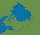
 Lake Ladoga as part of the Baltic Ice Lake (between 11200 and 10500 yr BP). The light blue line marks the margin of the ice sheet by 13300 cal yr BP.
 -
 Lake Ladoga as part of the Ancylus Lake (between 9300 and 9200 yr BP). The dark green line marks the southern shoreline of Lake Ladoga during the Yoldia stage of the Baltic basin.


Wildlife
The Ladoga is rich with fish. 48 forms (species and infra specific taxa) of fish have been encountered in the lake, including roach, carp bream, zander, European perch, ruffe, endemic variety of smelt, two varieties of Coregonus albula (vendace), eight varieties of Coregonus lavaretus, a number of other Salmonidae as well as, albeit rarely, endangered Atlantic sturgeon (formerly confused with European sea sturgeon). Commercial fishing was once a major industry but has been hurt by overfishing. After the war, between 1945 and 1954, the total annual catch increased and reached a maximum of 4,900 tonnes. However, unbalanced fishery led to the drastic decrease of catch in 1955–1963, sometimes to 1,600 tonnes per year. Trawling has been forbidden in Lake Ladoga since 1956 and some other restrictions were imposed. The situation gradually recovered, and in 1971–1990 the catch ranged between 4,900 and 6,900 tonnes per year, about the same level as the total catch in 1938.[15] Fish farms and recreational fishing are developing.[16]
It has its own endemic ringed seal subspecies known as the Ladoga seal.
Since the beginning of the 1960s Ladoga has become considerably eutrophicated.[17]
Nizhnesvirsky Natural Reserve is situated along the shore of Lake Ladoga immediately to the north of the mouth of the River Svir.
The Ladoga has a population of Arctic char that is genetically close to the chars of Lake Sommen and Lake Vättern in southern Sweden.[18]
History

In the Middle Ages, the lake formed a vital part of the trade route from the Varangians to the Eastern Roman Empire, with the Norse emporium at Staraya Ladoga defending the mouth of the Volkhov since the 8th century. In the course of the Swedish–Novgorodian Wars, the area was disputed between the Novgorod Republic and Sweden. In the early 14th century, the fortresses of Korela (Kexholm) and Oreshek (Nöteborg) were established along the banks of the lake.
During the Russo-Swedish War of 1656–1658, the Swedes deployed several armed vessels (called Lodja) on lake Ladoga to combat the Russians though no large sea battles were fought. [19]
The ancient Valaam Monastery was founded on the island of Valaam, the largest in Lake Ladoga, abandoned between 1611 and 1715, restored in the 18th century, and evacuated to Finland during the Winter War in 1940. In 1989 the monastic activities in the Valaam were resumed. Other historic cloisters in the vicinity are the Konevets Monastery, which sits on the Konevets island, and the Alexander-Svirsky Monastery, which preserves samples of medieval Muscovite architecture.
During the Ingrian War, a fraction of the Ladoga coast was occupied by Sweden. In 1617, by the Treaty of Stolbovo, the northern and western coast was ceded by Russia to Sweden. In 1721, after the Great Northern War, it was restitutioned to Russia by the Treaty of Nystad. In the 18th century, the Ladoga Canal was built to bypass the lake which was prone to winds and storms that destroyed hundreds of cargo ships.[20]
Later, from around 1812–1940 the lake was shared between Finland and Russia. According to the conditions of the 1920 Tartu Peace Treaty militarization of the lake was severely restricted. However, both Soviet Russia and Finland had flotillas in Ladoga (see also Finnish Ladoga Naval Detachment). After the Winter War (1939–40) according to the Moscow Peace Treaty, Ladoga, previously shared with Finland, became an internal basin of the Soviet Union.
During World War II not only Finnish and Soviet, but also German and Italian vessels operated there (see also Naval Detachment K and Regia Marina). Under these circumstances, during much of the Siege of Leningrad (1941–44), Lake Ladoga provided the only access to the besieged city as a section of the eastern shore remained in Soviet hands. Supplies were transported into Leningrad with trucks on winter roads over the ice, the "Road of Life", and by boat in the summer. After World War II, Finland lost the Karelia region again to the USSR, and all Finnish citizens were evacuated from the ceded territory. Ladoga became an internal Soviet basin once again. The northern shore, Ladoga Karelia with the town of Sortavala, is now part of the Republic of Karelia. The western shore, Karelian Isthmus, became part of Leningrad Oblast.
Lists
Tributaries
- (incomplete list)
- Svir River from Lake Onega (south-east, discharge: 790 m3/s);
- Volkhov River from Lake Ilmen (south, discharge: 580 m3/s);
- Vuoksi River (and Burnaya River) from Lake Saimaa in Finland (west, discharge: 540 m3/s).
- Syas River (south, discharge: 53 m3/s).
- Olonka River from Lake Utozero
Towns upon the lake
- Shlisselburg (at 59°56′N 31°02′E / 59.933°N 31.033°E)
- Novaya Ladoga (at 60°06′N 32°18′E / 60.100°N 32.300°E)
- Syasstroy (at 60°08′N 32°34′E / 60.133°N 32.567°E)
- Pitkyaranta (at 61°34′N 31°28′E / 61.567°N 31.467°E)
- Sortavala (at 61°42′N 30°41′E / 61.700°N 30.683°E)
- Lakhdenpokhya (at 61°31′N 30°12′E / 61.517°N 30.200°E)
- Priozersk (at 61°02′N 30°08′E / 61.033°N 30.133°E)
Image gallery
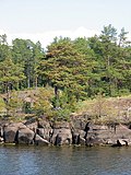
-
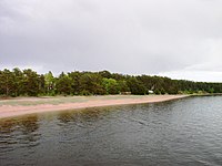
 Rocky shore
 -
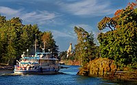
 The archipelago in Ladoga Lake with the Monastery of the Transfiguration of the Saviour
 -
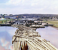 Rafts on the Peter the Great Canal. City of Shlisselburg
 -
-
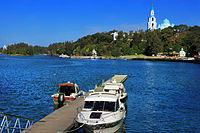
 Sortavala harbour, Karelia
 -
 Saint Nicholas Skete on island Valaam on Ladoga lake and little ship
 -
-
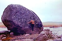 Boulder on Vidlitsa, west shore


-
 Iron whale on Lake Ladoga

-
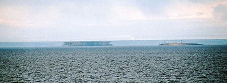 Superior mirage on Lake Ladoga
 -
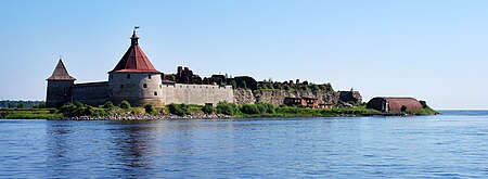 Oreshek Fortress on Ladoga shore in Shlisselburg


-
 View
View

References
- ^ a b Evgeny Pospelov: Geographical names of the world. Toponymic dictionary. Second edition. Astrel, Moscow 2001, pp. 106f.
- ^ S. V. Kirilovsky: Did you know? In: Gazetteer Leningrad region. Lenizdat, Leningrad 1974, pp. 79f.
- ^ T. N. Jackson: Альдейгья. Археология и топонимика. Archived 2007-11-11 at the Wayback Machine Памятники средневековой культуры: Открытия и версии. Saint Petersburg, 1994. pp. 77—79.
- ^ N. Mammoth: Топонимика Приладожья.
- ^ Helimski, Eugene (2008). "LADOGA AND PERM REVISITED". Studia Etymologica Cracoviensia. 13 (1). Cracow University: 75–88. Archived from the original on 3 August 2020. Retrieved 5 May 2020.
- ^ Sorokin, Aleksander I.; et al. (1996). "New morphometrical data of Lake Ladoga". Hydrobiologia. 322 (1–3): 65–67. doi:10.1007/BF00031806. S2CID 28835088.
- ^ Калесник С.В. Ладожское озеро. Л.: Гидрометеоиздат, 1968.
- ^ Amantov, A.; Laitakari, I.; Poroshin, Ye (1996). "Jotnian and Postjotnian: Sandstones and diabases in the surroundings of the Gulf of Finland". Geological Survey of Finland, Special Paper. 21: 99–113. Retrieved 27 July 2015.
- ^ Stroeven, Arjen P.; Hättestrand, Clas; Kleman, Johan; Heyman, Jakob; Fabel, Derek; Fredin, Ola; Goodfellow, Bradley W.; Harbor, Jonathan M.; Jansen, John D.; Olsen, Lars; Caffee, Marc W.; Fink, David; Lundqvist, Jan; Rosqvist, Gunhild C.; Strömberg, Bo; Jansson, Krister N. (2016). "Deglaciation of Fennoscandia". Quaternary Science Reviews. 147: 91–121. Bibcode:2016QSRv..147...91S. doi:10.1016/j.quascirev.2015.09.016. hdl:1956/11701.
- ^ Ailio, Julius (1915). "Die geographische Entwicklung des Ladogasees in postglazialer Zeit". Bull. Comm. Géol. Finlande. 45: 1–159.
- ^ Davydova, Natalia N.; et al. (1996). "Late- and postglacial history of lakes of the Karelian Isthmus". Hydrobiologia. 322 (1–3): 199–204. doi:10.1007/BF00031828. S2CID 9631019.
- ^ Saarnisto, Matti; Grönlund, Tuulikki; Ekman, Ilpo (1995-01-01). "Lateglacial of Lake Onega — Contribution to the history of the eastern Baltic basin". Quaternary International. 27 (Supplement C): 111–120. Bibcode:1995QuInt..27..111S. doi:10.1016/1040-6182(95)00068-T.
- ^ Saarnisto, Matti (1970). The Late Weichselian and Flandrian history of the Saimaa Lake complex. Societas Scientiarium Fennicae. Commentationes Physico-Mathematicae 37.
- ^ Saarnisto, Matti; Grönlund, Tuulikki (1996). "Shoreline displacement of Lake Ladoga – new data from Kilpolansaari". Hydrobiologia. 322 (1–3): 205–215. doi:10.1007/BF00031829. S2CID 42459564.
- ^ Kudersky, Leonid K.; et al. (1996). "Fishery of Lake Ladoga — past, present and future". Hydrobiologia. 322 (1–3): 57–64. doi:10.1007/BF00031805. S2CID 43547080.
- ^ "Ladoga". Archived from the original on 2020-01-17. Retrieved 2007-01-29.
- ^ Holopainen, Anna-Liisa; et al. (1996). "The tropic state of Lake Ladoga as indicated by late summer phytoplankton". Hydrobiologia. 322 (1–3): 9–16. doi:10.1007/BF00031799. S2CID 30122757.
- ^ Hammar, J. (2014). "Natural resilience in Arctic charr Salvelinus alpinus: life history, spatial and dietary alterations along gradients of interspecific interactions". Fish Biology. 85 (1): 81–118. Bibcode:2014JFBio..85...81H. doi:10.1111/jfb.12321. PMID 24754706.
- ^ Englund, Peter (2000). Den oövervinnerlige: om den svenska stormaktstiden och en man i dess mitt (in Swedish). Stockholm: Atlantis. p. 649. ISBN 978-91-7486-999-6.
- ^ Нежиховский Р.А. Река Нева. 3-е изд. Leningrad: Гидрометеоиздат, 1973. P. 158.
External links
- Kropotkin, Peter Alexeivitch; Bealby, John Thomas (1911). . Encyclopædia Britannica. Vol. 16 (11th ed.). p. 61.
- Simola, Heikki et al. (eds), Proceeding of The First International Lake Ladoga Symposium[dead link]. Special issue of Hydrobiologia. Vol. 322, Issues 1–3. / April 1996.
- Ladoga Lake (photos) Archived 2020-08-02 at the Wayback Machine
- War on Lake Ladoga, 1941–1944 Archived 2021-03-05 at the Wayback Machine
- Maps