
Teresina: Difference between revisions
Northumber (talk | contribs) No edit summary |
RodRabelo7 (talk | contribs) m clean up, replaced: Piaui → Piauí |
||
| (37 intermediate revisions by 28 users not shown) | |||
| Line 1: | Line 1: | ||
{{Short description|Capital city of Piauí, Brazil}} |
|||
{{For|the Polish village|Teresina, Greater Poland Voivodeship}} |
{{For|the Polish village|Teresina, Greater Poland Voivodeship}} |
||
{{more citations needed|date=October 2013}} |
{{more citations needed|date=October 2013}} |
||
{{Infobox settlement |
{{Infobox settlement |
||
|name |
| name = Teresina |
||
|settlement_type = Municipality |
| settlement_type = [[Municipalities of Brazil|Municipality]] |
||
|official_name |
| official_name = Municipality of Teresina |
||
|nickname = Capital do Sol e da Luz (Capital of Sun and Light), Cidade Verde (Green City), Mesopotâmia Brasileira (Brazilian Mesopotamia) and THE. |
| nickname = Capital do Sol e da Luz (Capital of Sun and Light), Cidade Verde (Green City), Mesopotâmia Brasileira (Brazilian Mesopotamia) and THE. |
||
|motto = Omnia in Charitate |
| motto = Omnia in Charitate |
||
|image_skyline = Montagem_Teresina.jpg |
| image_skyline = Montagem_Teresina.jpg |
||
|imagesize = 250px |
| imagesize = 250px |
||
|image_caption = '''From the top:''' Estaiada Mirante bridge, Teresina at night, Railway station complex, Cathedral of Our Lady of Sorrows, September 4th Theater and |
| image_caption = '''From the top:''' Estaiada Mirante bridge, Teresina at night, Railway station complex, Cathedral of Our Lady of Sorrows, September 4th Theater and tourist signboard |
||
|image_flag = Bandeira de Teresina - PI.svg |
| image_flag = Bandeira de Teresina - PI.svg |
||
|image_seal = Brasão_de_Teresina.svg |
| image_seal = Brasão_de_Teresina.svg |
||
|image_map = Brazil Piaui Teresina location map.svg |
| image_map = Brazil Piaui Teresina location map.svg |
||
|mapsize = 250px |
| mapsize = 250px |
||
|map_caption = Location of Teresina in the [[Piauí|State of Piauí]] |
| map_caption = Location of Teresina in the [[Piauí|State of Piauí]] |
||
|coordinates = {{Coord|-5.0949|-42.8042|type:city|format=dms|display=title,inline}} |
| coordinates = {{Coord|-5.0949|-42.8042|type:city|format=dms|display=title,inline}} |
||
|subdivision_type = [[List of sovereign states|Country]] |
| subdivision_type = [[List of sovereign states|Country]] |
||
|subdivision_type1 = [[Regions of Brazil|Region]] |
| subdivision_type1 = [[Regions of Brazil|Region]] |
||
|subdivision_type2 = [[States of Brazil|State]] |
| subdivision_type2 = [[States of Brazil|State]] |
||
|subdivision_name = {{flag|Brazil}} |
| subdivision_name = {{flag|Brazil}} |
||
|subdivision_name1 = [[Northeast Region, Brazil|Northeast]] |
| subdivision_name1 = [[Northeast Region, Brazil|Northeast]] |
||
|subdivision_name2 |
| subdivision_name2 = {{flag|Piauí}} |
||
|leader_title = [[List of mayors of Teresina|Mayor]] |
| leader_title = [[List of mayors of Teresina|Mayor]] |
||
|leader_name = Firmino Filho ([[Brazilian Social Democracy Party|PSDB]]) |
| leader_name = Firmino Filho ([[Brazilian Social Democracy Party|PSDB]]) |
||
|leader_title1 = |
| leader_title1 = |
||
|leader_name1 = |
| leader_name1 = |
||
|leader_title2 = |
| leader_title2 = |
||
|leader_name2 = |
| leader_name2 = |
||
|leader_title3 = |
| leader_title3 = |
||
|leader_name3 = |
| leader_name3 = |
||
|established_title = Founded |
| established_title = Founded |
||
|established_date = August 16, 1852 |
| established_date = August 16, 1852 |
||
|established_title2 = |
| established_title2 = |
||
|established_date2 = |
| established_date2 = |
||
|established_title3 = |
| established_title3 = |
||
|established_date3 = |
| established_date3 = |
||
| |
| area_total_km2 = 1167.25 |
||
| |
| area_total_sq_mi = |
||
| |
| area_land_km2 = |
||
| |
| area_land_sq_mi = |
||
| |
| area_water_km2 = |
||
| |
| area_water_sq_mi = |
||
| |
| area_water_percent = |
||
| |
| area_urban_km2 = 1,755 |
||
| |
| area_urban_sq_mi = 677 |
||
| |
| area_metro_km2 = |
||
| |
| area_metro_sq_mi = |
||
| population_as_of = 2021 <ref>[https://cidades.ibge.gov.br/brasil/pi/teresina/panorama IBGE 2020]</ref> |
|||
|area_metro_sq_mi = |
|||
| population_note = |
|||
|population_as_of = 2020 <ref>[https://cidades.ibge.gov.br/brasil/pi/teresina/panorama IBGE 2020]</ref> |
|||
| |
| population_total = 871,126 |
||
| population_density_km2 = auto |
|||
|population_total = 868,075 |
|||
| population_density_sq_mi = |
|||
|population_density_km2 = auto |
|||
| population_metro = 1,226,578 |
|||
|population_density_sq_mi = |
|||
| population_density_metro_km2 = auto |
|||
|population_metro = 1,135,920 |
|||
| population_density_metro_sq_mi = |
|||
|population_density_metro_km2 = auto |
|||
| population_urban = 953,172 |
|||
|population_density_metro_sq_mi = |
|||
| population_demonym = ''teresinense'' (teresenian) |
|||
|population_urban = 953,172 |
|||
|timezone = [[Time in Brazil|BRT]] |
| timezone = [[Time in Brazil|BRT]] |
||
|utc_offset = -03:00 |
| utc_offset = -03:00 |
||
|timezone_DST = |
| timezone_DST = |
||
|utc_offset_DST = |
| utc_offset_DST = |
||
| pushpin_map = Brazil |
| pushpin_map = Brazil |
||
| pushpin_label_position = |
| pushpin_label_position = |
||
| pushpin_map_alt = |
| pushpin_map_alt = |
||
| pushpin_map_caption = Location in Brazil |
| pushpin_map_caption = Location in Brazil |
||
|elevation_m = 87 |
| elevation_m = 87 |
||
|elevation_ft = |
| elevation_ft = |
||
|area_code_type = [[List of dialling codes in Brazil|Area code]] |
| area_code_type = [[List of dialling codes in Brazil|Area code]] |
||
|area_code = +55 86 |
| area_code = +55 86 |
||
|postal_code_type |
| postal_code_type = Postal code |
||
|postal_code = 64000-001 to 64099-999 |
| postal_code = 64000-001 to 64099-999 |
||
|blank_name = [[ |
| blank_name = '''[[Human Development Index|HDI]]''' (2010) |
||
| blank_info = 0.751 – <span style="color:#090">high</span><ref>{{Cite web |title=Archived copy |url=http://www.pnud.org.br/arquivos/ranking-idhm-2010.pdf |url-status=dead |archive-url=https://web.archive.org/web/20140708233352/http://www.pnud.org.br/arquivos/ranking-idhm-2010.pdf |archive-date=July 8, 2014 |access-date=August 1, 2013 |publisher=[[United Nations Development Programme]] (UNDP) |
|||
|blank_info = ''teresinense'' |
|||
}}</ref> |
|||
|website = {{URL|http://www.teresina.pi.gov.br}} |
|||
| |
| website = {{URL|http://www.teresina.pi.gov.br}} |
||
| footnotes = |
|||
}} |
}} |
||
'''Teresina''' is the capital and most populous [[municipality]] in the [[Brazil]]ian state of [[Piauí]]. Being located in north-central Piauí 366 km from the coast, it is the only capital in the Brazilian Northeast that is not located on the shores of the Atlantic Ocean. With |
'''Teresina''' is the capital and most populous [[municipality]] in the [[Brazil]]ian state of [[Piauí]]. Being located in north-central Piauí 366 km from the coast, it is the only capital in the Brazilian Northeast that is not located on the shores of the Atlantic Ocean. With 871,126 inhabitants, Teresina is the 21st largest city in Brazil, and the 15th largest state capital in the country. Together with Timon in the nearby state of Maranhão, it forms a [[conurbation]] with a population of about 978,734 inhabitants; the entire metropolitan region of Teresina has over 1,226,509 inhabitants. The only natural barrier that separates Teresina from Timon is the [[Parnaíba River|Parnaíba river]], one of the largest in the [[Northeast Region, Brazil|Northeast]]. |
||
Teresina is the capital with the first best quality of life in the North-Northeast according to FIRJAN<ref>{{cite web |last1=FIRJAN |first1=Sistema |title=Índice |
Teresina is the capital with the first best quality of life in the North-Northeast according to FIRJAN<ref>{{cite web |last1=FIRJAN |first1=Sistema |title=Índice FIRJAN de Desenvolvimento Municipal – IFDM |url=https://www.firjan.com.br/data/files/E8/06/F0/D5/58E1B610E6543AA6A8A809C2/Metodologia%20IFDM%20-%20Final.pdf |website=Sistema FIRJAN |publisher=FIRJAN |access-date=7 November 2021}}</ref> and the 4th in Brazil. It is among the 50 cities in the world with the highest murder rates, with 315 homicides in 2017.<ref>{{Cite web|url=http://www.pc.pi.gov.br/download/201801/PC17_448ef88cfc.pdf|title=State of Piauí (Center on Crime and Statistical Analysis) Annual Report on Crime|date=January 2018|archive-url=https://web.archive.org/web/20180313094400/http://www.pc.pi.gov.br/download/201801/PC17_448ef88cfc.pdf|archive-date=2018-03-13|url-status=live}}</ref> |
||
Its motto is the Latin phrase ''Omnia in Charitatis'', which means, in English, "All for charity". The city is the birthplace of, among others, [[Torquato Neto]], who belonged to the [[Tropicalismo]] movement. |
Its motto is the Latin phrase ''Omnia in Charitatis'', which means, in English, "All for charity". The city is the birthplace of, among others, [[Torquato Neto]], who belonged to the [[Tropicalismo]] movement. |
||
| Line 86: | Line 88: | ||
== History and names == |
== History and names == |
||
{{Unreferenced section|date=March 2023}} |
|||
[[File:Brasil Hoje n. 95 (1975) - Reportagem da Agência Nacional sobre o turismo em Teresina, Piauí.webm|left|thumb|Teresina, 1975. [[Brazilian National Archives|National Archives of Brazil.]]]] |
[[File:Brasil Hoje n. 95 (1975) - Reportagem da Agência Nacional sobre o turismo em Teresina, Piauí.webm|left|thumb|Teresina, 1975. [[Brazilian National Archives|National Archives of Brazil.]]]] |
||
Teresina was founded on August 16, 1852 under the name of Vila Nova do Poty (because its origin is linked to the Poti river) as the capital of the state of Piauí. It was the first planned city in the Brazil and the only northeast capital located out of the coast. Until 1852, Oeiras was the capital of the Piauí Captaincy. However, due to difficulties in communication and trade, the capital was transferred to an area next to the Parnaíba River, to the other cities and to the sea coast. Colonization of the area where Teresina is now located dates back to the 18th century. The chosen place was a small community of fishermen, in 1760, nearby Poty and Panaíba rivers, which grew into a village called "Vila do Poty", but, due to the inundation of the Parnaíba River riverbanks, the city had to be built in a higher position. |
Teresina was founded on August 16, 1852, under the name of Vila Nova do Poty (because its origin is linked to the Poti river) as the capital of the state of Piauí. It was the first planned city in the Brazil and the only northeast capital located out of the coast. Until 1852, Oeiras was the capital of the Piauí Captaincy. However, due to difficulties in communication and trade, the capital was transferred to an area next to the Parnaíba River, to the other cities and to the sea coast. Colonization of the area where Teresina is now located dates back to the 18th century. The chosen place was a small community of fishermen, in 1760, nearby Poty and Panaíba rivers, which grew into a village called "Vila do Poty", but, due to the inundation of the Parnaíba River riverbanks, the city had to be built in a higher position. |
||
In the 19th century, it was initially called '''Vila Nova do Poty''', but later the city was renamed Teresina, in honor of Empress Teresa Cristina, the wife of Emperor [[Pedro II of Brazil|Pedro II]] of Brazil. |
In the 19th century, it was initially called '''Vila Nova do Poty''', but later the city was renamed Teresina, in honor of Empress Teresa Cristina, the wife of Emperor [[Pedro II of Brazil|Pedro II]] of Brazil. |
||
Teresina is the hottest city in the country and the city with the third-highest incidence of lightning in the world. Nowadays, Teresina's economy is based on international manufacturing industries and trade. |
Teresina is the hottest city in the country and the city with the third-highest incidence of lightning in the world. Nowadays{{When|date=January 2024}}, Teresina's economy is based on international manufacturing industries and trade. |
||
== Main sights == |
== Main sights == |
||
{{Unreferenced section|date=March 2023}} |
|||
[[File:ISS Teresina, Brazil.jpg|thumb|left|Teresina pictured from the [[International Space Station]]]] |
[[File:ISS Teresina, Brazil.jpg|thumb|left|Teresina pictured from the [[International Space Station]]]] |
||
| Line 111: | Line 115: | ||
[[File:Vista do mirante da ponte estaiada de Teresina.jpg|thumb|left|Teresina seen from João Isidoro França Bridge Observatory.]] |
[[File:Vista do mirante da ponte estaiada de Teresina.jpg|thumb|left|Teresina seen from João Isidoro França Bridge Observatory.]] |
||
Teresina is located on the east side of the Parnaíba river at the border with [[Maranhão]] state, at an altitude of about 72 meters. The city faces the city of Timon across the river and is situated between the Parnaíba river and its tributary the Poti River. The two rivers join at the city's northern end, where there is an environmental park with gazebos. Teresina is the largest capital in the northeastern territorial extension, at 1,756 km |
Teresina is located on the east side of the Parnaíba river at the border with [[Maranhão]] state, at an altitude of about 72 meters. The city faces the city of Timon across the river and is situated between the Parnaíba river and its tributary the Poti River. The two rivers join at the city's northern end, where there is an environmental park with gazebos. Teresina is the largest capital in the northeastern territorial extension, at 1,756 km<sup>2</sup>. |
||
Located in a transition zone between the northeast and the Amazon (Mid-North), Teresina is surrounded by mata dos cocais, savannas and cerradões where many carnaúba, babaçu, buriti palms, jatobás, ipês, and many other medium-sized trees can be seen. In the region there are also remnants of Teresina Atlantic Forest, which makes the landscape shrub coverage very rich and dense. |
Located in a transition zone between the northeast and the Amazon (Mid-North), Teresina is surrounded by mata dos cocais, savannas and cerradões where many carnaúba, babaçu, buriti palms, jatobás, ipês, and many other medium-sized trees can be seen. In the region there are also remnants of Teresina Atlantic Forest, which makes the landscape shrub coverage very rich and dense. |
||
=== Climate === |
=== Climate === |
||
Teresina has a [[tropical wet and dry climate]] ([[Köppen climate classification]]: ''Aw'') with semi-humid characteristics and two seasons: the rainy season (which occurs in summer and autumn) and the dry season (which occurs in winter and spring). |
Teresina has a [[tropical wet and dry climate]] ([[Köppen climate classification]]: ''Aw'') with semi-humid characteristics and two seasons: the rainy season (which occurs in summer and autumn of the [[southern hemisphere]]) and the dry season (which occurs in winter and spring). |
||
From January to May, due to the rains, the weather is hot and wet (likely to occur when there is fog in the morning), while from June to August the climate gets dry with relatively milder nights; in September to December the weather becomes hotter and humid, with the gradual return of rainy conditions from October. This period is referred to as "Bro" by locals as the hottest months end with -bro in Portuguese: ''{{lang|pt|setembro}}'', ''{{lang|pt|outubro}}'', ''{{lang|pt|novembro}}'', and ''{{lang|pt|dezembro}}''. A peculiar feature of the rains in the city are their speed and intensity, with strong winds, large force of water and very common lightning. The annual rainfall stands at around {{convert|1, |
From January to May, due to the rains, the weather is hot and wet (likely to occur when there is fog in the morning), while from June to August the climate gets dry with relatively milder nights; in September to December the weather becomes hotter and humid decreases, with the gradual return of rainy conditions from October. This period is referred to as "Bro" by locals as the hottest months end with -bro in Portuguese: ''{{lang|pt|setembro}}'', ''{{lang|pt|outubro}}'', ''{{lang|pt|novembro}}'', and ''{{lang|pt|dezembro}}''. A peculiar feature of the rains in the city are their speed and intensity, with strong winds, large force of water and very common lightning. The annual rainfall stands at around {{convert|1,325|mm|in|0|disp=or}}. The highest recorded daily precipitation was {{convert|125|mm|in|0|}}.<ref name =NCEI/> |
||
Hot most of the year, Teresina has an average temperature around {{convert|27|°C|°F|1|disp=or}}, with a minimum of {{convert|20|°C|°F|disp=or}} in July and a maximum of {{convert|36|°C|°F|1|disp=or}} in October. The lowest ever recorded in Teresina was {{convert|11.9|°C|°F|1|disp=or}} in June, while the record hot temperature exceeds {{convert|40|°C|°F|disp=or}} (October). These fluctuations are mitigated by the contribution of the winds. Air quality is considered good in Teresina, except in the driest period, when the relative humidity drops, and there are occurrences of fires. |
Hot most of the year, Teresina has an average temperature around {{convert|27|°C|°F|1|disp=or}}, with a minimum of {{convert|20|°C|°F|disp=or}} in July and a maximum of {{convert|36|°C|°F|1|disp=or}} in October. The lowest ever recorded in Teresina was {{convert|11.9|°C|°F|1|disp=or}} in June, while the record hot temperature exceeds {{convert|40|°C|°F|disp=or}} (October and November). Annually, there are approximately 129.4 days in which the maximum daily temperature reaches or exeeds {{convert|35|C|F|0|}}.<ref name=NCEI/> These fluctuations are mitigated by the contribution of the winds. Air quality is considered good in Teresina, except in the driest period, when the relative humidity drops, and there are occurrences of fires. |
||
{{Weather box |
{{Weather box |width = auto |
||
| metric first = yes |
|||
|location = Teresina (1961–1990) |
|||
| single line = Yes |
|||
|metric first = yes |
|||
| location = Teresina (1981–2010 normals, extremes 1961–2010) |
|||
|single line = yes |
|||
| Jan record high C =38.4 |
|||
|width = auto |
|||
| Feb record high C =38.0 |
|||
|temperature colour = pastel |
|||
| |
| Mar record high C =39.6 |
||
| |
| Apr record high C =35.0 |
||
| |
| May record high C =35.8 |
||
| |
| Jun record high C =36.9 |
||
| |
| Jul record high C =37.6 |
||
| |
| Aug record high C =38.4 |
||
| |
| Sep record high C =39.6 |
||
| |
| Oct record high C =40.4 |
||
| |
| Nov record high C =40.8 |
||
| |
| Dec record high C =39.5 |
||
| |
| year record high C = |
||
| |
| Jan high C =32.5 |
||
| |
| Feb high C =32.0 |
||
| Mar high C =31.9 |
|||
| Apr high C =31.8 |
|||
| May high C =32.2 |
|||
| Jun high C =32.5 |
|||
| Jul high C =33.6 |
|||
| Aug high C =35.4 |
|||
| Sep high C =36.6 |
|||
| Oct high C =37.2 |
|||
| Nov high C =36.2 |
|||
| Dec high C =34.8 |
|||
| year high C = |
|||
| Jan low C =22.8 |
|||
| Feb low C =22.6 |
|||
| Mar low C =22.8 |
|||
| Apr low C =22.8 |
|||
| May low C =22.6 |
|||
| Jun low C =21.5 |
|||
| Jul low C =20.8 |
|||
| Aug low C =21.1 |
|||
| Sep low C =22.1 |
|||
| Oct low C =23.2 |
|||
| Nov low C =23.6 |
|||
| Dec low C =23.4 |
|||
| Jan record low C =19.8 |
|||
| Feb record low C =20.0 |
|||
| Mar record low C =18.5 |
|||
| Apr record low C =19.0 |
|||
| May record low C =19.4 |
|||
| Jun record low C =11.9 |
|||
| Jul record low C =15.0 |
|||
| Aug record low C =15.6 |
|||
| Sep record low C =17.7 |
|||
| Oct record low C =18.0 |
|||
| Nov record low C =19.0 |
|||
| Dec record low C =18.4 |
|||
| year record low C = |
|||
|precipitation colour = green |
|||
|Jan record low C = 20.2 |
|||
| Jan precipitation mm =196.8 |
|||
|Feb record low C = 20.2 |
|||
| Feb precipitation mm =239.1 |
|||
|Mar record low C = 20.3 |
|||
| |
| Mar precipitation mm =286.9 |
||
| Apr precipitation mm =265.7 |
|||
|May record low C = 19.4 |
|||
| May precipitation mm =120.6 |
|||
|Jun record low C = 11.9 |
|||
| Jun precipitation mm =14.7 |
|||
|Jul record low C = 15.0 |
|||
| |
| Jul precipitation mm =10.6 |
||
| Aug precipitation mm =12.1 |
|||
|Sep record low C = 18.2 |
|||
| |
| Sep precipitation mm =13.0 |
||
| |
| Oct precipitation mm =19.5 |
||
| Nov precipitation mm =45.9 |
|||
|Dec record low C = 20.4 |
|||
| Dec precipitation mm =100.1 |
|||
|year record low C = 11.9 |
|||
| year precipitation mm = |
|||
|unit precipitation days = 1.0 mm |
|||
| Jan precipitation days =11.8 |
|||
| Feb precipitation days =13.7 |
|||
| Mar precipitation days =18.8 |
|||
| Apr precipitation days =16.6 |
|||
| May precipitation days =9.6 |
|||
| Jun precipitation days =2.3 |
|||
| Jul precipitation days =1.6 |
|||
| Aug precipitation days =1.4 |
|||
| Sep precipitation days =1.8 |
|||
| Oct precipitation days =2.2 |
|||
| Nov precipitation days =3.8 |
|||
| Dec precipitation days =7.2 |
|||
| year rain days = |
|||
| Jan humidity =80.2 |
|||
| Feb humidity =83.6 |
|||
| Mar humidity =85.1 |
|||
| Apr humidity =85.4 |
|||
| May humidity =83.4 |
|||
| Jun humidity =76.9 |
|||
| Jul humidity =69.4 |
|||
| Aug humidity =61.8 |
|||
| Sep humidity =56.6 |
|||
| Oct humidity =56.2 |
|||
| Nov humidity =61.8 |
|||
| Dec humidity =69.8 |
|||
| year humidity = |
|||
| Jan dew point C =23.5 |
|||
| Feb dew point C =23.8 |
|||
| Mar dew point C =24.0 |
|||
| Apr dew point C =24.3 |
|||
| May dew point C =23.8 |
|||
| Jun dew point C =22.3 |
|||
| Jul dew point C =21.0 |
|||
| Aug dew point C =20.4 |
|||
| Sep dew point C =20.0 |
|||
| Oct dew point C =20.7 |
|||
| Nov dew point C =21.5 |
|||
| Dec dew point C =22.5 |
|||
| Jan sun =191.6 |
|||
| Feb sun =170.6 |
|||
| Mar sun =187.9 |
|||
| Apr sun =191.4 |
|||
| May sun =236.3 |
|||
| Jun sun =264.9 |
|||
| Jul sun =285.5 |
|||
| Aug sun =302.5 |
|||
| Sep sun =283.9 |
|||
| Oct sun =286.8 |
|||
| Nov sun =251.3 |
|||
| Dec sun =221.1 |
|||
| year sun = |
|||
| Jand sun = |
|||
|Jan high C = 32.2 |Jan low C = 22.5 |
|||
| Febd sun = |
|||
|Feb high C = 31.5 |Feb low C = 22.4 |
|||
| Mard sun = |
|||
|Mar high C = 31.8 |Mar low C = 22.4 |
|||
| Aprd sun = |
|||
|Apr high C = 31.6 |Apr low C = 22.7 |
|||
| Mayd sun = |
|||
|May high C = 31.8 |May low C = 22.4 |
|||
| Jund sun = |
|||
|Jun high C = 32.4 |Jun low C = 21.2 |
|||
| Juld sun = |
|||
|Jul high C = 33.3 |Jul low C = 20.4 |
|||
| Augd sun = |
|||
|Aug high C = 35 |Aug low C = 20.5 |
|||
| Sepd sun = |
|||
|Sep high C = 35.8 |Sep low C = 22 |
|||
| Octd sun = |
|||
|Oct high C = 36.4 |Oct low C = 22.8 |
|||
| Novd sun = |
|||
|Nov high C = 35.4 |Nov low C = 23 |
|||
| Decd sun = |
|||
|Dec high C = 34.2 |Dec low C = 23.1 |
|||
| yeard sun = |
|||
|year high C = 33.5 |year low C = 22.1 |
|||
| Jan light = 12.4 |
|||
| |
| Feb light = 12.3 |
||
| |
| Mar light = 12.1 |
||
| |
| Apr light = 12.0 |
||
| |
| May light = 11.9 |
||
| |
| Jun light = 11.8 |
||
| |
| Jul light = 11.9 |
||
| |
| Aug light = 12.0 |
||
| |
| Sep light = 12.1 |
||
| |
| Oct light = 12.2 |
||
| |
| Nov light = 12.4 |
||
| |
| Dec light = 12.4 |
||
| year light= |
|||
|Dec mean C = 28.1 |
|||
| Jan uv =7 |
|||
| |
| Feb uv =6 |
||
| |
| Mar uv =7 |
||
| |
| Apr uv =7 |
||
| |
| May uv =7 |
||
| |
| Jun uv =7 |
||
| |
| Jul uv =7 |
||
| |
| Aug uv =7 |
||
| |
| Sep uv =7 |
||
| |
| Oct uv =7 |
||
| |
| Nov uv =7 |
||
| |
| Dec uv =7 |
||
| |
| year uv = |
||
|source = NOAA<ref name=NCEI>{{Cite web |url=https://www.ncei.noaa.gov/pub/data/normals/WMO/1981-2010/RA-III/Brazil/Normals_ASCII_Brazil_82578_TERESINA.csv |title=World Meteorological Organization Climate Normals for 1981-2010: Brazil-Teresina |access-date=2024-01-17 |website=ncei.noaa.gov |publisher=[[NOAA]] |format=CSV}}</ref> |
|||
|year sun = 2781.7 |
|||
|source 2= Brazilian National Institute of Meteorology (INMET)<ref name="RecordHighC_INMET">{{cite web|url=http://www.inmet.gov.br/webcdp/climatologia/normais/imagens/normais/planilhas/Temperatura-Maxima-Absoluta-NCB_1961-1990.xls |title=Temperatura Máxima Absoluta (°C) |publisher=Brazilian National Institute of Meteorology (Inmet) |access-date=September 8, 2014}}{{dead link|date=July 2018|bot=medic}}{{cbignore|bot=medic}}</ref><ref name="RecordLowC_INMET">{{cite web|url=http://www.inmet.gov.br/webcdp/climatologia/normais/imagens/normais/planilhas/Temperatura-Minima-Absoluta-NCB_1961-1990.xls |title=Temperatura Mínima Absoluta (°C) |publisher=Brazilian National Institute of Meteorology (Inmet) |access-date=September 8, 2014}}{{dead link|date=July 2018|bot=medic}}{{cbignore|bot=medic}}</ref> Weather atlas(Daylight-UV)<ref name="atlas">{{cite web |title=Climate and monthly weather forecast Teresina, Brazil |url=https://www.weather-atlas.com/en/brazil/teresina-climate |website=weather atlas |access-date=17 January 2024}}</ref> |
|||
|rain colour = green |
|||
|Jan rain mm = 177.7 |
|||
|Feb rain mm = 268 |
|||
|Mar rain mm = 297.8 |
|||
|Apr rain mm = 272.4 |
|||
|May rain mm = 113.2 |
|||
|Jun rain mm = 24.1 |
|||
|Jul rain mm = 10.5 |
|||
|Aug rain mm = 8.4 |
|||
|Sep rain mm = 9.1 |
|||
|Oct rain mm = 20.4 |
|||
|Nov rain mm = 73.2 |
|||
|Dec rain mm = 118.4 |
|||
|year rain mm = 1393.2 |
|||
|unit rain days = 1 mm |
|||
|Jan rain days = 11 |
|||
|Feb rain days = 15 |
|||
|Mar rain days = 19 |
|||
|Apr rain days = 16 |
|||
|May rain days = 10 |
|||
|Jun rain days = 3 |
|||
|Jul rain days = 1 |
|||
|Aug rain days = 1 |
|||
|Sep rain days = 2 |
|||
|Oct rain days = 2 |
|||
|Nov rain days = 4 |
|||
|Dec rain days = 7 |
|||
|year rain days = 91 |
|||
|Jan humidity = 75 |
|||
|Feb humidity = 83 |
|||
|Mar humidity = 83 |
|||
|Apr humidity = 84.1 |
|||
|May humidity = 81 |
|||
|Jun humidity = 72 |
|||
|Jul humidity = 65 |
|||
|Aug humidity = 59 |
|||
|Sep humidity = 56 |
|||
|Oct humidity = 58 |
|||
|Nov humidity = 60 |
|||
|Dec humidity = 64 |
|||
|year humidity = 70 |
|||
|source 1= Brazilian National Institute of Meteorology (INMET).<ref name="DailyMeanC_INMET">{{cite web|url=http://www.inmet.gov.br/webcdp/climatologia/normais/imagens/normais/planilhas/Temperatura-Media-Compensada_NCB_1961-1990.xls|title=Temperatura Média Compensada (°C)|date=1961–1990|language=pt|publisher=Brazilian National Institute of Meteorology|access-date=September 8, 2014|archive-url=https://web.archive.org/web/20140808060540/http://www.inmet.gov.br/webcdp/climatologia//normais//imagens//normais//planilhas/Temperatura-Media-Compensada_NCB_1961-1990.xls|archive-date=August 8, 2014|url-status=dead}}</ref><ref name="AverageHighC_INMET">{{cite web|url=http://www.inmet.gov.br/webcdp/climatologia/normais/imagens/normais/planilhas/Temperatura-Maxima_NCB_1961-1990.xls|title=Temperatura Máxima (°C)|date=1961–1990|language=pt|publisher=Brazilian National Institute of Meteorology|access-date=September 8, 2014|archive-url=https://web.archive.org/web/20140808060537/http://www.inmet.gov.br/webcdp/climatologia//normais//imagens//normais//planilhas/Temperatura-Maxima_NCB_1961-1990.xls|archive-date=August 8, 2014|url-status=dead}}</ref><ref name="AverageLowC_INMET">{{cite web|url=http://www.inmet.gov.br/webcdp/climatologia/normais/imagens/normais/planilhas/Temperatura-Minima_NCB_1961-1990.xls|title=Temperatura Mínima (°C)|date=1961–1990|language=pt|publisher=Brazilian National Institute of Meteorology|access-date=September 8, 2014|archive-url=https://web.archive.org/web/20140808060545/http://www.inmet.gov.br/webcdp/climatologia//normais//imagens//normais//planilhas/Temperatura-Minima_NCB_1961-1990.xls|archive-date=August 8, 2014|url-status=dead}}</ref><ref name="Rainfall_INMET">{{cite web|url=http://www.inmet.gov.br/webcdp/climatologia/normais/imagens/normais/planilhas/Precipitacao-Acumulada_NCB_1961-1990.xls|title=Precipitação Acumulada Mensal e Anual (mm)|date=1961–1990|language=pt|publisher=Brazilian National Institute of Meteorology|access-date=September 8, 2014|archive-url=https://web.archive.org/web/20140808060527/http://www.inmet.gov.br/webcdp/climatologia//normais//imagens//normais//planilhas/Precipitacao-Acumulada_NCB_1961-1990.xls|archive-date=August 8, 2014|url-status=dead}}</ref><ref name="RainyDays_INMET">{{cite web|url=http://www.inmet.gov.br/webcdp/climatologia/normais/imagens/normais/planilhas/Numero-Dias-Precipitacao-Maior-ou-Igual-1mm_NCB_1961-1990.xls|title=Número de Dias com Precipitação Maior ou Igual a 1 mm (dias)|publisher=Brazilian National Institute of Meteorology|access-date=September 8, 2014|archive-url=https://web.archive.org/web/20140827173708/http://www.inmet.gov.br/webcdp/climatologia/normais/imagens/normais/planilhas/Numero-Dias-Precipitacao-Maior-ou-Igual-1mm_NCB_1961-1990.xls|archive-date=August 27, 2014|url-status=dead}}</ref><ref name="Sunshine_INMET">{{cite web|url=http://www.inmet.gov.br/webcdp/climatologia/normais/imagens/normais/planilhas/Insolacao-Total_NCB_1961-1990.xls|title=Insolação Total (horas)|publisher=Brazilian National Institute of Meteorology|access-date=September 8, 2014|archive-url=https://web.archive.org/web/20140808060530/http://www.inmet.gov.br/webcdp/climatologia//normais//imagens//normais//planilhas/Insolacao-Total_NCB_1961-1990.xls|archive-date=August 8, 2014|url-status=dead}}</ref><ref name="Humidity_INMET">{{cite web|url=http://www.inmet.gov.br/webcdp/climatologia/normais/imagens/normais/planilhas/Umidade-Relativa-Mensal-Media-Compensada_NCB_1961-1990.xls|title=Umidade Relativa do Ar Média Compensada (%)|publisher=Brazilian National Institute of Meteorology|access-date=September 8, 2014|archive-url=https://web.archive.org/web/20140808060524/http://www.inmet.gov.br/webcdp/climatologia//normais//imagens//normais//planilhas/Umidade-Relativa-Mensal-Media-Compensada_NCB_1961-1990.xls|archive-date=August 8, 2014|url-status=dead}}</ref><ref name="RecordHighC_INMET">{{cite web|url=http://www.inmet.gov.br/webcdp/climatologia/normais/imagens/normais/planilhas/Temperatura-Maxima-Absoluta-NCB_1961-1990.xls |title=Temperatura Máxima Absoluta (ºC) |publisher=Brazilian National Institute of Meteorology (Inmet) |access-date=September 8, 2014}}{{dead link|date=July 2018|bot=medic}}{{cbignore|bot=medic}}</ref><ref name="RecordLowC_INMET">{{cite web|url=http://www.inmet.gov.br/webcdp/climatologia/normais/imagens/normais/planilhas/Temperatura-Minima-Absoluta-NCB_1961-1990.xls |title=Temperatura Mínima Absoluta (ºC) |publisher=Brazilian National Institute of Meteorology (Inmet) |access-date=September 8, 2014}}{{dead link|date=July 2018|bot=medic}}{{cbignore|bot=medic}}</ref> |
|||
}} |
}} |
||
| Line 257: | Line 306: | ||
|value3 = 0.89 |
|value3 = 0.89 |
||
|color3 = YellowGreen |
|color3 = YellowGreen |
||
|label4 = [[Spiritism]] |
|label4 = [[Kardecist spiritism|Spiritism]] |
||
|value4 = 0.85 |
|value4 = 0.85 |
||
|color4 = SaddleBrown |
|color4 = SaddleBrown |
||
| Line 267: | Line 316: | ||
|color6 = WhiteSmoke |
|color6 = WhiteSmoke |
||
}} |
}} |
||
In 2010, 78.94% of the municipality's population was Roman Catholic, 13.34% were evangelicals, 4.49% had no religion, 0.89% Jehovah's Witnesses, 0.85% were spiritists, 0.74% others Christian religiosities (which include the [[Brazilian Catholic Apostolic Church]], the [[Eastern Orthodox Church]], [[ |
In 2010, 78.94% of the municipality's population was Roman Catholic, 13.34% were evangelicals, 4.49% had no religion, 0.89% Jehovah's Witnesses, 0.85% were spiritists, 0.74% others Christian religiosities (which include the [[Brazilian Catholic Apostolic Church]], the [[Eastern Orthodox Church]], [[churchofjesuschrist.org|Church of Jesus Christ of Latter-day Saints]] and others) and 0.75% of other religions.<ref name="Religion2">[https://www.ecodebate.com.br/2017/04/12/teresinapiaui-capital-mais-catolica-brasil-artigo-de-jose-eustaquio-diniz-alves/ Teresina/Piauí: a capital mais católica do Brasil, artigo de José Eustáquio Diniz Alves]</ref><ref name="Religion1"/> |
||
Among the [[Protestant]] denominations in Teresina, the majority is [[Pentecostal]], about 7.79%. [[Baptists]] constitute 2.62% of the population of the municipality, 0.86% [[Adventist]]s, 0.12% are [[Presbyterian]]s, 0.08% the other Protestant groups ([[Lutheran]]s, Congregationals and [[Methodist]]s) and 1.84% have no denomination.<ref name="Religion2"/><ref name="Religion1"/> The [[Assemblies of God]] is the largest Pentecostal group, with 4.16% of the population, followed by the [[Universal Church of the Kingdom of God]] with 1.31% and the Christian Congregation in Brazil with 0.41%.<ref name="Religion2"/><ref name="Religion1"/> |
Among the [[Protestant]] denominations in Teresina, the majority is [[Pentecostal]], about 7.79%. [[Baptists]] constitute 2.62% of the population of the municipality, 0.86% [[Adventist]]s, 0.12% are [[Presbyterian]]s, 0.08% the other Protestant groups ([[Lutheran]]s, Congregationals and [[Methodist]]s) and 1.84% have no denomination.<ref name="Religion2"/><ref name="Religion1"/> The [[Assemblies of God]] is the largest Pentecostal group, with 4.16% of the population, followed by the [[Universal Church of the Kingdom of God]] with 1.31% and the Christian Congregation in Brazil with 0.41%.<ref name="Religion2"/><ref name="Religion1"/> |
||
==Health== |
|||
In Teresina there are 634 health institutions, eight hospitals, 181 clinics and 170 clinics,{{clarify|reason=What is the difference between the types(?) of clinics|date=June 2019}} employing some 15,000 people. |
|||
There are 20 congregations of the [[churchofjesuschrist.org|Church of Jesus Christ of Latter-day Saints]] in Teresina. |
|||
Moreover, there is a significant number of small "pensions" that host people from the hinterland of Piauí and neighboring states in search of health services in Teresina. |
|||
==Health== |
|||
In Teresina there are 634 health institutions, eight hospitals, 181 clinics and 170 clinics,{{clarify|reason=What is the difference between the types(?) of clinics|date=June 2019}} employing some 15,000 people.{{citation needed|date=May 2022}} |
|||
== Education == |
== Education == |
||
| Line 286: | Line 336: | ||
* [[Instituto Camilo Filho]] (ICF) |
* [[Instituto Camilo Filho]] (ICF) |
||
* [[Centro de Ensino Unificado de Teresina]] (CEUT) |
* [[Centro de Ensino Unificado de Teresina]] (CEUT) |
||
* [[Faculdade das Atividades Empresariais de Teresina]]<ref>{{Cite web |url=http://www.faete.edu.br/ |title= |
* [[Faculdade das Atividades Empresariais de Teresina]]<ref>{{Cite web |url=http://www.faete.edu.br/ |title=FAETE |access-date=2019-10-05 |archive-url=https://web.archive.org/web/20190502223527/http://faete.edu.br/ |archive-date=2019-05-02 |url-status=live }}</ref> (FAETE) |
||
===Schools=== |
===Schools=== |
||
*[[School Sacred Heart of Jesus]] (1906) |
*[[School Sacred Heart of Jesus|Colégio Sagrado Coração de Jesus]] (1906) |
||
*Instituto Dom Barreto (1944)<ref>{{Cite web |title=Página Inicial |url=https://dombarreto.com/instituto%20dom%20barreto |access-date=2024-05-24 |website=dombarreto.com |language=pt-BR}}</ref> |
|||
== Economy == |
== Economy == |
||
The Gross Domestic Product of Teresina represents about 40% of GDP in the state of |
The Gross Domestic Product of Teresina represents about 40% of GDP in the state of Piauí. In industry, there is the textile and garment industry, which exports to other regions and generates about ten thousand jobs. There are also manufacturers bicycles, drink industries, pharmaceuticals, chemicals, furniture and ceramics, among others. The building deserves to be a fast-growing sector due to the verticality of the city over the past 15 years. |
||
{{Further|Integrated Development Region of Greater Teresina}} |
|||
=== Transportation === |
=== Transportation === |
||
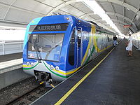
Teresina has a |
Teresina has a rail service ([[Teresina Metro]]) comprising nine different stations. There is also bus service through the city. [[Teresina Airport|Teresina/Senador Petrônio Portella Airport]], opened in 1967, lies north of the capital, between the rivers Parnaíba and Poty. |
||
<gallery widths="200px" heights="160px"> |
<gallery widths="200px" heights="160px"> |
||
| Line 307: | Line 359: | ||
The Albertão Stadium holds 60,000 spectators, houses soccer, athletics and other games. A smaller stadium (6,000 places) is the Lindolfo Monteiro Stadium, opened in 1944. It was restored in 2008. |
The Albertão Stadium holds 60,000 spectators, houses soccer, athletics and other games. A smaller stadium (6,000 places) is the Lindolfo Monteiro Stadium, opened in 1944. It was restored in 2008. |
||
Football teams Teresina include Flamengo-PI, River-PI, Tiradentes and Piauí-PI. |
Football teams Teresina include Flamengo-PI, River-PI, Tiradentes and Piauí-PI. Teresina has one [[rugby union]] club that is in Brazil's women's rugby top flight, Delta Rugby Clube. |
||
{{clear}} |
{{clear}} |
||
| Line 328: | Line 380: | ||
<!--Categories--> |
<!--Categories--> |
||
[[Category:Teresina| ]] |
[[Category:Teresina| ]] |
||
[[Category:State capitals in Brazil]] |
|||
Revision as of 00:33, 29 June 2024
This article needs additional citations for verification. (October 2013) |
Teresina | |
|---|---|
| Municipality of Teresina | |
 From the top: Estaiada Mirante bridge, Teresina at night, Railway station complex, Cathedral of Our Lady of Sorrows, September 4th Theater and tourist signboard | |
 Flag  Seal | |
| Nickname(s): Capital do Sol e da Luz (Capital of Sun and Light), Cidade Verde (Green City), Mesopotâmia Brasileira (Brazilian Mesopotamia) and THE. | |
| Motto: Omnia in Charitate | |
 Location of Teresina in the State of Piauí | |
 Teresina Location in Brazil | |
| Coordinates: 5°05′42″S 42°48′15″W / 5.0949°S 42.8042°W | |
| Country | |
| Region | Northeast |
| State | |
| Founded | August 16, 1852 |
| Government | |
| • Mayor | Firmino Filho (PSDB) |
| Area | |
| • Municipality | 1,167.25 km2 (450.68 sq mi) |
| • Urban | 1,755 km2 (677 sq mi) |
| Elevation | 87 m (285 ft) |
| Population (2021 [1]) | |
| • Municipality | 871,126 |
| • Density | 750/km2 (1,900/sq mi) |
| • Urban | 953,172 |
| • Metro | 1,226,578 |
| Demonym | teresinense (teresenian) |
| Time zone | UTC-03:00 (BRT) |
| Postal code | 64000-001 to 64099-999 |
| Area code | +55 86 |
| HDI (2010) | 0.751 – high[2] |
| Website | www |
Teresina is the capital and most populous municipality in the Brazilian state of Piauí. Being located in north-central Piauí 366 km from the coast, it is the only capital in the Brazilian Northeast that is not located on the shores of the Atlantic Ocean. With 871,126 inhabitants, Teresina is the 21st largest city in Brazil, and the 15th largest state capital in the country. Together with Timon in the nearby state of Maranhão, it forms a conurbation with a population of about 978,734 inhabitants; the entire metropolitan region of Teresina has over 1,226,509 inhabitants. The only natural barrier that separates Teresina from Timon is the Parnaíba river, one of the largest in the Northeast.
Teresina is the capital with the first best quality of life in the North-Northeast according to FIRJAN[3] and the 4th in Brazil. It is among the 50 cities in the world with the highest murder rates, with 315 homicides in 2017.[4]
Its motto is the Latin phrase Omnia in Charitatis, which means, in English, "All for charity". The city is the birthplace of, among others, Torquato Neto, who belonged to the Tropicalismo movement.
Its cathedral, Catedral Metropolitana Nossa Senhora das Dores, dedicated to Our Lady of Sorrows, is the archiepiscopal see of the Roman Catholic Archdiocese of Teresina.
History and names
Teresina was founded on August 16, 1852, under the name of Vila Nova do Poty (because its origin is linked to the Poti river) as the capital of the state of Piauí. It was the first planned city in the Brazil and the only northeast capital located out of the coast. Until 1852, Oeiras was the capital of the Piauí Captaincy. However, due to difficulties in communication and trade, the capital was transferred to an area next to the Parnaíba River, to the other cities and to the sea coast. Colonization of the area where Teresina is now located dates back to the 18th century. The chosen place was a small community of fishermen, in 1760, nearby Poty and Panaíba rivers, which grew into a village called "Vila do Poty", but, due to the inundation of the Parnaíba River riverbanks, the city had to be built in a higher position.
In the 19th century, it was initially called Vila Nova do Poty, but later the city was renamed Teresina, in honor of Empress Teresa Cristina, the wife of Emperor Pedro II of Brazil.
Teresina is the hottest city in the country and the city with the third-highest incidence of lightning in the world. Nowadays[when?], Teresina's economy is based on international manufacturing industries and trade.
Main sights

Sights include:
- Casa da Cultura de Teresina, exhibiting elements of the culture of the city, and home to cultural events
- Centro Artesanal "Master Dezinho", home to handcrafts made of various materials, mainly clay, decorated with paintings;
- Teatro 4 de Setembro, a theatre holding cultural shows, plays and others;
- Mirante da Ponte Estaiada "João Isidoro França"
- Encontro dos Rios, a natural place by the riverside Parnaíba and Poti.
- Parque Zoobotânico, a zoo with typical animals of the Brazilian fauna and other countries.
- Igreja de São Benedito, the main Catholic church of the city
- Museu do Piaui, with numerous elements of the history of Teresina and of Piauí in general, including antiques, furniture and documents.
Geography

Teresina is located on the east side of the Parnaíba river at the border with Maranhão state, at an altitude of about 72 meters. The city faces the city of Timon across the river and is situated between the Parnaíba river and its tributary the Poti River. The two rivers join at the city's northern end, where there is an environmental park with gazebos. Teresina is the largest capital in the northeastern territorial extension, at 1,756 km2.
Located in a transition zone between the northeast and the Amazon (Mid-North), Teresina is surrounded by mata dos cocais, savannas and cerradões where many carnaúba, babaçu, buriti palms, jatobás, ipês, and many other medium-sized trees can be seen. In the region there are also remnants of Teresina Atlantic Forest, which makes the landscape shrub coverage very rich and dense.
Climate
Teresina has a tropical wet and dry climate (Köppen climate classification: Aw) with semi-humid characteristics and two seasons: the rainy season (which occurs in summer and autumn of the southern hemisphere) and the dry season (which occurs in winter and spring).
From January to May, due to the rains, the weather is hot and wet (likely to occur when there is fog in the morning), while from June to August the climate gets dry with relatively milder nights; in September to December the weather becomes hotter and humid decreases, with the gradual return of rainy conditions from October. This period is referred to as "Bro" by locals as the hottest months end with -bro in Portuguese: setembro, outubro, novembro, and dezembro. A peculiar feature of the rains in the city are their speed and intensity, with strong winds, large force of water and very common lightning. The annual rainfall stands at around 1,325 millimetres or 52 inches. The highest recorded daily precipitation was 125 millimetres (5 in).[5]
Hot most of the year, Teresina has an average temperature around 27 °C or 80.6 °F, with a minimum of 20 °C or 68 °F in July and a maximum of 36 °C or 96.8 °F in October. The lowest ever recorded in Teresina was 11.9 °C or 53.4 °F in June, while the record hot temperature exceeds 40 °C or 104 °F (October and November). Annually, there are approximately 129.4 days in which the maximum daily temperature reaches or exeeds 35 °C (95 °F).[5] These fluctuations are mitigated by the contribution of the winds. Air quality is considered good in Teresina, except in the driest period, when the relative humidity drops, and there are occurrences of fires.
| Climate data for Teresina (1981–2010 normals, extremes 1961–2010) | |||||||||||||
|---|---|---|---|---|---|---|---|---|---|---|---|---|---|
| Month | Jan | Feb | Mar | Apr | May | Jun | Jul | Aug | Sep | Oct | Nov | Dec | Year |
| Record high °C (°F) | 38.4 (101.1) |
38.0 (100.4) |
39.6 (103.3) |
35.0 (95.0) |
35.8 (96.4) |
36.9 (98.4) |
37.6 (99.7) |
38.4 (101.1) |
39.6 (103.3) |
40.4 (104.7) |
40.8 (105.4) |
39.5 (103.1) |
40.8 (105.4) |
| Mean daily maximum °C (°F) | 32.5 (90.5) |
32.0 (89.6) |
31.9 (89.4) |
31.8 (89.2) |
32.2 (90.0) |
32.5 (90.5) |
33.6 (92.5) |
35.4 (95.7) |
36.6 (97.9) |
37.2 (99.0) |
36.2 (97.2) |
34.8 (94.6) |
33.9 (93.0) |
| Mean daily minimum °C (°F) | 22.8 (73.0) |
22.6 (72.7) |
22.8 (73.0) |
22.8 (73.0) |
22.6 (72.7) |
21.5 (70.7) |
20.8 (69.4) |
21.1 (70.0) |
22.1 (71.8) |
23.2 (73.8) |
23.6 (74.5) |
23.4 (74.1) |
22.4 (72.4) |
| Record low °C (°F) | 19.8 (67.6) |
20.0 (68.0) |
18.5 (65.3) |
19.0 (66.2) |
19.4 (66.9) |
11.9 (53.4) |
15.0 (59.0) |
15.6 (60.1) |
17.7 (63.9) |
18.0 (64.4) |
19.0 (66.2) |
18.4 (65.1) |
11.9 (53.4) |
| Average precipitation mm (inches) | 196.8 (7.75) |
239.1 (9.41) |
286.9 (11.30) |
265.7 (10.46) |
120.6 (4.75) |
14.7 (0.58) |
10.6 (0.42) |
12.1 (0.48) |
13.0 (0.51) |
19.5 (0.77) |
45.9 (1.81) |
100.1 (3.94) |
1,325 (52.18) |
| Average precipitation days (≥ 1.0 mm) | 11.8 | 13.7 | 18.8 | 16.6 | 9.6 | 2.3 | 1.6 | 1.4 | 1.8 | 2.2 | 3.8 | 7.2 | 90.8 |
| Average relative humidity (%) | 80.2 | 83.6 | 85.1 | 85.4 | 83.4 | 76.9 | 69.4 | 61.8 | 56.6 | 56.2 | 61.8 | 69.8 | 72.5 |
| Average dew point °C (°F) | 23.5 (74.3) |
23.8 (74.8) |
24.0 (75.2) |
24.3 (75.7) |
23.8 (74.8) |
22.3 (72.1) |
21.0 (69.8) |
20.4 (68.7) |
20.0 (68.0) |
20.7 (69.3) |
21.5 (70.7) |
22.5 (72.5) |
22.3 (72.2) |
| Mean monthly sunshine hours | 191.6 | 170.6 | 187.9 | 191.4 | 236.3 | 264.9 | 285.5 | 302.5 | 283.9 | 286.8 | 251.3 | 221.1 | 2,873.8 |
| Mean daily daylight hours | 12.4 | 12.3 | 12.1 | 12.0 | 11.9 | 11.8 | 11.9 | 12.0 | 12.1 | 12.2 | 12.4 | 12.4 | 12.1 |
| Average ultraviolet index | 7 | 6 | 7 | 7 | 7 | 7 | 7 | 7 | 7 | 7 | 7 | 7 | 7 |
| Source 1: NOAA[5] | |||||||||||||
| Source 2: Brazilian National Institute of Meteorology (INMET)[6][7] Weather atlas(Daylight-UV)[8] | |||||||||||||
Demographics
Religion
Religion in Teresina (2010)[9][10]
In 2010, 78.94% of the municipality's population was Roman Catholic, 13.34% were evangelicals, 4.49% had no religion, 0.89% Jehovah's Witnesses, 0.85% were spiritists, 0.74% others Christian religiosities (which include the Brazilian Catholic Apostolic Church, the Eastern Orthodox Church, Church of Jesus Christ of Latter-day Saints and others) and 0.75% of other religions.[10][9]
Among the Protestant denominations in Teresina, the majority is Pentecostal, about 7.79%. Baptists constitute 2.62% of the population of the municipality, 0.86% Adventists, 0.12% are Presbyterians, 0.08% the other Protestant groups (Lutherans, Congregationals and Methodists) and 1.84% have no denomination.[10][9] The Assemblies of God is the largest Pentecostal group, with 4.16% of the population, followed by the Universal Church of the Kingdom of God with 1.31% and the Christian Congregation in Brazil with 0.41%.[10][9]
There are 20 congregations of the Church of Jesus Christ of Latter-day Saints in Teresina.
Health
In Teresina there are 634 health institutions, eight hospitals, 181 clinics and 170 clinics,[clarification needed] employing some 15,000 people.[citation needed]
Education
English and Spanish are part of the official high school curriculum, in addition to the official national language, Portuguese.
Universities in Teresina
- Universidade Federal do Piauí (UFPI);
- Universidade Estadual do Piauí (Uespi);
- Instituto Federal de Educação, Ciência e Tecnologia do Piauí (IFPI).
- Faculdade de Saúde, Ciências Humanas e Tecnológicas do Piauí (Faculdade Novafapi)
- Faculdade Integral Diferencial (Facid)
- Instituto Camilo Filho (ICF)
- Centro de Ensino Unificado de Teresina (CEUT)
- Faculdade das Atividades Empresariais de Teresina[11] (FAETE)
Schools
- Colégio Sagrado Coração de Jesus (1906)
- Instituto Dom Barreto (1944)[12]
Economy
The Gross Domestic Product of Teresina represents about 40% of GDP in the state of Piauí. In industry, there is the textile and garment industry, which exports to other regions and generates about ten thousand jobs. There are also manufacturers bicycles, drink industries, pharmaceuticals, chemicals, furniture and ceramics, among others. The building deserves to be a fast-growing sector due to the verticality of the city over the past 15 years.
Transportation
Teresina has a rail service (Teresina Metro) comprising nine different stations. There is also bus service through the city. Teresina/Senador Petrônio Portella Airport, opened in 1967, lies north of the capital, between the rivers Parnaíba and Poty.
-
 Teresina Airport.
 -
 Teresina Metro.


Sports

The Albertão Stadium holds 60,000 spectators, houses soccer, athletics and other games. A smaller stadium (6,000 places) is the Lindolfo Monteiro Stadium, opened in 1944. It was restored in 2008.
Football teams Teresina include Flamengo-PI, River-PI, Tiradentes and Piauí-PI. Teresina has one rugby union club that is in Brazil's women's rugby top flight, Delta Rugby Clube.
References
- ^ IBGE 2020
- ^ "Archived copy" (PDF). United Nations Development Programme (UNDP). Archived from the original (PDF) on July 8, 2014. Retrieved August 1, 2013.
{{cite web}}: CS1 maint: archived copy as title (link) - ^ FIRJAN, Sistema. "Índice FIRJAN de Desenvolvimento Municipal – IFDM" (PDF). Sistema FIRJAN. FIRJAN. Retrieved 7 November 2021.
- ^ "State of Piauí (Center on Crime and Statistical Analysis) Annual Report on Crime" (PDF). January 2018. Archived (PDF) from the original on 2018-03-13.
- ^ a b c "World Meteorological Organization Climate Normals for 1981-2010: Brazil-Teresina" (CSV). ncei.noaa.gov. NOAA. Retrieved 2024-01-17.
- ^ "Temperatura Máxima Absoluta (°C)". Brazilian National Institute of Meteorology (Inmet). Retrieved September 8, 2014.[dead link]
- ^ "Temperatura Mínima Absoluta (°C)". Brazilian National Institute of Meteorology (Inmet). Retrieved September 8, 2014.[dead link]
- ^ "Climate and monthly weather forecast Teresina, Brazil". weather atlas. Retrieved 17 January 2024.
- ^ a b c d «Censo do Instituto Brasileiro de Geografia e Estatística de 2010 sobre Religião em Teresina».
- ^ a b c d Teresina/Piauí: a capital mais católica do Brasil, artigo de José Eustáquio Diniz Alves
- ^ "FAETE". Archived from the original on 2019-05-02. Retrieved 2019-10-05.
- ^ "Página Inicial". dombarreto.com (in Brazilian Portuguese). Retrieved 2024-05-24.
External links
- Official website (in Portuguese)
- Teresina Info—Bilingual tourist information (in English)
- Panoramic Teresina—Tourist information (in Portuguese and English)
- Visit Piauí—Tourist information (in English)

| International | |
|---|---|
| National | |
| Geographic | |
| Other | |