
Patchogue, New York: Difference between revisions
→Education: better like this |
Citation bot (talk | contribs) Altered url. URLs might have been anonymized. Add: archive-date, archive-url. Removed parameters. | Use this bot. Report bugs. | Suggested by Neko-chan | #UCB_webform 22/498 |
||
| (29 intermediate revisions by 16 users not shown) | |||
| Line 1: | Line 1: | ||
| ⚫ | |||
{{for|United States Navy ships named ''Patchogue''|USS Patchogue}} |
{{for|United States Navy ships named ''Patchogue''|USS Patchogue}} |
||
{{distinguish|East Patchogue, New York|North Patchogue, New York}} |
|||
| ⚫ | |||
{{Infobox settlement |
{{Infobox settlement |
||
| name |
| name = Patchogue, New York |
||
| official_name |
| official_name = Incorporated Village of Patchogue |
||
| settlement_type |
| settlement_type = [[Village (New York)|Village]] |
||
| nickname |
| nickname = |
||
| motto |
| motto = <!-- Images --> |
||
| image_skyline |
| image_skyline = W Main St in Patchogue, NY.jpg |
||
| imagesize |
| imagesize = |
||
| image_caption |
| image_caption = W Main St |
||
| image_flag |
| image_flag = |
||
| image_seal |
| image_seal = <!-- Maps --> |
||
| pushpin_map |
| pushpin_map = USA New York Long Island#New York |
||
| pushpin_label_position |
| pushpin_label_position = none |
||
| pushpin_map_caption |
| pushpin_map_caption = Location within the state of New York |
||
| pushpin_mapsize |
| pushpin_mapsize = |
||
| image_map |
| image_map = Patchogue-map.gif |
||
| mapsize |
| mapsize = 250x200px |
||
| map_caption |
| map_caption = U.S. Census map |
||
| image_map1 |
| image_map1 = |
||
| mapsize1 |
| mapsize1 = |
||
| map_caption1 |
| map_caption1 = <!-- Location --> |
||
| subdivision_type |
| subdivision_type = [[List of sovereign states|Country]] |
||
| subdivision_name |
| subdivision_name = United States |
||
| subdivision_type1 |
| subdivision_type1 = [[U.S. state|State]] |
||
| subdivision_name1 |
| subdivision_name1 = [[New York (state)|New York]] |
||
| subdivision_type2 |
| subdivision_type2 = [[List of counties in New York|County]] |
||
| subdivision_name2 |
| subdivision_name2 = [[Suffolk County, New York|Suffolk]] |
||
| government_footnotes |
| government_footnotes = |
||
| government_type |
| government_type = |
||
| leader_title |
| leader_title = Mayor |
||
| leader_name |
| leader_name = Paul V. Pontieri Jr. |
||
| established_title |
| established_title = |
||
| established_date |
| established_date = <!-- Area --> |
||
| unit_pref |
| unit_pref = Imperial |
||
| area_footnotes |
| area_footnotes = <ref name="TigerWebMapServer">{{cite web|title=ArcGIS REST Services Directory|url=https://tigerweb.geo.census.gov/arcgis/rest/services/TIGERweb/Places_CouSub_ConCity_SubMCD/MapServer|publisher=United States Census Bureau|accessdate=September 20, 2022}}</ref> |
||
| area_magnitude |
| area_magnitude = |
||
| area_total_km2 |
| area_total_km2 = 6.53 |
||
| area_land_km2 |
| area_land_km2 = 5.85 |
||
| area_water_km2 |
| area_water_km2 = 0.67 |
||
| area_total_sq_mi |
| area_total_sq_mi = 2.52 |
||
| area_land_sq_mi |
| area_land_sq_mi = 2.26 |
||
| area_water_sq_mi |
| area_water_sq_mi = 0.26 |
||
<!-- Population -->| population_as_of |
<!-- Population -->| population_as_of = [[2020 United States Census|2020]] |
||
| population_footnotes |
| population_footnotes = |
||
| population_total |
| population_total = 12408 |
||
| population_density_km2 |
| population_density_km2 = 2119.54 |
||
| population_density_sq_mi = 5490.27 |
| population_density_sq_mi = 5490.27 |
||
<!-- General information -->| timezone |
<!-- General information -->| timezone = [[Eastern Time Zone]] |
||
| utc_offset |
| utc_offset = −05:00 |
||
| timezone_DST |
| timezone_DST = |
||
| utc_offset_DST |
| utc_offset_DST = −04:00 |
||
| elevation_footnotes |
| elevation_footnotes = |
||
| elevation_m |
| elevation_m = 6 |
||
| elevation_ft |
| elevation_ft = 20 |
||
| coordinates |
| coordinates = {{coord|40|45|48|N|73|1|4|W|region:US-NY|display=inline,title}} |
||
| postal_code_type |
| postal_code_type = [[ZIP Code]] |
||
| postal_code |
| postal_code = 11772 |
||
| area_code |
| area_code = [[Area codes 631 and 934|631, 934]] |
||
| blank_name |
| blank_name = [[Federal Information Processing Standards|FIPS code]] |
||
| blank_info |
| blank_info = 36-56660 |
||
| blank1_name |
| blank1_name = [[Geographic Names Information System|GNIS]] feature ID |
||
| blank1_info |
| blank1_info = 0959977 |
||
| website |
| website = {{URL|www.patchoguevillage.gov}} |
||
| footnotes |
| footnotes = |
||
| pop_est_as_of |
| pop_est_as_of = |
||
| pop_est_footnotes |
| pop_est_footnotes = |
||
| population_est |
| population_est = |
||
}} |
}} |
||
'''Patchogue''' ({{IPAc-en|ˈ|p|æ|tʃ|ɒ|ɡ}} |
'''Patchogue''' ({{IPAc-en|ˈ|p|æ|tʃ|ɒ|ɡ}} {{respell|PATCH|og}}) is a [[Administrative divisions of New York#Village|village]] in [[Suffolk County, New York]]. The population was 12,408 at the time of the 2020 census. '''Patchogue''' is an incorporated community part of the [[Town (New York)|town]] of [[Brookhaven, New York|Brookhaven]], on the [[South Shore (Long Island)|south shore]] of Long Island, adjoining the [[Great South Bay]]. It is officially known as the ''Incorporated Village of Patchogue''. |
||
== History == |
== History == |
||
| Line 76: | Line 77: | ||
[[File:George Bradford Brainerd (American, 1845-1887). Creek, Patchogue, Long Island, ca. 1872-1878.jpg|thumbnail|left|[[George Bradford Brainerd]]. ''Creek, Patchogue, Long Island'', ca. 1872–1878. [[Brooklyn Museum]]]] |
[[File:George Bradford Brainerd (American, 1845-1887). Creek, Patchogue, Long Island, ca. 1872-1878.jpg|thumbnail|left|[[George Bradford Brainerd]]. ''Creek, Patchogue, Long Island'', ca. 1872–1878. [[Brooklyn Museum]]]] |
||
[[File:George Bradford Brainerd. Ocean Avenue, Patchogue, Long Island, ca. 1872-1887.jpg|thumbnail|[[George Bradford Brainerd]]. ''Ocean Avenue, Patchogue, Long Island'', ca. 1872–1887. [[Brooklyn Museum]]]] |
[[File:George Bradford Brainerd. Ocean Avenue, Patchogue, Long Island, ca. 1872-1887.jpg|thumbnail|[[George Bradford Brainerd]]. ''Ocean Avenue, Patchogue, Long Island'', ca. 1872–1887. [[Brooklyn Museum]]]] |
||
[[File:New York - Oakdale through Shelter Island - NARA - 68145585 (cropped).jpg|thumb|left|View of Patchogue in 1930]] |
|||
Patchogue, which is approximately {{convert|60|mi|-1}} east of Manhattan, became incorporated in 1893. |
Patchogue, which is approximately {{convert|60|mi|-1}} east of Manhattan, became incorporated in 1893. |
||
| Line 84: | Line 86: | ||
The [[Patchogue Theatre]] opened in 1923. It was later renovated into a triplex, after which it was converted to a single movie theater. It closed in the late 1980s. In the mid-1990s the village acquired the theater, and completely refurbished the building; it now seats 1,166 people. |
The [[Patchogue Theatre]] opened in 1923. It was later renovated into a triplex, after which it was converted to a single movie theater. It closed in the late 1980s. In the mid-1990s the village acquired the theater, and completely refurbished the building; it now seats 1,166 people. |
||
Three churches in Patchogue are listed on the [[National Register of Historic Places]]: the [[Congregational Church of Patchogue|Congregational Church]] on East Main Street, [[United Methodist Church (Patchogue, New York)|United Methodist Church]] on South Ocean Avenue between Church Street and Terry Street, and [[St. Paul's Episcopal Church Complex (Patchogue, New York)|St. Paul's Episcopal Church]] on Rider Avenue across from Terry Street. |
Three churches in Patchogue are listed on the [[National Register of Historic Places]]: the [[Congregational Church of Patchogue|Congregational Church]] on East Main Street, [[United Methodist Church (Patchogue, New York)|United Methodist Church]] on South Ocean Avenue between Church Street and Terry Street, and [[St. Paul's Episcopal Church Complex (Patchogue, New York)|St. Paul's Episcopal Church]] on Rider Avenue across from Terry Street. |
||
In 2019, the local downtown area was recognized by the American Planning Association as one of America's four "Great Neighborhoods". Since 2007, the association has recognized over 300 neighborhoods, streets, and public spaces that make communities stronger and bring people together through good planning.<ref>{{Cite news|url=https://patch.com/new-york/patchogue/patchogue-village-named-among-2019-great-neighborhoods|title=Patchogue Village Named Among 2019 Great Neighborhoods|last=Korb|first=Priscila|date=September 25, 2019|work=Patch|location=Patchogue, NY|access-date=January 29, 2020}}</ref> |
In 2019, the local downtown area was recognized by the American Planning Association as one of America's four "Great Neighborhoods". Since 2007, the association has recognized over 300 neighborhoods, streets, and public spaces that make communities stronger and bring people together through good planning.<ref>{{Cite news|url=https://patch.com/new-york/patchogue/patchogue-village-named-among-2019-great-neighborhoods|title=Patchogue Village Named Among 2019 Great Neighborhoods|last=Korb|first=Priscila|date=September 25, 2019|work=Patch|location=Patchogue, NY|access-date=January 29, 2020}}</ref> |
||
| Line 92: | Line 94: | ||
A natural riverfront and harbor are resources that the village has utilized since its founding, to become a modern and largely self-contained community. |
A natural riverfront and harbor are resources that the village has utilized since its founding, to become a modern and largely self-contained community. |
||
== Government == |
|||
The Mayor of '''Patchogue''' is Paul V. Pontieri |
|||
=== Public Safety === |
|||
The Patchogue Department of Public Safety is a [[Public security]] department to insure well being of all Patchogue Residents, Similar to a [[Police|Police Department]].<ref>{{Cite web |title=Public Safety {{!}} Patchogue, NY |url=https://www.patchoguevillage.org/165/Public-Safety |access-date=2023-09-18 |website=www.patchoguevillage.org}}</ref> The Patchogue Police Department stopped operating in the 1940s. |
|||
==Demographics== |
==Demographics== |
||
| Line 113: | Line 121: | ||
}} |
}} |
||
[[File:Patchogue, Main Street, 1-22-10.jpg|thumbnail|right|The Four Corners, where West & East Main Streets meet South & North Ocean Avenues]] |
[[File:Patchogue, Main Street, 1-22-10.jpg|thumbnail|right|The Four Corners, where West & East Main Streets meet South & North Ocean Avenues]] |
||
As of the 2000 [[census]],<ref name="GR2" /> there were 11,919 people, 4,636 households, and 2,749 families residing in the village. The population density was {{convert|5,301.2|PD/sqmi|PD/km2|sp=us|adj=off}}. There were 4,902 housing units at an average density of {{convert|2,180.2|/sqmi|/km2|sp=us|adj=off}}. The racial makeup of the village was 81.27% [[White (U.S. Census)|White]], 3.89% [[African American (U.S. Census)|African American]], 0.34% [[Native American (U.S. Census)|Native American]], 1.39% [[Asian (U.S. Census)|Asian]], 0.02% [[Pacific Islander Americans|Pacific Islander]], 9.23% from [[Race (United States Census)|other races]], and 3.85% from two or more races. Hispanics or Latinos of any race were 23.84% of the population.<ref name="censusviewer2000">{{cite web|url=http://censusviewer.com/city/NY/Patchogue |title=Patchogue, NY Population – Census 2010 and 2000 Interactive Map, Demographics, Statistics, Quick Facts |publisher=CensusViewer |access-date=May 19, 2014}}</ref> |
As of the 2000 [[census]],<ref name="GR2">{{cite web|url=https://www.census.gov|publisher=[[United States Census Bureau]]|access-date=January 31, 2008|title=U.S. Census website}}</ref> there were 11,919 people, 4,636 households, and 2,749 families residing in the village. The population density was {{convert|5,301.2|PD/sqmi|PD/km2|sp=us|adj=off}}. There were 4,902 housing units at an average density of {{convert|2,180.2|/sqmi|/km2|sp=us|adj=off}}. The racial makeup of the village was 81.27% [[White (U.S. Census)|White]], 3.89% [[African American (U.S. Census)|African American]], 0.34% [[Native American (U.S. Census)|Native American]], 1.39% [[Asian (U.S. Census)|Asian]], 0.02% [[Pacific Islander Americans|Pacific Islander]], 9.23% from [[Race (United States Census)|other races]], and 3.85% from two or more races. Hispanics or Latinos of any race were 23.84% of the population.<ref name="censusviewer2000">{{cite web|url=http://censusviewer.com/city/NY/Patchogue |title=Patchogue, NY Population – Census 2010 and 2000 Interactive Map, Demographics, Statistics, Quick Facts |publisher=CensusViewer |access-date=May 19, 2014}}</ref> |
||
There were 4,636 households, out of which 29.5% had children under the age of 18 living with them, 40.3% were [[Marriage|married couples]] living together, 13.4% had a female householder with no husband present, and 40.7% were non-families. 31.8% of all households were made up of individuals, and 9.0% had someone living alone who was 65 years of age or older. The average household size was 2.54 and the average family size was 3.20. |
There were 4,636 households, out of which 29.5% had children under the age of 18 living with them, 40.3% were [[Marriage|married couples]] living together, 13.4% had a female householder with no husband present, and 40.7% were non-families. 31.8% of all households were made up of individuals, and 9.0% had someone living alone who was 65 years of age or older. The average household size was 2.54 and the average family size was 3.20. |
||
| Line 126: | Line 134: | ||
The [[Blue Point Brewing Company]] is based in Patchogue.<ref>{{Cite book |last1=Bryson |first1=Lew |url=https://books.google.com/books?id=TmVoAwAAQBAJ&dq=Blue+Point+Brewing+Company+Patchogue&pg=PT282 |title=New York Breweries: 2nd Edition |last2=Cazentre |first2=Don |date=March 1, 2014 |publisher=Stackpole Books |isbn=978-0-8117-5873-4 |language=en}}</ref> |
The [[Blue Point Brewing Company]] is based in Patchogue.<ref>{{Cite book |last1=Bryson |first1=Lew |url=https://books.google.com/books?id=TmVoAwAAQBAJ&dq=Blue+Point+Brewing+Company+Patchogue&pg=PT282 |title=New York Breweries: 2nd Edition |last2=Cazentre |first2=Don |date=March 1, 2014 |publisher=Stackpole Books |isbn=978-0-8117-5873-4 |language=en}}</ref> |
||
The Patchogue Central Business District or "Downtown" is the 2nd Largest [[Downtown|Financial district]]<ref>{{Cite web |date=2019-11-20 |title=See and Be Part of the Scene at These 8 Vibrant Downtowns |url=https://www.discoverlongisland.com/blog/stories/post/see-scene-8-vibrant-downtowns/ |access-date=2023-09-16 |website=www.discoverlongisland.com |language=en-us}}</ref> in Eastern [[Long Island]]. Downtown is major transport and exchange [[Transport hub|hub]] throughout Eastern [[New York (state)|New York]] and Southern [[Connecticut]]. There is a museum located within the village called [[MoCA Long Island]]. |
|||
The Median family income is $110,576. |
|||
==Education== |
==Education== |
||
Patchogue |
Patchogue is served by the [[Patchogue-Medford School District|Patchogue-Medford Public Schools]], [[Patchogue-Medford Library]] and [https://pmlib.org/library-branches/carnegie/ Carnegie Library]. Extreme Western parts of '''Patchogue''' are served by the [[Bayport-Blue Point School District]].<ref>{{Cite web |title=School Districts Serving Patchogue, NY |url=https://www.niche.com/k12/search/best-school-districts/t/patchogue-suffolk-ny/ |access-date=2023-09-18 |website=Niche |language=en}}</ref> There are primary, middle and high schools, plus continuing education programs for adults. The school district, library, and [[St. Joseph's University (New York)|St. Joseph's University]] a variety of educational opportunities. In 2010, the Patchogue-Medford Library was awarded the 2010 National Medal for Museum and Library Science for the library's work in bilingual programming.<ref>{{cite news|last=Gillespie |first=Lisa |url=http://patchogue.patch.com/groups/arts-and-entertainment/p/first-lady-presents-patchogue-medford-library-with-na7883976e61 |title=First Lady Presents Patchogue-Medford Library with National Award – Arts & Entertainment |work=Patch |location=Patchogue, NY |date=December 21, 2010 |access-date=May 19, 2014}}</ref> |
||
'''Secondary Education''' |
|||
* [[Patchogue High School|Patchogue High School South]] (Non-Operating) |
|||
* South Ocean Middle School |
|||
'''Primary Education''' |
|||
* Bay Elementary School |
|||
* River Elementary School |
|||
* Medford Elementary School |
|||
*Barton Elementary School |
|||
'''Private''' |
|||
* [[Seton Hall High School]] |
|||
* Holy Angels Regional School |
|||
* Emanuel Lutheran Preschool<ref>{{Cite web |date=2024-04-06 |title=Emanuel Lutheran School Patchogue {{!}} Faithfully Serving Families Since 1957 |url=https://www.elspatchogue.org/ |access-date=2024-04-10 |archive-url=https://web.archive.org/web/20240406012819/https://www.elspatchogue.org/ |archive-date=April 6, 2024 }}</ref> |
|||
'''Adult Education''' |
|||
* [[Briarcliffe College–Patchogue|Briarcliff College-Patchogue]] |
|||
* [[St. Joseph's University (New York)]] |
|||
* [http://www.bramsteinschool.com Bramstein School of Applied Studies] |
|||
==Media== |
==Media== |
||
| Line 141: | Line 176: | ||
==Transportation== |
==Transportation== |
||
* Patchogue operates a small fleet of buses that transport in and out of Downtown called Patchogue-Village Transit with routes R1S, R2S, R3N, R4N |
|||
* Patchogue is served by the LIRR [[Montauk Branch]]. The station is a hub for several [[Suffolk County Transit]] bus lines (the |
* Patchogue is served by the LIRR [[Montauk Branch]]. The station is a hub for several [[Suffolk County Transit]] bus lines (the 2, 6, 51, 53, 55, 66, 77 and 77Y), as well as the Village of Patchogue Bus.<ref>{{cite web |url=http://www.patchoguevillage.org/trans.htm |title=transportation |publisher=Patchoguevillage.org |access-date=May 19, 2014 |url-status=dead |archive-url=https://web.archive.org/web/20140725212813/http://www.patchoguevillage.org/trans.htm |archive-date=July 25, 2014 }}</ref> |
||
* Within walking distance of [[Patchogue station|the LIRR station]] are the Watch Hill Ferry Terminal, which serves the Watch Hill Visitor's Center in the [[Otis Pike Fire Island High Dune Wilderness]], and the Davis Park Ferry Terminal which serves [[Davis Park, New York]], both ferries taking passengers to and from [[Fire Island]]. |
* Within walking distance of [[Patchogue station|the LIRR station]] are the Watch Hill Ferry Terminal, which serves the Watch Hill Visitor's Center in the [[Otis Pike Fire Island High Dune Wilderness]], and the Davis Park Ferry Terminal which serves [[Davis Park, New York]], both ferries taking passengers to and from [[Fire Island]]. |
||
* The main |
* The main roads through Patchogue is [[Montauk Highway]] and [[New York State Route 27|Sunrise Highway]]. Other important roads are (from west to east) [[County Route 19 (Suffolk County, New York)|County Route 19]], South and North Ocean Avenues, the latter of which leads to [[County Route 83 (Suffolk County, New York)|County Route 83]], [[List of county roads in Suffolk County, New York|County Route 101]] and [[New York State Route 112]]. |
||
==Notable people== |
==Notable people== |
||
| Line 156: | Line 192: | ||
* [[Biz Markie]], rapper – lived in Patchogue<ref>{{cite news |title=Rapper Biz Markie from Long Island dies at 57 |url=https://www.newsday.com/long-island/obituaries/biz-markie-hip-hop-obituary-1.50307908 |access-date=July 29, 2021 |work=[[Newsday]] |agency=[[The Associated Press]] |date=July 17, 2021}}</ref> |
* [[Biz Markie]], rapper – lived in Patchogue<ref>{{cite news |title=Rapper Biz Markie from Long Island dies at 57 |url=https://www.newsday.com/long-island/obituaries/biz-markie-hip-hop-obituary-1.50307908 |access-date=July 29, 2021 |work=[[Newsday]] |agency=[[The Associated Press]] |date=July 17, 2021}}</ref> |
||
* [[Chrisette Michele]], Patchogue-raised Grammy winner who won a [[Grammy Award for Best Urban/Alternative Performance]] in 2009 for her song "[[Be OK (Chrisette Michele song)|Be OK]]". |
* [[Chrisette Michele]], Patchogue-raised Grammy winner who won a [[Grammy Award for Best Urban/Alternative Performance]] in 2009 for her song "[[Be OK (Chrisette Michele song)|Be OK]]". |
||
* [[Michael P. Murphy]], |
* [[Michael P. Murphy]], Navy SEAL officer awarded the Medal of Honor, grew up in Patchogue |
||
* [[Robert Pelletreau]], diplomat and ambassador, born in Patchogue, lawyer from family of prominent judges and lawyers in Patchogue, Pelletreau & Pelletreau. |
* [[Robert Pelletreau]], diplomat and ambassador, born in Patchogue, lawyer from family of prominent judges and lawyers in Patchogue, Pelletreau & Pelletreau. |
||
* [[Sylvia Porter]], journalist – born in Patchogue (1913) |
* [[Sylvia Porter]], journalist – born in Patchogue (1913) |
||
| Line 162: | Line 198: | ||
* [[Jeff Schaefer]], baseball player for [[Chicago White Sox]] (1989), born in Patchogue. |
* [[Jeff Schaefer]], baseball player for [[Chicago White Sox]] (1989), born in Patchogue. |
||
* [[Edgar A. Sharp]], [[United States House of Representatives|United States representative]] to the Seventy-ninth Congress (1945–1947): born in Patchogue (1876). |
* [[Edgar A. Sharp]], [[United States House of Representatives|United States representative]] to the Seventy-ninth Congress (1945–1947): born in Patchogue (1876). |
||
* [[Renée Felice Smith]], actress on [[NCIS: Los Angeles]]. Attended Patchogue-Medford High School. |
|||
* [[William Stuart-Houston]] (born William Patrick Hitler), [[Adolf Hitler]]'s nephew lived on Silver Street, along with his mother Bridget, his wife Phyllis, and his four sons, Alexander, Louis, Howard, and Brian.<ref>{{cite news |url=https://www.nytimes.com/2006/04/24/nyregion/24patchogue.html?pagewanted=all |title=Three Quiet Brothers on Long Island, All of Them Related to Hitler |first=Corey |last=Kilgannon |date=April 24, 2006 |newspaper=The New York Times |access-date=February 11, 2012}}</ref> |
* [[William Stuart-Houston]] (born William Patrick Hitler), [[Adolf Hitler]]'s nephew lived on Silver Street, along with his mother Bridget, his wife Phyllis, and his four sons, Alexander, Louis, Howard, and Brian.<ref>{{cite news |url=https://www.nytimes.com/2006/04/24/nyregion/24patchogue.html?pagewanted=all |title=Three Quiet Brothers on Long Island, All of Them Related to Hitler |first=Corey |last=Kilgannon |date=April 24, 2006 |newspaper=The New York Times |access-date=February 11, 2012}}</ref> |
||
| Line 192: | Line 229: | ||
{{Commons category|Patchogue, New York}} |
{{Commons category|Patchogue, New York}} |
||
* [http://www.patchoguevillage.org/ Village of Patchogue] |
* [http://www.patchoguevillage.org/ Village of Patchogue] |
||
* https://www.niche.com/k12/search/best-school-districts/t/patchogue-suffolk-ny/ |
|||
* https://www.patchoguevillage.org/165/Public-Safety |
|||
* [https://web.archive.org/web/20070311060322/http://www.newsday.com/community/guide/lihistory/ny-historytown-hist004t,0,7441743.story?coll=ny-lihistory-navigation ''Patchogue—Still Banking on the River''] article by Rhoda Amon, Newsday staff writer |
* [https://web.archive.org/web/20070311060322/http://www.newsday.com/community/guide/lihistory/ny-historytown-hist004t,0,7441743.story?coll=ny-lihistory-navigation ''Patchogue—Still Banking on the River''] article by Rhoda Amon, Newsday staff writer |
||
Revision as of 19:45, 25 June 2024
Patchogue, New York | |
|---|---|
| Incorporated Village of Patchogue | |
 W Main St | |
 U.S. Census map | |
 Location within the state of New York  Patchogue, New York (New York) | |
| Coordinates: 40°45′48″N 73°1′4″W / 40.76333°N 73.01778°W | |
| Country | United States |
| State | New York |
| County | Suffolk |
| Government | |
| • Mayor | Paul V. Pontieri Jr. |
| Area | |
| • Total | 2.52 sq mi (6.53 km2) |
| • Land | 2.26 sq mi (5.85 km2) |
| • Water | 0.26 sq mi (0.67 km2) |
| Elevation | 20 ft (6 m) |
| Population (2020) | |
| • Total | 12,408 |
| • Density | 5,490.27/sq mi (2,119.54/km2) |
| Time zone | UTC−05:00 (Eastern Time Zone) |
| • Summer (DST) | UTC−04:00 |
| ZIP Code | 11772 |
| Area code(s) | 631, 934 |
| FIPS code | 36-56660 |
| GNIS feature ID | 0959977 |
| Website | www |
Patchogue (/ˈpætʃɒɡ/ PATCH-og) is a village in Suffolk County, New York. The population was 12,408 at the time of the 2020 census. Patchogue is an incorporated community part of the town of Brookhaven, on the south shore of Long Island, adjoining the Great South Bay. It is officially known as the Incorporated Village of Patchogue.
History


._Creek,_Patchogue,_Long_Island,_ca._1872-1878.jpg)

.jpg)
Patchogue, which is approximately 60 miles (100 km) east of Manhattan, became incorporated in 1893.
In 1812, there were 75 inhabitants in Patchogue according to The Brooklyn Eagle, published in 1930.[2]
The Patchogue Former Manufactured Gas Plant (MGP) was operated from 1904 to 1926. The company was a small operation, converting coal and/or petroleum products to a flammable gas for use in lighting and industry. The company was sold to Long Island Lighting Company (LILCO).[3]
The Patchogue Theatre opened in 1923. It was later renovated into a triplex, after which it was converted to a single movie theater. It closed in the late 1980s. In the mid-1990s the village acquired the theater, and completely refurbished the building; it now seats 1,166 people.
Three churches in Patchogue are listed on the National Register of Historic Places: the Congregational Church on East Main Street, United Methodist Church on South Ocean Avenue between Church Street and Terry Street, and St. Paul's Episcopal Church on Rider Avenue across from Terry Street.
In 2019, the local downtown area was recognized by the American Planning Association as one of America's four "Great Neighborhoods". Since 2007, the association has recognized over 300 neighborhoods, streets, and public spaces that make communities stronger and bring people together through good planning.[4]
Geography
According to the United States Census Bureau, the village has a total area of 2.5 square miles (6.5 km2), of which 2.2 square miles (5.8 km2) is land and 0.3 square mile (0.7 km2) (10.71%) is water.
A natural riverfront and harbor are resources that the village has utilized since its founding, to become a modern and largely self-contained community.
Government
The Mayor of Patchogue is Paul V. Pontieri
Public Safety
The Patchogue Department of Public Safety is a Public security department to insure well being of all Patchogue Residents, Similar to a Police Department.[5] The Patchogue Police Department stopped operating in the 1940s.
Demographics
| Census | Pop. | Note | %± |
|---|---|---|---|
| 1880 | 2,503 | — | |
| 1900 | 2,926 | — | |
| 1910 | 3,824 | 30.7% | |
| 1920 | 4,031 | 5.4% | |
| 1930 | 6,860 | 70.2% | |
| 1940 | 7,181 | 4.7% | |
| 1950 | 7,361 | 2.5% | |
| 1960 | 8,838 | 20.1% | |
| 1970 | 11,582 | 31.0% | |
| 1980 | 11,291 | −2.5% | |
| 1990 | 11,060 | −2.0% | |
| 2000 | 11,919 | 7.8% | |
| 2010 | 11,798 | −1.0% | |
| 2020 | 12,408 | 5.2% | |
| U.S. Decennial Census[6] | |||

As of the 2000 census,[7] there were 11,919 people, 4,636 households, and 2,749 families residing in the village. The population density was 5,301.2 inhabitants per square mile (2,046.8/km2). There were 4,902 housing units at an average density of 2,180.2 per square mile (841.8/km2). The racial makeup of the village was 81.27% White, 3.89% African American, 0.34% Native American, 1.39% Asian, 0.02% Pacific Islander, 9.23% from other races, and 3.85% from two or more races. Hispanics or Latinos of any race were 23.84% of the population.[8]
There were 4,636 households, out of which 29.5% had children under the age of 18 living with them, 40.3% were married couples living together, 13.4% had a female householder with no husband present, and 40.7% were non-families. 31.8% of all households were made up of individuals, and 9.0% had someone living alone who was 65 years of age or older. The average household size was 2.54 and the average family size was 3.20.
22.5% of Patchogue's inhabitants were under the age of 18, 9.2% ranged from 18 and 24, 37.1% from 25 to 44, 20.7% from 45 to 64, and 10.5% were 65 years of age or older. The median age was 35 years. For every 100 females, there were 100.4 males. For every 100 females age 18 and over, there were 99.7 males.
The median income for a household in the village was $47,027, and the median income for a family was $60,126. Males had a median income of $38,561 versus $30,599 for females. The per capita income for the village was $22,962. 8.1% of families and 10.7% of the population were below the poverty threshold, including 13.5% of those under age 18 and 10.4% of those age 65 or over.
In 2010, the demographics were 61.8% White, 29.6% Hispanic, 5.3% Black, 0.3% Native American, 1.6% Asian, 0.1% Some Other Race, and 1.4% Two or More Races.[8][9]
Economy
The Blue Point Brewing Company is based in Patchogue.[10] The Patchogue Central Business District or "Downtown" is the 2nd Largest Financial district[11] in Eastern Long Island. Downtown is major transport and exchange hub throughout Eastern New York and Southern Connecticut. There is a museum located within the village called MoCA Long Island.
The Median family income is $110,576.
Education
Patchogue is served by the Patchogue-Medford Public Schools, Patchogue-Medford Library and Carnegie Library. Extreme Western parts of Patchogue are served by the Bayport-Blue Point School District.[12] There are primary, middle and high schools, plus continuing education programs for adults. The school district, library, and St. Joseph's University a variety of educational opportunities. In 2010, the Patchogue-Medford Library was awarded the 2010 National Medal for Museum and Library Science for the library's work in bilingual programming.[13]
Secondary Education
- Patchogue High School South (Non-Operating)
- South Ocean Middle School
Primary Education
- Bay Elementary School
- River Elementary School
- Medford Elementary School
- Barton Elementary School
Private
- Seton Hall High School
- Holy Angels Regional School
- Emanuel Lutheran Preschool[14]
Adult Education
Media
The Patchogue newspaper The Long Island Advance dates back to 1871, when Timothy J. Dyson a former newspaper correspondent from Brooklyn, printed the first edition out of a small office on West Main Street.[15]
The news website GreaterPatchogue.com began publication in 2015.[16] It is owned by Greater Long Island Media Group, Inc., an independent company based in Patchogue.
Radio stations Big 98.1, WALK-FM, WBLI, WLID and WNYG are licensed to serve Patchogue.
Transportation
- Patchogue operates a small fleet of buses that transport in and out of Downtown called Patchogue-Village Transit with routes R1S, R2S, R3N, R4N
- Patchogue is served by the LIRR Montauk Branch. The station is a hub for several Suffolk County Transit bus lines (the 2, 6, 51, 53, 55, 66, 77 and 77Y), as well as the Village of Patchogue Bus.[17]
- Within walking distance of the LIRR station are the Watch Hill Ferry Terminal, which serves the Watch Hill Visitor's Center in the Otis Pike Fire Island High Dune Wilderness, and the Davis Park Ferry Terminal which serves Davis Park, New York, both ferries taking passengers to and from Fire Island.
- The main roads through Patchogue is Montauk Highway and Sunrise Highway. Other important roads are (from west to east) County Route 19, South and North Ocean Avenues, the latter of which leads to County Route 83, County Route 101 and New York State Route 112.
Notable people
- Emily Newton Barto, painter, was born in Patchogue
- Walta Borawski, American poet
- Frank Castellano, captain of USS Bainbridge
- Mike Fagan, professional bowler
- Billy Idol, English musician – lived in a house in Patchogue when his family emigrated to the United States in 1958.
- Leila Kenzle, actress – was born in Patchogue (1960)
- Jeffrey R. MacDonald, convicted of killing his wife and daughters, lived in Patchogue and attended Patchogue High School. This story was the focus of the book and television mini-series Fatal Vision
- Biz Markie, rapper – lived in Patchogue[18]
- Chrisette Michele, Patchogue-raised Grammy winner who won a Grammy Award for Best Urban/Alternative Performance in 2009 for her song "Be OK".
- Michael P. Murphy, Navy SEAL officer awarded the Medal of Honor, grew up in Patchogue
- Robert Pelletreau, diplomat and ambassador, born in Patchogue, lawyer from family of prominent judges and lawyers in Patchogue, Pelletreau & Pelletreau.
- Sylvia Porter, journalist – born in Patchogue (1913)
- William T. Sanders, anthropologist specialising in Mesoamerican archaeology, born and grew up in Patchogue.
- Jeff Schaefer, baseball player for Chicago White Sox (1989), born in Patchogue.
- Edgar A. Sharp, United States representative to the Seventy-ninth Congress (1945–1947): born in Patchogue (1876).
- Renée Felice Smith, actress on NCIS: Los Angeles. Attended Patchogue-Medford High School.
- William Stuart-Houston (born William Patrick Hitler), Adolf Hitler's nephew lived on Silver Street, along with his mother Bridget, his wife Phyllis, and his four sons, Alexander, Louis, Howard, and Brian.[19]
See also
- East Patchogue, New York
- Mascot Dock
- North Patchogue, New York
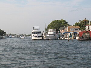
- Patchogue Bay
- Patchogue-Medford High School
- Patchogue-Medford Library
- Patchogue-Medford School District
- Patchogue River
- Patchogue Theatre
- Sandspit Park Beach & Marina
- Shorefront Park
-
 Sunset off the Mascot Dock
 -
 Patchogue Bay
 -
 Patchogue River


References
- ^ "ArcGIS REST Services Directory". United States Census Bureau. Retrieved September 20, 2022.
- ^ "History of Patchogue Village, East Patchogue and North Patchogue". Patchogue.com. Archived from the original on March 18, 2012. Retrieved January 12, 2012.
- ^ "Record of Decision, Patchogue" (PDF). New York State Department of Environmental Conservation. March 2011. Retrieved April 9, 2014.
- ^ Korb, Priscila (September 25, 2019). "Patchogue Village Named Among 2019 Great Neighborhoods". Patch. Patchogue, NY. Retrieved January 29, 2020.
- ^ "Public Safety | Patchogue, NY". www.patchoguevillage.org. Retrieved September 18, 2023.
- ^ "Census of Population and Housing". Census.gov. Retrieved June 4, 2015.
- ^ "U.S. Census website". United States Census Bureau. Retrieved January 31, 2008.
- ^ a b "Patchogue, NY Population – Census 2010 and 2000 Interactive Map, Demographics, Statistics, Quick Facts". CensusViewer. Retrieved May 19, 2014.
- ^ "2010 Census data for PATCHOGUE, NY". Zip-codes.com. Retrieved May 19, 2014.
- ^ Bryson, Lew; Cazentre, Don (March 1, 2014). New York Breweries: 2nd Edition. Stackpole Books. ISBN 978-0-8117-5873-4.
- ^ "See and Be Part of the Scene at These 8 Vibrant Downtowns". www.discoverlongisland.com. November 20, 2019. Retrieved September 16, 2023.
- ^ "School Districts Serving Patchogue, NY". Niche. Retrieved September 18, 2023.
- ^ Gillespie, Lisa (December 21, 2010). "First Lady Presents Patchogue-Medford Library with National Award – Arts & Entertainment". Patch. Patchogue, NY. Retrieved May 19, 2014.
- ^ "Emanuel Lutheran School Patchogue | Faithfully Serving Families Since 1957". April 6, 2024. Archived from the original on April 6, 2024. Retrieved April 10, 2024.
- ^ "Timothy J. Dyson Dead". The Brooklyn Citizen. May 6, 1911. p. 12. Retrieved May 18, 2021.
- ^ "About Us". greaterlongisland.com. Retrieved June 4, 2021.
- ^ "transportation". Patchoguevillage.org. Archived from the original on July 25, 2014. Retrieved May 19, 2014.
- ^ "Rapper Biz Markie from Long Island dies at 57". Newsday. The Associated Press. July 17, 2021. Retrieved July 29, 2021.
- ^ Kilgannon, Corey (April 24, 2006). "Three Quiet Brothers on Long Island, All of Them Related to Hitler". The New York Times. Retrieved February 11, 2012.
Bibliography
- Images of America: Patchogue, by Hans Henke, Patchogue village historian, Arcadia Publishing.
- The Patchogue Story, by historian Anne Swezey, (February 6, 1924 – April 20, 2009)
External links
- Village of Patchogue
- https://www.niche.com/k12/search/best-school-districts/t/patchogue-suffolk-ny/
- https://www.patchoguevillage.org/165/Public-Safety
- Patchogue—Still Banking on the River article by Rhoda Amon, Newsday staff writer
| International | |
|---|---|
| National | |
| Geographic | |
| Other | |