
Solukhumbu District: Difference between revisions
m →Geography and climate: cleanup |
m →top: links |
||
| (27 intermediate revisions by 20 users not shown) | |||
| Line 8: | Line 8: | ||
| native_name_lang = <!-- ISO 639-2 code e.g. "fr" for French. If more than one, use {{lang}} instead --> |
| native_name_lang = <!-- ISO 639-2 code e.g. "fr" for French. If more than one, use {{lang}} instead --> |
||
| motto = |
| motto = |
||
| image_skyline = |
| image_skyline = Everest, Nuptse, Khumbu Glacier, Nepal, Himalayas.jpg |
||
| image_alt = |
| image_alt = |
||
| image_caption = |
| image_caption = View of [[Mount Everest]] from [[Kala Patthar]] |
||
| image_map = Solukhumbu district locator map.png |
| image_map = Solukhumbu district locator map.png |
||
| map_alt = |
| map_alt = |
||
| Line 23: | Line 23: | ||
| subdivision_name = {{NPL}} |
| subdivision_name = {{NPL}} |
||
| subdivision_type1 = [[Provinces of Nepal|Province]] |
| subdivision_type1 = [[Provinces of Nepal|Province]] |
||
| subdivision_name1 = [[Province |
| subdivision_name1 = [[Koshi Province]] |
||
| parts_type = [[Local self-government in Nepal|Municipality]] |
| parts_type = [[Local self-government in Nepal|Municipality]] |
||
| Line 52: | Line 52: | ||
| leader_title3 = [[Provincial Assembly (Nepal)|Provincial constituencies]] |
| leader_title3 = [[Provincial Assembly (Nepal)|Provincial constituencies]] |
||
| leader_name3 = 2 |
| leader_name3 = 2 |
||
| leader_title4 = Chief District Officer |
|||
| leader_name4 = Anil Khanal |
|||
| government_footnotes = |
| government_footnotes = |
||
| government_type = [[District Coordination Committee|Coordination committee]] |
| government_type = [[District Coordination Committee|Coordination committee]] |
||
| Line 63: | Line 67: | ||
| elevation_min_m = 600 |
| elevation_min_m = 600 |
||
| elevation_max_m = 8848 |
| elevation_max_m = 8848 |
||
| population_footnotes = <ref name=" |
| population_footnotes = <ref name="citypop"/> |
||
| population_total = |
| population_total = 104,768 |
||
| population_as_of = |
| population_as_of = 2021 |
||
| population_density_km2 = auto |
| population_density_km2 = auto |
||
| population_note = |
| population_note = |
||
| population_rank = |
| population_rank = |
||
| population_blank1_title = Households |
| population_blank1_title = Households |
||
| population_blank1 = 23,758<ref name=solu>https://nepalmap.org/profiles/district-11-solukhumbu/</ref> |
| population_blank1 = 23,758<ref name=solu>{{Cite web|url=https://nepalmap.org/profiles/district-11-solukhumbu/|title = NepalMap profile: Bhojpur}}</ref> |
||
| demographics_type1 = [[Demographics]] |
| demographics_type1 = [[Demographics]] |
||
| demographics1_title1 = Ethnic groups |
| demographics1_title1 = Ethnic groups |
||
| demographics1_info1 = {{hlist|[[Rai people|Rai]]|[[Sherpa people|Sherpa]]|[[Chhetri]]|[[Tamang people|Tamang]]|[[Kulung people|Kulung]]|[[Kami (caste)|Kami]]|[[Magars|Magar]]|[[Bahun]]|Nachhiring|[[Newar people|Newar]]|[[Damai]]|Thulung}} |
| demographics1_info1 = {{hlist|[[Rai people|Rai]]|[[Sherpa people|Sherpa]]|[[Chhetri]]|[[Tamang people|Tamang]]|[[Kulung people|Kulung Rai]]|[[Kami (caste)|Kami]]|[[Magars|Magar]]|[[Bahun]]|[[Rai people|Nachhiring Rai]]|[[Newar people|Newar]]|[[Damai]]| [[Rai people|Thulung Rai]]}} |
||
| demographics1_title2 = Female [[♀]] |
| demographics1_title2 = Female [[♀]] |
||
| demographics1_info2 = 52%<ref name=solu/> |
| demographics1_info2 = 52%<ref name=solu/> |
||
| Line 104: | Line 108: | ||
| footnotes = |
| footnotes = |
||
}} |
}} |
||
'''Solukhumbu District '''({{lang-ne|[[:ne:सोलुखुम्बु जिल्ला|सोलुखुम्बु जिल्ला]]}} {{IPA-ne|solukʰumbu||Solukhumbu.ogg}}, [[Sherpa language|Sherpa]]: {{bo-textonly|ཤར་ཁུམ་བུ་རྫོང་།}}, [[Wylie transliteration|Wylie]]: shar khum bu dzong) is one of [[Districts of Province No. 1|14 districts]] of [[Province |
'''Solukhumbu District '''({{lang-ne|[[:ne:सोलुखुम्बु जिल्ला|सोलुखुम्बु जिल्ला]]}} {{IPA-ne|solukʰumbu||Solukhumbu.ogg}}, [[Sherpa language|Sherpa]]: {{bo-textonly|ཤར་ཁུམ་བུ་རྫོང་།}}, [[Wylie transliteration|Wylie]]: shar khum bu dzong) is one of [[Districts of Province No. 1|14 districts]] of [[Koshi Province]] of eastern [[Nepal]]. As the name suggests, it consists of the sub-regions Solu and [[Khumbu]]. The closest post office to Solukhumbu with a postal code assigned to it is the Sindhuli D.P.O., which has the postal code 56000. |
||
The district, with [[Solududhkunda Municipality|Salleri]] as its headquarters, covers an area of {{cvt|3,312|km2}} and had a population 107,686 in 2001 and 105,886 in 2011.<ref name="statoid">{{statoids|id=ynp|title=Districts of Nepal}}</ref> |
The district, with [[Solududhkunda Municipality|Salleri]] as its headquarters, covers an area of {{cvt|3,312|km2}} and had a population 107,686 in [[2001 Nepal census|2001]] and 105,886 in [[2011 Nepal census|2011]].<ref name="statoid">{{statoids|id=ynp|title=Districts of Nepal}}</ref> |
||
[[Mount Everest]] is in the northern part of this district, within [[Sagarmatha National Park]]. |
[[Mount Everest]] is in the northern part of this district, within [[Sagarmatha National Park]]. |
||
==History== |
==History== |
||
Historically, Solukhumbu was part of [[Kirata Kingdom]]s in early and medieval era. It was a part of Majh |
Historically, Solukhumbu was part of [[Kirata Kingdom]]s in early and medieval era. It was a part of Majh Kirat Khambuwan (central province or region of [[Kirat Autonomous State|Kirat Kingdoms]]).<ref name=":0">{{cite book |url=https://books.google.com/books?id=YVWtaeE5WgoC&q=Majhkirat&pg=PA1 |title=A grammar of Dumi |isbn=9783110123517 |access-date=30 March 2020|last1=Driem |first1=George van |year=1993 }}</ref> |
||
Before the [[unification of Nepal]] by king of [[Kingdom of Gorkha|Gorkha]], what is now Solukhumbu district was part of Chaudandi of Majh |
Before the [[unification of Nepal]] by king of [[Kingdom of Gorkha|Gorkha]], what is now Solukhumbu district was part of Chaudandi of Majh Kirat (Khambuwan). In 1773 AD the King of Gorkha attacked and absorbed it into [[Nepal]].<ref>{{cite book |url=https://books.google.com/books?id=_7M9AwAAQBAJ&q=chaudandi+majhkirat+1773&pg=PT99 |title=Kirat history and culture |date= 15 April 2014|access-date=30 March 2020 |quote=The fort of Hatuwa Chaudandi of Majh kirat was occupied by the [[Kingdom of Nepal|Gorkha]] force on the fourth day of Srawan in the year 1830 Bikram Sambat which corresponds to 1773 AD.|last1=Chemjong |first1=Imanshing }}</ref> |
||
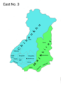
The Solukhumbu district was established in 1962<ref>{{cite web |url=https://asiafoundation.org/resources/pdfs/AGuidetoGovernmentinNepal.pdf |title=A Guide to Government in Nepal |access-date=30 March 2020 |quote=In 1961, the country was demarcated into 14 administrative zones with each zone headed by a zone commissioner, a royal appointee whose function, among others, was to assist the palace secretariat in suppressing political opposition. In the districts, now increased in number to 75 from 35, district panchayats were established by amalgamating the former village development blocks, and village and nagar (town) panchayats were also established.}}</ref> |
The Solukhumbu district was established in 1962,<ref>{{cite web |url=https://asiafoundation.org/resources/pdfs/AGuidetoGovernmentinNepal.pdf |title=A Guide to Government in Nepal |access-date=30 March 2020 |quote=In 1961, the country was demarcated into 14 administrative zones with each zone headed by a zone commissioner, a royal appointee whose function, among others, was to assist the palace secretariat in suppressing political opposition. In the districts, now increased in number to 75 from 35, district panchayats were established by amalgamating the former village development blocks, and village and nagar (town) panchayats were also established.}}</ref> out of the old '''East No. 3''' district. Before 1962, present-day Solukhumbu, [[Okhaldhunga District|Okhaldhunga]] and some parts of [[Khotang District|Khotang]] previously constitute district "East No. 3".<ref>{{cite web |url=http://dccokhaldhunga.gov.np/en/brief-introduction/ |title=Brief introduction of Okhaldhunga |publisher=DCC Okhaldhunga |access-date=30 March 2020 |quote=Okhaldhunga along with Khotang and Solukhumbu were combined to form East No.3 area among the 32 districts of administrative division of Prime Minister Bhimsen Thapa recently after the unification campaign of His Majesty the King Prithvi Narayan Shah. At that time the headquarter of East No.3 area was Okhaldhunga as of today.}}</ref> Solu and Rawa thums (counties) were carved out of East No. 3 to create Solukhumbu District. |
||
<gallery> |
<gallery> |
||
East No. 3.png|East No. 3, a district of Nepal before 1962. |
East No. 3.png|East No. 3, a district of Nepal before 1962. |
||
| Line 121: | Line 125: | ||
</gallery> |
</gallery> |
||
==Geography |
==Geography== |
||
Solukhumbu is |
Solukhumbu is one of three Himalayan districts within Province No. 1, positioned on the west-by-northwestern corner of the province. It spans a total area of {{convert|3312|km2|mi2}}. It is geographically situated between latitudes 27°20'39" and 28°6'24" North, and longitudes 86°0'21" and 87°0'1" East. Its north border includes the world's highest peak {{convert|8848|m|ft}} ([[Mount Everest]]); and the district's lowest point is at {{convert|600|m|ft}} (Tuintar) above sea level. The district is bordered by [[Sankhuwasabha District|Sankhuwasabha]] in the east, [[Bhojpur District, Nepal|Bhojpur]] in the south-east, [[Khotang District|Khotang]] and [[Okhaldhunga District|Okhaldhunga]] in the south, [[Bagmati Province]] in the west and [[Tibet Autonomous Region|Tibet]] (China) in the north.<ref name=":0" /> |
||
The |
The diverse geography of Solukhumbu district is marked by three distinct levels: |
||
===Khumbu Himal (Highland mountains)=== |
===Khumbu Himal (Highland mountains)=== |
||
[[Mahalangur Himal |
This region is home to the [[Mahalangur Himal]] and other Himalayan mountain ranges. Situated on the northern border with [[Tibet]], it hosts some of the world's highest peaks, including [[Mount Everest]] (8,848m), [[Lhotse]] (8,516m), [[Makalu]] (8,485m), [[Cho Oyu]] (8,201m), [[Gyachung Kang]] (7,952m), among others. |
||
===Khumbu region (Highland valley)=== |
===Khumbu region (Highland valley)=== |
||
[[Khumbu|Khumbu valley]] is |
Known globally for its trekking and hiking opportunities, the highland [[Khumbu|Khumbu valley]] is predominantly inhabited by the [[Kulung people|Kulung]] and [[Sherpa people|Sherpa]] communities. The administrative division of [[Khumbu Pasanglhamu]] is located in this region, encompassing the roadless town of [[Namche Bazaar]] and villages such as [[Thame, Nepal|Thame]], [[Khumjung]], [[Pangboche]], [[Pheriche]] and [[Kunde, Nepal|Kunde]]. The renowned [[Buddhism|Buddhist]] [[monastery]] at [[Tengboche]] also falls within the Khumbu region.<ref>Bonington, Chris; Everest, The Hard Way; (1977); pp 72-75; Arrow Books editions; {{ISBN|0-09-915940-6}}.</ref> |
||
===Solu region (Mid-hills)=== |
===Solu region (Mid-hills)=== |
||
Lower Solukhumbu (lower parts of Solukhumbu District) is part of the Mid-hills region. It is less famous for trekking, however new trails such as the Mundhum trail are being developed. |
Lower Solukhumbu (lower parts of Solukhumbu District) is part of the Mid-hills region. It is less famous for trekking, however new trails such as the Mundhum trail are being developed. Rais are the main inhabitants in this region. |
||
== Climate == |
|||
{| class="wikitable" |
{| class="wikitable" |
||
|- |
|- |
||
| Line 320: | Line 326: | ||
===Former divisions (1990–2016)=== |
===Former divisions (1990–2016)=== |
||
Formerly, Solukhumbu district was divided into many [[Village development committee (Nepal)|Village development committee]]s. In 2014 [[Dudhkunda]] municipality was established merging some Village development committees. In 2016 all other Village development committee nullified and introduced [[Gaunpalika|rural municipality]] thus all former Village development committees grouped into 7 units and announced 7 rural municipality. |
Formerly, Solukhumbu district was divided into many [[Village development committee (Nepal)|Village development committee]]s. In 2014 [[Dudhkunda]] municipality was established merging some Village development committees. In 2016 all other Village development committee nullified and introduced [[Gaunpalika|rural municipality]] thus all former Village development committees grouped into 7 units and announced 7 rural municipality. |
||
[[File:NepalSolukhumbuDistrictmap.png|thumb|200px|Map of the VDCs in Solukhumbu District]] |
[[File:NepalSolukhumbuDistrictmap.png|thumb|200px|Map of the VDCs in Solukhumbu District|left]] |
||
There were 35 Village Development Committees in Solukhumbu District:<ref name="digitalhimalaya">{{cite web|url=http://www.digitalhimalaya.com/collections/nepalcensus/form.php?selection=68|publisher=digitalhimalaya.com|title=Digital Himalaya: Nepal Census 2001|access-date=Jun 11, 2017}}</ref> |
There were 35 Village Development Committees in Solukhumbu District:<ref name="digitalhimalaya">{{cite web|url=http://www.digitalhimalaya.com/collections/nepalcensus/form.php?selection=68|publisher=digitalhimalaya.com|title=Digital Himalaya: Nepal Census 2001|access-date=Jun 11, 2017}}</ref> |
||
{{col |
{{div col|colwidth=8em}} |
||
*[[Bapha]] |
|||
{{col-break}} |
|||
*[[Baku, Nepal|Baku]] |
|||
{{ordered list|start=1 |
|||
*[[Basa, Nepal|Basa]] |
|||
|[[Bapha]] |
|||
*[[Beni, Sagarmatha|Beni]] |
|||
*[[Bhakanje]] |
|||
|[[Basa, Nepal|Basa]] |
|||
*[[Bung, Nepal|Bung]] |
|||
*[[Chaulakharka]] |
|||
*[[Chaurikharka]] |
|||
|[[Bung, Nepal|Bung]] |
|||
*[[Chheskam]] |
|||
*[[Deusa]] |
|||
*[[Garma, Nepal|Garma]] |
|||
|[[Chheskam]]}} |
|||
*[[Goli, Solukhumbu|Goli]] |
|||
{{col-break}} |
|||
*[[Gorakhani]] |
|||
{{ordered list|start=10 |
|||
*[[Gudel]] |
|||
*[[Jubing]] |
|||
|[[Garma, Nepal|Garma]] |
|||
*[[Jubu, Nepal|Jubu]] |
|||
*[[Kaku, Nepal|Kaku]] |
|||
|[[Gorakhani]] |
|||
*[[Kangel]] |
|||
*[[Kerung]] |
|||
*[[Khumjung]] |
|||
|[[Jubu, Nepal|Jubu]] |
|||
*[[Loding Tamakhani]] |
|||
*[[Lokhim]] |
|||
*[[Mabe, Nepal|Mabe]] |
|||
{{col-break}} |
|||
*[[Mukali]] |
|||
{{ordered list|start=19 |
|||
*[[Namche]] |
|||
*[[Necha Batase]] |
|||
*[[Necha Bedghari]] |
|||
*[[Nele]] |
|||
*[[Panchan, Nepal|Panchan]] |
|||
*[[Salleri, Solukhumbu|Salleri]] |
|||
|[[Mukali]] |
|||
*[[Salyan, Solukhumbu|Salyan]] |
|||
|[[Namche]] |
|||
*[[Sotang]] |
|||
*[[Takasindu]] |
|||
|[[Necha Bedghari]]}} |
|||
*[[Tapting]] |
|||
{{col-break}} |
|||
*[[Tingla]] |
|||
{{ordered list|start=28 |
|||
{{div col end}} |
|||
|[[Nele]] |
|||
|[[Panchan, Nepal|Panchan]] |
|||
|[[Salleri, Solukhumbu|Salleri]] |
|||
|[[Salyan, Solukhumbu|Salyan]] |
|||
|[[Sotang]] |
|||
|[[Takasindu]] |
|||
|[[Tapting]] |
|||
|[[Tingla]]}} |
|||
{{col-end}} |
|||
==Demographics== |
==Demographics== |
||
{{Historical populations |
|||
{{Pie chart |
|||
| thumb = right |
|||
| caption =Ethnic castes in Solukhumbu |
|||
| other = yes |
|||
| label1 =[[Rai people|Rai]] |
|||
| value1 = 19.6 |
|||
| label2 =[[Sherpa people|Sherpa]] |
|||
| value2 = 16.7 |
|||
| label3 =[[Chhetri]] |
|||
| value3 = 15.1 |
|||
| label4 =[[Tamang people|Tamang]] |
|||
| value4 = 9.9 |
|||
| label5 =[[Kulung people (Nepal)|Kulung]] |
|||
| value5 = 8.9 |
|||
|label12=Thulung|value12=1.0|label10=[[Newar people|Newar]]|color11=maroon|color10=lavender|label11=Damai|value11=1.9|label7=[[Magar people|Magar]]|value10=2.4|label9=Nachhiring|value9=3.5|value8=4.6|label8=[[Bahun]]|value7=4.9|value6=5.6|label6=[[Kami (caste)|Kami]]|color12=gold}} |
|||
Total population of Solukhumbu district according to the ([[2011 Nepal census]]) is 105,886 individuals living in 23,758 households, in which 54686 (51.7%) are female.<ref name=solu/> |
|||
19.6% of the population was [[Rai people|Rai]], 16.7% [[Sherpa people|Sherpa]], 15.1% [[Chhetri]], 9.9% [[Tamang people|Tamang]], 8.9% [[Kulung people|Kulung]], 5.6% [[Kami (caste)|Kami]], 4.9% [[Magars|Magar]], 4.6% [[Bahun]], 3.5% Nachhiring, 2.4% [[Newar people|Newar]], 1.9% [[Damai]] and 1% Thulung.<ref name="solu" /> |
|||
36.8% of the population speak [[Nepali language|Nepali]], 16.8% [[Sherpa language|Sherpa]], 9.3% [[Tamang language|Tamang]], 9.2% [[Kulung language (Nepal)|Kulung]], 8.7% [[Thulung language|Thulung]], 8.5% [[Khaling language|Khaling]], 3.8% [[Nachhiring language|Nachhiring]], 2.4% [[Bahing language|Bahing]] and 1.5% [[Magar language|Magar]] as their first language. |
|||
56.0% of the population in the district speak [[Nepali language|Nepali]] and 1.8% [[Sherpa language|Sherpa]] as their [[second language]].<ref>[https://cbs.gov.np/wp-content/upLoads/2018/12/Volume05Part02.pdf 2011 Nepal Census, Social Characteristics Tables]</ref> {{bar box|title=Religion in Solukhambu district (2011)<ref name="Religion">{{cite web |title=C-1 Population By Religious Community |url=https://cbs.gov.np/wp-content/upLoads/2019/03/solu-profile-pdf.pdf}}</ref>|titlebar=#Fcd116|float=right|bars={{bar percent|[[Hinduism in Nepal|Hinduism]]|darkorange|40.20}} |
|||
{{bar percent|[[Kiratism]]|red|30.16}} {{bar percent|[[Buddhism in Nepal |Buddhism]]|yellow|27.15}} |
|||
{{bar percent|Others|black|2.33}}}}{{Historical populations |
|||
|align=left |
|align=left |
||
|percentages=pagr |
|percentages=pagr |
||
| Line 400: | Line 375: | ||
|2011 |105,886 |
|2011 |105,886 |
||
|2021 |104,768 |
|2021 |104,768 |
||
|footnote= Sources:<ref>{{cite web |title=Nepal: Provinces and Districts |url=http://www.citypopulation.de/en/nepal/admin/ |website=www.citypopulation.de|language=en}}</ref>}} |
|footnote= Sources:<ref name="citypop">{{cite web |title=Nepal: Provinces and Districts |url=http://www.citypopulation.de/en/nepal/admin/ |website=www.citypopulation.de|language=en}}</ref>}} |
||
At the time of the [[2011 Nepal census]], Solukhumbu District had a population of 105,886. |
|||
{{Pie chart |
|||
===Notable people=== |
|||
|caption=language in Solukhumbu District |
|||
|label1=Nepali|value1=37|color1=orange |
|||
|label2=Sherpa|value2=17|color2=grey |
|||
|label3=Tamang|value3=9|color3=red |
|||
|label4=Kulung|value4=9|color4=skyblue |
|||
|label5=Thulung|value5=9|color5=violet |
|||
|label6=Khaling|value6=9|color6=blue |
|||
|label7=Others|value7=19|color7=black |
|||
}} |
|||
As their first language, 36.7% spoke [[Nepali language|Nepali]], 16.7% [[Sherpa language|Sherpa]], 9.4% [[Tamang language|Tamang]], 9.2% [[Kulung language (Nepal)|Kulung]], 8.8% [[Thulung language|Thulung]], 8.5% [[Khaling language|Khaling]], 3.8% [[Nachhiring language|Nachhiring]], 2.4% [[Bahing language|Bahing]], 1.5% [[Magars|Magar]], 0.7% [[Maithili language|Maithili]], 0.6% [[Newar language|Newar]], 0.4% [[Kiranti languages|Rai]], 0.2% [[Sunwar language|Sunuwar]], 0.1% [[Bhujel language|Bhujel]], 0.1% [[Gurung language|Gurung]], 0.1% [[Tharu languages|Tharu]], 0.1% [[Lhasa Tibetan|Tibetan]] and 0.4% other languages.<ref>[https://nepalmap.org/data/table/?table=LANGUAGE&primary_geo_id=district-68&geo_ids=district-68,province-1,country-NP NepalMap Language]</ref> |
|||
{{Pie chart |
|||
| thumb = left |
|||
| caption = Castes/ethnic groups in Solukhumbu district (2011)<ref name="solu" /> |
|||
|label1 = [[Rai people|Rai]] |value1 = 19.61 |color1 = turquoise |
|||
|label2 = [[Sherpa people|Sherpa]] |value2 = 16.71 |color2 = darkblue |
|||
|label3 = [[Chhetri]] |value3 = 15.06 |color3 = red |
|||
|label4 = [[Tamang people|Tamang]] |value4 = 9.90 |color4 = dodgerblue |
|||
|label5 = [[Kulung people (Nepal)|Kulung Rai]] |value5 = 8.90 |color5 = lightcyan |
|||
|label6 = [[Kami (caste)|Kami]] |value6 = 5.59 |color6 = black |
|||
|label7 = [[Magar people|Magar]] |value7 = 4.91 |color7 = darkgreen |
|||
|label8 = [[Bahun]] |value8 = 4.62 |color8 = orange |
|||
|label9 = [[Rai people|Nachhiring Rai]] |value9 = 3.49 |color9 = aquamarine |
|||
|label10 = [[Newar people|Newar]] |value10 = 2.45 |color10 = pink |
|||
|label11 = [[Bhujel]] |value11 = 1.86 |color11 = maroon |
|||
|label12 = [[Damai]] |value12 = 1.50 |color12 = lavender |
|||
|label13 = [[Rai people|Thulung Rai]] |value13 = 1.02 |color13 = cadetblue |
|||
|label14 = Other Janajati |value14 = 1.70 |color14 = teal |
|||
|label15 = Other Khas |value15 = 1.27 |color15 = indianred |
|||
|label16 = Other |value16 = 1.41 |color16 = grey |
|||
}} |
|||
Ethnicity/caste: 19.7% were [[Rai people|Rai]], 16.6% [[Sherpa people|Sherpa]], 15.0% [[Chhetri]], 9.9% [[Tamang people|Tamang]], 8.9% [[Kulung people|Kulung]], 5.6% [[Kami (caste)|Kami]], 4.9% [[Magars|Magar]], 4.6% [[Bahun|Hill Brahmin]], 3.5% Nachhiring, 2.4% [[Newar people|Newar]], 1.9% Gharti/[[Bhujel]], 1.5% [[Damai]]/Dholi, 1.0% Thulung, 0.7% [[Gurung people|Gurung]], 0.7% Sanyasi/Dasnami, 0.5% [[Sarki (ethnic group)|Sarki]], 0.3% Kalar, 0.3% Khaling, 0.3% [[Sunuwar people|Sunuwar]], 0.1% [[Badi people|Badi]], 0.1% [[Bahing]], 0.1% [[Hajjam|Hajam]]/Thakur, 0.1% [[Koeri|Koiri]]/[[Kushwaha]], 0.1% Majhi, 0.1% [[Tharu people|Tharu]] and 0.5% others.<ref>[https://nepalmap.org/data/table/?table=CASTE&primary_geo_id=district-68&geo_ids=district-68,province-1,country-NP NepalMap Caste]</ref> |
|||
{{bar box |
|||
|title=Religion in Solukhumbu district (2011)<ref name="Religion">{{cite web |title=C-1 Population By Religious Community |url=https://cbs.gov.np/wp-content/upLoads/2019/03/solu-profile-pdf.pdf}}</ref> |
|||
|titlebar=#Fcd116 |
|||
|float=right |
|||
|bars= |
|||
{{bar percent|[[Hinduism in Nepal|Hinduism]]|darkorange|40.20}} |
|||
{{bar percent|[[Kirat Mundhum]]|red|30.16}} |
|||
{{bar percent|[[Buddhism in Nepal|Buddhism]]|yellow|27.15}} |
|||
{{bar percent|Others|black|2.33}}}} |
|||
Religion: 40.2% were [[Hinduism in Nepal|Hindu]], 30.2% [[Kirat Mundhum|Kirati]], 27.2% [[Buddhism in Nepal|Buddhist]], 2.2% [[Christianity in Nepal|Christian]], 0.1% [[Animism|Prakriti]] and 0.2% others.<ref>[https://nepalmap.org/data/table/?table=RELIGION&primary_geo_id=district-68&geo_ids=district-68,province-1,country-NP NepalMap Religion]</ref> |
|||
Literacy: 64.0% could read and write, 3.2% could only read and 32.8% could neither read nor write.<ref>[https://nepalmap.org/data/table/?table=LITERACY_SEX&primary_geo_id=district-68&geo_ids=district-68,province-1,country-NP NepalMap Literacy]</ref> |
|||
==Notable people== |
|||
*[[Tenzing Norgay]]- First ascent of Mount Everest |
*[[Tenzing Norgay]]- First ascent of Mount Everest |
||
* [[Pasang Lhamu Sherpa]] - First Nepalese female ascent |
* [[Pasang Lhamu Sherpa]] - First Nepalese female ascent |
||
| Line 409: | Line 432: | ||
*[[Apa Sherpa]] - 21 times ascent Mount Everest |
*[[Apa Sherpa]] - 21 times ascent Mount Everest |
||
* [[Nawang Sherpa]] - First person to climb Mount Everest with a prosthetic leg |
* [[Nawang Sherpa]] - First person to climb Mount Everest with a prosthetic leg |
||
* [[Kami Rita Sherpa]] - A 28th times Everest summiter on 23 May 2023, breaking his own record set on 17 May 2023. |
|||
==See also== |
==See also== |
||
| Line 429: | Line 453: | ||
{{Solukhumbu District}} |
{{Solukhumbu District}} |
||
{{Districts of Nepal}} |
{{Districts of Nepal}} |
||
{{Authority control}} |
|||
{{Coord|27|30|N|86|35|E|type:adm2nd_region:NP_source:enwiki|display=title}} |
{{Coord|27|30|N|86|35|E|type:adm2nd_region:NP_source:enwiki|display=title}} |
||
{{Authority control}} |
|||
[[Category:Solukhumbu District| ]] |
[[Category:Solukhumbu District| ]] |
||
[[Category:Districts of Nepal established in 1962]] |
[[Category:Districts of Nepal established in 1962]] |
||
[[Category:Districts of Province |
[[Category:Districts of Koshi Province]] |
||
[[Category:Tibetan Buddhist places]] |
[[Category:Tibetan Buddhist places]] |
||
Latest revision as of 02:18, 7 May 2024
This article possibly contains original research. (October 2021) |
Solukhumbu District
सोलुखुम्बु जिल्ला | |
|---|---|
 View of Mount Everest from Kala Patthar | |
| Nickname: Khumbu | |
 Location of Solukhumbu | |
 Divisions of Solukhumbu District | |
| Coordinates: 27°20′39″N 86°0′21″E / 27.34417°N 86.00583°E to 28°6′24″N 87°0′1″E / 28.10667°N 87.00028°E | |
| Country | |
| Province | Koshi Province |
| Established | 1962 |
| Admin HQ. | Salleri |
| Municipality | |
| Government | |
| • Type | Coordination committee |
| • Body | DCC, Solukhumbu |
| • Head | Bir Kumar Rai (NCP) |
| • Parliamentary constituencies | 1 |
| • Provincial constituencies | 2 |
| • Chief District Officer | Anil Khanal |
| Area | |
| • Total | 3,312 km2 (1,279 sq mi) |
| Highest elevation | 8,848 m (29,029 ft) |
| Lowest elevation | 600 m (2,000 ft) |
| Population (2021)[2] | |
| • Total | 104,768 |
| • Density | 32/km2 (82/sq mi) |
| • Households | 23,758[1] |
| Demographics | |
| • Ethnic groups | |
| • Female ♀ | 52%[1] |
| Human Development Index | |
| • Income per capita (US dollars) | $1,841 per capita |
| • Poverty rate | 25.7 |
| • Literacy | 64%[1] |
| • Life Expectancy | 68.8[1] |
| Time zone | UTC+05:45 (NPT) |
| Postal Codes | 56000..., 56010 |
| Telephone Code | 38 |
| Website | ddcsolukhumbu |
Solukhumbu District (Nepali: सोलुखुम्बु जिल्ला [solukʰumbu] , Sherpa: ཤར་ཁུམ་བུ་རྫོང་།, Wylie: shar khum bu dzong) is one of 14 districts of Koshi Province of eastern Nepal. As the name suggests, it consists of the sub-regions Solu and Khumbu. The closest post office to Solukhumbu with a postal code assigned to it is the Sindhuli D.P.O., which has the postal code 56000.
The district, with Salleri as its headquarters, covers an area of 3,312 km2 (1,279 sq mi) and had a population 107,686 in 2001 and 105,886 in 2011.[3]
Mount Everest is in the northern part of this district, within Sagarmatha National Park.
History
[edit]Historically, Solukhumbu was part of Kirata Kingdoms in early and medieval era. It was a part of Majh Kirat Khambuwan (central province or region of Kirat Kingdoms).[4]
Before the unification of Nepal by king of Gorkha, what is now Solukhumbu district was part of Chaudandi of Majh Kirat (Khambuwan). In 1773 AD the King of Gorkha attacked and absorbed it into Nepal.[5]
The Solukhumbu district was established in 1962,[6] out of the old East No. 3 district. Before 1962, present-day Solukhumbu, Okhaldhunga and some parts of Khotang previously constitute district "East No. 3".[7] Solu and Rawa thums (counties) were carved out of East No. 3 to create Solukhumbu District.
-
 East No. 3, a district of Nepal before 1962.
 -
 VDCs of Solukhumbu before 2015.

Geography
[edit]Solukhumbu is one of three Himalayan districts within Province No. 1, positioned on the west-by-northwestern corner of the province. It spans a total area of 3,312 square kilometres (1,279 sq mi). It is geographically situated between latitudes 27°20'39" and 28°6'24" North, and longitudes 86°0'21" and 87°0'1" East. Its north border includes the world's highest peak 8,848 metres (29,029 ft) (Mount Everest); and the district's lowest point is at 600 metres (2,000 ft) (Tuintar) above sea level. The district is bordered by Sankhuwasabha in the east, Bhojpur in the south-east, Khotang and Okhaldhunga in the south, Bagmati Province in the west and Tibet (China) in the north.[4]
The diverse geography of Solukhumbu district is marked by three distinct levels:
Khumbu Himal (Highland mountains)
[edit]This region is home to the Mahalangur Himal and other Himalayan mountain ranges. Situated on the northern border with Tibet, it hosts some of the world's highest peaks, including Mount Everest (8,848m), Lhotse (8,516m), Makalu (8,485m), Cho Oyu (8,201m), Gyachung Kang (7,952m), among others.
Khumbu region (Highland valley)
[edit]Known globally for its trekking and hiking opportunities, the highland Khumbu valley is predominantly inhabited by the Kulung and Sherpa communities. The administrative division of Khumbu Pasanglhamu is located in this region, encompassing the roadless town of Namche Bazaar and villages such as Thame, Khumjung, Pangboche, Pheriche and Kunde. The renowned Buddhist monastery at Tengboche also falls within the Khumbu region.[8]
Solu region (Mid-hills)
[edit]Lower Solukhumbu (lower parts of Solukhumbu District) is part of the Mid-hills region. It is less famous for trekking, however new trails such as the Mundhum trail are being developed. Rais are the main inhabitants in this region.
Climate
[edit]| Climate Zone[9] | Elevation Range | % of Area |
|---|---|---|
| Upper Tropical | 300 to 1,000 meters 1,000 to 3,300 ft. |
0.7% |
| Subtropical | 1,000 to 2,000 meters 3,300 to 6,600 ft. |
9.3% |
| Temperate | 2,000 to 3,000 meters 6,400 to 9,800 ft. |
20.6% |
| Subalpine | 3,000 to 4,000 meters 9,800 to 13,100 ft. |
16.6% |
| Alpine | 4,000 to 5,000 meters 13,100 to 16,400 ft. |
28.3% |
| Nival | above 5,000 meters | 24.4% |
| Climate data for Salleri | |||||||||||||
|---|---|---|---|---|---|---|---|---|---|---|---|---|---|
| Month | Jan | Feb | Mar | Apr | May | Jun | Jul | Aug | Sep | Oct | Nov | Dec | Year |
| Mean daily maximum °C (°F) | 23.1 (73.6) |
25.8 (78.4) |
31.0 (87.8) |
35.1 (95.2) |
35.0 (95.0) |
34.9 (94.8) |
32.5 (90.5) |
32.8 (91.0) |
32.5 (90.5) |
31.6 (88.9) |
29.0 (84.2) |
24.8 (76.6) |
30.7 (87.2) |
| Mean daily minimum °C (°F) | 9.2 (48.6) |
11.0 (51.8) |
15.1 (59.2) |
19.4 (66.9) |
21.2 (70.2) |
22.9 (73.2) |
23.8 (74.8) |
24.2 (75.6) |
23.8 (74.8) |
21.2 (70.2) |
15.8 (60.4) |
10.6 (51.1) |
18.2 (64.7) |
| Average precipitation mm (inches) | 1 (0.0) |
1 (0.0) |
1 (0.0) |
2 (0.1) |
4 (0.2) |
7 (0.3) |
16 (0.6) |
12 (0.5) |
10 (0.4) |
3 (0.1) |
0 (0) |
1 (0.0) |
58 (2.2) |
| Source: www.yr.no[10] | |||||||||||||
| Climate data for Syangboche | |||||||||||||
|---|---|---|---|---|---|---|---|---|---|---|---|---|---|
| Month | Jan | Feb | Mar | Apr | May | Jun | Jul | Aug | Sep | Oct | Nov | Dec | Year |
| Mean daily maximum °C (°F) | 3.8 (38.8) |
4.3 (39.7) |
8 (46) |
11.7 (53.1) |
13.3 (55.9) |
14.4 (57.9) |
14.2 (57.6) |
14.2 (57.6) |
13.1 (55.6) |
11.6 (52.9) |
7.9 (46.2) |
5.7 (42.3) |
10.2 (50.3) |
| Mean daily minimum °C (°F) | −8.9 (16.0) |
−8 (18) |
−4.7 (23.5) |
−2.4 (27.7) |
0.2 (32.4) |
4.1 (39.4) |
5.3 (41.5) |
4.7 (40.5) |
3.4 (38.1) |
−0.5 (31.1) |
−5.5 (22.1) |
−7.1 (19.2) |
−1.6 (29.1) |
| Average precipitation mm (inches) | 13 (0.5) |
17 (0.7) |
25 (1.0) |
28 (1.1) |
38 (1.5) |
131 (5.2) |
221 (8.7) |
206 (8.1) |
128 (5.0) |
54 (2.1) |
5 (0.2) |
6 (0.2) |
872 (34.3) |
| Source: www.climate-data.org[11] | |||||||||||||
Administrative divisions
[edit]Solukhumbu is divided into 8 local level units, 1 unit is urban and 7 are rural. They are further divided into wards. Solukhumbu is single-seat constituency for parliamentary constituency and double seat for provincial constituency. Solukhumbu district coordination committee coordinates between local and provincial governments. Solukhumbu district administration office co-operates with Solukhumbu DCC to maintain peace, order and security in the district. The officer of District Administration office called CDO.
| Local units | Nepali | Type | Population (2011) | Area KM2 | Website |
|---|---|---|---|---|---|
| Solududhkunda | सोलुदूधकुण्ड | urban | 20,399 | 538.09 | solududhkundamun |
| Dudhakaushika | दूधकौशिका | rural | 19,672 | 144.6 | dudhkaushikamun |
| Necha Salyan | नेचा सल्यान | rural | 16,129 | 94.49 | nechasalyanmun |
| Dudhkoshi | दुधकोसी | rural | 13,414 | 167.67 | dudhkoshimun |
| Maha Kulung | महाकुलूङ्ग | rural | 11,452 | 648.05 | mahakulungmun |
| Sotang | सोतांग | rural | 9,530 | 103 | sotangmun |
| Likhu Pike | लिखु पीके | rural | 5,534 | 124.38 | likhupikemun |
| Khumbu Pasanglhamu | खुम्बु पासाङल्हामु | rural | 8,989 | 1539.11 | khumbupasanglhamumun |
| Constituency | Type | MP/MLA | Party | |
|---|---|---|---|---|
| Solukhumbu 1 | Parliamentary | Hem Kumar Rai | Nepal Communist Party | |
| Solukhumbu 1(A) | Provincial | Uttam Kumar Basnet | Nepal Communist Party | |
| Solukhumbu 1(B) | Provincial | Buddhi Kumar Rajbhandari | Nepal Communist Party | |
Former divisions (1990–2016)
[edit]Formerly, Solukhumbu district was divided into many Village development committees. In 2014 Dudhkunda municipality was established merging some Village development committees. In 2016 all other Village development committee nullified and introduced rural municipality thus all former Village development committees grouped into 7 units and announced 7 rural municipality.

There were 35 Village Development Committees in Solukhumbu District:[13]
Demographics
[edit]| Year | Pop. | ±% p.a. |
|---|---|---|
| 1981 | 88,245 | — |
| 1991 | 97,200 | +0.97% |
| 2001 | 107,686 | +1.03% |
| 2011 | 105,886 | −0.17% |
| 2021 | 104,768 | −0.11% |
| Sources:[2] | ||
At the time of the 2011 Nepal census, Solukhumbu District had a population of 105,886.
language in Solukhumbu District
As their first language, 36.7% spoke Nepali, 16.7% Sherpa, 9.4% Tamang, 9.2% Kulung, 8.8% Thulung, 8.5% Khaling, 3.8% Nachhiring, 2.4% Bahing, 1.5% Magar, 0.7% Maithili, 0.6% Newar, 0.4% Rai, 0.2% Sunuwar, 0.1% Bhujel, 0.1% Gurung, 0.1% Tharu, 0.1% Tibetan and 0.4% other languages.[14]
Castes/ethnic groups in Solukhumbu district (2011)[1]
Ethnicity/caste: 19.7% were Rai, 16.6% Sherpa, 15.0% Chhetri, 9.9% Tamang, 8.9% Kulung, 5.6% Kami, 4.9% Magar, 4.6% Hill Brahmin, 3.5% Nachhiring, 2.4% Newar, 1.9% Gharti/Bhujel, 1.5% Damai/Dholi, 1.0% Thulung, 0.7% Gurung, 0.7% Sanyasi/Dasnami, 0.5% Sarki, 0.3% Kalar, 0.3% Khaling, 0.3% Sunuwar, 0.1% Badi, 0.1% Bahing, 0.1% Hajam/Thakur, 0.1% Koiri/Kushwaha, 0.1% Majhi, 0.1% Tharu and 0.5% others.[15]
Religion: 40.2% were Hindu, 30.2% Kirati, 27.2% Buddhist, 2.2% Christian, 0.1% Prakriti and 0.2% others.[17]
Literacy: 64.0% could read and write, 3.2% could only read and 32.8% could neither read nor write.[18]
Notable people
[edit]- Tenzing Norgay- First ascent of Mount Everest
- Pasang Lhamu Sherpa - First Nepalese female ascent
- Babu Chiri Sherpa - 10 times ascent Mount Everest
- Ang Dorje Sherpa - 19 times ascent Mount Everest
- Apa Sherpa - 21 times ascent Mount Everest
- Nawang Sherpa - First person to climb Mount Everest with a prosthetic leg
- Kami Rita Sherpa - A 28th times Everest summiter on 23 May 2023, breaking his own record set on 17 May 2023.
See also
[edit]References
[edit]- ^ a b c d e "NepalMap profile: Bhojpur".
- ^ a b "Nepal: Provinces and Districts". www.citypopulation.de.
- ^ "Districts of Nepal". Statoids.
- ^ a b Driem, George van (1993). A grammar of Dumi. ISBN 9783110123517. Retrieved 30 March 2020.
- ^ Chemjong, Imanshing (15 April 2014). Kirat history and culture. Retrieved 30 March 2020.
The fort of Hatuwa Chaudandi of Majh kirat was occupied by the Gorkha force on the fourth day of Srawan in the year 1830 Bikram Sambat which corresponds to 1773 AD.
- ^ "A Guide to Government in Nepal" (PDF). Retrieved 30 March 2020.
In 1961, the country was demarcated into 14 administrative zones with each zone headed by a zone commissioner, a royal appointee whose function, among others, was to assist the palace secretariat in suppressing political opposition. In the districts, now increased in number to 75 from 35, district panchayats were established by amalgamating the former village development blocks, and village and nagar (town) panchayats were also established.
- ^ "Brief introduction of Okhaldhunga". DCC Okhaldhunga. Retrieved 30 March 2020.
Okhaldhunga along with Khotang and Solukhumbu were combined to form East No.3 area among the 32 districts of administrative division of Prime Minister Bhimsen Thapa recently after the unification campaign of His Majesty the King Prithvi Narayan Shah. At that time the headquarter of East No.3 area was Okhaldhunga as of today.
- ^ Bonington, Chris; Everest, The Hard Way; (1977); pp 72-75; Arrow Books editions; ISBN 0-09-915940-6.
- ^ The Map of Potential Vegetation of Nepal - a forestry/agroecological/biodiversity classification system (PDF), Forest & Landscape Development and Environment Series 2-2005 and CFC-TIS Document Series No.110., 2005, ISBN 87-7903-210-9, retrieved Nov 22, 2013
- ^ "Climatological Data for Selected Trekking Towns". www.yr.no. Retrieved 17 October 2018.
- ^ "Climatological Data for Selected Trekking Towns". www.en.climate-data.org. Retrieved 17 October 2018.
- ^ "हेर्नुस तपाई कुन गाउँपालिका वा नगरपालिकामा पर्नुभयो ?". nepalipatra.com. Retrieved Jun 11, 2017.
- ^ "Digital Himalaya: Nepal Census 2001". digitalhimalaya.com. Retrieved Jun 11, 2017.
- ^ NepalMap Language
- ^ NepalMap Caste
- ^ "C-1 Population By Religious Community" (PDF).
- ^ NepalMap Religion
- ^ NepalMap Literacy
Places adjacent to Solukhumbu District | ||||||||||||||||
|---|---|---|---|---|---|---|---|---|---|---|---|---|---|---|---|---|
| ||||||||||||||||
Headquarter: Salleri | ||
| Municipality | | |
| Rural Municipalities | ||
| International | |
|---|---|
| National | |