
Barroosky: Difference between revisions
MOS:IMOS COUNTIES fixes, per discussion at WT:IRELAND#IMOS COUNTIES cleanup |
Guliolopez (talk | contribs) →Glenamoy bog: ce |
||
| (18 intermediate revisions by 5 users not shown) | |||
| Line 3: | Line 3: | ||
{{Use Hiberno-English|date=December 2021}} |
{{Use Hiberno-English|date=December 2021}} |
||
{{Infobox settlement |
{{Infobox settlement |
||
| name |
| name = |
||
| official_name |
| official_name = Barroosky |
||
| subdivision_name |
| subdivision_name = [[Republic of Ireland|Ireland]] |
||
| subdivision_type3 |
| subdivision_type3 = [[Counties of Ireland|County]] |
||
| subdivision_type |
| subdivision_type = Country |
||
| subdivision_name1 |
| subdivision_name1 = [[Connacht]] |
||
| subdivision_name3 |
| subdivision_name3 = [[County Mayo]] |
||
| subdivision_type1 |
| subdivision_type1 = [[Provinces of Ireland|Province]] |
||
| timezone1 |
| timezone1 = [[West European Time|WET]] |
||
| timezone1_DST |
| timezone1_DST = [[Irish Standard Time|IST]] ([[Western European Summer Time|WEST]]) |
||
| settlement_type |
| settlement_type = Townland |
||
| pushpin_map |
| pushpin_map = Ireland |
||
| pushpin_map_caption |
| pushpin_map_caption = Location in Ireland |
||
| other_name |
| other_name = |
||
| image_skyline |
| image_skyline = Barrooskey Village.jpg |
||
| pushpin_label_position |
| pushpin_label_position = right |
||
| image_caption |
| image_caption = View of Barroosky |
||
| blank_name_sec1 |
| blank_name_sec1 = [[Irish grid reference system|Irish Grid Reference]] |
||
| blank_info_sec1 |
| blank_info_sec1 = F 94231 30017 |
||
| coordinates |
| coordinates = {{coord|54.2083|-9.6220|dim:100000_region:IE-MO|format=dms|display=inline,title}} |
||
| native_name = {{pad top italic|Barr Rúscaígh}} |
|||
| native_name_lang = ie |
|||
| footnotes = As this is in the Gaeltacht, the Irish ''Barr Rúscaígh'' is the only official name. The anglicized spelling ''Barroosky'' has no official status. |
|||
| area_total_km2 = 7.78 |
|||
}} |
}} |
||
'''Barroosky''' ( |
'''Barroosky''' (also spelt as '''Barroskey''' or '''Barrooskey'''. [[Irish language|Irish]]: '''''Barr Rúscaígh''''', meaning "top of the undulation")<ref>{{Cite book |last=Noone |first=Fr Sean |title=Where The Sun Sets |date=1991 |publisher=The Leinster Leader |year=1991 |isbn=0951817906 |edition=1st |location=Naas |pages=148}}</ref> is a [[Gaeltacht]] [[townland]] within the [[Civil parishes in Ireland|civil parish]] of [[Kilcommon (County Mayo civil parish)|Kilcommon]] in [[County Mayo]], [[Republic of Ireland|Ireland]].<ref name="townlandsIE">{{Cite web|title=Barroosky Townland, Co. Mayo|url=https://www.townlands.ie/mayo/erris/kilcommon/barroosky/barroosky/|access-date=2018-12-11|website=www.townlands.ie}}</ref> It is located within the ecclesiastical parish of Kilcommon-Erris.<ref>{{Cite web|url=http://kilcommonerrisparish.com/|title=Parish of Kilcommon Erris, County Mayo, Ireland|language=en-US|access-date=2018-12-11}}</ref> Barroosky townland has an area of approximately {{convert|1923|acres|km2|sigfig=2}}.<ref name="townlandsIE"/> |
||
Barroosky is also the name of the [[Electoral division (Ireland)|electoral division]] (ED) in which the townland lies.<ref name="townlandsIE"/> As of 2022, Barroosky ED had a population of 96 people.<ref>{{cite web|url = https://data.gov.ie/dataset/fp009-population-and-actual-and-percentage-change-2016-to-2022 | publisher = Central Statistics Office | website = data.gov.ie | title = FP009 - Population and Actual and Percentage Change 2016 to 2022 | accessdate = 2 January 2024 | quote = Barr Rúscaí, Co.Mayo, 29054 [..] Electoral Division [..] Population - 2022 [..] 96 }}</ref> |
|||
== History == |
== History == |
||
[[File:Traditional_Barn_at_the_Hamlet_of_Barrooskey.jpg|thumb| |
[[File:Traditional_Barn_at_the_Hamlet_of_Barrooskey.jpg|thumb|Farm shed in Barroosky]] |
||
In [[Irish folklore]], Barroosky is mentioned in the epic tale of [[Táin Bó Flidhais]]. It also is mentioned in a popular Erris folktale called the ''Fool of Barr Rúscaígh'' as part of the year of the French celebrations.<ref>{{Cite book|url=https://books.google.com/books?id=I2LqGAIj8VQC&q=barr+ruscai&pg=PA183|title=Remembering the Year of the French: Irish Folk History and Social Memory|last=Beiner|first=Guy|date=2007|publisher=Univ of Wisconsin Press|isbn=9780299218249|language=en}}</ref> In 1911, the population was recorded as 34.<ref name="auto1">{{Cite web|url=http://www.census.nationalarchives.ie/reels/nai002973259/|title=Census of Ireland, 1911|website=www.census.nationalarchives.ie|access-date=2021-12-02}}</ref> |
|||
Little is known of the early-history of Barroosky; however, it is mentioned in the 1900s in an article about the battle of [[Glenamoy]] which took place in 1922.<ref>{{Cite web|url=http://goldenlangan.com/glenamoy.html|title=Civil War in Mayo: The Battle of Glenamoy, 1922 by Thomas Langan {{!}} Family History in North County Mayo|website=goldenlangan.com|access-date=2018-12-09}}</ref> It also is mentioned in a 'popular Erris folk tale' called the 'Fool of Barr Rúscaigh' as part of the year of the french celebrations.<ref>{{Cite book|url=https://books.google.com/books?id=I2LqGAIj8VQC&q=barr+ruscai&pg=PA183|title=Remembering the Year of the French: Irish Folk History and Social Memory|last=Beiner|first=Guy|date=2007|publisher=Univ of Wisconsin Press|isbn=9780299218249|language=en}}</ref> In fiction it is mentioned in the epic tale of [[Táin Bó Flidhais]]. In 1911 the population was recorded as 34 ,<ref name=":2">{{Cite web|url=http://www.census.nationalarchives.ie/search/results.jsp?census_year=1911&surname=&exact=&firstname=&county19011911=&county1821=&county1831=&county1841=&county1851=&townland=barrooskey&ded=&age=&sex=&relationToHead=&religion=&education=&occupation=&marriageStatus=&marriageYears=&childrenBorn=&childrenLiving=&birthplace=&language=&deafdumb=&search=Search&sort=&pageSize=&houseNumber=&familiesNumber=&malesNumber=&femalesNumber=&maleServNumber=&femaleServNumber=&estChurchNumber=&romanCatNumber=&presbNumberDiv=&protNumber=&parish=&barony=&yearsMarried=&causeOfDeath=&yearOfDeath=&familyId=&ageInMonths=&pager.offset=30|title=National Archives: Census of Ireland 1911|website=www.census.nationalarchives.ie|access-date=2018-12-09}}</ref><ref name="auto1">{{Cite web|url=http://www.census.nationalarchives.ie/reels/nai002973259/|title=Census of Ireland, 1911|website=www.census.nationalarchives.ie|access-date=2021-12-02}}</ref> notable families included the Healy's, the Clarke's, the Rielly's, the Ginty's, the O'Boyle's and the Moran's.<ref name=":2" /> The predominant religious belief of the inhabitants of Barroosky in 1911 was [[Catholic Church|Roman Catholicism]]<ref>{{Cite web|url=http://www.census.nationalarchives.ie/reels/nai002973269/|website=www.census.nationalarchives.ie|access-date=2018-12-11}}</ref><ref>{{Cite web|url=http://www.census.nationalarchives.ie/pages/1911/Mayo/Barrooskey/Barrooskey/709970/|title=National Archives: Census of Ireland 1911|website=www.census.nationalarchives.ie|access-date=2018-12-11}}</ref><ref>{{Cite web|url=http://www.census.nationalarchives.ie/reels/nai002973267/|website=www.census.nationalarchives.ie|access-date=2018-12-11}}</ref><ref>{{Cite web|url=http://www.census.nationalarchives.ie/search/results.jsp?searchMoreVisible=false&census_year=1911&surname=&firstname=&county19011911=&county1821=&county1831=&county1841=&county1851=&barony=&parish=&ward=&townland=barrooskey&houseNumber=&familyId=&ded=&age=&sex=&search=Search&ageInMonths=&relationToHead=&religion=&education=&occupation=&marriageStatus=&yearsMarried=&birthplace=&nativeCountry=&language=&deafdumb=&causeOfDeath=&yearOfDeath=&familiesNumber=&malesNumber=&femalesNumber=&maleServNumber=&femaleServNumber=&estChurchNumber=&romanCatNumber=&presbNumber=&protNumber=&marriageYears=&childrenBorn=&childrenLiving=|title=National Archives: Census of Ireland 1911|website=www.census.nationalarchives.ie|access-date=2018-12-11}}</ref><ref name="auto1"/> which was the predominant faith in Ireland at that time.<ref>{{Cite web|url=https://www.cso.ie/en/releasesandpublications/ep/p-cp8iter/p8iter/p8rrc/|title=Religion - Religious Change - CSO - Central Statistics Office|website=www.cso.ie|language=en|access-date=2018-12-11}}</ref> |
|||
In September 1922, during the [[Irish Civil War]], the [[Glenamoy#History|Battle of Glenamoy]] took place nearby.<ref>{{Cite web|url=http://goldenlangan.com/glenamoy.html|title=Civil War in Mayo: The Battle of Glenamoy, 1922 by Thomas Langan {{!}} Family History in North County Mayo|website=goldenlangan.com|access-date=2018-12-09}}</ref> |
|||
== Agriculture and geography of Barroosky == |
|||
| ⚫ | The area in which the Barroosky lies on is mostly covered in peaty, [[blanket bog]] which covers |
||
== Agriculture and geography == |
|||
| ⚫ | The area in which the Barroosky lies on is mostly covered in peaty, [[blanket bog]] which covers much of the North Mayo coastlines of [[Kilcommon (County Mayo civil parish)|Kilcommon]] and the [[Erris|Barony of Erris]].<ref name=":1">{{Cite web|url=https://www.protectedplanet.net/glenamoy-bog-complex-sac-site-of-community-importance-habitats-directive|title=Glenamoy Bog Complex SAC|website=Protected Planet|access-date=2018-12-11}}</ref> |
||
The Glenamoy Bog Complex is a large site situated in the extreme north-west of [[Erris]], County Mayo, incorporating both inland and coastal regions. The climate is wet and oceanic and there are frequent strong winds across the area which is largely treeless and relatively exposed. The bog complex area is drained by four main river systems - the Glenamoy, the Muingnabo, the Belderg and the Glenglassra rivers. Extreme oceanic blanket bog dominates the site in its inland areas.<ref name=":1" /> The coastal habitats of Glenamoy bog complex are extensive and varied. Sea cliffs dominate the coastline reaching a height of 253 metres at [[Benwee Head]].<ref>{{Cite web|url=https://www.thewildatlanticway.com/benwee-head.html|title=Benwee Head - Wild Atlantic Way|website=www.thewildatlanticway.com|language=en|access-date=2018-12-11}}</ref> There are many steep-sided islands off the coastline which are mainly used a summer grazing for livestock if the area of [[Grass|machair]] on them is large enough.<ref>{{Cite web|url=https://eunis.eea.europa.eu/sites/IE0000500#tab-habitats|title=EUNIS -Site factsheet for Glenamoy Bog Complex SAC|website=eunis.eea.europa.eu|access-date=2018-12-11}}</ref> Bog can be used a rich source of fuel and has been harvested for centuries;<ref>{{Cite web|url=https://www.timetravelturtle.com/irish-turf-farming-peat-bogs/|title=Time Travel Turtle - Turf and serf|date=2013-06-25|website=Time Travel Turtle|language=en-AU|access-date=2018-12-11}}</ref> however, it is more difficult to be used for agriculture because of its acidic properties<ref>{{Cite web|url=http://www.ipcc.ie/a-to-z-peatlands/raised-bogs/|title=Raised Bogs in Ireland Factsheet|website=Irish Peatland Conservation Council|language=en-US|access-date=2018-12-11}}</ref> and moistness of its soil.<ref>{{Cite web|url=http://www.irishbogrestorationproject.ie/about_bogs.html|title=Information About Bogs from the Blanket Bog Restoration Project in Ireland|website=www.irishbogrestorationproject.ie|access-date=2018-12-11}}</ref> |
|||
=== |
=== Glenamoy bog === |
||
The Glenamoy bog complex, which spans parts of Barroosky,<ref name="npws">{{Cite web |url=http://www.npws.ie/en/media/Media,3965,en.pdf |title=Site Synopsis - Glenamoy Bog Complex | work = National Parks and Wildlife Service | access-date=14 April 2010 |archive-url=https://web.archive.org/web/20071218152314/http://www.npws.ie/en/media/Media,3965,en.pdf |archive-date=18 December 2007 |url-status=dead }}</ref> is a large site situated in the extreme north-west of [[Erris]], County Mayo.<ref>{{Cite web|url=https://eunis.eea.europa.eu/sites/IE0000500#tab-habitats|title=EUNIS -Site factsheet for Glenamoy Bog Complex SAC|website=eunis.eea.europa.eu|access-date=2018-12-11}}</ref> The area, which incorporates both inland and coastal regions, has a wet and oceanic climate and there are frequent strong winds across the largely treeless and relatively exposed area. The bog complex is drained by four main river systems - the [[Glenamoy River|Glenamoy]], the [[Muingnabo River|Muingnabo]], the Belderg and the Glenglassra rivers. Extreme oceanic blanket bog dominates the site in its inland areas.<ref name=":1" /> |
|||
| ⚫ | Barroosky is situated near to |
||
=== Sheskin forestry === |
|||
| ⚫ | Barroosky is situated near to the Sheskin Forest (not to be confused with [[Sheskin]], [[County Monaghan]]) which stretches from near [[Ballycastle, County Mayo|Ballycastle]] to [[Bellacorick]]. The forest is a large area of conifer [[forest plantation]] established on the bog lands of north [[County Mayo|Mayo]].<ref>{{Cite web|url=https://www.coillte.ie/site/sheskin-north/|title=Sheskin North|website=Coillte|language=en-US|access-date=2018-12-11}}</ref> A hunting lodge built by the McDonnell family and later owned by the Jameson family, now in ruins lies there.<ref>{{Cite web|url=http://landedestates.nuigalway.ie/LandedEstates/jsp/estate-show.jsp?id=1728|title=Estate Record: Jameson (Sheskin)|website=landedestates.nuigalway.ie|access-date=2018-12-11}}</ref><ref>{{Cite web|url=http://landedestates.nuigalway.ie/LandedEstates/jsp/refsource-show.jsp?id=14|title=HUSSEY DE BURGH, U. H. ''The Landowners of Ireland. An alphabetical list of the owners of estates of 500 acres or £500 valuation and upwards in Ireland''. Dublin: Hodges, Foster and Figgis, 1878. [available online at www.askaboutireland.ie]|website=landedestates.nuigalway.ie|access-date=2018-12-11}}</ref><ref>{{Cite journal|last=Connolly|first=Linda|date=August 2004|title=The limits of 'Irish Studies': historicism, culturalism, paternalism|journal=Irish Studies Review|volume=12|issue=2|pages=139–162|doi=10.1080/0967088042000228914|s2cid=145506909|issn=0967-0882}}</ref> |
||
== Gallery == |
== Gallery == |
||
| Line 48: | Line 56: | ||
File:Sign showing Barrooskey.jpg|View of a sign |
File:Sign showing Barrooskey.jpg|View of a sign |
||
</gallery> |
</gallery> |
||
== See also == |
|||
*[[Glenamoy]] |
|||
*[[County Mayo]] |
|||
*[[Kilcommon (County Mayo civil parish)|Kilcommon]] |
|||
*[[Erris]] |
|||
*[[Irish language|Irish Language]] |
|||
== References == |
== References == |
||
Latest revision as of 20:57, 2 January 2024
Barroosky
Barr Rúscaígh | |
|---|---|
Townland | |
 View of Barroosky | |
 Barroosky Location in Ireland | |
| Coordinates: 54°12′30″N 9°37′19″W / 54.2083°N 9.6220°W | |
| Country | Ireland |
| Province | Connacht |
| County | County Mayo |
| Area | |
| • Total | 7.78 km2 (3.00 sq mi) |
| Time zone | WET |
| • Summer (DST) | IST (WEST) |
| Irish Grid Reference | F 94231 30017 |
| As this is in the Gaeltacht, the Irish Barr Rúscaígh is the only official name. The anglicized spelling Barroosky has no official status. | |
Barroosky (also spelt as Barroskey or Barrooskey. Irish: Barr Rúscaígh, meaning "top of the undulation")[1] is a Gaeltacht townland within the civil parish of Kilcommon in County Mayo, Ireland.[2] It is located within the ecclesiastical parish of Kilcommon-Erris.[3] Barroosky townland has an area of approximately 1,923 acres (7.8 km2).[2]
Barroosky is also the name of the electoral division (ED) in which the townland lies.[2] As of 2022, Barroosky ED had a population of 96 people.[4]
History
[edit]
In Irish folklore, Barroosky is mentioned in the epic tale of Táin Bó Flidhais. It also is mentioned in a popular Erris folktale called the Fool of Barr Rúscaígh as part of the year of the French celebrations.[5] In 1911, the population was recorded as 34.[6]
In September 1922, during the Irish Civil War, the Battle of Glenamoy took place nearby.[7]
Agriculture and geography
[edit]The area in which the Barroosky lies on is mostly covered in peaty, blanket bog which covers much of the North Mayo coastlines of Kilcommon and the Barony of Erris.[8]
Glenamoy bog
[edit]The Glenamoy bog complex, which spans parts of Barroosky,[9] is a large site situated in the extreme north-west of Erris, County Mayo.[10] The area, which incorporates both inland and coastal regions, has a wet and oceanic climate and there are frequent strong winds across the largely treeless and relatively exposed area. The bog complex is drained by four main river systems - the Glenamoy, the Muingnabo, the Belderg and the Glenglassra rivers. Extreme oceanic blanket bog dominates the site in its inland areas.[8]
Sheskin forestry
[edit]Barroosky is situated near to the Sheskin Forest (not to be confused with Sheskin, County Monaghan) which stretches from near Ballycastle to Bellacorick. The forest is a large area of conifer forest plantation established on the bog lands of north Mayo.[11] A hunting lodge built by the McDonnell family and later owned by the Jameson family, now in ruins lies there.[12][13][14]
Gallery
[edit]-
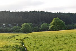 Drainage in a field
 -
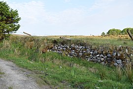 Dry stone walling
 -
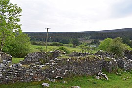 Ruin of a house
 -
![A view of Slieve Fyagh (335 Metres).[15]](//upload.wikimedia.org/wikipedia/commons/thumb/f/f3/A_view_of_Slieve_Fyagh_from_Barrooskey.jpg/270px-A_view_of_Slieve_Fyagh_from_Barrooskey.jpg) A view of Slieve Fyagh (335 Metres).[15]
A view of Slieve Fyagh (335 Metres).[15] -
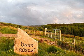 View of a sign


![A view of Slieve Fyagh (335 Metres).[15]](/https/en.wikipedia.org/wiki/File:A_view_of_Slieve_Fyagh_from_Barrooskey.jpg)

References
[edit]- ^ Noone, Fr Sean (1991). Where The Sun Sets (1st ed.). Naas: The Leinster Leader. p. 148. ISBN 0951817906.
{{cite book}}: CS1 maint: date and year (link) - ^ a b c "Barroosky Townland, Co. Mayo". www.townlands.ie. Retrieved 11 December 2018.
- ^ "Parish of Kilcommon Erris, County Mayo, Ireland". Retrieved 11 December 2018.
- ^ "FP009 - Population and Actual and Percentage Change 2016 to 2022". data.gov.ie. Central Statistics Office. Retrieved 2 January 2024.
Barr Rúscaí, Co.Mayo, 29054 [..] Electoral Division [..] Population - 2022 [..] 96
- ^ Beiner, Guy (2007). Remembering the Year of the French: Irish Folk History and Social Memory. Univ of Wisconsin Press. ISBN 9780299218249.
- ^ "Census of Ireland, 1911". www.census.nationalarchives.ie. Retrieved 2 December 2021.
- ^ "Civil War in Mayo: The Battle of Glenamoy, 1922 by Thomas Langan | Family History in North County Mayo". goldenlangan.com. Retrieved 9 December 2018.
- ^ a b "Glenamoy Bog Complex SAC". Protected Planet. Retrieved 11 December 2018.
- ^ "Site Synopsis - Glenamoy Bog Complex" (PDF). National Parks and Wildlife Service. Archived from the original (PDF) on 18 December 2007. Retrieved 14 April 2010.
- ^ "EUNIS -Site factsheet for Glenamoy Bog Complex SAC". eunis.eea.europa.eu. Retrieved 11 December 2018.
- ^ "Sheskin North". Coillte. Retrieved 11 December 2018.
- ^ "Estate Record: Jameson (Sheskin)". landedestates.nuigalway.ie. Retrieved 11 December 2018.
- ^ "HUSSEY DE BURGH, U. H. The Landowners of Ireland. An alphabetical list of the owners of estates of 500 acres or £500 valuation and upwards in Ireland. Dublin: Hodges, Foster and Figgis, 1878. [available online at www.askaboutireland.ie]". landedestates.nuigalway.ie. Retrieved 11 December 2018.
- ^ Connolly, Linda (August 2004). "The limits of 'Irish Studies': historicism, culturalism, paternalism". Irish Studies Review. 12 (2): 139–162. doi:10.1080/0967088042000228914. ISSN 0967-0882. S2CID 145506909.
- ^ "Slieve Fyagh 335m hill, North Mayo Ireland at MountainViews.ie". mountainviews.ie. Retrieved 21 December 2018.
