File:NPS jacob-riis-park-fishing-map.jpg
Jump to navigation
Jump to search
Size of this preview: 800 × 527 pixels. Other resolutions: 320 × 211 pixels | 640 × 422 pixels | 1,024 × 675 pixels | 1,280 × 844 pixels | 1,980 × 1,305 pixels.
Original file (1,980 × 1,305 pixels, file size: 316 KB, MIME type: image/jpeg)
Captions
Captions
Add a one-line explanation of what this file represents
Summary
[edit]
| Description |
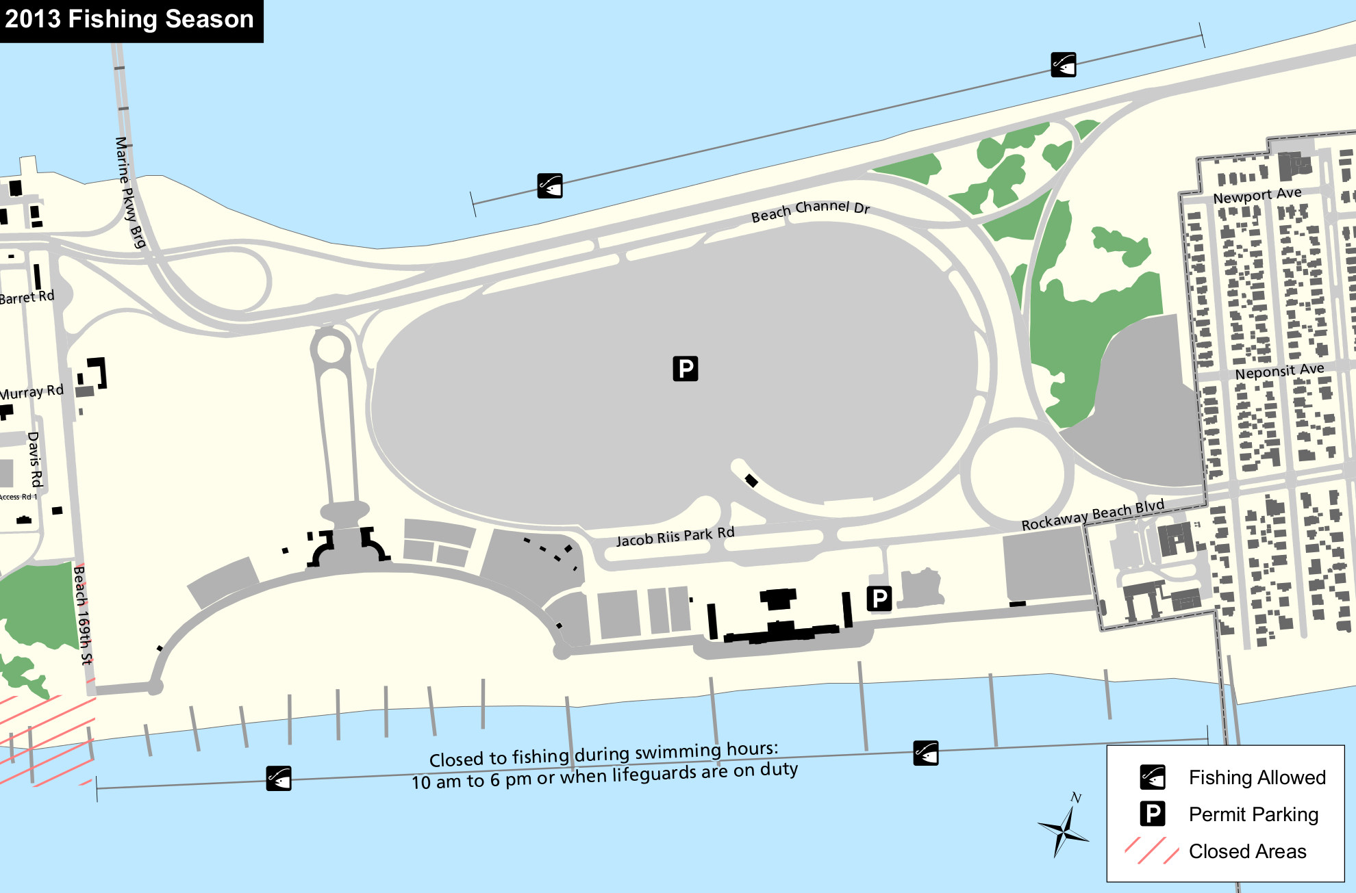
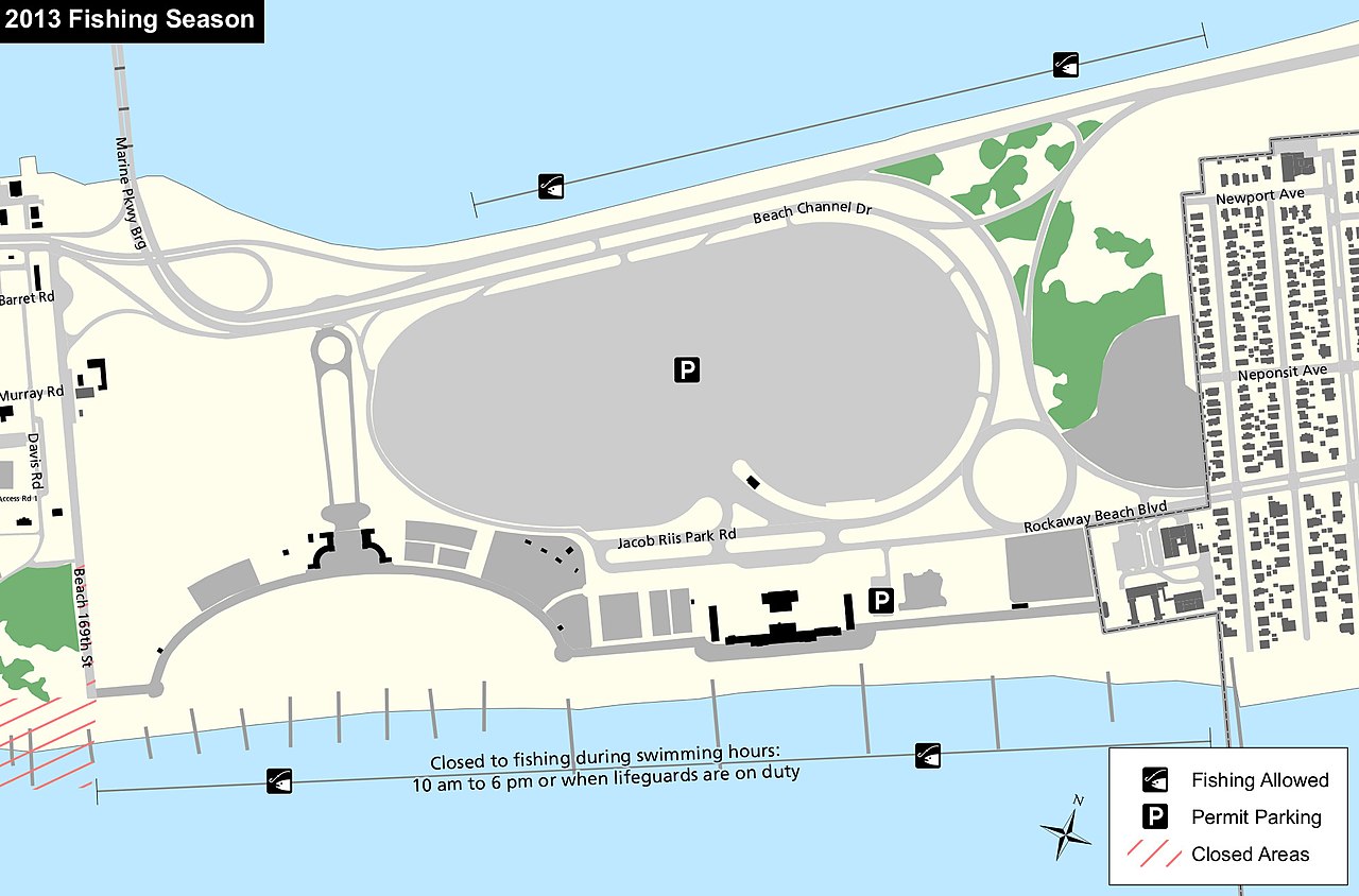
English: This Jacob Riis Park fishing map shows the public fishing areas located on both the Rockaway Inlet side and Atlantic Ocean side of Jacob Riis Park near the very popular beach. |
| Date | |
| Source | U.S. National Park Service (http://npmaps.com/wp-content/uploads/jacob-riis-park-fishing-map.jpg) |
| Author | U.S. National Park Service, restoration/cleanup by Matt Holly |
Licensing
[edit]
| This image or media file contains material based on a work of a National Park Service employee, created as part of that person's official duties. As a work of the U.S. federal government, such work is in the public domain in the United States. See the NPS website and NPS copyright policy for more information. |
File history
Click on a date/time to view the file as it appeared at that time.
| Date/Time | Thumbnail | Dimensions | User | Comment | |
|---|---|---|---|---|---|
| current | 21:31, 16 May 2017 | | 1,980 × 1,305 (316 KB) | RKBot (talk | contribs) | =={{int:filedesc}}== {{Information |description= {{en|1=This Jacob Riis Park fishing map shows the public fishing areas located on both the Rockaway Inlet side and Atlantic Ocean side of Jacob Riis Park near the very popular beach.}} |date= 2016-06-17... |
You cannot overwrite this file.
File usage on Commons
The following page uses this file:
File usage on other wikis
The following other wikis use this file:
- Usage on en.wikipedia.org