Category:Koornbeurs (Delft)
Jump to navigation
Jump to search
| Object location | | View all coordinates using: OpenStreetMap |
|---|
 | |||||
| Upload media | |||||
| Instance of | |||||
|---|---|---|---|---|---|
| Location | Delft, South Holland, Netherlands | ||||
| Street address |
| ||||
| Located on street | |||||
| Heritage designation |
| ||||
 | |||||
|
This is a category about rijksmonument number 12190
|
| Address |
|
Media in category "Koornbeurs (Delft)"
The following 30 files are in this category, out of 30 total.
-
 De Koornbeurs met visbanken.JPG 3,264 × 2,448; 1.6 MB
-
 Delft Voldersgracht1-2 017 5880.jpg 6,000 × 3,987; 22.95 MB
-
 Details van kleurresten op fronton aan de voorgevel - Delft - 20378236 - RCE.jpg 1,200 × 1,200; 290 KB
-
 Details van kleurresten op fronton in voorgevel - Delft - 20378231 - RCE.jpg 1,200 × 1,200; 325 KB
-
-
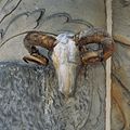
 Details van kleurresten op runderkop op voorgevel - Delft - 20378233 - RCE.jpg 1,200 × 1,200; 246 KB
-

-
 Details van kleurresten op zandstenen voorgevel - Delft - 20378230 - RCE.jpg 1,200 × 1,200; 290 KB
-
 Details van kleurresten op zandstenen voorgevel - Delft - 20378234 - RCE.jpg 1,200 × 1,200; 359 KB
-
 Details van kleurresten op zandstenen voorgevel - Delft - 20378235 - RCE.jpg 1,200 × 1,200; 374 KB
-
 Informatiebord Vleeshal DSCF1029.jpg 2,048 × 1,536; 1.64 MB
-
 InZicht Delft 059.JPG 3,648 × 2,598; 1.32 MB
-
 InZicht Delft 060.JPG 3,648 × 2,598; 1.63 MB
-
 InZicht Delft 061.JPG 3,298 × 1,733; 1.04 MB
-
 InZicht Delft 062.JPG 3,653 × 2,473; 1.33 MB
-
 InZicht Delft 063.JPG 3,648 × 2,598; 1.59 MB
-
 Koornbeurs (Delft) DSCF1027.jpg 2,048 × 1,536; 1.54 MB
-
 Koornbeurs Delft 2010.JPG 3,648 × 2,736; 2.44 MB
-
 Koornbeurs delft.jpg 450 × 600; 108 KB
-
 Koornbeurs en Visbanken DSCF1028.jpg 2,048 × 1,536; 1.55 MB
-
 Koornbeurs in Delft.JPG 3,264 × 2,448; 1.41 MB
-
 Koornbeurs in Delft2.JPG 2,448 × 3,264; 1.42 MB
-
 Netherlands-4681 - Meat Hall (12171835684).jpg 6,000 × 4,000; 14.47 MB
-
 Overzicht - Delft - 20050806 - RCE.jpg 1,200 × 941; 237 KB
-
 Stadsgezichten van Delft, reportage, Bestanddeelnr 916-1712.jpg 2,628 × 2,635; 1.28 MB
-
 Vleeshal Delft.jpg 2,592 × 1,944; 2.47 MB
-
 Voldersgracht 1 - Delft - 20049053 - RCE.jpg 803 × 1,200; 199 KB
-
 Voldersgracht hoek Markt - Delft - 20049052 - RCE.jpg 887 × 1,200; 202 KB
-
 Voorgevel - Delft - 20049054 - RCE.jpg 1,200 × 958; 191 KB
-
 Zandstenen voorgevel en fronton met stadswapen - Delft - 20389926 - RCE.jpg 920 × 1,200; 236 KB


_DSCF1027.jpg)


.jpg)


