Category:Huchting (Bremen)
Jump to navigation
Jump to search
human settlement   | |||||
| Upload media | |||||
| Instance of |
| ||||
|---|---|---|---|---|---|
| Location | Bremen-Süd, Bremen, Germany | ||||
| Area |
| ||||
| Different from | |||||
 | |||||
Subcategories
This category has the following 6 subcategories, out of 6 total.
Media in category "Huchting (Bremen)"
The following 30 files are in this category, out of 30 total.
-
 891Bahnunterf Neue Ochtum li.jpg 3,264 × 2,448; 5.13 MB
-
 897Bahnunterf Neue Ochtum li.jpg 3,264 × 2,448; 5.08 MB
-
 898 Schöpfwerk Huchting-Nord.jpg 3,264 × 2,448; 4.83 MB
-
 905Sodenmatt Kloßkampsw neu Zementpfl.jpg 3,264 × 2,448; 4.02 MB
-
 Bremen 24 Huchting.svg 1,172 × 846; 1.8 MB
-
 Bremen tram 2007 I.jpg 2,592 × 1,944; 2.53 MB
-
 Bremen tram 2007 III.jpg 2,592 × 1,944; 2.6 MB
-
 Bremen tram 2015 eindpunt lijn 1 bij Roland Centrum.jpg 4,288 × 3,216; 3.6 MB
-
 Bremen tramhalte Grolland 2015 1.JPG 4,288 × 3,216; 3.63 MB
-
 Bremen tramhalte Grolland 2015 2.JPG 4,288 × 3,216; 3.76 MB
-
 Bremen tramhalte Grolland 2015 3.JPG 4,288 × 3,216; 3.46 MB
-
 Bremen tramhalte Grolland 2015 4.JPG 4,288 × 3,216; 3.56 MB
-
 Bremen tramhalte Grolland 2015 5.JPG 4,288 × 3,216; 3.47 MB
-
 Bremen-Huchting Ente Juli-2016 DSC 0129.JPG 4,928 × 3,264; 8.07 MB
-
 Bremen-Huchting Huchtinger-Fleet Juli-2016 DSC 0122.JPG 4,928 × 3,264; 8.34 MB
-
 Bremen-Huchting Schneckenhebewerk Juli-2016 DSC 0112.jpg 4,928 × 3,264; 7.37 MB
-
 Bremen-Huchting Wassergraben Juli-2016 DSC 0116.JPG 4,928 × 3,264; 9.23 MB
-
 Bremen-Huchting.png 500 × 382; 16 KB
-
 FFH-Gebiet Binnensalzstelle Rethriehen 01.jpg 3,072 × 2,304; 3.35 MB
-
 Flug -Nordholz-Hammelburg 2015 by-RaBoe 0190 - Grolland & Huchting.jpg 3,666 × 2,382; 1.32 MB
-
 Freiwillige Feuerwehr Bremen-Huchting.jpg 5,184 × 3,456; 5.51 MB
-
 G. Menken Bremen v d Heerstraße nach Hamburg.jpg 2,572 × 1,860; 2.34 MB
-
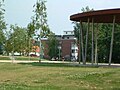
 Huchting Bürger und Sozialzentrum.jpeg 1,280 × 960; 321 KB
-
 Huchting OchtumPark.jpeg 1,280 × 960; 309 KB
-
 Huchting Ortsamt.jpeg 1,280 × 960; 333 KB
-
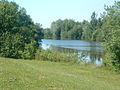
 Huchting ParkSodenmattsee.jpeg 1,280 × 960; 306 KB
-
 Huchtinger Dorfschaften 1798.jpg 1,989 × 2,787; 3.99 MB
-
 J H Menken Die St. Georgs-Kirche in Huchting.jpg 2,635 × 1,857; 1.52 MB
-
 Karte des Dorfes Grolland 1804.jpg 1,800 × 2,667; 3.1 MB
-
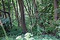 Vogelschutzgehölz Sodenmatt.jpg 2,784 × 1,856; 3.51 MB


