Category:Maps by Htonl
Media in category "Maps by Htonl"
The following 200 files are in this category, out of 358 total.
(previous page) (next page)-
Bantustans in South Africa.svg 807 × 711; 240 KB
-
Bergrivier LM topographic map.svg 1,198 × 1,011; 8.15 MB
-
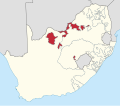
Bophuthatswana in South Africa.svg 807 × 711; 225 KB
-
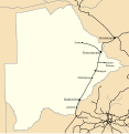
Botswana rail network map.svg 986 × 1,014; 167 KB
-
Cape Colony railways map 1910.svg 827 × 726; 224 KB
-
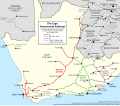
Cape Govt Railways map 1910.svg 827 × 726; 286 KB
-
Cape Main Line map.svg 1,070 × 934; 408 KB
-
Cape Town 2001 dominant language map.svg 814 × 966; 1.48 MB
-
Cape Town 2011 dominant language map.svg 771 × 1,140; 299 KB
-
Cape Town 2011 LGE PR result by ward.svg 623 × 923; 399 KB
-
Cape Town 2011 LGE ward winners.svg 623 × 923; 399 KB
-
Cape Town 2016 LGE PR result by ward.svg 623 × 923; 635 KB
-
Cape Town 2016 LGE ward winners.svg 623 × 923; 714 KB
-
Cape Town electoral wards 2011 blank.svg 623 × 923; 411 KB
-
Cape Town electoral wards 2016 blank.svg 623 × 923; 674 KB
-
Cape Town Subcouncils 2006 labelled.svg 800 × 1,000; 470 KB
-
Cape Town subcouncils 2011.svg 642 × 934; 447 KB
-
Cape Town subcouncils and wards 2011.svg 642 × 934; 1.6 MB
-
Cape Winelands Education District.svg 1,000 × 714; 278 KB
-
Cederberg LM topographic map.svg 1,113 × 1,087; 9.7 MB
-
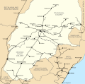
Central South African Railways map 1910.svg 778 × 771; 162 KB
-
Ciskei in South Africa.svg 807 × 711; 225 KB
-
De Hoop locator map.svg 1,214 × 972; 1.96 MB
-
Diagram of Hospital Bend after upgrade.svg 1,151 × 757; 98 KB
-
Diagram of Hospital Bend before upgrade.svg 1,151 × 757; 97 KB
-
Eastern Cape 2001 dominant language map.svg 1,233 × 811; 1.5 MB
-
Eastern Cape provincial election 2014 winner by ward.svg 1,291 × 856; 120 KB
-
Eden & Central Karoo Education District.svg 1,000 × 714; 278 KB
-
Ekurhuleni 2001 dominant language map.svg 778 × 1,011; 1.17 MB
-
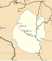
Eswatini rail network map.svg 655 × 764; 171 KB
-
Eswatini relief location map.svg 604 × 742; 2.26 MB
-
Ethekwini 2001 dominant language map.svg 805 × 977; 3.18 MB
-
EThekwini 2011 LGE PR result by ward.svg 643 × 893; 534 KB
-
EThekwini 2011 LGE ward winners.svg 643 × 893; 534 KB
-
EThekwini electoral wards 2011 blank.svg 643 × 893; 531 KB
-
Free State 2001 dominant language map.svg 1,095 × 913; 1.44 MB
-
Free State provincial election 2014 winner by ward.svg 1,150 × 959; 100 KB
-
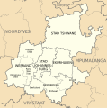
Gauteng 2001 dominant language map.svg 996 × 1,004; 1.03 MB
-
Gauteng provincial election 2014 winner by ward.svg 1,046 × 1,054; 85 KB
-
Gautrain map on OSM base.svg 373 × 760; 6.08 MB
-
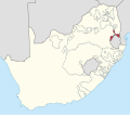
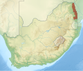
Gazankulu in South Africa.svg 807 × 711; 225 KB
-
History of the area of jurisdiction of the Western Cape High Court.svg 1,000 × 800; 54 KB
-
Johannesburg 2001 dominant language map.svg 786 × 1,000; 1.65 MB
-
Kaart van Gauteng munisipaliteite (2011).svg 754 × 760; 223 KB
-
Kaart van Gauteng munisipaliteite (2016).svg 754 × 760; 295 KB
-
Kaart van Wes-Kaap munisipaliteite (2011).svg 849 × 676; 540 KB
-
Kaart van Wes-Kaap munisipaliteite (2016).svg 849 × 676; 676 KB
-
KaNgwane in South Africa.svg 807 × 711; 225 KB
-
Kruger National Park locator map.svg 2,031 × 1,741; 5.25 MB
-
KwaNdebele in South Africa.svg 807 × 711; 225 KB
-
KwaZulu in South Africa.svg 807 × 711; 225 KB
-
KwaZulu-Natal 2001 dominant language map.svg 938 × 1,066; 1.06 MB
-
KwaZulu-Natal 2011 LGE council winners.svg 712 × 805; 1.28 MB
-
KwaZulu-Natal provincial election 2014 winner by ward.svg 987 × 1,118; 162 KB
-
Lebowa in South Africa.svg 807 × 711; 225 KB
-
Lesotho relief location map.svg 1,023 × 1,000; 2.69 MB
-
Limpopo 2001 dominant language map.svg 1,228 × 814; 812 KB
-
Limpopo provincial election 2014 winner by ward.svg 1,287 × 858; 62 KB
-
Locator map of Cape Province as of 1 March 1994.svg 1,120 × 985; 341 KB
-
Locator map of Natal Province as of 1 March 1994.svg 1,120 × 985; 341 KB
-
Locator map of Orange Free State Province as of 1 March 1994.svg 1,120 × 985; 341 KB
-
Locator map of Transvaal Province as of 1 March 1994.svg 1,120 × 985; 341 KB
-
Map of Bophuthatswana with boundary changes from independence to dissolution.svg 2,000 × 1,267; 1.41 MB
-
Map of Gauteng with municipalities labelled (2011).svg 754 × 760; 223 KB
-
Map of Gauteng with municipalities labelled (2016).svg 754 × 760; 258 KB
-
Map of Gauteng with municipalities named and districts shaded (2016).svg 754 × 760; 328 KB
-
Map of Limpopo with municipalities named and districts shaded (2016).svg 925 × 621; 634 KB
-
Map of local government in Cape Town at the end of apartheid (1994).svg 792 × 1,122; 459 KB
-
Map of local government in Cape Town in the interim phase (1996-2000).svg 792 × 1,122; 608 KB
-
Map of local government in Cape Town in the pre-interim phase (1995-6).svg 792 × 1,122; 531 KB
-
Map of South Africa with provincial borders.svg 809 × 709; 462 KB
-
Map of the administrative geography of South Africa 2018.svg 3,179 × 2,245; 2.21 MB
-
Map of the administrative geography of South Africa 2021.svg 3,179 × 2,245; 1.63 MB
-
Map of the administrative geography of South Africa 2024.svg 3,179 × 2,245; 1.63 MB
-
Map of the N1 (South Africa) with labels.svg 809 × 709; 553 KB
-
Map of the N1 (South Africa).svg 809 × 709; 486 KB
-
Map of the N10 (South Africa) with labels.svg 809 × 709; 510 KB
-
Map of the N10 (South Africa).svg 809 × 709; 486 KB
-
Map of the N11 (South Africa) with labels.svg 809 × 709; 522 KB
-
Map of the N11 (South Africa).svg 809 × 709; 486 KB
-
Map of the N12 (South Africa) with labels.svg 809 × 709; 547 KB
-
Map of the N12 (South Africa).svg 809 × 709; 486 KB
-
Map of the N14 (South Africa) with labels.svg 809 × 709; 522 KB
-
Map of the N14 (South Africa).svg 809 × 709; 486 KB
-
Map of the N17 (South Africa) with labels.svg 809 × 709; 508 KB
-
Map of the N17 (South Africa).svg 809 × 709; 486 KB
-
Map of the N18 (South Africa) with labels.svg 809 × 709; 502 KB
-
Map of the N18 (South Africa).svg 809 × 709; 486 KB
-
Map of the N2 (South Africa) with labels.svg 809 × 709; 592 KB
-
Map of the N2 (South Africa).svg 809 × 709; 486 KB
-
Map of the N3 (South Africa) with labels.svg 809 × 709; 520 KB
-
Map of the N3 (South Africa).svg 809 × 709; 486 KB
-
Map of the N4 (South Africa) with labels.svg 809 × 709; 521 KB
-
Map of the N4 (South Africa).svg 809 × 709; 486 KB
-
Map of the N5 (South Africa) with labels.svg 809 × 709; 504 KB
-
Map of the N5 (South Africa).svg 809 × 709; 486 KB
-
Map of the N6 (South Africa) with labels.svg 809 × 709; 512 KB
-
Map of the N6 (South Africa).svg 809 × 709; 486 KB
-
Map of the N7 (South Africa) with labels.svg 809 × 709; 511 KB
-
Map of the N7 (South Africa).svg 809 × 709; 486 KB
-
Map of the N8 (South Africa) with labels.svg 809 × 709; 513 KB
-
Map of the N8 (South Africa).svg 809 × 709; 486 KB
-
Map of the N9 (South Africa) with labels.svg 809 × 709; 508 KB
-
Map of the N9 (South Africa).svg 809 × 709; 486 KB
-
Map of the national and provincial routes of South Africa.svg 809 × 709; 479 KB
-
Map of the National Roads of South Africa with labels and cities.svg 809 × 709; 779 KB
-
Map of the National Roads of South Africa with labels.svg 809 × 709; 547 KB
-
Map of the National Roads of South Africa.svg 809 × 709; 486 KB
-
Map of the R21 (South Africa).svg 755 × 760; 201 KB
-
Map of the R22 (South Africa).svg 712 × 805; 260 KB
-
Map of the R23 (South Africa).svg 860 × 667; 277 KB
-
Map of the R24 (South Africa).svg 755 × 760; 201 KB
-
Map of the R25 (South Africa).svg 860 × 667; 277 KB
-
Map of the R26 (South Africa).svg 828 × 693; 304 KB
-
Map of the R27 (South Africa).svg 680 × 844; 327 KB
-
Map of the R28 (South Africa).svg 755 × 760; 201 KB
-
Map of the R29 (South Africa).svg 755 × 760; 201 KB
-
Map of the R30 (South Africa).svg 776 × 738; 360 KB
-
Map of the R31 (South Africa).svg 750 × 764; 270 KB
-
Map of the R33 (South Africa).svg 617 × 932; 406 KB
-
Map of the R34 (South Africa).svg 888 × 646; 424 KB
-
Map of the R35 (South Africa).svg 768 × 746; 246 KB
-
Map of the R36 (South Africa).svg 741 × 774; 309 KB
-
Map of the R37 (South Africa).svg 741 × 774; 309 KB
-
Map of the R38 (South Africa).svg 768 × 746; 246 KB
-
Map of the R39 (South Africa).svg 768 × 746; 246 KB
-
Map of the R40 (South Africa).svg 741 × 774; 309 KB
-
Map of the R41 (South Africa).svg 755 × 760; 201 KB
-
Map of the R42 (South Africa).svg 755 × 760; 202 KB
-
Map of the R43 (South Africa).svg 849 × 676; 264 KB
-
Map of the R44 (South Africa).svg 849 × 676; 264 KB
-
Map of the R45 (South Africa).svg 849 × 676; 264 KB
-
Map of the R46 (South Africa).svg 849 × 676; 264 KB
-
Map of the R48 (South Africa).svg 900 × 638; 437 KB
-
Map of the R49 (South Africa).svg 912 × 630; 242 KB
-
Map of the R50 (South Africa).svg 860 × 667; 277 KB
-
Map of the R51 (South Africa).svg 755 × 760; 201 KB
-
Map of the R52 (South Africa).svg 912 × 630; 242 KB
-
Map of the R53 (South Africa).svg 912 × 630; 242 KB
-
Map of the R54 (South Africa).svg 755 × 760; 201 KB
-
Map of the R55 (South Africa).svg 755 × 760; 201 KB
-
Map of the R56 (South Africa).svg 840 × 683; 394 KB
-
Map of the R57 (South Africa).svg 828 × 693; 304 KB
-
Map of the R58 (South Africa).svg 941 × 611; 296 KB
-
Map of the R59 (South Africa).svg 725 × 791; 361 KB
-
Map of the R60 (South Africa).svg 849 × 676; 264 KB
-
Map of the R61 (South Africa).svg 941 × 611; 294 KB
-
Map of the R62 (South Africa).svg 1,101 × 526; 350 KB
-
Map of the R63 (South Africa).svg 1,101 × 526; 351 KB
-
Map of the R64 (South Africa).svg 828 × 693; 304 KB
-
Map of the R65 (South Africa).svg 768 × 746; 246 KB
-
Map of the R66 (South Africa).svg 712 × 805; 260 KB
-
Map of the R67 (South Africa).svg 941 × 611; 295 KB
-
Map of the R68 (South Africa).svg 712 × 805; 260 KB
-
Map of the R69 (South Africa).svg 712 × 805; 260 KB
-
Map of the R70 (South Africa).svg 828 × 693; 304 KB
-
Map of the R71 (South Africa).svg 942 × 611; 187 KB
-
Map of the R72 (South Africa).svg 941 × 611; 296 KB
-
Map of the R73 (South Africa).svg 828 × 693; 304 KB
-
Map of the R74 (South Africa).svg 712 × 805; 260 KB
-
Map of the R75 (South Africa).svg 941 × 611; 296 KB
-
Map of the R76 (South Africa).svg 828 × 693; 304 KB
-
Map of the R80 (South Africa).svg 755 × 760; 201 KB
-
Map of the R81 (South Africa).svg 942 × 611; 243 KB
-
Map of the R82 (South Africa).svg 725 × 791; 361 KB
-
Map of Transkei with boundary changes from independence to dissolution-de.svg 1,000 × 900; 1.76 MB
-
Map of Transkei with boundary changes from independence to dissolution.svg 2,000 × 1,800; 1.94 MB
-
Map of Venda with boundary changes from independence to dissolution.svg 1,500 × 1,100; 478 KB
-
Maritime zones of South Africa.svg 681 × 843; 131 KB
-
Maritime zones of the South African mainland.svg 1,053 × 746; 407 KB
-
Maseru railway line map.svg 1,529 × 392; 1.33 MB
-
Matzikama LM topographic map.svg 956 × 1,268; 8.45 MB
-
Metro Central Education District.svg 842 × 1,000; 371 KB


