File:British and French empires 1920.png
Jump to navigation
Jump to search
Size of this preview: 800 × 351 pixels. Other resolutions: 320 × 140 pixels | 640 × 281 pixels | 1,425 × 625 pixels.
Original file (1,425 × 625 pixels, file size: 40 KB, MIME type: image/png)
Captions
Captions
Add a one-line explanation of what this file represents
Summary
[edit]
| Description |
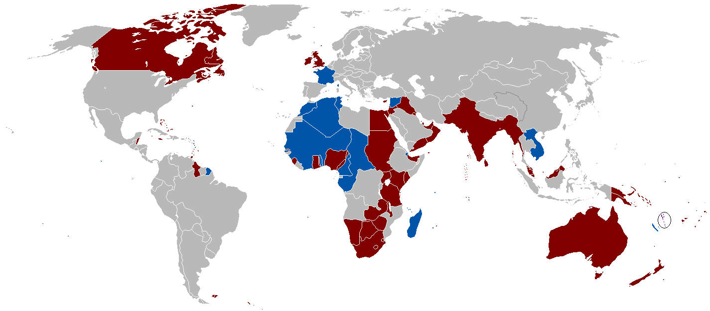
English: A map of the British Empire and French Colonial Empire in 1920. Shared territory is circled. |
||
| Date | Uploaded on 27 August 2008, 21:41. | ||
| Source | Own work. | ||
| Author | Vadac. | ||
| Permission (Reusing this file) |
|
||
| Other versions | File:British Empire 1921.png, File:Empire colonial français (1920).png |
.png)

|
This historical map image could be re-created using vector graphics as an SVG file. This has several advantages; see Commons:Media for cleanup for more information. If an SVG form of this image is available, please upload it and afterwards replace this template with
{{vector version available|new image name}}.
It is recommended to name the SVG file “British and French empires 1920.svg”—then the template Vector version available (or Vva) does not need the new image name parameter. |
File history
Click on a date/time to view the file as it appeared at that time.
| Date/Time | Thumbnail | Dimensions | User | Comment | |
|---|---|---|---|---|---|
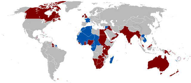
| 01:47, 13 October 2010 |  | 1,425 × 625 (49 KB) | Vadac (talk | contribs) | More accurate version with critical islands added in Pacific and Caribbean and fixing of political borders. | |
| 10:40, 12 April 2008 |  | 1,520 × 628 (52 KB) | Votolom (talk | contribs) | {{Information |Description=Map of the British and French colonial empires at their peak around 1920. |Source=self-made |Date=2008 |Author=User:Votolom }} ==Licence== {{GFDL-self}} |
You cannot overwrite this file.
File usage on Commons
There are no pages that use this file.
File usage on other wikis
The following other wikis use this file:
- Usage on ar.wikipedia.org
- Usage on arz.wikipedia.org
- Usage on el.wikipedia.org
- Usage on en.wikipedia.org
- Usage on eo.wikipedia.org
- Usage on fr.wikipedia.org
- Usage on he.wikipedia.org
- Usage on hu.wikipedia.org
- Usage on ko.wikipedia.org
- Usage on pt.wikipedia.org
- Usage on ro.wikipedia.org
- Usage on th.wikipedia.org
- Usage on uk.wikipedia.org
- Usage on zh.wikipedia.org