File:Canton de Le-Loroux-Bottereau(Position).png: Difference between revisions

From Wikimedia Commons, the free media repository
Jump to navigation Jump to search
Content deleted Content added
TigH (talk | contribs)
'''Description:''' Map for localisazion of cantons of Bretagne, (now Pays-de-Loire), region in France '''Source:''' made by Hervé Tigier in april 2005 from another large map (published in 1990) {{PD}} [[Category:Cant
 
m Category:Cantons of Loire-Atlantique
Line 5: Line 5:
{{PD}}
{{PD}}


[[Category:Cantons of France|Loire-Atlantique]]
[[Category:Cantons of Loire-Atlantique|Le Loroux-Bottereau]]

Revision as of 19:24, 26 June 2005

Captions

Captions

Add a one-line explanation of what this file represents

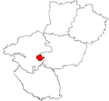
Description: Map for localisazion of cantons of Bretagne, (now Pays-de-Loire), region in France

Source: made by Hervé Tigier in april 2005 from another large map (published in 1990)


This file has been released into the public domain by the copyright holder, its copyright has expired, or it is ineligible for copyright. This applies worldwide.
Note: This tag is obsolete, and if you add it to an image after October 10 2008, it is liable to be tagged as {{nsd}} or {{npd}} as appropriate – this will result in deletion after 7 days.

File history

Click on a date/time to view the file as it appeared at that time.

Date/TimeThumbnailDimensionsUserComment
current20:21, 5 February 2007Thumbnail for version as of 20:21, 5 February 2007418 × 314 (38 KB)Yun (talk | contribs)Reverted to earlier revision
17:45, 5 February 2007Thumbnail for version as of 17:45, 5 February 2007548 × 507 (13 KB)Moa mrick (talk | contribs)Rétablissement de la version précédente
22:14, 4 February 2007Thumbnail for version as of 22:14, 4 February 2007418 × 314 (38 KB)Yun (talk | contribs)Reverted to earlier revision
21:19, 4 February 2007Thumbnail for version as of 21:19, 4 February 2007548 × 507 (13 KB)Moa mrick (talk | contribs)Rétablissement de la version précédente
18:54, 3 February 2007Thumbnail for version as of 18:54, 3 February 2007418 × 314 (38 KB)Yun (talk | contribs)Reverted to earlier revision
18:57, 23 August 2006Thumbnail for version as of 18:57, 23 August 2006548 × 507 (13 KB)Moa mrick (talk | contribs)
18:42, 25 April 2005Thumbnail for version as of 18:42, 25 April 2005418 × 314 (38 KB)TigH (talk | contribs)'''Description:''' Map for localisazion of cantons of Bretagne, (now Pays-de-Loire), region in France '''Source:''' made by Hervé Tigier in april 2005 from another large map (published in 1990) {{PD}} [[Category:Cant

The following page uses this file:

File usage on other wikis

The following other wikis use this file: