Category:Maps of the Suez Canal
Subcategories
This category has the following 3 subcategories, out of 3 total.
M
- Maps of Port Said (13 F)
O
- Old maps of the Suez Canal (70 F)
Media in category "Maps of the Suez Canal"
The following 26 files are in this category, out of 26 total.
-

-
 Canal de Suez.jpg 836 × 794; 66 KB
-
 Dynamap suez.png 450 × 415; 33 KB
-
 Egypt blockade of Israeli passage through the Suez Canal and Straits of Tiran-ar.png 1,004 × 938; 1.29 MB
-
 Egypt blockade of Israeli passage through the Suez Canal and Straits of Tiran.png 1,004 × 938; 1.51 MB
-
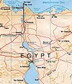
 Ep location.jpg 545 × 352; 45 KB
-
 Karte Suezkanal mit ehemaligen Militärzonen.png 1,862 × 2,753; 757 KB
-
 Karte Suezkanal.png 1,186 × 2,455; 504 KB
-
 Lange diercke sachsen afrika nildelta.jpg 1,078 × 702; 381 KB
-

-

-
 Map of the Sinai campaign.png 406 × 622; 477 KB
-
 Operation gazelle akl 2.png 385 × 594; 295 KB
-
 Operation gazelle akl.png 381 × 598; 296 KB
-
 Suez Canal (HY).jpg 3,400 × 4,400; 1.24 MB
-
 Suez canal Arabic.jpg 484 × 1,420; 87 KB
-
 Suez canal blank.jpg 484 × 1,420; 56 KB
-
 Suez canal english.jpg 484 × 1,420; 88 KB
-
 Suez canal francais.jpg 484 × 1,420; 84 KB
-
 Suez canal hy.png 456 × 1,331; 214 KB
-
 Suez canal map he.jpg 500 × 582; 224 KB
-
 Suez canal map-ar.jpg 503 × 582; 101 KB
-
 Suez canal map.jpg 500 × 582; 107 KB
-
 Suez Canal. LOC 81692681.jpg 3,143 × 4,117; 1.18 MB
-
 Suez Canal. LOC 81692681.tif 3,143 × 4,117; 37.02 MB
-
 Suez2021.jpg 1,200 × 2,928; 236 KB
.jpg)


.jpg)


