Category:Maps of Lyon
Wikimedia category | |||||
| Upload media | |||||
| Instance of | |||||
|---|---|---|---|---|---|
| Category combines topics | |||||
| Lyon | |||||
city of France | |||||
| Instance of |
| ||||
| Part of | |||||
| Named after | |||||
| Location |
| ||||
| Located in or next to body of water | |||||
| Street address |
| ||||
| Head of government |
| ||||
| Significant event |
| ||||
| Population |
| ||||
| Area |
| ||||
| Elevation above sea level |
| ||||
| Replaces |
| ||||
| Different from | |||||
| official website | |||||
 | |||||
Subcategories
This category has the following 10 subcategories, out of 10 total.
C
E
- Election maps of Lyon (4 F)
G
- Geological maps of Lyon (1 F)
L
- Maps of La Croix-Rousse (20 F)
M
- Maps of Lugdunum (9 F)
T
- Travel maps of Lyon (3 F)
Media in category "Maps of Lyon"
The following 88 files are in this category, out of 88 total.
-
Lyon, Pergamon World Atlas 1967.jpg 886 × 727; 187 KB
-
38 ISERE carte grille communale densite INSEE.png 3,507 × 2,480; 3.61 MB
-
69 RHONE carte grille communale densite INSEE.png 3,507 × 2,480; 3.42 MB
-
69-AAV2020-Lyon.png 3,519 × 2,930; 2.34 MB
-
69-Lyon-AAV2020.png 3,519 × 2,930; 3.77 MB
-
69123-Lyon-Hydro.jpeg 5,846 × 4,133; 4.37 MB
-
69123-Lyon-Sols.png 3,270 × 2,598; 10.64 MB
-
Aire urbaine lyon data INSEE.png 1,962 × 1,460; 4.19 MB
-
Arrondissement de Lyon.PNG 503 × 482; 19 KB
-
Arrondissements de Lyon.svg 309 × 349; 23 KB
-
Campus Centrale Lyon 2021-05-03.png 603 × 801; 348 KB
-
Carte de Lyon - Essai.jpg 1,240 × 1,753; 468 KB
-
Carte GRETA académie de Lyon.jpg 894 × 685; 60 KB
-
Carte HCL.jpg 2,313 × 2,432; 1.02 MB
-
Carte Originale Sillon Alpin.svg 685 × 790; 17.78 MB
-
Carte Vieux-Lyon.JPG 1,536 × 2,048; 1.32 MB
-
Diocèse Lyon 1789.svg 2,000 × 1,922; 801 KB
-
Espace urbanisé à Lyon aux premier et deuxième siècles.svg 587 × 718; 373 KB
-
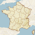
France lyon.PNG 280 × 278; 32 KB
-
GeocachingMap.jpg 950 × 498; 82 KB
-
Géolocalisation arrondissement Lyon.png 299 × 338; 24 KB
-
Géolocalisation Lyon.jpg 538 × 538; 143 KB
-
Géolocalisation Parc de la Tête d'Or.jpg 689 × 809; 238 KB
-
Géolocalisation Parc de la Tête d'Or.png 682 × 801; 740 KB
-
La Tranclière and Lyon location map.jpg 470 × 475; 37 KB
-
Localisation Lyon.jpg 200 × 214; 13 KB
-
Lyon - Tracé Grand Prix de 1924.JPG 671 × 665; 126 KB
-
Lyon 1351-1562.pdf 4,966 × 7,020; 472 KB
-
Lyon 1351-1562.png 887 × 1,145; 148 KB
-
Lyon 1351-1562.svg 744 × 1,052; 510 KB
-
Lyon 1745.pdf 4,966 × 7,020; 7.99 MB
-
Lyon 1745.svg 744 × 1,052; 1.12 MB
-
Lyon 8e - Quartier de Monplaisir en bleu, sur fond OpenStreetMap-uMap.png 1,171 × 912; 850 KB
-
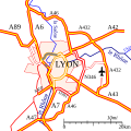
Lyon Autoroutes.svg 400 × 400; 20 KB
-
Lyon dot.png 1,804 × 1,689; 164 KB
-
Lyon en 1745.png 889 × 1,260; 227 KB
-
Lyon et ses arrondissements map-numbers.png 1,402 × 1,583; 1.74 MB
-
Lyon et ses arrondissements map.svg 1,402 × 1,583; 8.94 MB
-
Lyon France street map.svg 1,312 × 1,341; 5.79 MB
-
Lyon OSM.png 2,061 × 1,899; 4.62 MB
-
Lyon Part-Dieu OSM map.svg 1,198 × 874; 3.15 MB
-
Lyon rings of fortification map-blank.svg 1,750 × 1,750; 462 KB
-
Lyon Rohault de Fleury fortifications map-blank.svg 800 × 800; 575 KB
-
Lyon site Antiquaille plan 2016.png 1,367 × 1,197; 1.91 MB
-
Lyon Séré de Rivières fortifications map-blank.svg 1,750 × 1,750; 608 KB
-
Lyon-arr1.png 638 × 399; 236 KB
-
Lyon-arr2.png 724 × 1,422; 807 KB
-
Lyon-Carte de France.jpg 4,270 × 3,345; 12.85 MB
-
Lyon.png 700 × 700; 99 KB
-
LyonArrondissements01.png 1,000 × 1,129; 45 KB
-
LyonArrondissements02.png 1,000 × 1,129; 45 KB
-
LyonArrondissements03.png 1,000 × 1,129; 45 KB
-
LyonArrondissements04.png 1,000 × 1,129; 45 KB
-
LyonArrondissements05.png 1,000 × 1,129; 45 KB
-
LyonArrondissements06.png 1,000 × 1,129; 45 KB
-
LyonArrondissements07.png 1,000 × 1,129; 45 KB
-
LyonArrondissements08.png 1,000 × 1,129; 45 KB
-
LyonArrondissements09.png 1,000 × 1,129; 45 KB
-
Metropòli de Lion en França (2015).svg 507 × 553; 100 KB
-
Metropòli de Lion en França (2016).svg 507 × 553; 168 KB
-
Municipal boroughs of Lyon.svg 294 × 331; 10 KB
-
OSM Lyon Centre - Tunnel de Fourvière.PNG 621 × 645; 210 KB
-
Place Ambroise-Courtois - carte OSM.png 617 × 589; 526 KB
-
Plan Ancien Cimetière de la Croix-Rousse - 20 novembre 2016.jpg 5,152 × 3,864; 4.06 MB
-
Plan de base Lyon an 1000.pdf 13,800 × 13,800; 670 KB
-
Plan de Lyon antique.jpg 1,280 × 1,010; 145 KB
-
Plan des Forts de Lyon première ceinture - OSM.png 5,761 × 5,147; 23.8 MB
-
Plan des Forts de Lyon première ceinture - OSM.svg 6,275 × 5,661; 29.83 MB
-
Planlugdunum.PNG 890 × 872; 28 KB
-
Pontsdelyon.png 300 × 646; 44 KB
-
Pontsdelyon.svg 300 × 646; 49 KB
-
PontsSurLaSaone.svg 2,646 × 929; 80 KB
-
PontsSurLeRhone.svg 2,646 × 929; 42 KB
-
Province de Lyon 1789.svg 2,000 × 1,922; 787 KB
-
Ressort de la CAA de Lyon.PNG 526 × 556; 23 KB
-
Situation Pont Raymond Barre.png 4,325 × 3,299; 933 KB
-
Six-plans-scenographiques-de-lyon 1.1.jpg 1,518 × 1,318; 2.27 MB
-
Stade Gerland coloré.png 405 × 434; 61 KB
-
Territoire d'intervention de l'ADERLY.JPG 527 × 587; 28 KB
-
Traboules du vieux Lyon.svg 201 × 337; 2.27 MB
-
Voiries contenant le mot "boulevard" à Lyon.jpg 1,200 × 546; 248 KB
-
Échangeur A43 - Périphérique Lyon.svg 1,925 × 1,311; 2.51 MB
-
Écran centre commercial Lyon confluence - Wikipedia et OSM 01.jpg 3,264 × 2,448; 1.96 MB
-
Écran centre conmercial Lyon confluence - Wikipedia et OSM 02.JPG 3,264 × 2,448; 1.96 MB


